- Gratis verzending vanaf 30 euro
- Levert in Nederland, België etc.
- Meer dan 30.000 titels
- Vakkundige klantenservice
- Snelle levering
- Veilig en eenvoudig betalen

Direct contact?
Bel +31 (0)6 42428571
maandag t/m vrijdag
van 10 tot 17 uur
Fietsgids Cycle Touring in Northern Scotland | Cicerone Press
528 mile circular route from Inverness

This guidebook describes a 528-mile cycling route in northern Scotland. Starting and finishing in the highland capital Inverness, the circular route passes through the ancient counties and districts of Wester Ross, Sutherland, Caithness, Easter Ross and the Black Isle and is suitable for mountain, touring and road bikes: the going is entirely on asphalt-surfaced roads, though many are quiet with little traffic. The circuit can be comfortably completed in a fortnight. Featuring clear and concise route description, together with 1:150,000 mapping, gradient profiles, suggested schedules and invaluable practical information - including complete lists of all hostel/bunkhouse accommodation, official campsites and services for cyclists and advice on other accommodation and refreshment opportunities, this guidebook provides all the information needed to plan and execute a terrific cycle tour. Alternative routes are provided in case you should wish to avoid the steep ascent of Bealach na Bà or the undulating Assynt peninsula, or to include the busier A9 east coast road. The route boasts stunning scenery and rich historical interest and cyclists will be treated to mile upon mile of unspoilt wilderness. The journey takes in varied landscapes of craggy mountains, verdant glens, rolling peat moorland dotted with lochs and wild rugged coastlines - and if the scenery isn't enough, there are many distilleries and micro-breweries on or near the route guaranteed to entice. With notes on history, geology, wildlife and local points of interest, the guide offers a perfect way to get to know Scotland's captivating far north.
Engelstalig
EAN: 9781786310026
Uitgeverij: Cicerone Press
Verschijningsdatum: 2019
Meest recente editie
Engelstalig
208 pagina's


(Tijdelijk) niet leverbaar
- Vakkundige klantenservice
- Groot assortiment
- Gratis retourneren binnen 14 dagen
- Aangesloten bij WebwinkelKEUR
Meer producten die interessant kunnen zijn
Topografische kaarten Noord-Schotland
Topografische Wandelkaart OL57 van Groot-Brittannië (1:25.000) Cairn Gorm & Aviemore, Loch Morlich - Explorer Map OL 57
Wandelkaart | Ordnance Survey (OS) Groot-Brittannië
€ 18,99
Topografische Wandelkaart 15 Loch Assynt Lochinver & Kylesku - Landranger Map
Wandelkaart & Fietskaart | Ordnance Survey (OS) Groot-Brittannië
€ 18,99
Topografische Wandelkaart 19 Gairloch / Ullapool (Loch Maree) - Landranger Map
Wandelkaart & Fietskaart | Ordnance Survey (OS) Groot-Brittannië
€ 18,99
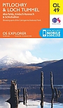
Topografische Wandelkaart OL49 van Groot-Brittannië (1:25.000) Pitlorchry & Loch Tummel / Aberfeldy - Explorer Map OL 49
Wandelkaart | Ordnance Survey (OS) Groot-Brittannië
€ 18,99
Wandelgidsen Noord-Schotland
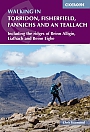
Wandelgids Walking in Torridon Fisherfield Fannichs and An Teallach Cicerone Guidebooks
Including the ridges of Beinn Alligin, Liathach and Beinn Eighe
€ 21,99
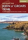
Wandelgids Walking the John o' Groats Trail | Cicerone
Coastal walking from Inverness to John o' Groats
€ 21,99
Wandelgids Cape Wrath Trail Cicerone Guidebooks
through the Scottish Highlands from Fort William to Cape Wrath
€ 21,99
Wegenkaarten Noord-Schotland
Wandelkaarten Noord-Schotland
Wandelkaart Cairngorms and Lochnagar - Mountain Map | Harvey Maps
Water- en scheurvaste wandelkaart
€ 28,99