- Gratis verzending vanaf 30 euro
- Levert in Nederland, België etc.
- Meer dan 30.000 titels
- Vakkundige klantenservice
- Snelle levering
- Veilig en eenvoudig betalen

Direct contact?
Bel +31 (0)6 42428571
maandag t/m vrijdag
van 10 tot 17 uur
Europa / Groot-Brittannië / Wales
Wales bestsellers
Wegenkaart - Landkaart 503 Wales & The Midlands - Michelin Regional
Wales, the Midlands, South West England 503
11,50

Wandelgids 34 Pembrokeshire and Carmarthenshire Pathfinder Guide
Pathfinder Guide 34 | Met Ordanance Survey kaarten
17,99
|
|
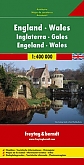
Wegenkaart - Landkaart 503 Wales & The Midlands - Michelin Regional | Wales, the Midlands, South West England 503De Michelinkaarten zijn onmisbare overzichtskaarten van een uitstekende kwaliteit. Deze bekende serie wegenkaarten bevatten in goed detail alle hoofdwegen en verbindingswegen tussen de dorpen en steden. Uitgebreid met andere belangrijke weginformatie, zoals tolwegen, tankstations, parkeerplaatsen, af- en opritten, wegnummers, , hoogteverschillen, winterafsluitingen en groene routes. Het zijn dus complete kaarten voor onderweg. Schaal: 1:400.000 |
11,50 |
|
Reisgids Wales Ontdek ANWBVerken Wales op een andere manier met de uitgebreide ANWB Ontdek reisgids Wales! Natuurlijk mag je bezienswaardigheden zoals Mount Snowdon, met zijn kusten en kastelen en Cardiff met de spannende combinatie van moderne architectuur en industrieel erfgoed niet missen. Maar ga ook eens van de gebaande paden en ga op zoek naar de Welsh-mediterrane flair van Tenby Harbour, wandel door de kleurrijke tuinen van Bodnant Garden en ontdek de charme van de getijdenwerking en het rode zandstrand bij Three Clifs Bay. Deze reisgids Wales biedt naast praktische tips over routes, hot... |
23,50 |

|
Wegenkaart - Landkaart 6 Wales - AA Road Map BritainOverzichtelijke wegenkaarten met een helder kaartbeeld. Wegnummers zijn weergegeven. Toerististische informatie door middel van pictogrammen. Campings, VVV, musea, grotten, picnic plekken, kastelen zijn onder andere aangegeven. Op de achterzijde staat een plaatsnamen register plus een aantal stadsplattegrondjes. Schaal: 1:250.000 |
9,95 |
|
Wandelgids 269 Wales Rother Bergverlag | Rother Bergverlag | Die schonsten Küsten- und Bergwanderungen. 50 Touren. Mit GPS-DatenDe vermaarde wandelgiden van Rother Bergverlag zijn uitstekende wandelgidsen voor ieder niveau. Op een kaartje is de wandelroute aangegeven, maar deze is ook beschreven in een beknopte en heldere tekst. Daarnaast is ook de afstand, de verwachte wandeltijd, het niveau, de hoogte en andere praktische informatie aangegeven. Met deze degelijke wandelgids ontdek je de mooiste plekken van jouw bestemming en kun je de spannendste wandeluitdagingen zoeken. In Wales, dem kleinen Land zwischen Irland und England, findet sich eine unglaubliche landschaftliche Vielfalt diese lasst... |
14,90 |
|
Wegenkaart - Landkaart AK0287 Engeland en Wales - Freytag & BerndtEen goede wegenkaart met een natuurlijke uitstraling en met uitstekende reliëfschaduwen. Bevat een aantal belangrijke culturele en natuurlijke toeristische bezienswaardigheden. Daarnaast bevat de kaart een uitgebreide index waarin dorpen en steden eenvoudig op te zoeken zijn. Het geeft daarnaast ook informatie over de ligging van een aantal toegankelijke campings. Gedetailleerde informatie over wegen is ook aangegeven: tolwegen, privé wegen, wintersluitingen, mooie routes, maar ook de rijafstanden zijn aangegeven. Kortom, een uitstekende kaart voor onderweg. Schaal: 1:400.000 |
14,50 |
|
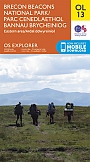
Topografische Wandelkaart OL13 van Groot-Brittannië (1:25.000) Brecon Beacons NP East - Explorer Map OL 13 | Wandelkaart | Ordnance Survey (OS) Groot-BrittanniëDeze gedetailleerde en informatieve topografische kaart (stafkaart, schaal 1:25.000) van Groot-Brittannië bevat alle topografische elementen van het landschap en geeft daarmee een nauwkeurig beeld van het terrein. Daarnaast heeft Ordnance Survey (OS) ook toeristische informatie op de meeste kaart verwerkt, zoals de aanduiding voor campings en ingetekende wandelpaden . Deze kaart is ideaal voor wandelaars of fietsers, maar ook voor de scouting of sportverenigingen die activiteiten in Groot-Brittannië gaan uitvoeren. De kaarten zijn voorzien van een GPS aanduid... Schaal: 1:25.000 |
18,99 |

|
Reisgids Engeland Noord & Wales Trotter | De no-nonsensegids voor een allesomvattende trip.De Nederlandstalige Trotter is de no-nonsensegids voor een allesomvattende trip. Of je gaat reizen met een groep of individueel, deze reisgids biedt je talrijke praktische tips in een overzichtelijk boek. Er is een uitgebreid aanbod van adresjes voor elk budget: slapen, eten, drinken, uitgaan en shoppen van goedkoop tot luxueus. De bezienswaardigheden zijn eigenzinnig gequoteerd door een team van kenners: 3 Trottermannetjes voor de toppers, 2 of 1 voor de minder bekende of nog onontdekte plekjes. Eenduidige overzichtskaarten en handige stadsplattegronden tonen je in &e... |
18,99 Tijdelijk niet leverbaar |
|
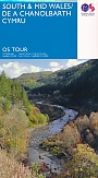
Fietskaart Wegenkaart 11 South & Mid Wales / De a Chanolbarth Cymru | Ordnance Survey Tour MapOverzichtelijke kaart van Ordnance Survey, de Britse topografische dienst. Deze Tour Maps met schaal 1:100.000 zijn prima kaarten voor het plannen van fietstochten. Alle wegen, grote en kleine zijn op de kaart vermeld. Eveneens staan de routes van het National Cycle Network op de kaart ingetekend. Verder zijn campings, jeugdherbergen en andere accommodaties vermeld. Schaal: 1:100.000 |
11,90 |
|
|
Wandelgids 34 Pembrokeshire and Carmarthenshire Pathfinder Guide | Pathfinder Guide 34 | Met Ordanance Survey kaartenDeze Pathfinder Guide is een goed uitgevoerde gids met verschillende wandelingen in Groot-Britannië. De gids bevat naast goede topografische kaarten van de Britse topografische dienst (Ordanance Survey) ook beschrijvingen van het landschap, de cultuur en/of de flora en fauna. Verder is de gids voorzien van praktische informatie zoals startpunten, verwachte wandeltijd, restaurants en cafés voor onderweg. Although deep in South Wales, Pembrokeshire and Carmarthenshire have a strong English influence, but their most striking feature, from the point of view of ... |
17,99 |
|
Wandelgids 47 Brecon Beacons Pathfinder Guide (Short Walks) | 20 korte wandelingen 7.5 kmDeze Pathfinder Guide is een goed uitgevoerde gids met verschillende wandelingen in Groot-Britannie. De gids bevat naast goede topografische kaarten van de Britse topografische dienst (Ordanance Survey) ook beschrijvingen van het landschap, de cultuur en/of de flora en fauna. Verder is de gids voorzien van praktische informatie zoals startpunten, verwachte wandeltijd, restaurants en cafes voor onderweg. Short Walks Brecon Beacons covering parts of The Sugar Loaf, Pen y Fan and Llyn y Fan Fach. This selection offers interest and regional variety in the Brecon Beacons, p... |
11,50 Tijdelijk niet leverbaar |
|
Wandelgids Offa's Dyke Path Cicerone Guidebooks | A journey through the border country of England and WalesThis guidebook to the Offas Dyke Path National Trail has been designed to allow some flexibility in following the official route, offering suggestions for circular walks covering sections of the dyke. The walk typically takes around two weeks to complete, while this is fully described, alternative routes to places of interest, or to find accommodation are included and form part of the total mileage quoted. Offas Dyke was constructed by the powerful King of Mercia in the late eighth century to mark out the western boundary of his kingdom. Hundreds of years later this is... |
19,99 |
|
Topografische Wandelkaart 115 Snowdon / Yr Wyddfa - Landranger Map | Wandelkaart & Fietskaart | Ordnance Survey (OS) Groot-BrittanniëDeze gedetailleerde en informatieve topografische kaart (stafkaart, schaal 1:50.000) van Groot-Brittannië bevat alle topografische elementen van het landschap en geeft daarmee een nauwkeurig beeld van het terrein. Daarnaast heeft Ordnance Survey (OS) ook toeristische informatie op de meeste kaart verwerkt, zoals de aanduiding voor campings en ingetekende wandelpaden . Deze kaart is ideaal voor wandelaars of fietsers, maar ook voor de scouting of sportverenigingen die activiteiten in Groot-Brittannië gaan uitvoeren. De kaarten zijn voorzien van een GPS aanduid... Schaal: 1:50.000 |
18,99 |
|
Topografische Wandelkaart 160 Brecon Beacons Wales- Landranger Map | Wandelkaart & Fietskaart | Ordnance Survey (OS) Groot-BrittanniëDeze gedetailleerde en informatieve topografische kaart (stafkaart, schaal 1:50.000) van Groot-Brittannië bevat alle topografische elementen van het landschap en geeft daarmee een nauwkeurig beeld van het terrein. Daarnaast heeft Ordnance Survey (OS) ook toeristische informatie op de meeste kaart verwerkt, zoals de aanduiding voor campings en ingetekende wandelpaden . Deze kaart is ideaal voor wandelaars of fietsers, maar ook voor de scouting of sportverenigingen die activiteiten in Groot-Brittannië gaan uitvoeren. De kaarten zijn voorzien van een GPS aanduiding en e... Schaal: 1:50.000 |
18,99 |
|
Topografische Wandelkaart 161 Black Mountains Abergavenny Brecon Beacons - Landranger Map | Wandelkaart & Fietskaart | Ordnance Survey (OS) Groot-BrittanniëDeze gedetailleerde en informatieve topografische kaart (stafkaart, schaal 1:50.000) van Groot-Brittannië bevat alle topografische elementen van het landschap en geeft daarmee een nauwkeurig beeld van het terrein. Daarnaast heeft Ordnance Survey (OS) ook toeristische informatie op de meeste kaart verwerkt, zoals de aanduiding voor campings en ingetekende wandelpaden . Deze kaart is ideaal voor wandelaars of fietsers, maar ook voor de scouting of sportverenigingen die activiteiten in Groot-Brittannië gaan uitvoeren. De kaarten zijn voorzien van een GPS aanduiding en e... Schaal: 1:50.000 |
18,99 |
|
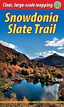
Wandelgids Snowdonia Slate Trail Rucksack Readers | Waterproof met spiraalbindingRucksack Readers zijn handig uitgevoerd in een klapper met ringband. Deze gids heeft een goede beschrijving van de lange afstands route met overzichtelijke kaarten doch zonder veel detail. De kracht van de Rucksack Readers is de uitgebreide achtergrondinformatie over de flora, fauna en geologische verschijnselen. Dit alles rijkelijk omkleed met kleurrijke foto's en praktische tips. The Snowdonia Slate Trail is a waymarked trail that runs for 83 miles (134 km) from Bangor on the North Wales coast, making a circuit through the heart of Snowdonia. It visits welcoming ... |
21,99 |
|
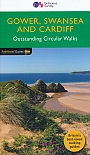
Wandelgids 55 Gower / Swansea / Cardiff Pathfinder Guide | Pathfinder Guide 55 | Met Ordanance Survey kaartenDeze Pathfinder Guide is een goed uitgevoerde gids met verschillende wandelingen in Groot-Britannie. De gids bevat naast goede topografische kaarten van de Britse topografische dienst (Ordanance Survey) ook beschrijvingen van het landschap, de cultuur en/of de flora en fauna. Verder is de gids voorzien van praktische informatie zoals startpunten, verwachte wandeltijd, restaurants en cafes voor onderweg. 28 wandelingen. |
17,99 Tijdelijk niet leverbaar |
|
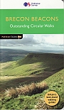
Wandelgids 18 Brecon Beacons Pathfinder Guide | Pathfinder Guide 18 | Met Ordanance Survey kaarteneze Pathfinder Guide is een goed uitgevoerde gids met verschillende wandelingen in Groot-Britannië. De gids bevat naast goede topografische kaarten van de Britse topografische dienst (Ordanance Survey) ook beschrijvingen van het landschap, de cultuur en/of de flora en fauna. Verder is de gids voorzien van praktische informatie zoals startpunten, verwachte wandeltijd, restaurants en cafés voor onderweg. Within the boundaries of the Brecon Beacons National Park there are four separate mountain ranges: Black Mountain, the most westerly, Fforest Fawr, th... |
17,99 |
|
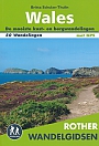
Wandelgids Wales | Rother BergverlagDe Rother wandelgids Wales beschrijft de 50 mooiste kust- en bergwandelingen in het westen van het Verenigd Koninkrijk - van Pembrokeshire tot Anglesey, van de Ierse Zee tot de grens met Engeland, in de bergachtige regio's, het binnenland en langs de kust. * Betrouwbare routebeschrijvingen * Gedetailleerde wandelkaarten * Informatieve hoogteprofielen * Downloadbare GPS Tracks |
18,99 Tijdelijk niet leverbaar |
|
Topografische Wandelkaart OL12 van Groot-Brittannië (1:25.000) Explorer Brecon Beacons NP West- Explorer Map OL 12 | Wandelkaart | Ordnance Survey (OS) Groot-BrittanniëDeze gedetailleerde en informatieve topografische kaart (stafkaart, schaal 1:25.000) van Groot-Brittannië bevat alle topografische elementen van het landschap en geeft daarmee een nauwkeurig beeld van het terrein. Daarnaast heeft Ordnance Survey (OS) ook toeristische informatie op de meeste kaart verwerkt, zoals de aanduiding voor campings en ingetekende wandelpaden . Deze kaart is ideaal voor wandelaars of fietsers, maar ook voor de scouting of sportverenigingen die activiteiten in Groot-Brittannië gaan uitvoeren. De kaarten zijn voorzien van een GPS aanduid... Schaal: 1:25.000 |
18,99 |
|
Wandelkaart Offa's Dyke Path National Trail Maps | Harvey Maps | Water- en scheurvaste wandelkaartDe Harvey Map is de wandelkaart voor het lange afstand wandelpad in het Groot-Brittannië. Duidelijke topografische wandelkaarten met praktische informatie van de route zoals overnachtingsmogelijkheden, eetgelegenheden en bezienswaardigheden. Deze wandelkaart is scheur- en watervast. Met GPS compatible (UTM-Grid). 285 kilometer van Chepstow in het zuiden naar Prestatyn in het noorden van Wales. Schaal: 1:40.000 |
25,99 |
|
Topografische Wandelkaart OL23 van Groot-Brittannië (1:25.000) Cadair Idris / Llyn Tegid - Explorer Map OL 23 | Wandelkaart | Ordnance Survey (OS) Groot-BrittanniëDeze gedetailleerde en informatieve topografische kaart (stafkaart, schaal 1:25.000) van Groot-Brittannië bevat alle topografische elementen van het landschap en geeft daarmee een nauwkeurig beeld van het terrein. Daarnaast heeft Ordnance Survey (OS) ook toeristische informatie op de meeste kaart verwerkt, zoals de aanduiding voor campings en ingetekende wandelpaden . Deze kaart is ideaal voor wandelaars of fietsers, maar ook voor de scouting of sportverenigingen die activiteiten in Groot-Brittannië gaan uitvoeren. De kaarten zijn voorzien van een GPS aanduid... Schaal: 1:25.000 |
18,99 |
|
Wandelgids Walking in Pembrokeshire Cicerone Guide | 40 circular walks in and around the Pembrokeshire Coast National ParkGuidebook to 40 circular walks in Pembrokeshire in Wales. Routes take in the dramatic beauty of the national park and its coast, the Daugleddau and the Preseli Hills, while exploring wooded gorges, prehistoric hillforts and medieval castles. Walks range from 1 to 12 miles and route descriptions are accompanied by 1:50,000 OS map extracts. |
16,99 |
|
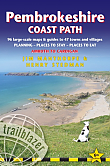
Wandelgids Pembrokeshire Coast Path Amroth to Cardigan Trailblazer | Amroth to CardiganAll-in-one hiking route guide, maps and accommodations for the Pembrokeshire Coast Path that follows a 186-mile National Trail around the coastline in south-west Wales. Includes 96 large-scale walking maps & guides to 47 towns and villages along the way plus planning, places to stay, places to eat, public transport information; downloadable GPS waypoints. Practical guidebook to walking the Pembrokeshire Coast Path. The walk follows a National Trail around the coastline in south-west Wales. Includes maps, accommodation, pubs and restaurants, and what to see along th... |
19,50 |
|
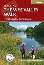
Wandelgids The Wye Valley Walk Cicerone Guidebooks | Official guidebook to the trailThe Wye Valley Walk is river and hill walking at its finest, with beautiful and interesting landscape every step of the way. This, the official guide to the Way, has been produced in conjunction with the Wye Valley Walk Partnership. The partnership works to conserve and enhance the natural beauty of the area, and team works hard to maintain the area's beauty for future generations. Passing sites such as Tintern Abbey, Goodrich Castle, Hereford Cathedral and Hay-on-Wye, the walk is accessible throughout the year and is suitable for all walkers with a reasonable level of... |
16,99 Tijdelijk niet leverbaar |
|
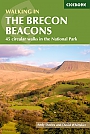
Wandelgids Walking on the Brecon Beacons Cicerone Guidebooks45 circular day walks are described in this guidebook to the Brecon Beacons National Park. From west to east, Mynydd Du, Fforest Fawr, the Brecon Beacons and the Black Mountains these mountain and valley routes offer many options, highlighting the natural features. The walks described explore dramatic waterfalls, wooded gorges and upland valleys. all year round walking if properly equipped; high summits and ridge walks best in winter; wooded valleys best in springtime or autumn when flowers are out or leaves are turning. Llandovery, Brecon, Crickhowell, Abergavenny and... |
18,99 |

|
Wandelgids The Pembrokeshire Coast Path Cicerone Guidebooks | From Amroth to St Dogmaelshis guidebook describes the Pembrokeshire Coast Path National Trail, a scenic 180-mile long-distance walk from Amroth, near Tenby, to St Dogmaels, north of Newport. The route, which takes roughly two weeks to complete, is divided into 14 stages of between 9 and 16 miles. Neither technically demanding nor difficult to navigate, the trail is suitable both for experienced distance walkers and those looking to cut their teeth on a long-distance route. ‚ Detailed two-way route instructions are accompanied by 1:100,000 OS mapping. A route summary table and compr... |
22,99 |
|
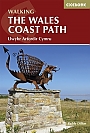
Wandelgids Walking the Wales coast path | Cicerone Guide | Llwybr Arfordir Cymru | 1400 km kustwandelpadThis guidebook explores the Welsh Coast Path which, at 1408km, is the longest trail in Britain, as it traces the coastline from Chester to Chepstow. This guide divides the Path into 9 geographical areas and 57 stages, ranging between 15 to 32km in length. The names of Anglesey, the Llyn Peninsula, Cardigan Bay, Pembrokeshire, and the Gower conjour ideas of spectacular scenery, world-famous geology, seabirds and wildlife, all of which can be explored with this guide. Â Opened in 2012, the entire coast is now accessible and waymarked; a true adventur... |
20,99 Tijdelijk niet leverbaar |
|
Topografische Wandelkaart 215 Newtown / Machynlleth Llanfair Caereinion - Explorer Map | Wandelkaart & Fietskaart | Ordnance Survey (OS) Groot-BrittanniëDeze gedetailleerde en informatieve topografische kaart (stafkaart, schaal 1:25.000) van Groot-Brittannië bevat alle topografische elementen van het landschap en geeft daarmee een nauwkeurig beeld van het terrein. Daarnaast heeft Ordnance Survey (OS) ook toeristische informatie op de meeste kaart verwerkt, zoals de aanduiding voor campings en ingetekende wandelpaden . Deze kaart is ideaal voor wandelaars of fietsers, maar ook voor de scouting of sportverenigingen die activiteiten in Groot-Brittannië gaan uitvoeren. De kaarten zijn voorzien van een GPS aanduiding en e... Schaal: 1:25.000 |
18,99 |
|
Wandelkaartgids Offa's Dyke Path - Wales | Cicerone | Handzaam wandelgidsje, alleen topografische kaarten met de wandelroute
Schaal: 1:25.000 |
13,99 |
|
Topografische Wandelkaart 124 Porthmadog / Dolgellau Snowdonia - Landranger Map | Wandelkaart & Fietskaart | Ordnance Survey (OS) Groot-BrittanniëDeze gedetailleerde en informatieve topografische kaart (stafkaart, schaal 1:50.000) van Groot-Brittannië bevat alle topografische elementen van het landschap en geeft daarmee een nauwkeurig beeld van het terrein. Daarnaast heeft Ordnance Survey (OS) ook toeristische informatie op de meeste kaart verwerkt, zoals de aanduiding voor campings en ingetekende wandelpaden . Deze kaart is ideaal voor wandelaars of fietsers, maar ook voor de scouting of sportverenigingen die activiteiten in Groot-Brittannië gaan uitvoeren. De kaarten zijn voorzien van een GPS aanduiding en e... Schaal: 1:50.000 |
18,99 |
|
Topografische Wandelkaart 135 Aberystwyth / Machynlleth - Landranger Map | Wandelkaart & Fietskaart | Ordnance Survey (OS) Groot-BrittanniëDeze gedetailleerde en informatieve topografische kaart (stafkaart, schaal 1:50.000) van Groot-Brittannië bevat alle topografische elementen van het landschap en geeft daarmee een nauwkeurig beeld van het terrein. Daarnaast heeft Ordnance Survey (OS) ook toeristische informatie op de meeste kaart verwerkt, zoals de aanduiding voor campings en ingetekende wandelpaden . Deze kaart is ideaal voor wandelaars of fietsers, maar ook voor de scouting of sportverenigingen die activiteiten in Groot-Brittannië gaan uitvoeren. De kaarten zijn voorzien van een GPS aanduiding en e... Schaal: 1:50.000 |
18,99 |
|
Fietskaart Wegenkaart 10 North & Mid Wales / Gogledd a Chanolbarth Cymru | Ordnance Survey Tour MapOverzichtelijke kaart van Ordnance Survey, de Britse topografische dienst. Deze Tour Maps met schaal 1:100.000 zijn prima kaarten voor het plannen van fietstochten. Alle wegen, grote en kleine zijn op de kaart vermeld. Eveneens staan de routes van het National Cycle Network op de kaart ingetekend. Verder zijn campings, jeugdherbergen en andere accommodaties vermeld. Schaal: 1:100.000 |
11,90 |

|
Wandelgids 29 Wye Valley & Forrest of Dean Pathfinder Guide | Pathfinder Guide 29 | Met Ordanance Survey kaartenDeze Pathfinder Guide is een goed uitgevoerde gids met verschillende wandelingen in Groot-Britannië. De gids bevat naast goede topografische kaarten van de Britse topografische dienst (Ordanance Survey) ook beschrijvingen van het landschap, de cultuur en/of de flora en fauna. Verder is de gids voorzien van praktische informatie zoals startpunten, verwachte wandeltijd, restaurants en cafes voor onderweg. 28 wandelingen. The Wye Valley and Forest of Dean Pathfinder guidebook contains 28 circular walks for all abilities. Walks are from 4km to 17km long, and each rout... |
17,99 |
|
Wandelgids 32 Wales North & Snowdonia Pathfinder Guide | Pathfinder Guide 32 | Met Ordanance Survey kaartenDeze Pathfinder Guide is een goed uitgevoerde gids met verschillende wandelingen in Groot-Britannie. De gids bevat naast goede topografische kaarten van de Britse topografische dienst (Ordanance Survey) ook beschrijvingen van het landschap, de cultuur en/of de flora en fauna. Verder is de gids voorzien van praktische informatie zoals startpunten, verwachte wandeltijd, restaurants en cafes voor onderweg. 28 wandelingen. Discover far more than Wales' highest mountain with the Pathfinder guidebook for North Wales and Snowdonia. Routes include Great Orme, Tal Y Fan, th... |
17,99 Tijdelijk niet leverbaar |
|
Wandelkaart Pembrokeshire Coast Path - National Trail Maps | Harvey Maps | Water- en scheurvaste wandelkaartDe Harvey Map is de wandelkaart voor het lange afstand wandelpad in het Groot-Brittannië. Duidelijke topografische wandelkaarten met praktische informatie van de route zoals overnachtingsmogelijkheden, eetgelegenheden en bezienswaardigheden. Deze wandelkaart is scheur- en watervast. Met GPS compatible (UTM-Grid). Schaal: 1:40.000 |
25,99 Tijdelijk niet leverbaar |
|
Wandelgids Walking in the Wye Valley | Cicerone | 30 varied walks between Chepstow and PlynlimonGuidebook to 30 varied walks of 3 - 10 miles, in the valley of the Wye, the most scenic river in England and Wales, between Chepstow in the south and Plynlimon. Landscape ranges from open moorland to wooded gorges and is dotted with the sites of Iron Age hillforts and castles. Centres include Ross-on-Wye, Hereford, Hay-on-Wye and Rhayader.all walks can be enjoyed in any season, although care needs to be taken on the mountain and moorland walks in the upper valley in winter; risk of winter flooding between Hereford and Monmouth. Chepstow, Monmouth, Ross-on-Wye, Hereford... |
17,99 |
|
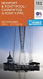
Topografische Wandelkaart 152 Newport / Pontypool - Explorer Map | Wandelkaart & Fietskaart | Ordnance Survey (OS) Groot-BrittanniëDeze gedetailleerde en informatieve topografische kaart (stafkaart, schaal 1:25.000) van Groot-Brittannië bevat alle topografische elementen van het landschap en geeft daarmee een nauwkeurig beeld van het terrein. Daarnaast heeft Ordnance Survey (OS) ook toeristische informatie op de meeste kaart verwerkt, zoals de aanduiding voor campings en ingetekende wandelpaden . Deze kaart is ideaal voor wandelaars of fietsers, maar ook voor de scouting of sportverenigingen die activiteiten in Groot-Brittannië gaan uitvoeren. De kaarten zijn voorzien van een GPS aanduiding en e... Schaal: 1:25.000 |
18,99 |
|
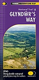
Wandelkaart Glyndwr's Way | Harvey Maps | Water- en scheurvaste wandelkaartDe Harvey Map is de wandelkaart voor het wandelen in de mooiste natuurgebieden in het Groot-Brittannië. Duidelijke topografische wandelkaarten met praktische informatie van de route zoals overnachtingsmogelijkheden, eetgelegenheden en bezienswaardigheden. Deze wandelkaart is scheur- en watervast. Met GPS compatible (UTM-Grid). Compact and light - the map itself weighs just 60gms - a third of the weight of a laminated map, and much less bulky. And you can fold or refold it time and again, or stuff it in your back pocket and it won't fall to pieces. Shows the entire rou... Schaal: 1:40.000 |
25,99 |
|
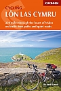
Fietsgids Wales Cycling Lôn Las Cymru | Cicerone Guide | 250 miles through the heart of Wales on traffic-free paths and quiet roadsGuidebook to cycling Lôn Las Cymru, a 255 mile (410km) route from Cardiff, or 242 mile (390km) from Chepstow to Holyhead, showcasing Wales's beautiful rural heartland. Cycling is on quiet roads and traffic-free paths, and although there are some mountainous sections, gradients are mostly gentle. The route can be completed in 4-7 days. The route passes through many of the main towns in the Brecon Beacons, Black Mountains, Cambrian Mountains and Snowdonia National Park. The route can be ridden as a leisure ride or as a challenge and there are schedules for both typ... |
12,99 |
|
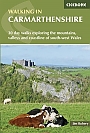
Wandelgids Walking in Carmarthenshire | Cicerone | 20 day walks exploring the mountains, valleys and coastline of south-west WalesThis guidebook presents 30 contrasting day walks exploring the mountains, valleys and coastline of Carmarthernshire in south-west Wales. Ranging from 2 to 10 miles in length and suitable for walkers of all abilities, the routes introduce the varied walking on offer in this county, including parts of the Brecon Beacons and the Cambrian Mountains. Alongside detailed route descriptions and clear OS mapping, the book is packed with interesting information about the places and heritage encountered. Notes on landscape, geology and wildlife of the area are included, and fo... |
17,99 |
|
Wandelgids The Ceredigion and Snowdonia Coast Paths | Cicerone | the Ceredigion Coast Path and Snowdonia Coast PathAs part of the Wales Coast Path, the Ceredigion Coast Path and Snowdonia Coast Path trace a curve of 233km (145 miles) of coastal and inland walking down Cardigan Bay. This guidebook describes a 16-stage guide to the walk from Porthmadog to St Dogmaels covering the trail between the Llyn Peninsula and the Pembrokeshire Coast Path. .In 16 day stages from Porthmadog to St Dogmaels, this guidebook offers all the information walkers need to complete the 233km (145 miles) section of the Wales Coast Path that curve down Cardigan Bay, passing through a range of contrasting la... |
17,99 Tijdelijk niet leverbaar |

|
Wandelgids Glyndwr's Way From Knighton to Welshpool Wales | CiceroneGuidebook to walking Glyndwr's Way, a long-distance National Trail through mid-Wales. The 135 mile route from Knighton via Machynlleth to Welshpool takes 9 days to walk, and 2 days (29 miles) to complete the loop down the Offa's Dyke Path to create a circular trail. A lovely trail through quiet hills, forests and rolling countryside. A complete guide to walking Glyndŵr's Way National Trail. This guidebook divides the 135 mile trail into nine day stages, starting at Knighton and ending at Welshpool. Days 10 and 11 follow the Offa's Dyke Path National Tr... |
21,99 |

|
Wandelgids 50 Walks in Brecon Beacons & South Wales | AA PublishingOverzichtelijke wandelgids met duidelijke beschrijvingen en wandelkaarten. Wandeltochten van 5 tot 13 kilometer. The books feature all the practical detail you need, accompanied by fascinating background reading on the history and wildlife of the area, and clear mapping for ease of use. Every route has been colour coded according to difficulty. All walks are annotated with local points of interest and places to stop for refreshments. |
18,99 |
|
Topografische Wandelkaart 151 Cardiff / Bridgend Vale of Glamorgan - Explorer Map | Wandelkaart & Fietskaart | Ordnance Survey (OS) Groot-BrittanniëDeze gedetailleerde en informatieve topografische kaart (stafkaart, schaal 1:25.000) van Groot-Brittannië bevat alle topografische elementen van het landschap en geeft daarmee een nauwkeurig beeld van het terrein. Daarnaast heeft Ordnance Survey (OS) ook toeristische informatie op de meeste kaart verwerkt, zoals de aanduiding voor campings en ingetekende wandelpaden . Deze kaart is ideaal voor wandelaars of fietsers, maar ook voor de scouting of sportverenigingen die activiteiten in Groot-Brittannië gaan uitvoeren. De kaarten zijn voorzien van een GPS aanduiding en e... Schaal: 1:25.000 |
18,99 |

|
Topografische Wandelkaart OL36van Groot-Brittannië (1:25.000) Pembrokeshire South / De Sir Benfro - Explorer Map OL 36 | Wandelkaart | Ordnance Survey (OS) Groot-BrittanniëDeze gedetailleerde en informatieve topografische kaart (stafkaart, schaal 1:25.000) van Groot-Brittannië bevat alle topografische elementen van het landschap en geeft daarmee een nauwkeurig beeld van het terrein. Daarnaast heeft Ordnance Survey (OS) ook toeristische informatie op de meeste kaart verwerkt, zoals de aanduiding voor campings en ingetekende wandelpaden . Deze kaart is ideaal voor wandelaars of fietsers, maar ook voor de scouting of sportverenigingen die activiteiten in Groot-Brittannië gaan uitvoeren. De kaarten zijn voorzien van een GPS aanduiding en e... Schaal: 1:25.000 |
18,99 |
|
Wandelkaart Brecon Beacons West - Walking Maps Superwalker | Harvey Maps | Water- en scheurvaste wandelkaartDe Harvey Map is de wandelkaart voor het wandelen in de mooiste natuurgebieden in het Groot-Brittannië. Duidelijke topografische wandelkaarten met praktische informatie van de route zoals overnachtingsmogelijkheden, eetgelegenheden en bezienswaardigheden. Deze wandelkaart is scheur- en watervast. Met GPS compatible (UTM-Grid). The Brecon Beacons West map for walkers covers Brynamman to Ystradfellte. Schaal: 1:25.000 |
25,99 |
|
Wandelkaart Brecon Beacons East - Walking Maps Superwalker | Harvey Maps | Water- en scheurvaste wandelkaartDe Harvey Map is de wandelkaart voor het wandelen in de mooiste natuurgebieden in het Groot-Brittannië. Duidelijke topografische wandelkaarten met praktische informatie van de route zoals overnachtingsmogelijkheden, eetgelegenheden en bezienswaardigheden. Deze wandelkaart is scheur- en watervast. Met GPS compatible (UTM-Grid). Brecon Beacons East map for hillwalkers covers Ystradfellte to Llangynidr. Schaal: 1:25.000 |
24,95 Tijdelijk niet leverbaar |
|
Fietskaart Pembrokeshire West Wales cycling map | GoldeneyeDe Goldeneye kaarten zijn uitstekende vrijetijdskaarten voor Groot-Brittannië, met name goed te gebruiken voor het fietsen door de overzichtelijke schaal. De De kaarten zijn helder, overzichtelijk en gedrukt op stevig papier. De MapGuide-kaarten bevatten toeristische informatie op de achterzijde van de kaart. De CyclingMaps bevatten fietspaden die over het algemeen vrij liggen van drukke wegen en/of gemotoriseerd verkeer en daarnaast ook de fietspaden van NCN (De Britse 'National Cycle Network'). Een handig register met plaatsnamen maakt het eenvoudig om p... Schaal: 1:126.720 |
10,99 |
|
Fietskaart Wales Celtic Trail East Cycle NN4B Map | Sustrans | Chepstow - Swansea, Cardiff - Brecon and other routesSustrans kaarten geven een goed overzicht van het National Cycle Network. 25.000 km lang is het fietsnetwerk inmiddels. De routes zijn bewegwijzerd, autoluw en fietsvriendelijk. Oude spoorwegen zijn omgetoverd in fietspaden of er wordt gebruik gemaakt van jaagpaden langs waterwegen. De cartografie is duidelijk met veel praktische informatie. Schaal: 1:100.000 |
10,99 |
|
Wandelgids Offa's Dyke Path Trailblazer | Prestatyn to ChepstowThe Offa's Dyke Path is a superb National Trail that runs from the North Wales coast to the Severn Estuary following the line of Offa's Dyke, an impressive 8th-century earthwork along the English/Welsh border. The ever-changing landscape – the Clwydian Range, the Shropshire Hills, the Black Mountains and the Wye Valley – is steeped in history and legend providing 177 miles (285km) of fascinating walking. Fourth edition entirely rewalked with all accommodation and each place to eat fully checked. Includes 98 detailed walking maps: the largest-scale m... |
18,99 Tijdelijk niet leverbaar |
Wales biedt bezoekers een scala aan bezienswaardigheden, waaronder het majestueuze kasteel van Cardiff, de historische Conwy-muren en het prachtige Snowdonia National Park voor wandelaars. Geschiedenisliefhebbers kunnen de stoomtreinrit van Ffestiniog maken en het St. Fagans National History Museum verkennen. De natuur is adembenemend, met de Brecon Beacons voor wandelingen en de dramatische kustlijn van Pembrokeshire. Outdoor activiteiten omvatten bergbeklimmen, kajakken en surfen. Overnachtingsmogelijkheden variëren van knusse bed & breakfasts tot luxe hotels. Wales biedt een rijke mix van geschiedenis, natuur en avontuur, en is ideaal voor reizigers die op zoek zijn naar een veelzijdige en betoverende bestemming.