- Gratis verzending vanaf 30 euro
- Levert in Nederland, België etc.
- Meer dan 30.000 titels
- Vakkundige klantenservice
- Snelle levering
- Veilig en eenvoudig betalen

Direct contact?
Bel +31 (0)6 42428571
maandag t/m vrijdag
van 10 tot 17 uur
Wandelgids 29 Wye Valley & Forrest of Dean Pathfinder Guide
Pathfinder Guide 29 | Met Ordanance Survey kaarten
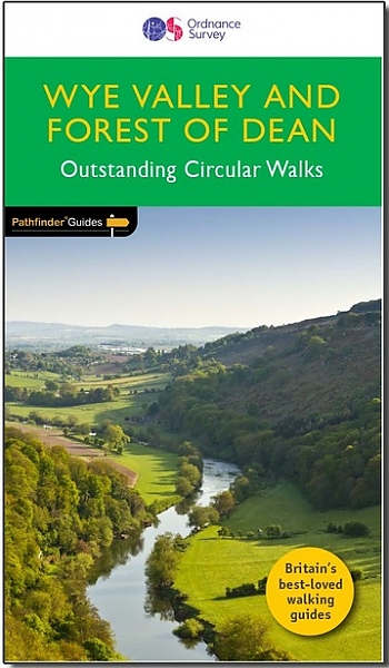
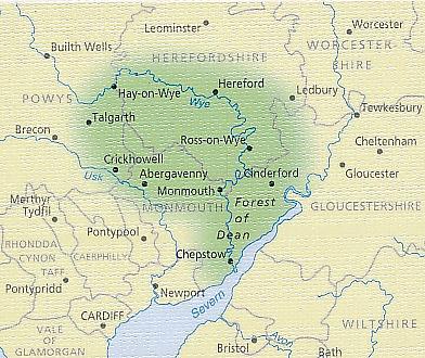
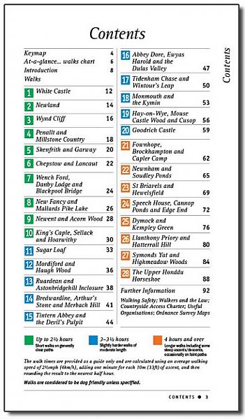
Deze Pathfinder Guide is een goed uitgevoerde gids met verschillende wandelingen in Groot-Britannië. De gids bevat naast goede topografische kaarten van de Britse topografische dienst (Ordanance Survey) ook beschrijvingen van het landschap, de cultuur en/of de flora en fauna. Verder is de gids voorzien van praktische informatie zoals startpunten, verwachte wandeltijd, restaurants en cafes voor onderweg. 28 wandelingen. The Wye Valley and Forest of Dean Pathfinder guidebook contains 28 circular walks for all abilities. Walks are from 4km to 17km long, and each route includes a difficulty rating, route directions, an extract of the Ordnance Survey map and notes and photos of key features to look for. All of them have been created and tested by experienced walkers to help you make the most of the area. This guide focuses on the middle and lower sections of the Wye Valley, roughly where the river leaves its upper reaches in mid-Wales to enter Herefordshire. Hay-on-Wye, Hereford and the walled town of Chepstow are also covered, as is the classic view over the winding Wye Valley from Symonds Yat. The imposing ruins of medieval castles can often be found, a striking reminder of ancient warfare in the area. This is part of the Pathfinder series of guidebooks, which have carefully selected walks in the most popular areas of Britain.
Engelstalig
EAN: 9780319090442
Uitgeverij: Ordnance Survey Books
Serie: Pathfinder
Verschijningsdatum: 2017
Meest recente editie
Engelstalig
96 pagina's

Op voorraad
Overmorgen in huis (Nederland)
- Vakkundige klantenservice
- Groot assortiment
- Gratis retourneren binnen 14 dagen
- Aangesloten bij WebwinkelKEUR
€ 17,99
Verder in deze serie
- Wandelgids 01 South Devon and Dartmoor Pathfinder Guide
- Wandelgids 01 Yorkshire Dales Pathfinder Guide (Short Walks)
- Wandelgids 02 Peak District Pathfinder Guide (Short Walks)
- Wandelgids 03 Isle of Skye Pathfinder Guide
- Wandelgids 03 Lake District Pathfinder Guide (Short Walks)
- Wandelgids 04 Cairngorms Pathfinder Guide
- Wandelgids 04 Cotswolds Pathfinder Guide (Short Walks)
- Wandelgids 06 Cotswolds Pathfinder Guide
- Wandelgids 07 Fort William & Glen Coe Walks Pathfinder Guide
- Wandelgids 08 Dartmoor Pathfinder Guide (Short Walks)
- Wandelgids 08 Kent Pathfinder Guide
- Wandelgids 09 Exmoor and the Quantocks Pathfinder Guide
- Wandelgids 10 Snowdonia Pathfinder Guide
- Wandelgids 11 Dorset Pathfinder Guide
- Wandelgids 12 New Forest, Hampshire and South Downs Pathfinder Guide
- Wandelgids 13 North York Moors Pathfinder Guide (Short Walks)
- Wandelgids 14 Shropshire and Staffordshire Pathfinder Guide
- Wandelgids 14 Snowdonia Pathfinder Guide (Short Walks)
- Wandelgids 15 Yorkshire Dales Pathfinder Guide
- Wandelgids 18 Brecon Beacons Pathfinder Guide
- Wandelgids 19 Dumfries & Galloway Pathfinder Guide
- Wandelgids 21 Exmoor Pathfinder Guide (Short Walks)
- Wandelgids 21Somerset the Mendips Wiltshire Pathfinder Guide
- Wandelgids 23 Loch Lomond, The Trossachs and Stirling Pathfinder Guide
- Wandelgids 23 New Forest NP Pathfinder Guide (Short Walks)
- Wandelgids 25 Thames Valley and Chilterns Pathfinder Guide
- Wandelgids 26 Dartmoor Pathfinder Guide
- Wandelgids 27 Isle of Wight Pathfinder Guide (Short Walks)
- Wandelgids 27 Perthshire, Angus & Fife Pathfinder Guide
- Wandelgids 28 North York Moors Pathfinder Guide
- Wandelgids 29 Devon South Pathfinder Guide (Short Walks)
- Wandelgids 30 Loch Ness & Iverness Pathfinder Guide
- Wandelgids 32 Wales North & Snowdonia Pathfinder Guide
- Wandelgids 34 Pembrokeshire and Carmarthenshire Pathfinder Guide
- Wandelgids 35 Northumberland & the Scottish Borders Pathfinder Guide
- Wandelgids 39 Durham, North Pennines & Tyne & Wear Pathfinder Guide
- Wandelgids 41 Mid Wales Pathfinder Guide
- Wandelgids 42 Cheshire Pathfinder Guide
- Wandelgids 45 Norfolk Pathfinder Guide
- Wandelgids 46 Aberdeen / Royal Deeside Pathfinder Guide
- Wandelgids 47 Brecon Beacons Pathfinder Guide (Short Walks)
- Wandelgids 47 Edinburgh, Pentlands & the Lothians Pathfinder Guide
- Wandelgids 48 Suffolk Pathfinder Guide
- Wandelgids 49 Vale of York and the Yorkshire Wolds Pathfinder Guide
- Wandelgids 50 Lincolnshire & the Wolds Pathfinder Guide
- Wandelgids 53 Lancashire Pathfinder Guide
- Wandelgids 54 Hertfordshire and Bedfordshire Pathfinder Guide
- Wandelgids 55 Gower / Swansea / Cardiff Pathfinder Guide
- Wandelgids 60 Lake District Pathfinder Guide
- Wandelgids 63 Peak District Pathfinder Guide
- Wandelgids 64 South Pennines Pathfinder Guide
- Wandelgids 67 Downs South NP & East Sussex Pathfinder Guide
- Wandelgids 68 Devon North & Mid Pathfinder Guide
- Wandelgids 74 Malverns to Warwickshire Pathfinder Guide
Meer producten die interessant kunnen zijn
Wegenkaarten Wales
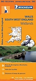
Wegenkaart - Landkaart 503 Wales & The Midlands - Michelin Regional
Wales, the Midlands, South West England 503
€ 11,50

Reisgidsen Wales


Reisgids Engeland Noord & Wales Trotter
De no-nonsensegids voor een allesomvattende trip.
€ 18,99
Tijdelijk niet leverbaar


Topografische kaarten Wales

Topografische Wandelkaart 152 Newport / Pontypool - Explorer Map
Wandelkaart & Fietskaart | Ordnance Survey (OS) Groot-Brittannië
€ 18,99

Topografische Wandelkaart 189 Hereford & Ross-on-Wye - Explorer Map
Wandelkaart & Fietskaart | Ordnance Survey (OS) Groot-Brittannië
€ 18,99
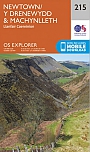
Topografische Wandelkaart 215 Newtown / Machynlleth Llanfair Caereinion - Explorer Map
Wandelkaart & Fietskaart | Ordnance Survey (OS) Groot-Brittannië
€ 18,99
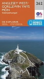
Topografische Wandelkaart 262 Anglesey West Holyhead - Explorer Map
Wandelkaart & Fietskaart | Ordnance Survey (OS) Groot-Brittannië
€ 18,99
Fietskaarten Wales
Wandelkaarten Wales
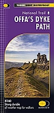
Wandelkaart Offa's Dyke Path National Trail Maps | Harvey Maps
Water- en scheurvaste wandelkaart
€ 25,99