- Gratis verzending vanaf 30 euro
- Levert in Nederland, België etc.
- Meer dan 30.000 titels
- Vakkundige klantenservice
- Snelle levering
- Veilig en eenvoudig betalen

Direct contact?
Bel +31 (0)6 42428571
maandag t/m vrijdag
van 10 tot 17 uur
Europa / Groot-Brittannië / Engeland
Engeland bestsellers
|
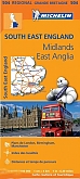
Wegenkaart - Landkaart 504 Zuid-Oost Engeland Kent Sussex - Michelin Regional | South East England, the Midlands, East Anglia 504De Michelinkaarten zijn onmisbare overzichtskaarten van een uitstekende kwaliteit. Deze bekende serie wegenkaarten bevatten in goed detail alle hoofdwegen en verbindingswegen tussen de dorpen en steden. Uitgebreid met andere belangrijke weginformatie, zoals tolwegen, tankstations, parkeerplaatsen, af- en opritten, wegnummers, , hoogteverschillen, winterafsluitingen en groene routes. Het zijn dus complete kaarten voor onderweg. Schaal: 1:400.000 |
11,50 |

|
Wegenkaart - Landkaart 502 Noord-Engeland - Michelin Regional | Northern England, the Midlands 502De Michelinkaarten zijn onmisbare overzichtskaarten van een uitstekende kwaliteit. Deze bekende serie wegenkaarten bevatten in goed detail alle hoofdwegen en verbindingswegen tussen de dorpen en steden. Uitgebreid met andere belangrijke weginformatie, zoals tolwegen, tankstations, parkeerplaatsen, af- en opritten, wegnummers, , hoogteverschillen, winterafsluitingen en groene routes. Het zijn dus complete kaarten voor onderweg. Schaal: 1:400.000 |
11,50 |
|
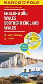
Wegenkaart - Landkaart Zuid Engeland, Wales | Marco Polo MapsPrima wegenkaart van Marco Polo, alle wegen staan erop vermeldt plus onverharde wegen. Pittoreske weggetjes die de moeite waard zijn, zijn groen gearceerd. Veel toeristische informatie is toegevoegd zoals de nationale parken, campings, kerken, vliegvelden en andere toeristische elementen. Vanzelfsprekend zijn er ook handige wegelementen aan toegevoegd: benzinestations, afstanden tussen de plaatsen enzovoorts. Een plaatsnamenregister zit bij de kaart. Schaal: 1:300.000 |
Tijdelijk niet leverbaar |

|
Wegenkaart - Landkaart 7 Northern England AA Road Map BritainOverzichtelijke wegenkaarten met een helder kaartbeeld. Wegnummers zijn weergegeven. Toerististische informatie door middel van pictogrammen. Campings, VVV, musea, grotten, picnic plekken, kastelen zijn onder andere aangegeven. Op de achterzijde staat een plaatsnamen register plus een aantal stadsplattegrondjes. Schaal: 1:200.000 |
9,95 |
|
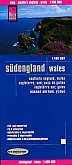
Wegenkaart - Landkaart Zuid-Engeland Wales - World Mapping Project (Reise Know-How) | Water- en scheurvaste wegenkaartEen degelijke water- en scheurvaste wegenkaart met een prettige en rustige kleurstelling. De kaart is 'Polyart' gemaakt, dit synthetische papier bevat geen chloor of andere halogenen en is niet giftig, en dus duurzaam in gebruik. De kaart is slijtvast en beschrijfbaar. Op de kaart zijn de GPS-coördinaten, is er een plaatsnamenregister aanwezig, zijn hoogtelijnen, toeristische informatie en spoorwegen zijn aangegeven. De kaart is in de meeste gevallen bedrukt aan beide zijden. Schaal: 1:400.000 |
11,25 |

|
Wegenkaart - Landkaart 8 North of England & Scottish Borders - AA Road Map BritainOverzichtelijke wegenkaarten met een helder kaartbeeld. Wegnummers zijn weergegeven. Toerististische informatie door middel van pictogrammen. Campings, VVV, musea, grotten, picnic plekken, kastelen zijn onder andere aangegeven. Op de achterzijde staat een plaatsnamen register plus een aantal stadsplattegrondjes. Schaal: 1:200.000 |
9,95 |
|
Wandelgids Hadrian's Wall Path Trailblazer | Two-way guide: Bowness to Newcastle and Newcastle to BownessPractical guide with 58 large scale maps (1:20,000). Includes accommodation guides, pubs and restaurants and public transport information. Hadrian's Wall Path is a magnificent 84 mile national trail that follows the course of northern Europe's largest surviving Roman monument, the 2nd century fortification built on the orders of the Emperor Hadrian in AD122 and now listed as a UNESCO World Heritage Site. The guide includes 58 detailed walking maps, unique mapping features such as walking times, directions, tricky junctions, places to stay, places to eat, points... |
19,50 |

|
Wegenkaart - Landkaart 3 South East England - AA Road Map BritainOverzichtelijke wegenkaarten met een helder kaartbeeld. Wegnummers zijn weergegeven. Toerististische informatie door middel van pictogrammen. Campings, VVV, musea, grotten, picnic plekken, kastelen zijn onder andere aangegeven. Op de achterzijde staat een plaatsnamen register plus een aantal stadsplattegrondjes. Schaal: 1:200.000 |
9,95 |

|
Wegenkaart - Landkaart 2 Central Southern England - AA Road Map BritainOverzichtelijke wegenkaarten met een helder kaartbeeld. Wegnummers zijn weergegeven. Toerististische informatie door middel van pictogrammen. Campings, VVV, musea, grotten, picnic plekken, kastelen zijn onder andere aangegeven. Op de achterzijde staat een plaatsnamen register plus een aantal stadsplattegrondjes. Schaal: 1:200.000 |
9,95 |

|
Wegenkaart - Landkaart 5 Midlands & Central England - AA Road Map BritainOverzichtelijke wegenkaarten met een helder kaartbeeld. Wegnummers zijn weergegeven. Toerististische informatie door middel van pictogrammen. Campings, VVV, musea, grotten, picnic plekken, kastelen zijn onder andere aangegeven. Op de achterzijde staat een plaatsnamen register plus een aantal stadsplattegrondjes. Schaal: 1:200.000 |
9,95 |
|
Topografische Wandelkaart 179 Canterbury / East Kent Dover Margate - Landranger Map | Wandelkaart & Fietskaart | Ordnance Survey (OS) Groot-BrittanniëDeze gedetailleerde en informatieve topografische kaart (stafkaart, schaal 1:50.000) van Groot-Brittannië bevat alle topografische elementen van het landschap en geeft daarmee een nauwkeurig beeld van het terrein. Daarnaast heeft Ordnance Survey (OS) ook toeristische informatie op de meeste kaart verwerkt, zoals de aanduiding voor campings en ingetekende wandelpaden . Deze kaart is ideaal voor wandelaars of fietsers, maar ook voor de scouting of sportverenigingen die activiteiten in Groot-Brittannië gaan uitvoeren. De kaarten zijn voorzien van een GPS aanduid... Schaal: 1:50.000 |
18,99 |
|
Topografische Wandelkaart 124 Hastings / Bexhill - Explorer Map | Wandelkaart & Fietskaart | Ordnance Survey (OS) Groot-BrittanniëDeze gedetailleerde en informatieve topografische kaart (stafkaart, schaal 1:25.000) van Groot-Brittannië bevat alle topografische elementen van het landschap en geeft daarmee een nauwkeurig beeld van het terrein. Daarnaast heeft Ordnance Survey (OS) ook toeristische informatie op de meeste kaart verwerkt, zoals de aanduiding voor campings en ingetekende wandelpaden . Deze kaart is ideaal voor wandelaars of fietsers, maar ook voor de scouting of sportverenigingen die activiteiten in Groot-Brittannië gaan uitvoeren. De kaarten zijn voorzien van een GPS aanduiding en e... Schaal: 1:25.000 |
18,99 |
|
Topografische Wandelkaart 189 Ashford / Romney Marsh - Landranger Map | Wandelkaart & Fietskaart | Ordnance Survey (OS) Groot-BrittanniëDeze gedetailleerde en informatieve topografische kaart (stafkaart, schaal 1:50.000) van Groot-Brittannië bevat alle topografische elementen van het landschap en geeft daarmee een nauwkeurig beeld van het terrein. Daarnaast heeft Ordnance Survey (OS) ook toeristische informatie op de meeste kaart verwerkt, zoals de aanduiding voor campings en ingetekende wandelpaden . Deze kaart is ideaal voor wandelaars of fietsers, maar ook voor de scouting of sportverenigingen die activiteiten in Groot-Brittannië gaan uitvoeren. De kaarten zijn voorzien van een GPS aanduiding en e... Schaal: 1:50.000 |
18,99 |
|
Wandelkaart South Downs Way - National Trail Maps | Harvey Maps | Water- en scheurvaste wandelkaartDe Harvey Map is de wandelkaart voor het lange afstand wandelpad in het Groot-Brittannië. Duidelijke topografische wandelkaarten met praktische informatie van de route zoals overnachtingsmogelijkheden, eetgelegenheden en bezienswaardigheden. Deze wandelkaart is scheur- en watervast. Met GPS compatible (UTM-Grid). Shows the entire route on one sheet, 162km (101 miles) between Winchester and Eastbourne. Suitable for walkers, cyclists and horse riders with alternative routes clearly shown. Information on finding accommodation, camping, food. Directions to the start. Also... Schaal: 1:40.000 |
25,99 |

|
Wandelkaart Hadrian's Wall Path - National Trail Maps | Harvey Maps | Water- en scheurvaste wandelkaartDe Harvey Map is de wandelkaart voor het lange afstand wandelpad in het Groot-Brittannië. Duidelijke topografische wandelkaarten met praktische informatie van de route zoals overnachtingsmogelijkheden, eetgelegenheden en bezienswaardigheden. Deze wandelkaart is scheur- en watervast. Met GPS compatible (UTM-Grid). Compact and light - the map itself weighs just 60gms - a third of the weight of a laminated map, and much less bulky. And you can fold or refold it time and again, or stuff it in your back pocket and it won't fall to pieces. Schaal: 1:40.000 |
25,99 |
|
Wandelgids Walking in Kent Cicerone Guidebooks | 40 rondwandelingenWalking in Kent describes 40 walks in the Garden of England selected by Kev Reynolds. This guidebook includes the best routes from the previous two volumes (now out of print), as well as recently discovered routes in all corners of the county. There"s plenty to appeal to both family strollers and determined ramblers, and each route has been rewalked by the author and carefully revised. |
16,99 |
|
Wandelgids 60 Lake District Pathfinder Guide | Pathfinder Guide 60 | Met Ordanance Survey kaartenDeze Pathfinder Guide is een goed uitgevoerde gids met verschillende wandelingen in Groot-Britannië. De gids bevat naast goede topografische kaarten van de Britse topografische dienst (Ordanance Survey) ook beschrijvingen van het landschap, de cultuur en/of de flora en fauna. Verder is de gids voorzien van praktische informatie zoals startpunten, verwachte wandeltijd, restaurants en cafés voor onderweg. Pathfinder Lake District covering Coniston, Kewswick and Devoke Water. This selection offers interest, regional variety and balance of routes in the Lake Di... |
17,99 |
|
Topografische Wandelkaart 199 Eastbourne / Hastings - Landranger Map | Wandelkaart & Fietskaart | Ordnance Survey (OS) Groot-BrittanniëDeze gedetailleerde en informatieve topografische kaart (stafkaart, schaal 1:50.000) van Groot-Brittannië bevat alle topografische elementen van het landschap en geeft daarmee een nauwkeurig beeld van het terrein. Daarnaast heeft Ordnance Survey (OS) ook toeristische informatie op de meeste kaart verwerkt, zoals de aanduiding voor campings en ingetekende wandelpaden . Deze kaart is ideaal voor wandelaars of fietsers, maar ook voor de scouting of sportverenigingen die activiteiten in Groot-Brittannië gaan uitvoeren. De kaarten zijn voorzien van een GPS aanduiding en e... Schaal: 1:50.000 |
18,99 |
|
Topografische Wandelkaart 136 High Weald / Royal Tunbridge Wells - Explorer Map | Wandelkaart & Fietskaart | Ordnance Survey (OS) Groot-BrittanniëDeze gedetailleerde en informatieve topografische kaart (stafkaart, schaal 1:25.000) van Groot-Brittannië bevat alle topografische elementen van het landschap en geeft daarmee een nauwkeurig beeld van het terrein. Daarnaast heeft Ordnance Survey (OS) ook toeristische informatie op de meeste kaart verwerkt, zoals de aanduiding voor campings en ingetekende wandelpaden . Deze kaart is ideaal voor wandelaars of fietsers, maar ook voor de scouting of sportverenigingen die activiteiten in Groot-Brittannië gaan uitvoeren. De kaarten zijn voorzien van een GPS aanduiding en e... Schaal: 1:25.000 |
18,99 |
|
Wandelgids 11 Dorset Pathfinder Guide | Pathfinder Guide 11 | Met Ordanance Survey kaartenDeze Pathfinder Guide is een goed uitgevoerde gids met verschillende wandelingen in Groot-Britannië. De gids bevat naast goede topografische kaarten van de Britse topografische dienst (Ordanance Survey) ook beschrijvingen van het landschap, de cultuur en/of de flora en fauna. Verder is de gids voorzien van praktische informatie zoals startpunten, verwachte wandeltijd, restaurants en cafés voor onderweg. Dorset must rank as one of the most unspoilt counties in England. Dominating the landscape are the chalk downs open, sweeping, grassy uplands that stretch f... |
17,99 Tijdelijk niet leverbaar |
|
Wandelkaart North Downs Way - National Trail Maps | Harvey Maps | Water- en scheurvaste wandelkaartDe Harvey Map is de wandelkaart voor het lange afstand wandelpad in het Groot-Brittannië. Duidelijke topografische wandelkaarten met praktische informatie van de route zoals overnachtingsmogelijkheden, eetgelegenheden en bezienswaardigheden. Deze wandelkaart is scheur- en watervast. Met GPS compatible (UTM-Grid). Compact and light - the map itself weighs just 60gms - a third of the weight of a laminated map, and much less bulky. And you can fold or refold it time and again, or stuff it in your back pocket and it won't fall to pieces. Schaal: 1:40.000 |
25,99 |
|
Wegenkaart - Landkaart Zuid-Engeland/Wales - ITMB MapDe ITMB kaarten kenmerken zich door een kleurrijke en volle cartografische weergave. Het zijn degelijke kaarten, zeker voor gebieden waarvoor kaarten lastig te krijgen zijn, met aanduidingen van onder andere nationale parken en natuurgebieden, vliegvelden, toeristische bezienswaardigheden en een goede aanduiding van het wegennet. Daarnaast bevatten enkele kaarten ook stadsplattegronden (hoofdsteden of belangrijke centra). Bevat voor sommige landen ook aanduidingen in de orginele taal. Schaal: 1:550.000 |
13,50 |

|
Wandelkaartgids Hadrian's Wall Path | All the Ordnance Survey mapping needed for Hadrian's Wall PathHandzaam gidsje met topografische kaartjes van het gehele traject. Schaal 1:25.000, het wandelpad is extra ingetekend. Praktische informatie zoals pubs, picknick plekken, campings etc zijn door middel van pictogrammen aangegeven. Map of the 84-mile (135km) Hadrian's Wall Path National Trail, from Bowness-on-Solway to Wallsend, Newcastle. The trail typically takes a week to walk, and is suitable for walkers at all levels of experience. This compact booklet of Ordnance Survey 1:25,000 maps shows the full route, providing all of the mapping you need to complete ... Schaal: 1:25.000 |
13,50 |

|
Wandelkaart Cleveland Way - National Trail Maps | Harvey Maps | Water- en scheurvaste wandelkaartDe Harvey Map is de wandelkaart voor het lange afstand wandelpad in het Groot-Brittannië. Duidelijke topografische wandelkaarten met praktische informatie van de route zoals overnachtingsmogelijkheden, eetgelegenheden en bezienswaardigheden. Deze wandelkaart is scheur- en watervast. Met GPS compatible (UTM-Grid). Compact and light - the map itself weighs just 60gms - a third of the weight of a laminated map, and much less bulky. And you can fold or refold it time and again, or stuff it in your back pocket and it won't fall to pieces. Shows the entire route on one shee... Schaal: 1:40.000 |
25,99 Tijdelijk niet leverbaar |
|
Wandelgids Kintyre Way Rucksack ReadersRucksack Readers zijn handig uitgevoerd in een klapper met ringband. Deze gids heeft een goede beschrijving van de lange afstands route met overzichtelijke kaarten doch zonder veel detail. De kracht van de Rucksack Readers is de uitgebreide achtergrondinformatie over de flora, fauna en geologische verschijnselen. Dit alles rijkelijk omkleed met kleurrijke foto's en praktische tips. The Kintyre Way is a fully waymarked trail that criss-crosses the Kintyre peninsula for 100 miles (161 km). Starting from Tarbert in the north, it visits coastal villages and inland loch... |
23,90 |
|
Fietskaart Sussex South Surrey cycling map | GoldeneyeDe Goldeneye kaarten zijn uitstekende vrijetijdskaarten voor Groot-Brittannië, met name goed te gebruiken voor het fietsen door de overzichtelijke schaal. De De kaarten zijn helder, overzichtelijk en gedrukt op stevig papier. De MapGuide-kaarten bevatten toeristische informatie op de achterzijde van de kaart. De CyclingMaps bevatten fietspaden die over het algemeen vrij liggen van drukke wegen en/of gemotoriseerd verkeer en daarnaast ook de fietspaden van NCN (De Britse 'National Cycle Network'). Een handig register met plaatsnamen maakt het eenvoudig om p... Schaal: 1:126.720 |
10,99 Tijdelijk niet leverbaar |
|
Wandelgids 08 Kent Pathfinder Guide | Pathfinder Guide 8 | Met Ordanance Survey kaartenDeze Pathfinder Guide is een goed uitgevoerde gids met verschillende wandelingen in Groot-Britannië. De gids bevat naast goede topografische kaarten van de Britse topografische dienst (Ordanance Survey) ook beschrijvingen van het landschap, de cultuur en/of de flora en fauna. Verder is de gids voorzien van praktische informatie zoals startpunten, verwachte wandeltijd, restaurants en cafés voor onderweg. Walkers in Kent enjoy a number of long-distance footpaths, including the North Downs Way, Wealdway, Pilgrims' Way and Greensand Way, and sections of them are incorpor... |
17,99 |
|
Reisgids Dorset, Hampshire & Isle of Wight Rough GuideDe Rough Guide is een zeer degelijke, uitgebreide en informatieve reisgids voor iedere type reiziger: van backpacker tot cultuurreiziger. De Rough Guide staat bekend om de degelijke en goed onderzochte achtergrondinformatie en de goede ordening van verschillende onderwerpen. Voor veel gebieden is de Rough Guide een goed, soms zelfs een beter, alternatief voor de populaire Lonely Planet. Rough Guide: The Rough Guide to Dorset, Hampshire & The Isle of Wight is your definitive handbook to one of the most beautiful and diverse holiday destinations in the UK. From the w... |
18,50 |
|
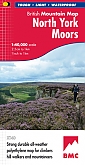
Wandelkaart North York Moors - Mountain Map | Harvey Maps | Water- en scheurvaste wandelkaartDe Harvey Map is de wandelkaart voor het wandelen in de mooiste natuurgebieden in het Groot-Brittannië. Duidelijke topografische wandelkaarten met praktische informatie van de route zoals overnachtingsmogelijkheden, eetgelegenheden en bezienswaardigheden. Deze wandelkaart is scheur- en watervast. Met GPS compatible (UTM-Grid). North York Moors - Part of the highly successful and innovative British Mountain Map series. It covers around 560 square miles of country - the only really detailed map to cover this whole area on one sheet. It also includes the popular North Yo... Schaal: 1:40.000 |
28,99 |
|
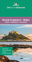
Reisgids Noord-Engeland Wales - De Groene Gids Michelin | Cardiff - Manchester - Lake DistrictDe Michelin Groene Gids is een overzichtelijke reisgids met uitgebreide achtergrondinformatie over de bezienswaardigheden, interessante overnachtings- en restaurantadressen geselecteerd door Michelin, en een keur aan andere praktische informatie. De beroemde sterrenbeoordeling geeft aan wat je moet hebben gezien. De is geïllustreerd met kleurenfoto's. Heldere kaarten wijzen je de weg naar de interessantste bezienswaardigheden en leiden je via de mooiste rondritten naar je bestemming. Kortom, een ideale gids om met het hele gezin van een goede vakantie te kunnen geniet... |
25,99 |
|
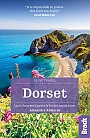
Reisgids Slow Dorset Bradt Travel GuideThis new third edition of Bradt's popular guide to Dorset - part of its distinctive series of 'Slow Travel' guides to local UK regions - has been thoroughly updated to reflect all the most recent changes to the region. Where - and what - to eat, where and when to go and what to see are all covered, providing an essential guide to one of Britain's most rural counties. The author, a Dorset girl born and bred, says: 'Many of Dorset's attractions are well-hidden and known only to locals, who like to keep the county's treasures to themselves. Thi... |
17,99 Tijdelijk niet leverbaar |

|
Reisgids Zuid-Engeland Capitool
|
28,99 |
|
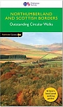
Wandelgids 35 Northumberland & the Scottish Borders Pathfinder Guide | Pathfinder Guide 35 | Met Ordanance Survey kaartenDeze Pathfinder Guide is een goed uitgevoerde gids met verschillende wandelingen in Groot-Britannie. De gids bevat naast goede topografische kaarten van de Britse topografische dienst (Ordanance Survey) ook beschrijvingen van het landschap, de cultuur en/of de flora en fauna. Verder is de gids voorzien van praktische informatie zoals startpunten, verwachte wandeltijd, restaurants en cafes voor onderweg. 28 wandelingen. Pathfinder(R) Northumberland and the Scottish Borders covering Blanchland, Melrose and Hartside. This selection offers interest, regional variety and ba... |
17,99 |
|
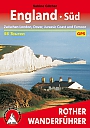
Wandelgids 254 Zuid Engeland Süd | Rother | 56 wandelingen Zwischen London, Dover, Jurassic Coast und Exmoor.De vermaarde wandelgiden van Rother Bergverlag zijn uitstekende wandelgidsen voor ieder niveau. Op een kaartje is de wandelroute aangegeven, maar deze is ook beschreven in een beknopte en heldere tekst. Daarnaast is ook de afstand, de verwachte wandeltijd, het niveau, de hoogte en andere praktische informatie aangegeven. Met deze degelijke wandelgids ontdek je de mooiste plekken van jouw bestemming en kun je de spannendste wandeluitdagingen zoeken. 56 wandelingen. |
14,90 |
|
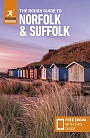
Reisgids Norfolk & Suffolk Rough GuideDe Rough Guide is een zeer degelijke, uitgebreide en informatieve reisgids voor iedere type reiziger: van backpacker tot cultuurreiziger. De Rough Guide staat bekend om de degelijke en goed onderzochte achtergrondinformatie en de goede ordening van verschillende onderwerpen. Voor veel gebieden is de Rough Guide een goed, soms zelfs een beter, alternatief voor de populaire Lonely Planet. The Rough Guide to Norfolk & Suffolk focuses on one of the UK's most popular regions. In full colour throughout, with dozens of gorgeous photos, it will inspire you to explore t... |
20,99 |
|
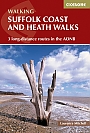
Wandelgids Suffolk Coast and Heath Walks | Cicerone | 3 long-distance routes in the AONBGuidebook to 3 long-distance routes exploring the varied landscapes of the Suffolk Coast and Heaths AONB. The Suffolk Coast Path covers 55 to 60 miles from Lowestoft to Felixstowe. The Stour and Orwell Walk is 40 miles from Felixstowe to Cattawade near Manningtree, while the Sandlings Walk is 59 miles from Ipswich to Southwold. all the routes can be walked at any time of year; summer is the busiest time and accommodation may be hard to find during the Aldeburgh Festival in June; spring and autumn are best for watching birds; winter has its own charm when you may find t... |
17,99 |
|
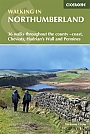
Wandelgids Walking in Northumberland | Ciceorone | 36 walks throughout the national park - coast, Cheviots, Hadrian's Wall and PenninesGuidebook to walking in Northumberland. 36 graded walks of 4 to 14 miles, from the beautiful coast with its immense, empty beaches and dramatic, crag-top castles to the remote hills of the Cheviots and Pennines. Includes Hadrian's Wall, Lindisfarne Priory, Kielder, Berwick, Bamburgh and Dunstanburgh Castles and more. Lindisfarne, Craster, Berwick-upon-Tweed, Seahouses, Wooler, Rothbury, Allendale, Haltwhistle, Alwinton, Ingram, Kielder and many other villages. A wide selection of walks including full days on the hills and coast and shorter walks at lower levels. Terrai... |
17,99 |
|
Reisgids Zuid-Engeland - Londen Bath Oxford Cambridge De Groene Gids MichelinDe Michelin Groene Gids is een overzichtelijke reisgids met uitgebreide achtergrondinformatie over de bezienswaardigheden, interessante overnachtings- en restaurantadressen geselecteerd door Michelin, en een keur aan andere praktische informatie. De beroemde sterrenbeoordeling geeft aan wat je moet hebben gezien. De is geïllustreerd met kleurenfoto's. Heldere kaarten wijzen je de weg naar de interessantste bezienswaardigheden en leiden je via de mooiste rondritten naar je bestemming. Kortom, een ideale gids om met het hele gezin van een goede vakantie te kunnen geni... |
25,99 |
|
Topografische Wandelkaart 125 Romney Marsh / Rye / Winchelsea - Explorer Map | Wandelkaart & Fietskaart | Ordnance Survey (OS) Groot-BrittanniëDeze gedetailleerde en informatieve topografische kaart (stafkaart, schaal 1:25.000) van Groot-Brittannië bevat alle topografische elementen van het landschap en geeft daarmee een nauwkeurig beeld van het terrein. Daarnaast heeft Ordnance Survey (OS) ook toeristische informatie op de meeste kaart verwerkt, zoals de aanduiding voor campings en ingetekende wandelpaden . Deze kaart is ideaal voor wandelaars of fietsers, maar ook voor de scouting of sportverenigingen die activiteiten in Groot-Brittannië gaan uitvoeren. De kaarten zijn voorzien van een GPS aanduiding en e... Schaal: 1:25.000 |
18,99 |
|
Wandelgids Thames Path Thames Head to the Thames Barrier | TrailblazerPraktische, alles-in-een gids voor het lopen van het Thames Path National Trail van de Costwolds naar de Thames Barrier in Londen, inclusief grootschalige wandelkaarten, verblijfplaatsen, plaatsen om te eten en informatie over het openbaar vervoer. De National Trail van The Thames Path loopt over 294 km van de bron bij Thames Head bij Kemble in de Cotswolds naar de Thames Barrier in Londen. Het landschap is prachtig gevarieerd, variërend van wilde en eenzame delen van de bovenloop van de rivier tot even indrukwekkende stedelijke vergezichten. Je komt langs zoveel ... |
18,95 Tijdelijk niet leverbaar |
|
Fietskaart 22 Shropshire Staffordshire & the Black Country Cycle Map Sustrans Pocket Sized | van 9.99 voor 4.99!Mid-Wales South Cycle Map including the Ystwyth Trail, Elan Valley Trail, Lon Las Cymru, Lon Teifi, 3 day rides & 6 town centre maps. This is in the series of pocket sized, folded maps to the National Cycle Network which include clearly mapped on-road and traffic-free paths, easy to read contours and detailed town insets. The series is published by CycleCity Guides in partnership with Sustrans. 1:110,000 scale; folded. Schaal: 1:110.00 |
4,99 |
|
Topografische Wandelkaart OL22 van Groot-Brittannië (1:25.000) Brighton & Hove, Lewes & Burgess Hill - Explorer Map OL 11 | Wandelkaart | Ordnance Survey (OS) Groot-BrittanniëDeze gedetailleerde en informatieve topografische kaart (stafkaart, schaal 1:25.000) van Groot-Brittannië bevat alle topografische elementen van het landschap en geeft daarmee een nauwkeurig beeld van het terrein. Daarnaast heeft Ordnance Survey (OS) ook toeristische informatie op de meeste kaart verwerkt, zoals de aanduiding voor campings en ingetekende wandelpaden . Deze kaart is ideaal voor wandelaars of fietsers, maar ook voor de scouting of sportverenigingen die activiteiten in Groot-Brittannië gaan uitvoeren. De kaarten zijn voorzien van een GPS aanduid... Schaal: 1:25.000 |
18,99 |
|
Topografische Wandelkaart OL43 van Groot-Brittannië (1:25.000) Hadrian's Wall / Haltwhistle / Hexham - Explorer Map OL 43 | Wandelkaart | Ordnance Survey (OS) Groot-BrittanniëDeze gedetailleerde en informatieve topografische kaart (stafkaart, schaal 1:25.000) van Groot-Brittannië bevat alle topografische elementen van het landschap en geeft daarmee een nauwkeurig beeld van het terrein. Daarnaast heeft Ordnance Survey (OS) ook toeristische informatie op de meeste kaart verwerkt, zoals de aanduiding voor campings en ingetekende wandelpaden . Deze kaart is ideaal voor wandelaars of fietsers, maar ook voor de scouting of sportverenigingen die activiteiten in Groot-Brittannië gaan uitvoeren. De kaarten zijn voorzien van een GPS aanduid... Schaal: 1:25.000 |
18,99 |
|
Fietskaart Kent cycling map | GoldeneyeDe Goldeneye kaarten zijn uitstekende vrijetijdskaarten voor Groot-Brittannië, met name goed te gebruiken voor het fietsen door de overzichtelijke schaal. De De kaarten zijn helder, overzichtelijk en gedrukt op stevig papier. De MapGuide-kaarten bevatten toeristische informatie op de achterzijde van de kaart. De CyclingMaps bevatten fietspaden die over het algemeen vrij liggen van drukke wegen en/of gemotoriseerd verkeer en daarnaast ook de fietspaden van NCN (De Britse 'National Cycle Network'). Een handig register met plaatsnamen maakt het eenvoudig om p... Schaal: 1:126.720 |
12,50 |
|
Wandelgids South Downs Way Trailblazer | Winchester to EastbourneDe South Downs Way is een 160 km lange nationale route die de lijn van krijtheuvels volgt die zich uitstrekt van Winchester in Hampshire over Sussex naar Eastbourne. Langs de Downs lopen is de beste manier om dit prachtige landschap te ervaren met zijn mix van glooiende heuvels, steile hangende bossen en winderige velden. Je passeert ook dorpjes met ansichtkaarten met gastvrije pubs, huisjes met rieten daken en typisch Engelse landtuinen. |
20,90 |
|
Reisgids Engeland Centraal DominicusDe Dominicus gidsen zijn zeer degelijke reisgidsen waar de nadruk vooral ligt op het bieden van achtergrondinformatie bij de reisbestemming. Op een persoonlijke wijze worden thema's behandeld als de ontwikkeling van de lokale economie, de kenmerken van de lokale bevolking, verschillende culturele uitingen (zoals religie, gebruiken en gewoonten) en de algemene geschiedenis. Daarnaast wordt er per regio, stad of gebied specifieke informatie gegeven over de belangrijkste kenmerken. Er is een sterke focus op de culturele bezienswaardigheden. De Dominicus is vloeiend geschr... |
22,99 Tijdelijk niet leverbaar |
|
Wandelgids Walking in the South Downs National Park Cicerone Guidebooks | 40 circular walks
|
19,99 Tijdelijk niet leverbaar |

|
Wandelkaart Coast to Coast - St. Bees to Robin Hood's Bay - National Trail Maps | Harvey Maps | Water- en scheurvaste wandelkaartDe Harvey Map is de wandelkaart voor het lange afstand wandelpad in het Groot-Brittannië. Duidelijke topografische wandelkaarten met praktische informatie van de route zoals overnachtingsmogelijkheden, eetgelegenheden en bezienswaardigheden. Deze wandelkaart is scheur- en watervast. Met GPS compatible (UTM-Grid). Compact and light - the map itself weighs just 60gms - a third of the weight of a laminated map, and much less bulky. And you can fold or refold it time and again, or stuff it in your back pocket and it won't fall to pieces. Schaal: 1:40.000 |
25,99 |

|
Topografische Wandelkaart 137 Ashford - Explorer Map | Wandelkaart & Fietskaart | Ordnance Survey (OS) Groot-BrittanniëDeze gedetailleerde en informatieve topografische kaart (stafkaart, schaal 1:25.000) van Groot-Brittannië bevat alle topografische elementen van het landschap en geeft daarmee een nauwkeurig beeld van het terrein. Daarnaast heeft Ordnance Survey (OS) ook toeristische informatie op de meeste kaart verwerkt, zoals de aanduiding voor campings en ingetekende wandelpaden . Deze kaart is ideaal voor wandelaars of fietsers, maar ook voor de scouting of sportverenigingen die activiteiten in Groot-Brittannië gaan uitvoeren. De kaarten zijn voorzien van een GPS aanduiding en e... Schaal: 1:25.000 |
18,99 |
|
Wandelgids 13 North York Moors Pathfinder Guide (Short Walks) | 20 korte wandelingen 7.5 kmDeze Pathfinder Guide is een goed uitgevoerde gids met verschillende wandelingen in Groot-Britannie. De gids bevat naast goede topografische kaarten van de Britse topografische dienst (Ordanance Survey) ook beschrijvingen van het landschap, de cultuur en/of de flora en fauna. Verder is de gids voorzien van praktische informatie zoals startpunten, verwachte wandeltijd, restaurants en cafes voor onderweg. Short Walks North York Moors covering parts of Danby, Sutton Bank and Bridestone. This selection offers interest and regional variety in the North York Moors, providing... |
11,50 |
Bij een bezoek aan Engeland mag een toerist niet missen: de Tower of London, Stonehenge, Buckingham Palace, de Cotswolds, en de prachtige stad Oxford. Geschiedenisliefhebbers vinden inzichten in musea zoals het British Museum en Imperial War Museum. De natuurlijke schoonheid omvat het Lake District en de kliffen van Dover. Populaire outdoor activiteiten zijn wandelen in het Peak District en zeilen op het Lake Windermere. Overnachtingsmogelijkheden variëren van historische herbergen tot moderne hotels en charmante B&B's. Reisinformatie is beschikbaar in reisgidsen, op toeristische websites en boekingsplatforms zoals Booking.com en TripAdvisor voor accommodaties, evenals lokale toeristenbureaus voor activiteiten.