- Gratis verzending vanaf 30 euro
- Levert in Nederland, België etc.
- Meer dan 30.000 titels
- Vakkundige klantenservice
- Snelle levering
- Veilig en eenvoudig betalen

Direct contact?
Bel +31 (0)6 42428571
maandag t/m vrijdag
van 10 tot 17 uur
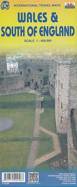
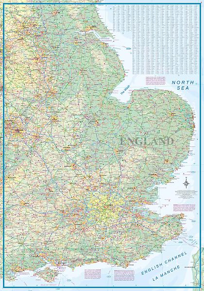
Wegenkaart - Landkaart Zuid-Engeland/Wales - ITMB Map
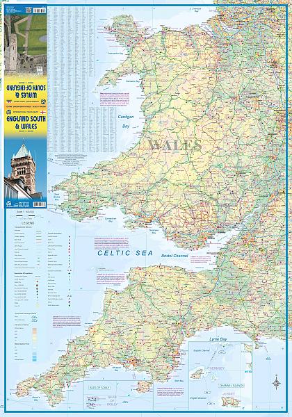
De ITMB kaarten kenmerken zich door een kleurrijke en volle cartografische weergave. Het zijn degelijke kaarten, zeker voor gebieden waarvoor kaarten lastig te krijgen zijn, met aanduidingen van onder andere nationale parken en natuurgebieden, vliegvelden, toeristische bezienswaardigheden en een goede aanduiding van het wegennet. Daarnaast bevatten enkele kaarten ook stadsplattegronden (hoofdsteden of belangrijke centra). Bevat voor sommige landen ook aanduidingen in de orginele taal.
We are gradually increasing the scales for our data of Great Britain and this is our latest effort. Most visitors to the UK fly into one of London's four airports and combine a visit to the city with an opportunity to travel to various destinations within striking distance of London. England is so incredibly rich in heritage and scenic attractions that it is extremely difficult to portray the country as a map of the entire entity. As a result, England lends itself nicely to be divided into a central/northern portion and a southern portion. To fit areas as diverse as Cornwall and Norwich on one sheet, one needs to have a vertical frame, with Devon/Cornwall up to the top of Wales on one side and Wiltshire to Kent up to York (admittedly, not normally considered to be part of 'southern', but vertically, that's what happens. At this scale, all of southern England and all of Wales can be shown in good detail, especially the motorways, A-type roads, and most B-type roads. Most C-level village roads are also there, but the scale available makes them somewhat difficult to see. Also, the scale enables us to add many more place names than was previously possible, but there are limits to what one can portray at any particular scale and the smallest level of village life will have to await more detailed maps at 1:250,000 that we will be preparing at a future date. This map is what we call a 'work in progress' and we would welcome input as to how to improve future editions. The map is quite detailed but not cluttered, and covers an area that one can drive in a four to five hour time period from Heathrow. A generation ago, this would have been impossible, but road improvements have extended a visitor's ability to cover more distance in the same time period as I used to cover in the 1960s. Somewhat surprisingly, the map also shows how the 'greenbelt' surrounding London is steadily disappearing as the city continues to expand. I suspect that most of our yellow urban infill areas are shown too conservative for modern times. The artwork, is accurate, detailed, attractively portrayed, and hopefully of interest to those visiting England.
Legend Includes:
Roads by classification, Rivers and Lakes, National Park, Airports, Points of Interests, Mining, Highways, Main Roads, Zoos, Fishing, , and much more...
Schaal: 1:550.000
Engelstalig
EAN: 9781771292566
Uitgeverij: ITMB (International Tavel Maps & Books)
Meest recente editie
Engelstalig
Op voorraad
Levertijd 1 week (Nederland) (wegens vakantie)
- Vakkundige klantenservice
- Groot assortiment
- Gratis retourneren binnen 14 dagen
- Aangesloten bij WebwinkelKEUR
€ 13,50
Meer producten die interessant kunnen zijn
Reisgidsen Engeland