- Gratis verzending vanaf 30 euro
- Levert in Nederland, België etc.
- Meer dan 30.000 titels
- Vakkundige klantenservice
- Snelle levering
- Veilig en eenvoudig betalen

Direct contact?
Bel +31 (0)6 42428571
maandag t/m vrijdag
van 10 tot 17 uur
Europa / Groot-Brittannië / Engeland
Engeland bestsellers
|
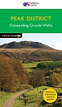
Wandelgids 63 Peak District Pathfinder Guide | Pathfinder Guide 63 | Met Ordanance Survey kaartenDeze Pathfinder Guide is een goed uitgevoerde gids met verschillende wandelingen in Groot-Britannië. De gids bevat naast goede topografische kaarten van de Britse topografische dienst (Ordanance Survey) ook beschrijvingen van het landschap, de cultuur en/of de flora en fauna. Verder is de gids voorzien van praktische informatie zoals startpunten, verwachte wandeltijd, restaurants en cafés voor onderweg. 28 beautiful country walks around the Peak District, graded by length and ranging from 3 to 11 miles. All routes come with a clear, large-scale OS map, GPS ... |
17,99 |
|
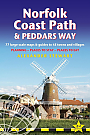
Wandelgids Peddars Way and Norfolk Coast Path Trailblazer | Knettishall Heath to Cromer
|
21,50 |
|
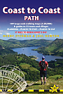
Wandelgids Coast to Coast Path Trailblazer | St Bees to Robin Hood's Bay, Planning, Places to Stay
|
19,90 |

|
Reisgids Slow Sussex and The South Downs Bradt Travel GuideStraddling the Hampshire Downs and the distinctive countryside of Sussex, the South Downs is Britain's newest and most visited national park, and is abutted by a long coastline and the surprisingly remote landscapes of the Weald. Slow-travel enthusiast and Sussex resident Tim Locke takes a close-up look at the best of the countryside and places in his back yard, and celebrates what makes the area so distinctive. This is not a book of dry practicalities. Locke's local knowledge leads the reader to his favourite walks, pubs and and places to stay, while his colou... |
17,99 |
|
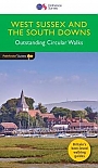
Wandelgids 66 West Sussex / South Downs Pathfinder Guide | Pathfinder Guide 66 | Met Ordanance Survey kaartenDeze Pathfinder Guide is een goed uitgevoerde gids met verschillende wandelingen in Groot-Britannie. De gids bevat naast goede topografische kaarten van de Britse topografische dienst (Ordanance Survey) ook beschrijvingen van het landschap, de cultuur en/of de flora en fauna. Verder is de gids voorzien van praktische informatie zoals startpunten, verwachte wandeltijd, restaurants en cafes voor onderweg. 28 dagwandelingen. Containing 28 circular, graded walks that have all been created and tested by experienced walkers, this walking guidebook is ideal for both visitors ... |
17,99 |
|
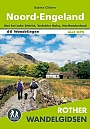
Wandelgids Noord-Engeland Rother Wandelgids | 60 wandelingenDe 60 mooiste wandelingen in Noord-Engeland, met het lake District, de Yorkshire Dales en Northumberland. Zoals gebruikelijk zijn er verschillende wandelingen voor beginnende en ervaren wandelaars en is er onmisbare informatie over de streek, de bezienswaardigheden en recreatiemogelijkheden. met het Lake District, Yorkshire Dales, Northumberland. De betrouwbare routebeschrijvingen, gedetailleerde kaarten en hoogteprofielen zorgen voor een onvergetelijke wandelervaring. |
18,99 |
|
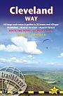
Wandelgids Cleveland Way | TrailblazerThe Cleveland Way is a National Trail set in the beautiful wild countryside of the North York Moors National Park. It runs 107.4 miles (127.9km) from Helmsley near Thirsk around the western edge of the park to reach the coast at Saltburn-by-the-Sea. It then continues along the eastern edge of the park south down the coast through Whitby, Robin Hood’s Bay and Scarborough to finish in Filey. Combining moorland and coast, there’s wonderful scenic variety to this walk, with crumbling castles and idyllic fishing villages to explore. Includes 48 detailed walking ... |
16,99 |
|
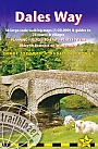
Wandelgids Dales Way | Trailblazer | Ilkley to Bowness-on-Windermere: 38 Large-scale Maps & Guides to 32 Towns and Villages - Planning - Places to Stay - Places to EThe popular Dales Way long-distance footpath begins in Ilkley, West Yorkshire and runs for 84 miles (135km) to end in the Lake District, in Bowness-on-Windermere. It follows riverside paths along the River Wharf towards Ribblehead and the watershed of northern England, then meanders along the river valleys of Dentdale, the River Mint and the River Kent dropping down into the Lake District to end beside Lake Windermere. It's a relatively easy walk that takes about a week. Includes 40 large-scale maps (3 1/8 inches to 1 mile); 9 town plans and 8 overview maps. Full d... Schaal: 1:20.000 |
18,95 |
|
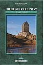
Wandelgids The Border Country: A Walker’s Guide Cicerone GuidebooksCovering the border hills, northern Northumberland and the Southern Uplands, this full-colour third edition of the guide offers a broad selection of around 50 routes, as well as outlines of a number of long-distance trails which cross the region. The Border country that lies between England and Scotland is a countryside surrounded by ridge after high ridge rythmically fading into gently folding valleys, through which the Tweed and Teviot rivers flow. The area has been the scene of thousands of years of sometimes turbulent history, from the early Iron Age, through the R... |
17,99 |
|
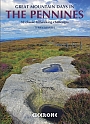
Wandelgids Great Mountain Days in the Pennines | Cicerone | 50 classic walksAn inspirational guidebook to 50 classic walks on the rolling Pennine landscape. The graded routes, between 6 and 13 miles in length, cover classic Pennine fells and moorland such as Whernside, Ilkley Moor and Pendle Hill; exploring the North and South Pennines, Yorkshire Dales, Howgills and Dark Peak. Many routes are also suited to fell running. Walks are grouped into five areas: the North Pennines, the Howgills, the Yorkshire Dales, the South Pennines and the Dark Peak. Walks are graded from 'Moderate' to 'Strenuous' but unlike other mountainous areas where the abili... |
23,99 |
|
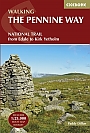
Wandelgids The Pennine Way Cicerone Guidebooks | From Edale to Kirk YetholmThe Pennine Way is Britain's oldest, toughest long-distance footpath and arguably its most iconic. Now a National Trail, the 427km (265 ½ mile) route from Edale in Derbyshire to Kirk Yetholm in the Scottish Borders offers wayfarers the opportunity to immerse themselves in wild beauty of the North. The Pennines boast rolling hills, sweeping moorland and wide glacial valleys, and the Pennine Way has come to embody personal challenge and adventure. This guidebook presents the route in 20 daily stages of 10.5-31.5km (6 ½-19 ½ miles). Step-by... |
22,99 |
|
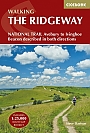
Wandelgids Ridgeway Cicerone Guidebooks | From Lyme Regis to HunstantonThis guidebook - which includes both a guide to the route and a separate OS map booklet - describes the Ridgeway National Trail, an 87 mile (139km) route through southern England from Avebury in Wiltshire to Ivinghoe Beacon in Buckinghamshire. Typically walked in 6 or 8 days, this is a low-level waymarked route suitable for all abilities and for year round walking. The guidebook details the trail in both directions, west to east and east to west. Step-by-step route descriptions are accompanied by 1:100,000 OS mapping and a separate OS 1:25,000 map booklet showing the e... |
17,99 |
|
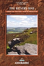
Wandelgids The Reivers Way Cicerone Guidebooks | through historic NorthumberlandWalk in the footsteps of the notorious border reivers and discover how they survived centuries of strife and warfare. The Reivers Way almost encircles the county of Northumberland, offering a wonderful opportunity to walk and explore its wildest and most scenic parts. The trail starts at Corbridge in the North Pennines AONB. After following part of Hadrian"s Wall, a series of little towns and villages are visited, as the route heads in an out of the Northumberland National Park. After catching a glimpse of Lindisfarne, the route traces the scenic Northumberland Heritag... |
14,99 Tijdelijk niet leverbaar |
|
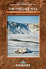
Wandelgids The Teesdale Way Cicerone Guidebooks | From Dufton to the North SeaA new, fully updated, full-colour edition of this guide. The Teesdale Way explores the course of the River Tees for exactly 100 miles from its source in the Cumbrian North Pennines to its outlet at Middlesbrough on the north-east coast. This is a delightful walk through unmatched river scenery including historic sites, SSSIs, pretty villages, woods, rolling farmland and wetlands. Passing as it does from remote Pennine moorland, through traditional Dales towns and finally to Teeside's industrial heartland, the Teesdale Way gives us a fascinating cross-section of the reg... |
16,99 Tijdelijk niet leverbaar |
|
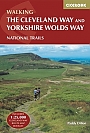
Wandelgids The Cleveland Way and the Yorkshire Wolds Way Cicerone Guidebooks | National TrailGuidebook to the Cleveland Way and Yorkshire Wolds Way National Trails, plus the Tabular Hills Walk link route. The guidebook also contains a 1:25,000 scale OS route map booklet of the Cleveland Way. The Cleveland Way National Trail, described in seven day stages, is a fine 177km (110 miles) walk around the North York Moors National Park from Helmsley to Filey. The Yorkshire Wolds Way is one of the quietest of Britain's National Trails and wanders for 130km (80 miles) through gentle, cultivated and sparsely populated countryside. Described here in nine day stages, f... |
22,99 |
|
Wandelgids The Thames Path Cicerone Guidebooks | National Trail from London to the river's source in Gloucestershire
|
22,99 |

|
Wandelgids The Yorkshire Dales - Walking in the North and East | Cicerone | Howgills, Mallerstang, Swaledale, Wensleydale, Coverdale and NidderdaleThis guidebook contains 43 circular day walks in the north and east Yorkshire Dales. It explores the dales, hills and moors between Kirkby Stephen and Pateley Bridge. Walking ranges from gentle three-mile strolls to more strenuous day-long rambles across the Howgills, Wensleydale, Swaledale, Nidderdale, Mallerstang and Coverdale In this guidebook, 43 circular walks, ranging from 3-mile strolls to full-day adventures are explored in the northern and eastern Dales. Few areas in England are as appealing as the Yorkshire Dales and this volume of a two-part guide provide... |
17,99 |

|
Reisgids Zuid-Engeland DominicusZuid-Engeland is een omvangrijk gebied dat loopt van de White Cliffs of Dover tot Land's End, van Windsor Castle tot het Isle of Wight. De zee is nooit ver weg en baaien en kliffen domineren de kustlijn. Het maritieme verleden van Plymouth, Southampton en Bristol is goed bewaard gebleven in gerestaureerde dokken en pakhuizen. De forten en kastelen die vroeger de kustlijn bewaakten, zijn nu opengesteld voor bezoekers. Meer landinwaarts liggen de ruïnes van de abdij van Glastonbury en Tintagel Castle. Cultuur vind je in de werelderfgoedsteden Canterbury en Bath ... |
23,99 Tijdelijk niet leverbaar |
|
Wandelgids Walking in Lancashire | Cicerone Guide | 40 walks throughout the county including the Forest of Bowland and Ribble ValleyGuidebook of 40 walks exploring the dales, moors, uplands and coasts of Lancashire, including Morecambe Bay, the Forest of Bowland, Ribble Valley and the West Pennine Moors. With routes for all seasons of the year and for a variety of abilities, these walks are within easy reach of Preston, Blackburn, Burnley, Lancaster and Clitheroe. Seasons Most of these walks can be completed all year round. Some higher level routes are challenging in winter, while lower level routes may become waterlogged after heavy rain. Centres Walks in the Forest of Bowland, Ribble Valley and W... |
16,99 |
|
Wandelgids Walking in Norfolk | Cicerone | 40 circular walks in the Broads, Brecks, Fens and along the coastThis book describes 40 easy-to-moderate circular day walks, grouped by area: Northeast coast and the Broads; South Norfolk, the Yare and the Waveney; North Norfolk and coast; Central Norfolk and Breckland and West Norfolk and Fens. Each walk is described step-by-step, illustrated with 1:40K OS map extracts and packed with historical, geological and other information about the landscape the route passes through. |
18,99 |

|
Wandelgids 50 Walks in Sussex and South Downs | AA PublishingOverzichtelijke wandelgids met duidelijke beschrijvingen en wandelkaarten. Wandeltochten van 5 tot 13 kilometer. A variety of mostly mapped walks to suit both the casual walker and the more serious hiker are contained in this illustrated guide. Detailed maps include information on the route - scenery, distance, terrain, places of interest - together with dog-friendly walks. Special features include: an introductory location map indicating the starting point of every walk; a summary of distance, time, gradient, level of difficulty, type of surface ... |
18,99 Tijdelijk niet leverbaar |

|
Reisgids Engeland Zuid Cambridge - Canterbury - Brighton - Exeter - Oxford Trotter | De no-nonsensegids voor een allesomvattende trip.De Nederlandstalige Trotter is de no-nonsensegids voor een allesomvattende trip. Of je gaat reizen met een groep of individueel, deze reisgids biedt je talrijke praktische tips in een overzichtelijk boek. Er is een uitgebreid aanbod van adresjes voor elk budget: slapen, eten, drinken, uitgaan en shoppen van goedkoop tot luxueus. De bezienswaardigheden zijn eigenzinnig gequoteerd door een team van kenners: 3 Trottermannetjes voor de toppers, 2 of 1 voor de minder bekende of nog onontdekte plekjes. Eenduidige overzichtskaarten en handige stadsplattegronden tonen je in &e... |
22,90 |
|
Fietskaart 4 North and South Devon Cycle Maps UK | Cordee | Water- en scheurvaste fietskaartKaart 4 omvat de South Downs, The New Forest en het Isle of Wight. De dekking strekt zich uit tot in het noorden tot Reigate Aldershot en Andover. De kaarten zijn allemaal gemaakt op een schaal van 1:100.000 en tonen belangrijke kenmerken, waaronder het Nationaal Fietsnetwerk. Secties over de weg, off-road en verkeersvrij worden allemaal in verschillende kleuren weergegeven, samen met hun routenummer. Er worden andere wegen en hun classificatie weergegeven, zodat u ritten kunt koppelen of secties kunt verkennen en nieuwe routes thuis of daarbuiten kunt ontdekken. Voorz... Schaal: 1:100.000 |
Tijdelijk niet leverbaar |
|
Fietskaart 5 Kent The High Weald and Kent Downs Cycle Maps UK | Cordee | Water- en scheurvaste fietskaartKaart 5 omvat Kent en East Sussex. Met alle NCN-routes, inclusief de meest zuidelijke delen van Dover tot Tain. De kaarten zijn allemaal gemaakt op een schaal van 1:100.000 en tonen belangrijke kenmerken, waaronder het Nationaal Fietsnetwerk. Secties over de weg, off-road en verkeersvrij worden allemaal in verschillende kleuren weergegeven, samen met hun routenummer. Er worden andere wegen en hun classificatie weergegeven, zodat u ritten kunt koppelen of secties kunt verkennen en nieuwe routes thuis of daarbuiten kunt ontdekken. Voorzieningen zoals toiletten, pubs, acc... Schaal: 1:100.000 |
Tijdelijk niet leverbaar |
|
Wandelkaart Pennine Way South: Edale to Horton in Ribblesdale - National Trail Maps | Harvey Maps | Water- en scheurvaste wandelkaartDe Harvey Map is de wandelkaart voor het lange afstand wandelpad in het Groot-Brittannië. Duidelijke topografische wandelkaarten met praktische informatie van de route zoals overnachtingsmogelijkheden, eetgelegenheden en bezienswaardigheden. Deze wandelkaart is scheur- en watervast. Met GPS compatible (UTM-Grid). Compact and light - the map itself weighs just 60gms - a third of the weight of a laminated map, and much less bulky. And you can fold or refold it time and again, or stuff it in your back pocket and it won't fall to pieces. Schaal: 1:40.000 |
25,99 |
|
Wandelgids 27 Isle of Wight Pathfinder Guide (Short Walks) | Pathfinder Guide 27 | Met Ordanance Survey kaartenDeze Pathfinder Guide is een goed uitgevoerde gids met verschillende wandelingen in Groot-Britannië. De gids bevat naast goede topografische kaarten van de Britse topografische dienst (Ordanance Survey) ook beschrijvingen van het landschap, de cultuur en/of de flora en fauna. Verder is de gids voorzien van praktische informatie zoals startpunten, verwachte wandeltijd, restaurants en cafés voor onderweg. Short Walks Isle of Wight covering parts of Newtown, Tennyson Down and Bembridge.This selection offers interest and regional variety in the Isle of Wight, p... |
11,50 |
|
Topografische Wandelkaart 138 Dover / Folkstone / Hythe - Explorer Map | Wandelkaart & Fietskaart | Ordnance Survey (OS) Groot-BrittanniëDeze gedetailleerde en informatieve topografische kaart (stafkaart, schaal 1:25.000) van Groot-Brittannië bevat alle topografische elementen van het landschap en geeft daarmee een nauwkeurig beeld van het terrein. Daarnaast heeft Ordnance Survey (OS) ook toeristische informatie op de meeste kaart verwerkt, zoals de aanduiding voor campings en ingetekende wandelpaden . Deze kaart is ideaal voor wandelaars of fietsers, maar ook voor de scouting of sportverenigingen die activiteiten in Groot-Brittannië gaan uitvoeren. De kaarten zijn voorzien van een GPS aanduiding en e... Schaal: 1:25.000 |
18,99 |
|
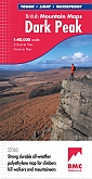
Wandelkaart Dark Peak - Mountain Map | Harvey Maps | Water- en scheurvaste wandelkaartDe Harvey Map is de wandelkaart voor het wandelen in de mooiste natuurgebieden in het Groot-Brittannië. Duidelijke topografische wandelkaarten met praktische informatie van de route zoals overnachtingsmogelijkheden, eetgelegenheden en bezienswaardigheden. Deze wandelkaart is scheur- en watervast. Met GPS compatible (UTM-Grid). Covering the popular highpoints of the Dark Peak. Printed on polyethylene - durable, tear-resistant and 100% waterproof. Made in cooperation with the British Mountaineering Council, colour shading for easy identification of hills and valleys. Le... Schaal: 1:40.000 |
28,99 |
|
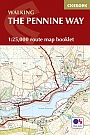
Wandelkaartgids Pennine Way map Booklet | CiceroneHandzaam kaartgidsje. Gedetailleerde topografische wandelkaarten gebonden in een handig boekje. Licht voor onderweg. Map of the 270 miles (435km) Pennine Way National Trail, between Edale in the Peak District and Kirk Yetholm in the Scottish Borders. This booklet is included with the Cicerone guidebook to the trail, and shows the full route on Ordnance Survey 1:25,000 maps. This popular long-distance route typically takes three weeks to complete. Schaal: 1:25.000 |
17,99 Tijdelijk niet leverbaar |
|
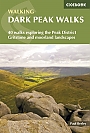
Wandelgids Dark Peak Walks | Cicerone Press | 40 wandelingenLocated in the Peak District and distinguished from the neighbouring White Peak by the layer of gritstone which covers its limestone bed, the Dark Peak features a wild landscape of sweeping moorland and big skies. Easily accessible from Sheffield, it boasts a wealth of natural, geological, historical and cultural interest – and some great walking. This guidebook describes 40 walks in the Dark Peak. Ranging from short strolls to full-day adventures, they showcase the region's unique character. Dramatic waterfalls, striking gritstone edges, heath and woodland a... |
17,99 Tijdelijk niet leverbaar |
|
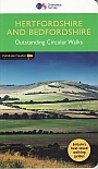
Wandelgids 54 Hertfordshire and Bedfordshire Pathfinder Guide | Pathfinder Guide 54 | Met Ordanance Survey kaartenDeze Pathfinder Guide is een goed uitgevoerde gids met verschillende wandelingen in Groot-Britannië. De gids bevat naast goede topografische kaarten van de Britse topografische dienst (Ordanance Survey) ook beschrijvingen van het landschap, de cultuur en/of de flora en fauna. Verder is de gids voorzien van praktische informatie zoals startpunten, verwachte wandeltijd, restaurants en cafés voor onderweg 28 great country walks from 3 to 10 1/2 miles with lage scale OS maps. |
17,99 |
|
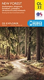
Topografische Wandelkaart OL22 van Groot-Brittannië (1:25.000) New Forest - Explorer Map OL 22 | Wandelkaart | Ordnance Survey (OS) Groot-BrittanniëDeze gedetailleerde en informatieve topografische kaart (stafkaart, schaal 1:25.000) van Groot-Brittannië bevat alle topografische elementen van het landschap en geeft daarmee een nauwkeurig beeld van het terrein. Daarnaast heeft Ordnance Survey (OS) ook toeristische informatie op de meeste kaart verwerkt, zoals de aanduiding voor campings en ingetekende wandelpaden . Deze kaart is ideaal voor wandelaars of fietsers, maar ook voor de scouting of sportverenigingen die activiteiten in Groot-Brittannië gaan uitvoeren. De kaarten zijn voorzien van een GPS aanduiding en e... Schaal: 1:25.000 |
18,99 |
|
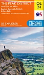
Topografische Wandelkaart OL24 van Groot-Brittannië (1:25.000) Peak District - White Peak area - Explorer Map OL 24 | Wandelkaart | Ordnance Survey (OS) Groot-BrittanniëDeze gedetailleerde en informatieve topografische kaart (stafkaart, schaal 1:25.000) van Groot-Brittannië bevat alle topografische elementen van het landschap en geeft daarmee een nauwkeurig beeld van het terrein. Daarnaast heeft Ordnance Survey (OS) ook toeristische informatie op de meeste kaart verwerkt, zoals de aanduiding voor campings en ingetekende wandelpaden . Deze kaart is ideaal voor wandelaars of fietsers, maar ook voor de scouting of sportverenigingen die activiteiten in Groot-Brittannië gaan uitvoeren. De kaarten zijn voorzien van een GPS aanduiding en e... Schaal: 1:25.000 |
18,99 |
|
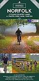
Fietskaart Norfolk cycling map | GoldeneyeDe Goldeneye kaarten zijn uitstekende vrijetijdskaarten voor Groot-Brittannië, met name goed te gebruiken voor het fietsen door de overzichtelijke schaal. De De kaarten zijn helder, overzichtelijk en gedrukt op stevig papier. De MapGuide-kaarten bevatten toeristische informatie op de achterzijde van de kaart. De CyclingMaps bevatten fietspaden die over het algemeen vrij liggen van drukke wegen en/of gemotoriseerd verkeer en daarnaast ook de fietspaden van NCN (De Britse 'National Cycle Network'). Een handig register met plaatsnamen maakt het eenvoudig om p... Schaal: 1:126.720 |
14,90 Tijdelijk niet leverbaar |

|
Fietskaart North York Moors cycling map | GoldeneyeDe Goldeneye kaarten zijn uitstekende vrijetijdskaarten voor Groot-Brittannië, met name goed te gebruiken voor het fietsen door de overzichtelijke schaal. De De kaarten zijn helder, overzichtelijk en gedrukt op stevig papier. De MapGuide-kaarten bevatten toeristische informatie op de achterzijde van de kaart. De CyclingMaps bevatten fietspaden die over het algemeen vrij liggen van drukke wegen en/of gemotoriseerd verkeer en daarnaast ook de fietspaden van NCN (De Britse 'National Cycle Network'). Een handig register met plaatsnamen maakt het eenvoudig om p... Schaal: 1:126.720 |
14,90 |
|
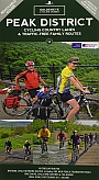
Fietskaart Peak District cycling map | Goldeneye | Water- en scheurvaste fietskaartDe Goldeneye kaarten zijn uitstekende vrijetijdskaarten voor Groot-Brittannië, met name goed te gebruiken voor het fietsen door de overzichtelijke schaal. De De kaarten zijn helder, overzichtelijk en gedrukt op stevig papier. De MapGuide-kaarten bevatten toeristische informatie op de achterzijde van de kaart. De CyclingMaps bevatten fietspaden die over het algemeen vrij liggen van drukke wegen en/of gemotoriseerd verkeer en daarnaast ook de fietspaden van NCN (De Britse 'National Cycle Network'). Een handig register met plaatsnamen maakt het eenvoudig om p... Schaal: 1:100.000 |
12,50 |
|
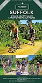
Fietskaart Suffolk cycling map | GoldeneyeDe Goldeneye kaarten zijn uitstekende vrijetijdskaarten voor Groot-Brittannië, met name goed te gebruiken voor het fietsen door de overzichtelijke schaal. De De kaarten zijn helder, overzichtelijk en gedrukt op stevig papier. De MapGuide-kaarten bevatten toeristische informatie op de achterzijde van de kaart. De CyclingMaps bevatten fietspaden die over het algemeen vrij liggen van drukke wegen en/of gemotoriseerd verkeer en daarnaast ook de fietspaden van NCN (De Britse 'National Cycle Network'). Een handig register met plaatsnamen maakt het eenvoudig om p... Schaal: 1:126.720 |
12,50 Tijdelijk niet leverbaar |
|
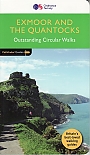
Wandelgids 09 Exmoor and the Quantocks Pathfinder Guide | Pathfinder Guide 09 | Met Ordanance Survey kaartenDeze Pathfinder Guide is een goed uitgevoerde gids met verschillende wandelingen in Groot-Britannië. De gids bevat naast goede topografische kaarten van de Britse topografische dienst (Ordanance Survey) ook beschrijvingen van het landschap, de cultuur en/of de flora en fauna. Verder is de gids voorzien van praktische informatie zoals startpunten, verwachte wandeltijd, restaurants en cafés voor onderweg. Exmoor National Park comprises 265 square miles, of which about two-thirds lie in west Somerset and the remaining third in north Devon. Its northern boundar... |
17,99 |
|
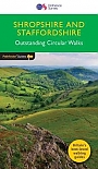
Wandelgids 14 Shropshire and Staffordshire Pathfinder Guide | Pathfinder Guide 14 | Met Ordanance Survey kaartenDeze Pathfinder Guide is een goed uitgevoerde gids met verschillende wandelingen in Groot-Britannie. De gids bevat naast goede topografische kaarten van de Britse topografische dienst (Ordanance Survey) ook beschrijvingen van het landschap, de cultuur en/of de flora en fauna. Verder is de gids voorzien van praktische informatie zoals startpunten, verwachte wandeltijd, restaurants en cafes voor onderweg. Britain's best loved walking guides brings you a brand new Pathfinder (R) Guide to Shropshire & Staffordshire Walks containing 28 fabulous walks exploring the unspo... |
17,99 Tijdelijk niet leverbaar |

|
Topografische Wandelkaart 172 Chiltern Hills East - Explorer Map | Wandelkaart & Fietskaart | Ordnance Survey (OS) Groot-BrittanniëDeze gedetailleerde en informatieve topografische kaart (stafkaart, schaal 1:25.000) van Groot-Brittannië bevat alle topografische elementen van het landschap en geeft daarmee een nauwkeurig beeld van het terrein. Daarnaast heeft Ordnance Survey (OS) ook toeristische informatie op de meeste kaart verwerkt, zoals de aanduiding voor campings en ingetekende wandelpaden . Deze kaart is ideaal voor wandelaars of fietsers, maar ook voor de scouting of sportverenigingen die activiteiten in Groot-Brittannië gaan uitvoeren. De kaarten zijn voorzien van een GPS aanduiding en e... Schaal: 1:25.000 |
18,99 |

|
Wandelgids Oxford City Walks | Pathfinder Guide | 15 wandelingen15 wandelingen helder beschreven met duidelijke wandelkaartjes. Are you visiting Oxford for the first time? Or are you an avid walker interested in taking a stroll around Oxford's scenic and famous sites? Whether you visit Oxford regularly or are a first-time visitor, City Walks Oxford provides a new look at this charming city with unique insights and imaginative tours. Take any route and see Oxford come to life, from Jericho and Port Meadow to Headington and Iffley, see Oxford's historic sites and top attractions. Expert local guide Victoria Bentata Azaz gives... |
14,50 |
|
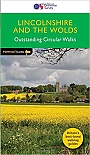
Wandelgids 50 Lincolnshire & the Wolds Pathfinder Guide | Pathfinder Guide 50 | Met Ordanance Survey kaartenDeze Pathfinder Guide is een goed uitgevoerde gids met verschillende wandelingen in Groot-Britannië. De gids bevat naast goede topografische kaarten van de Britse topografische dienst (Ordanance Survey) ook beschrijvingen van het landschap, de cultuur en/of de flora en fauna. Verder is de gids voorzien van praktische informatie zoals startpunten, verwachte wandeltijd, restaurants en cafés voor onderweg. With 28 circular walks all tried and tested by seasoned walkers, this walking guidebook is ideal for both visitors and locals. The routes range from extended strolls ... |
17,99 Tijdelijk niet leverbaar |
|
Topografische Wandelkaart 206 Edge Hill / Fenny Compton Badby, Kineton & Middle Tysoe - Explorer Map | Wandelkaart & Fietskaart | Ordnance Survey (OS) Groot-BrittanniëDeze gedetailleerde en informatieve topografische kaart (stafkaart, schaal 1:25.000) van Groot-Brittannië bevat alle topografische elementen van het landschap en geeft daarmee een nauwkeurig beeld van het terrein. Daarnaast heeft Ordnance Survey (OS) ook toeristische informatie op de meeste kaart verwerkt, zoals de aanduiding voor campings en ingetekende wandelpaden . Deze kaart is ideaal voor wandelaars of fietsers, maar ook voor de scouting of sportverenigingen die activiteiten in Groot-Brittannië gaan uitvoeren. De kaarten zijn voorzien van een GPS aanduiding en e... Schaal: 1:25.000 |
18,99 Tijdelijk niet leverbaar |

|
Topografische Wandelkaart 163 Gravesend / Rochester - Explorer Map | Wandelkaart & Fietskaart | Ordnance Survey (OS) Groot-BrittanniëDeze gedetailleerde en informatieve topografische kaart (stafkaart, schaal 1:25.000) van Groot-Brittannië bevat alle topografische elementen van het landschap en geeft daarmee een nauwkeurig beeld van het terrein. Daarnaast heeft Ordnance Survey (OS) ook toeristische informatie op de meeste kaart verwerkt, zoals de aanduiding voor campings en ingetekende wandelpaden . Deze kaart is ideaal voor wandelaars of fietsers, maar ook voor de scouting of sportverenigingen die activiteiten in Groot-Brittannië gaan uitvoeren. De kaarten zijn voorzien van een GPS aanduiding en e... Schaal: 1:25.000 |
18,99 |
|
Topografische Wandelkaart 173 London North The City, West End, Enfield, Ealing, Harrow & Watford - Explorer Map | Wandelkaart & Fietskaart | Ordnance Survey (OS) Groot-BrittanniëDeze gedetailleerde en informatieve topografische kaart (stafkaart, schaal 1:25.000) van Groot-Brittannië bevat alle topografische elementen van het landschap en geeft daarmee een nauwkeurig beeld van het terrein. Daarnaast heeft Ordnance Survey (OS) ook toeristische informatie op de meeste kaart verwerkt, zoals de aanduiding voor campings en ingetekende wandelpaden . Deze kaart is ideaal voor wandelaars of fietsers, maar ook voor de scouting of sportverenigingen die activiteiten in Groot-Brittannië gaan uitvoeren. De kaarten zijn voorzien van een GPS aanduiding en e... Schaal: 1:25.000 |
18,99 |
|
Topografische Wandelkaart 224 Corby/ Kettering / Wellingborough Rockingham Forest - Explorer Map | Wandelkaart & Fietskaart | Ordnance Survey (OS) Groot-BrittanniëDeze gedetailleerde en informatieve topografische kaart (stafkaart, schaal 1:25.000) van Groot-Brittannië bevat alle topografische elementen van het landschap en geeft daarmee een nauwkeurig beeld van het terrein. Daarnaast heeft Ordnance Survey (OS) ook toeristische informatie op de meeste kaart verwerkt, zoals de aanduiding voor campings en ingetekende wandelpaden . Deze kaart is ideaal voor wandelaars of fietsers, maar ook voor de scouting of sportverenigingen die activiteiten in Groot-Brittannië gaan uitvoeren. De kaarten zijn voorzien van een GPS aanduiding en e... Schaal: 1:25.000 |
18,99 |

|
Topografische Wandelkaart 237 Norwich / Wymondham / Attleborough / Watton - Explorer Map | Wandelkaart & Fietskaart | Ordnance Survey (OS) Groot-BrittanniëDeze gedetailleerde en informatieve topografische kaart (stafkaart, schaal 1:25.000) van Groot-Brittannië bevat alle topografische elementen van het landschap en geeft daarmee een nauwkeurig beeld van het terrein. Daarnaast heeft Ordnance Survey (OS) ook toeristische informatie op de meeste kaart verwerkt, zoals de aanduiding voor campings en ingetekende wandelpaden . Deze kaart is ideaal voor wandelaars of fietsers, maar ook voor de scouting of sportverenigingen die activiteiten in Groot-Brittannië gaan uitvoeren. De kaarten zijn voorzien van een GPS aanduiding en e... Schaal: 1:25.000 |
18,99 |

|
Topografische Wandelkaart 161 London South Westminster, Greenwich, Croydon, Esher & Twickenham - Explorer Map | Wandelkaart & Fietskaart | Ordnance Survey (OS) Groot-BrittanniëDeze gedetailleerde en informatieve topografische kaart (stafkaart, schaal 1:25.000) van Groot-Brittannië bevat alle topografische elementen van het landschap en geeft daarmee een nauwkeurig beeld van het terrein. Daarnaast heeft Ordnance Survey (OS) ook toeristische informatie op de meeste kaart verwerkt, zoals de aanduiding voor campings en ingetekende wandelpaden . Deze kaart is ideaal voor wandelaars of fietsers, maar ook voor de scouting of sportverenigingen die activiteiten in Groot-Brittannië gaan uitvoeren. De kaarten zijn voorzien van een GPS aanduiding en e... Schaal: 1:25.000 |
18,99 |
|
Topografische Wandelkaart 229 Thetford Forest in The Brecks / Thetford & Brandon - Explorer Map | Wandelkaart & Fietskaart | Ordnance Survey (OS) Groot-BrittanniëDeze gedetailleerde en informatieve topografische kaart (stafkaart, schaal 1:25.000) van Groot-Brittannië bevat alle topografische elementen van het landschap en geeft daarmee een nauwkeurig beeld van het terrein. Daarnaast heeft Ordnance Survey (OS) ook toeristische informatie op de meeste kaart verwerkt, zoals de aanduiding voor campings en ingetekende wandelpaden . Deze kaart is ideaal voor wandelaars of fietsers, maar ook voor de scouting of sportverenigingen die activiteiten in Groot-Brittannië gaan uitvoeren. De kaarten zijn voorzien van een GPS aanduiding en e... Schaal: 1:25.000 |
18,99 |
|
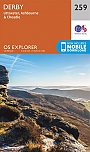
Topografische Wandelkaart 259 Derby / Utoxeter Uttoxeter, Ashbourne & Cheadle - Explorer Map | Wandelkaart & Fietskaart | Ordnance Survey (OS) Groot-BrittanniëDeze gedetailleerde en informatieve topografische kaart (stafkaart, schaal 1:25.000) van Groot-Brittannië bevat alle topografische elementen van het landschap en geeft daarmee een nauwkeurig beeld van het terrein. Daarnaast heeft Ordnance Survey (OS) ook toeristische informatie op de meeste kaart verwerkt, zoals de aanduiding voor campings en ingetekende wandelpaden . Deze kaart is ideaal voor wandelaars of fietsers, maar ook voor de scouting of sportverenigingen die activiteiten in Groot-Brittannië gaan uitvoeren. De kaarten zijn voorzien van een GPS aanduiding en e... Schaal: 1:25.000 |
18,99 |