Treinreizen
Treinreizen bestsellers

|
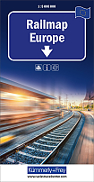
Spoorkaart Europa spoorwegen | Kümmerly+FreyEen heldere, praktische en uitstekende spoorkaart waarop de belangrijkste knooppunten staan, maar ook de tussengelegen stations. De heldere cartografie zorgt er voor dat je de verschillende plaatsen goed kunt vinden op de kaart. Een unieke kaart maar ook een praktische kaart om te gebruiken tijdens de treinreis. Schaal: 1:5 Miljoen |
14,50 |

|
Treinreisgids: Japan By Rail Trailblazer
|
27,95 |

|
Treinreisgids: Trans-Siberian Handbook Trailblazer | Trans-Siberian, Trans-Mongolian, Trans-ManchurianA trip across Siberia on the longest continuous railway track in the world is undoubtedly the journey of a lifetime. It's also a convenient way to reach China, Mongolia or Japan. Tickets are not expensive or difficult to arrange. This acclaimed guide shows you how to organise a trip, where to get tickets, where to stay and what to see. *Practical information - planning your trip; what to take; getting to Russia from Europe, North America and Australasia*Kilometre-by-kilometre route guides covering the entire routes of the Trans-Siberian, Trans-Manchurian, Trans-Mon... |
22,99 |

|
Treinreisgids: Usa By Rail Bradt Travel GuideThe American train journey has always had a strong hold on the imagination. Ever-changing landscapes pass by on the other side of the glass, from the primeval-looking Joshua trees of the Mojave Desert and the saw-toothed peaks of the Rocky Mountains to the pounding surf of the Pacific and Atlantic coasts. And in these ecologically-conscious times, rail travel offers a peace of mind that cannot be matched by a stressful domestic flight. |
22,99 |

|
Reisgids Trans-Siberian Railway Transsiberië Expres Lonely PlanetGaze through the window at the unfurling landscape as you pass, glimpse Lake Baikal, Russia"s sacred sea, or gawk at Moscow"s Kremlin at one end of your journey and Beijing"s Forbidden City at the other end; all with your trusted travel companion. Begin your journey now! Colour maps and images throughout Highlights and itineraries help you tailor your trip to your personal needs and interests Insider tips to save time and money and get around like a local, avoiding crowds and trouble spots Essential info at your fingertips - hours of operation, phone numbers, web... |
21,99 |

|
Spoorwegenkaart Europa West Railway - ITMB MapDe ITMB kaarten kenmerken zich door een kleurrijke en volle cartografische weergave. Deze spoorkaart van Europe geeft een goed overzicht van doorgaande spoorverbindingen en plaatsen die aan deze verbindingen liggen. Ideaal voor diegene die Europa gaat ontdekken tijdens het interrailen of vaak met de trein reist. This is a new title for ITMB. It focusses on the western half of the European land mass at a much better scale than would be possible for all of Europe. Even at this scale, showing the rail lines and the major roads results in a map with a lot of information on... Schaal: 1:2.5 Miljoen |
13,50 |

|
Wegenkaart - landkaart Spoorwegenkaart Zweden | ITMBDe ITMB kaarten kenmerken zich door een kleurrijke en volle cartografische weergave. Het zijn degelijke kaarten, zeker voor gebieden waarvoor kaarten lastig te krijgen zijn, met aanduidingen van onder andere nationale parken en natuurgebieden, vliegvelden, toeristische bezienswaardigheden en een goede aanduiding van het wegennet en sporrwegennet. Daarnaast bevatten enkele kaarten ook stadsplattegronden (hoofdsteden of belangrijke centra). Bevat voor sommige landen ook aanduidingen in de orginele taal. Schaal: 1:900.000 |
13,50 |

|
Reisgids Britain From The Rails Bradt Travel Guide | A Window Gazer's GuideExpert railway enthusiast Ben Le Vay returns with a new edition of his much-acclaimed guide to discovering Britain from the rails. This latest edition adds new lines and destinations in Britain's fast-changing railway, while updating the guide to the classic greats. Thoroughly updated, it includes a full, fascinating guide to the new Borders Railway in Scotland, plus details of the new route from London to Oxford and expanded coverage of the eccentric Jolly Fisherman line in Lincolnshire and the charming Cotswold line from Oxford to Hereford. Also included are more... |
21,99 Tijdelijk niet leverbaar |

|
Spoorwegenkaart Europa Railway - ITMB MapDe ITMB kaarten kenmerken zich door een kleurrijke en volle cartografische weergave. Deze spoorkaart van Europe geeft een goed overzicht van doorgaande spoorverbindingen en plaatsen die aan deze verbindingen liggen. Ideaal voor diegene die Europa gaat ontdekken tijdens het interrailen of vaak met de trein reist. This is a significantly updated map of the rail network of Europe from Moscow west to Lisbon and north to Narvik. We have added new fast-train lines and removed some of the older ones that are now just used for freight. Rail travel has always been a popular way... Schaal: 1:3.350.000 |
13,50 |

|
Spoorwegkaart Europa Spoorwegen en veerdiensten - Freytag & BerndtOverzichtelijk kaart van spoorwegen, wegen en veerdiensten. Plaatsnamenregister op de achterzijde plus afstandstabel. Schaal: 1:5.5 Miljoen |
13,90 |

|
Spoorwegenkaart - Landkaart Trans-Siberian Railway Geographical Map - Gizi MapsOverzichtelijke spoorkaart van de Trans-Siberische spoorweg. De trajecten Beijing - Moskou zijn ingetekend, maar ook het traject Vladivostok - Moskou. Er is een detailkaart van het Baikal meer toegevoegd. Schaal: 1:1.2 Miljoen |
15,75 |

|
Treinreisgids Canada By Rail TrailblazerFully revised 6th edition of this established guide to the world's most scenic rail ride A journey on Canada's transcontinental railroad ranks as one of the greatest rail experiences in the world. Stretching from the Atlantic to the Pacific, the lines span 6358km (3974 miles), taking in not only several of North America's finest cities but also some of the most dramatic scenery on earth, including the spectacular Rocky Mountains. Rail travel for all budgets Where to get the best deals whether you are looking for the cheapest rail tickets with shoestri... |
22,99 |

