- Gratis verzending vanaf 30 euro
- Levert in Nederland, België etc.
- Meer dan 30.000 titels
- Vakkundige klantenservice
- Snelle levering
- Veilig en eenvoudig betalen

Direct contact?
Bel +31 (0)6 42428571
maandag t/m vrijdag
van 10 tot 17 uur
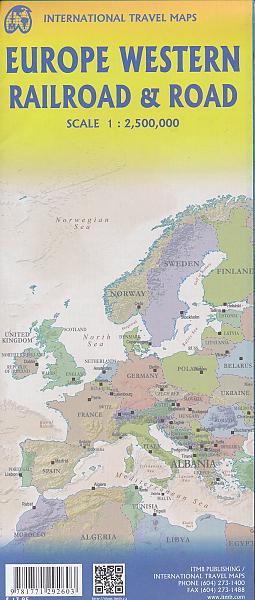
Spoorwegenkaart Europa West Railway - ITMB Map
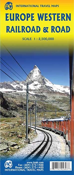
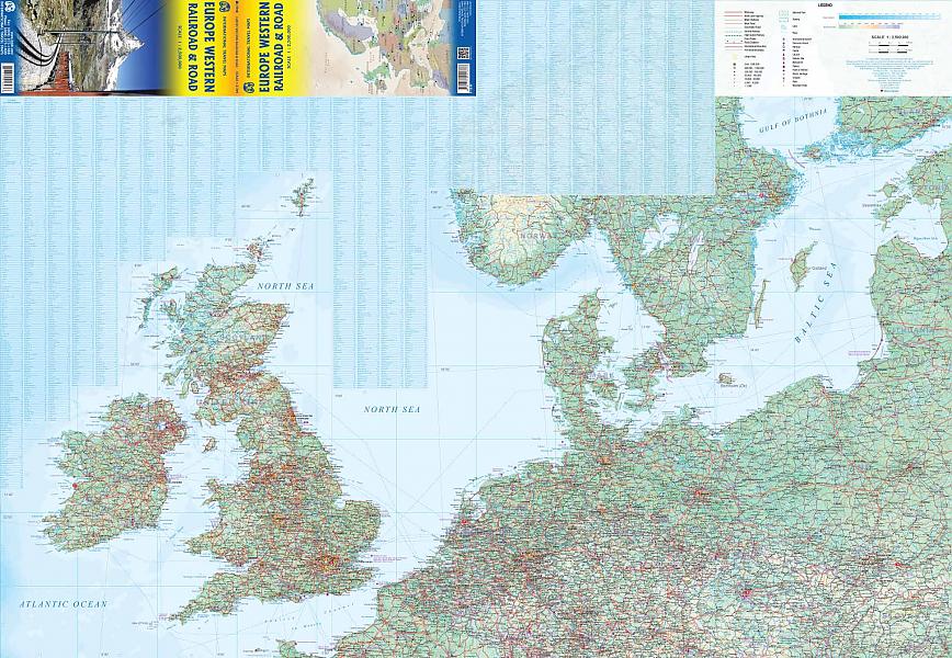
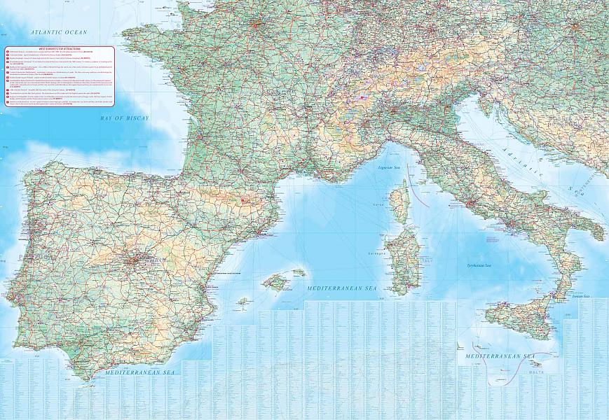
De ITMB kaarten kenmerken zich door een kleurrijke en volle cartografische weergave. Deze spoorkaart van Europe geeft een goed overzicht van doorgaande spoorverbindingen en plaatsen die aan deze verbindingen liggen. Ideaal voor diegene die Europa gaat ontdekken tijdens het interrailen of vaak met de trein reist. This is a new title for ITMB. It focusses on the western half of the European land mass at a much better scale than would be possible for all of Europe. Even at this scale, showing the rail lines and the major roads results in a map with a lot of information on it, but it meets the needs of those travelling around Europe by rail, which is its primary market. It can also be used by those driving, although it would be better for vehicle users to rely on individual country maps. Side 1 covers the British Isles, the Low Countries, Germany, Denmark, the Czech Republic, most of Poland, and southern Scandinavia. The second side covers the Iberian Peninsula, France, Italy, Slovenia, Croatia, Bosnia, Austria, Hungary, and the southern portion of Germany. Trains tend to be used by travellers in Europe for longer trips, say from Frankfurt to Rome, and for this reason our new map should find a good market. There has not been enough room on this map to show many touristically important sites, but where room exists, we have added UNESCO World Heritage sites, major churches, and most international airports. Coverage includes major ferry routes and includes the islands of Majorca, Menorca, Ibiza, Sardinia, Elba, and Corsica, Sicily, and Malta. As the EU evolves, passenger rail service is increasingly becoming a pan-European reality, but German trains running on French lines and Italian trains going north into Austria. This is a timely map; coming out at the beginning of a truly European rail system.
Schaal: 1:2.5 Miljoen
Engelstalig
EAN: 9781771292603
Uitgeverij: ITMB (International Tavel Maps & Books)
Meest recente editie
Engelstalig
Op voorraad
Levertijd 3 dagen (Nederland)
- Vakkundige klantenservice
- Groot assortiment
- Gratis retourneren binnen 14 dagen
- Aangesloten bij WebwinkelKEUR
€ 13,50
Meer producten die interessant kunnen zijn
Reliëfkaarten Europa


Reliefkaart Europa Europe (Engelstalig) 77cm x 57cm | Georelief
Formaat 77 x 57 cm | zonder lijst!
€ 69,99

Wegenatlassen Europa
Wegenkaarten Europa


Campergidsen Europa
Campergids Met de camper door Europa | Michelin
De 75 mooiste routes voor motorhomes
€ 25,99
Tijdelijk niet leverbaar

Campinggidsen Europa
Fietsgidsen Europa

Fietsgids Limes Fietsroute 2 Regensburg - Guyla (Hongarije) | Pirola
Langs de Noordgrens van het Romeinse Rijk - Donau en Puszta
€ 24,50

Fietsgids Eurovelo 1 - Atlantic Coast Route Bikeline | Esterbauer
From the fjords of Norway to the beaches of Portugal
€ 16,99
Wandelkaarten Europa
Wandelkaart 2562 Fernwanderwege Lange Afstandswandelpaden Europa | Kompass
12 paden op 1 continent
€ 13,99