- Gratis verzending vanaf 30 euro
- Levert in Nederland, België etc.
- Meer dan 30.000 titels
- Vakkundige klantenservice
- Snelle levering
- Veilig en eenvoudig betalen

Direct contact?
Bel +31 (0)6 42428571
maandag t/m vrijdag
van 10 tot 17 uur
Europa / Groot-Brittannië / Noord-Schotland / Wandelen / Wandelgidsen
Noord-Schotland Wandelgidsen bestsellers
Wandelgids Cape Wrath Trail Cicerone Guidebooks
through the Scottish Highlands from Fort William to Cape Wrath
21,99
Wandelgids Walking the John o' Groats Trail | Cicerone
Coastal walking from Inverness to John o' Groats
21,99
Wandelgids Walking in Torridon Fisherfield Fannichs and An Teallach Cicerone Guidebooks
Including the ridges of Beinn Alligin, Liathach and Beinn Eighe
21,99
|
Wandelkaartgids West Highland Way Map Booklet | CiceroneHandzaam kaartgidsje. Gedetailleerde topografische wandelkaarten gebonden in een handig boekje. Licht voor onderweg. This compact booklet of maps shows the full route of the 95 mile West Highland Way Scottish Long Distance Route, via Loch Lomond and Rannoch Moor. This booklet is included with the Cicerone guidebook to the trail, and shows the full route on Ordnance Survey 1:25,000 maps. Milngavie, Drymen, Crianlarich, Tyndrum, Kinlochleven, Fort William. The walking is not difficult for anyone accustomed to regular walks longer than 10 miles, although there is ample sc... Schaal: 1:25.000 |
12,50 Tijdelijk niet leverbaar |
|
|
Wandelgids Cape Wrath Trail Cicerone Guidebooks | through the Scottish Highlands from Fort William to Cape WrathThis is a glorious long-distance walk in the West Highlands from Fort William to Cape Wrath. Described as 'a quintessential backpacking walk' it is a challenging route for the experienced walker. The authors had six main criteria in mind: a variety of scenery, no long hauls over featureless terrain, use of designated paths, interesting geography, no high peaks to climb and a good day's walk every day with accommodation at the end. The route is split into 21 stages, many with an easier bad-weather alternative. Guide includes details of accommodation and advi... |
21,99 |
|
Wandelgids Backpacker's Britain: Northern Scotland Cicerone Guidebooks | Thirty two- and three-day treksThe Highlands of Scotland are one of Britain's great wilderness areas, particularly in the Far North. Backpackers venturing into these remote lands get a true sense of being away from it, and this book gives a superb starting point for those wanting to explore this wonderful mountain region. A total of 30 multi-day backpacking routes are described, along rugged coastlines from the Shetland Islands to the Rough Bounds of Knoydart, and across mountain ridges from the northern tip of Skye to the great trench of Glen Affric. Most routes take just 2 or 3 days to ... |
16,99 |
|
|
Wandelgids Walking in Torridon Fisherfield Fannichs and An Teallach Cicerone Guidebooks | Including the ridges of Beinn Alligin, Liathach and Beinn Eighe
|
21,99 |
|
Wandelgids Walking in the Cairngorms | Cicerone Guidebooks | A Walking and Scrambling GuideThis guidebook contains over 100 routes for walking in the Scottish Cairngorms. It includes 18 Munro summits and smaller viewpoint hills. Walks range in length from 1 to 26 miles and are graded for difficulty. For the adventurous there are the best of the area's rocky scrambles, and the classic through-routes including the Lairig Ghru. For those looking for a more gentle alternative, there are easy, sandy trails wandering among the tall pines and along the banks of the great rivers Spey, Nethy and Dee. Britain's biggest mountain range is home to e... |
22,99 |
|
|
Wandelgids Walking the John o' Groats Trail | Cicerone | Coastal walking from Inverness to John o' Groats
|
21,99 |
|
Wandelkaartgids The Speyside Way Booklet | CiceroneHandzaam kaartgidsje. Gedetailleerde topografische wandelkaarten gebonden in een handig boekje. Licht voor onderweg. Map of Scotland's Speyside Way, a 66 mile walk which follows the River Spey from Aviemore to Buckie and can be linked to the Dava Way and Moray Coast Trail. This booklet is included with the Cicerone guidebook to the trail, and shows the full route on Ordnance Survey 1:25,000 maps. Schaal: 1:25.000 |
11,99 Tijdelijk niet leverbaar |

|
Wandelgids The Speyside Way Cicerone Guidebooks | With Dava Way and Moray Coast TrailThis guidebook describes the Speyside Way, an official 66 mile (106km) Scottish Long Distance Route which follows the River Spey through northern Scotland from Aviemore to the old port of Buckie on the Moray coast. Featuring easy walking on good paths and along disused railway lines, the route can be comfortably completed in a week and is presented in 10 stages of between 2 and 13 miles (3-21km). The guide also details the recently opened 61/2-mile (10.5km) extension to the Speyside Way between Kincraig and Aviemore as well as two alternatives to the main route and rou... |
22,99 Tijdelijk niet leverbaar |
|
Wandelgids Great Glen Way Rucksack ReadersRucksack Readers zijn handig uitgevoerd in een klapper met ringband. Deze gids heeft een goede beschrijving van de lange afstands route met overzichtelijke kaarten doch zonder veel detail. De kracht van de Rucksack Readers is de uitgebreide achtergrondinformatie over de flora, fauna en geologische verschijnselen. Dit alles rijkelijk omkleed met kleurrijke foto's en praktische tips. The Great Glen Way runs for 78 miles (125 km) along Scotland’s historic Great Glen between Fort William and Inverness. It follows the historic Caledonian Canal and runs beside four... |
20,50 |
|
Wandelgids The Great Glen Way Cicerone Guidebooks | Two Way Trail guide
|
19,99 |
|
Wandelgids 30 Loch Ness & Iverness Pathfinder Guide | Pathfinder Guide 30 | Met Ordanance Survey kaartenDeze Pathfinder Guide is een goed uitgevoerde gids met verschillende wandelingen in Groot-Britannië. De gids bevat naast goede topografische kaarten van de Britse topografische dienst (Ordanance Survey) ook beschrijvingen van het landschap, de cultuur en/of de flora en fauna. Verder is de gids voorzien van praktische informatie zoals startpunten, verwachte wandeltijd, restaurants en cafes voor onderweg. 28 wandelingen. Discover the Highland 'capital' of Inverness, the dramatic shore of Loch Ness, Ben Wyvis and much more with this Pathfinder walking guidebo... |
17,99 |
|
Wandelgids Walking in the Ochils, Campsie Fells and Lomond Hills Cicerone Guidebooks | 33 Walks in Scotland’s central fellsAs rugged and spectacular as they can be tranquil and picturesque, the Campsie Fells, the Ochils and the Lomonds are the most accessible hills in Scotland"s Central Belt. Despite their close proximity to Edinburgh, Glasgow and Perth, these three ranges remain a remarkably uncrowded wilderness area. Combining a rich mixture of open moorland peaks, steep sided glens, fast flowing burns and lush woodland, few other areas can treat the hillwalker to such diverse scenery and varieties of animal and plant life in the space of a single day"s outing. This guide describes 33 co... |
17,99 Tijdelijk niet leverbaar |
|
Wandelgids 27 Perthshire, Angus & Fife Pathfinder Guide | Pathfinder Guide 27 | Met Ordanance Survey kaartenDeze Pathfinder Guide is een goed uitgevoerde gids met verschillende wandelingen in Groot-Britannië. De gids bevat naast goede topografische kaarten van de Britse topografische dienst (Ordanance Survey) ook beschrijvingen van het landschap, de cultuur en/of de flora en fauna. Verder is de gids voorzien van praktische informatie zoals startpunten, verwachte wandeltijd, restaurants en cafes voor onderweg. Each of the Jarrold Pathfinder titles features 28 circular routes, all tried and tested by seasoned walkers. The routes range from extended strolls to exhilarating... |
17,99 |
|
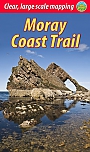
Wandelgids Moray Coast Trail with Dava Way and Moray Way | Rucksack ReadersDeze gids heeft een goede beschrijving van de lange afstands route met overzichtelijke kaarten doch zonder veel detail. De kracht van de Rucksack Readers is de uitgebreide achtergrondinformatie over de flora, fauna en geologische verschijnselen. Dit alles rijkelijk omkleed met kleurrijke foto's en praktische tips. The Moray Coast Trail consists of 44 miles/71 km of beach walking, on coastal paths, quiet roads and old railways. Its views are across coves, beaches and skerries to the vastness of the Moray Firth and the North Sea. |
18,99 |
|
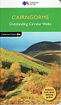
Wandelgids 04 Cairngorms Pathfinder Guide | Pathfinder Guide 04 | Met Ordanance Survey kaartenDeze Pathfinder Guide is een goed uitgevoerde gids met verschillende wandelingen in Groot-Britannië. De gids bevat naast goede topografische kaarten van de Britse topografische dienst (Ordanance Survey) ook beschrijvingen van het landschap, de cultuur en/of de flora en fauna. Verder is de gids voorzien van praktische informatie zoals startpunten, verwachte wandeltijd, restaurants en cafés voor onderweg. The Cairngorms cover 300 sq miles, making it the most mountainous area in Britain, with an equally wide range of wildlife. This walking guidebook contains 28 carefull... |
17,99 |
|
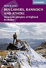
Wandelgids Walking Ben Lawers, Rannoch and Atholl | Cicerone Guides | Mountains and glens of Highland Perthshire 80 walks
|
18,99 |