- Gratis verzending vanaf 30 euro
- Levert in Nederland, België etc.
- Meer dan 30.000 titels
- Vakkundige klantenservice
- Snelle levering
- Veilig en eenvoudig betalen

Direct contact?
Bel +31 (0)6 42428571
maandag t/m vrijdag
van 10 tot 17 uur
Wandelkaart Cape Wrath Trail South | Harvey Maps
Water- en scheurvaste wandelkaart

De Harvey Map is de wandelkaart voor het wandelen in de mooiste natuurgebieden in het Groot-Brittannië. Duidelijke topografische wandelkaarten met praktische informatie van de route zoals overnachtingsmogelijkheden, eetgelegenheden en bezienswaardigheden. Deze wandelkaart is scheur- en watervast. Met GPS compatible (UTM-Grid). Compact and light - the map itself weighs just 60gms - a third of the weight of a laminated map, and much less bulky. And you can fold or refold it time and again, or stuff it in your back pocket and it won't fall to pieces. Shows the entire route on one sheet.
The Cape Wrath Trail is a challenging route from Fort William to Cape Wrath. It is around 200 miles long and passes through some of Scotland's wildest and most spectacular scenery.
This map covers the southern section of the route, from Fort William to Strathcarron.
The trail has evolved from use and is not an officially recognised National Trail. There is no single definitive route. There are various ways of tackling the traverse all of which are highlighted on the maps leaving the actual route choice to the individual walker. This is rough country not to be underestimated. Some sections of the route will require an overnight stop in the mountains. This will either have to be wild camping or the use of a bothy. The bothies are also shown on the map.
Schaal: 1:40.000
Engelstalig


Op voorraad
Levertijd 3 dagen (Nederland)
- Vakkundige klantenservice
- Groot assortiment
- Gratis retourneren binnen 14 dagen
- Aangesloten bij WebwinkelKEUR
€ 25,99
Meer producten die interessant kunnen zijn
Topografische kaarten Noord-Schotland
Topografische Wandelkaart OL57 van Groot-Brittannië (1:25.000) Cairn Gorm & Aviemore, Loch Morlich - Explorer Map OL 57
Wandelkaart | Ordnance Survey (OS) Groot-Brittannië
€ 18,99
Topografische Wandelkaart 15 Loch Assynt Lochinver & Kylesku - Landranger Map
Wandelkaart & Fietskaart | Ordnance Survey (OS) Groot-Brittannië
€ 18,99
Topografische Wandelkaart 19 Gairloch / Ullapool (Loch Maree) - Landranger Map
Wandelkaart & Fietskaart | Ordnance Survey (OS) Groot-Brittannië
€ 18,99
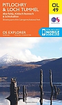
Topografische Wandelkaart OL49 van Groot-Brittannië (1:25.000) Pitlorchry & Loch Tummel / Aberfeldy - Explorer Map OL 49
Wandelkaart | Ordnance Survey (OS) Groot-Brittannië
€ 18,99
Wandelgidsen Noord-Schotland
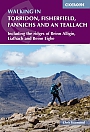
Wandelgids Walking in Torridon Fisherfield Fannichs and An Teallach Cicerone Guidebooks
Including the ridges of Beinn Alligin, Liathach and Beinn Eighe
€ 21,99
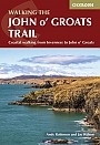
Wandelgids Walking the John o' Groats Trail | Cicerone
Coastal walking from Inverness to John o' Groats
€ 21,99
Wandelgids Cape Wrath Trail Cicerone Guidebooks
through the Scottish Highlands from Fort William to Cape Wrath
€ 21,99