- Gratis verzending vanaf 30 euro
- Levert in Nederland, België etc.
- Meer dan 30.000 titels
- Vakkundige klantenservice
- Snelle levering
- Veilig en eenvoudig betalen

Direct contact?
Bel +31 (0)6 42428571
maandag t/m vrijdag
van 10 tot 17 uur
Wegenkaart - landkaart Northern British Columbia | ITMB
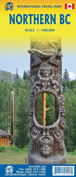
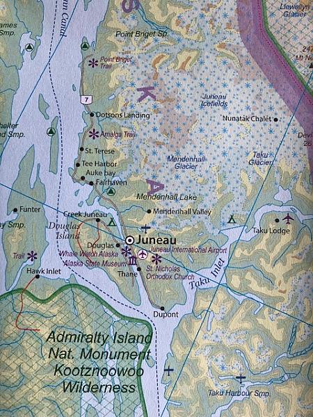
De ITMB kaarten kenmerken zich door een kleurrijke en volle cartografische weergave. Het zijn degelijke kaarten, zeker voor gebieden waarvoor kaarten lastig te krijgen zijn, met aanduidingen van onder andere nationale parken en natuurgebieden, vliegvelden, toeristische bezienswaardigheden en een goede aanduiding van het wegennet. Daarnaast bevatten enkele kaarten ook stadsplattegronden (hoofdsteden of belangrijke centra). Bevat voor sommige landen ook aanduidingen in de orginele taal. British Columbia is big! Gargantuan huge, in fact, although it is lightly populated. ITMB published a map of the more densely populated southern half of the province a number of years ago, and we have been asked to give the same emphasis to the northern half ever since. Here it is! Side 1 is of the western portion, including the Alaskan Panhandle, with the route followed by cruise ships heading north and clearly delineates the border between Canada and the USA that nearly erupted into warfare (54 40 or fight). It also shows the Stewart Highway heading north towards the Yukon, with its branch leading to Hyder, Alaska, the only place in the USA that uses Canadian money and does all its banking in Canada. The second side covers the eastern half of BC’s north, with the Alaska Highway starting in Dawson Creek and extending north to Fort Nelson before veering west into the eastern edge of the Rocky Mountains to the Yukon border. This is true wilderness country. It is virtually unpopulated outside of small towns. One can drive for hours and never see another vehicle. It rings with images such as the Chilcoot Trail to the goldfields, or the arduous wartime track created as a land bridge to defend Alaska in case of invasion. It would take a full day to drive from the south to the north of this map. This is a ‘must have’ map for any store considering itself a focal point for adventure travel.
Schaal: 1:900.000
Engelstalig
EAN: 9781771294157
Uitgeverij: ITMB (International Tavel Maps & Books)
Serie: British-Columbia ITM
Verschijningsdatum: 2023
Meest recente editie
Engelstalig
Op voorraad
Levertijd 3 dagen (Nederland)
- Vakkundige klantenservice
- Groot assortiment
- Gratis retourneren binnen 14 dagen
- Aangesloten bij WebwinkelKEUR
€ 12,99
Verder in deze serie
- Topografische Wandelkaart 92G/7 N Vancouver Pt. Coquitlam - ITMB Map
- Topografische Wandelkaart Bowron Lakes Travel Refer. map 93H2/3/6/7 - ITMB Map
- Topografische Wandelkaart Lower Mainland Richmond and New Westminster BC 92G/G2/G3 - ITMB Map
- Wandelkaart - Fietskaart North & West Vancouver Biking & Hiking - ITMB Map
- Wandelkaart 83D Wells Gray Park - ITMB Map
- Wandelkaart Garibaldi Provincial Park (BC) - ITMB Map
- Wandelkaart Gulf Islands (BC) - ITMB Map
- Wandelkaart Prince Edward Island - ITMB Map
- Wandelkaart West Coast Trail & Carmanah Valley - ITMB Map
- Wandelkaart Whistler Sea to Sky Highway - ITMB Map
- Wegenkaart - Landkaart British Columbia - ITMB Map
- Wegenkaart - Landkaart British Columbia South - ITMB Map Best Map!!
- Wegenkaart - Landkaart Fraser Valley / Vancouver's North Shore hiking Trails - ITMB Map
- Wegenkaart - Landkaart Sunshine Coast / British Columbia Zuidwest | ITM
- Wegenkaart - Landkaart Vancouver's Northshore Hiking Trails - ITMB Map
- Wegenkaart - Landkaart Vancouver Island Victoria Tofino Region - ITMB Map
- Wegenkaart - landkaart British Columbia & Alberta Rockies | ITMB
- Wegenkaart - landkaart Jasper National Park & Northern Alberta Edmonton | ITMB
- Wegenkaart - landkaart Queen Charlotte Islands - Haida Gwai | ITMB
- Wegenkaart - landkaart Vancouver Island south - Victoria | ITMB
- Wegenkaart - landkaart Washington State - British Columbia southwest | ITMB
Meer producten die interessant kunnen zijn
Wandelkaarten British-Columbia
Wandelkaart 83D Wells Gray Park - ITMB Map
Water- en scheurvaste wandelkaart
€ 13,50
Tijdelijk niet leverbaar
Wandelgidsen British-Columbia
Wildlife-gidsen British-Columbia
Reisgidsen British-Columbia
Topografische kaarten British-Columbia
Topografische Wandelkaart Canadian Rockies Banff, Kootenay, Yoho Park 82J/K/N/O - ITMB Map
Water- en scheurvaste wandelkaart
€ 13,50