- Gratis verzending vanaf 30 euro
- Levert in Nederland, België etc.
- Meer dan 30.000 titels
- Vakkundige klantenservice
- Snelle levering
- Veilig en eenvoudig betalen

Direct contact?
Bel +31 (0)6 42428571
maandag t/m vrijdag
van 10 tot 17 uur
Noord-Amerika / Canada / British-Columbia / Wandelen / Wandelkaarten
British-Columbia Wandelkaarten bestsellers
Wegenkaart - Landkaart 1 Banff National Park Map and Guide | Gem Trek Publishing
Water- en scheurvaste wandelkaart
15,99
Wandelkaart Jasper National Park Map and Guide | Gem Trek Publishing
Water- en scheurvaste wandelkaart
15,99
|
Wandelkaart Garibaldi Provincial Park (BC) - ITMB Map | Water- en scheurvaste waterkaartDe ITMB kaarten kenmerken zich door een kleurrijke en volle cartografische weergave. Het zijn degelijke kaarten, zeker voor gebieden waarvoor kaarten lastig te krijgen zijn, met aanduidingen van onder andere nationale parken en natuurgebieden, vliegvelden, toeristische bezienswaardigheden en een goede aanduiding van het wegennet. Daarnaast bevatten enkele kaarten ook stadsplattegronden (hoofdsteden of belangrijke centra). Bevat voor sommige landen ook aanduidingen in de orginele taal. Water- en scheurvaste waterkaart. The Whistler region is British Columbia's param... Schaal: 1:50.000 |
13,50 |
|
|
Wegenkaart - Landkaart 1 Banff National Park Map and Guide | Gem Trek Publishing | Water- en scheurvaste wandelkaartTopographic map and guide of Banff National Park (Alberta, British Columbia) published by Gem Trek. Contours, campgrounds, hiking trails and detailed legend. This user-friendly map-guide includes a 1:250,00-scale poster-quality map of Canada"s most popular national park, as well as useful and entertaining information about everything from mountain building to Banff Park wildlife. Schaal: 1:250.000 |
15,99 |
|
Wandelkaart 83D Wells Gray Park - ITMB Map | Water- en scheurvaste wandelkaartDe ITMB kaarten kenmerken zich door een kleurrijke en volle cartografische weergave. Het zijn degelijke kaarten, zeker voor gebieden waarvoor kaarten lastig te krijgen zijn, met aanduidingen van onder andere nationale parken en natuurgebieden, vliegvelden, toeristische bezienswaardigheden en een goede aanduiding van het wegennet. Daarnaast bevatten enkele kaarten ook stadsplattegronden (hoofdsteden of belangrijke centra). Bevat voor sommige landen ook aanduidingen in de orginele taal. Water- en scheurvaste wandelkaart. Schaal: 1:50.000 |
13,50 |
|
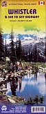
Wandelkaart Whistler Sea to Sky Highway - ITMB MapDe ITMB kaarten kenmerken zich door een kleurrijke en volle cartografische weergave. Het zijn degelijke kaarten, zeker voor gebieden waarvoor kaarten lastig te krijgen zijn, met aanduidingen van onder andere nationale parken en natuurgebieden, vliegvelden, toeristische bezienswaardigheden en een goede aanduiding van het wegennet. Daarnaast bevatten enkele kaarten ook stadsplattegronden (hoofdsteden of belangrijke centra). Bevat voor sommige landen ook aanduidingen in de orginele taal. Schaal: 1:50.000 |
13,50 |
|
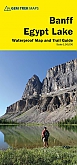
Wandelkaart 17 Banff: Egypt Lake | Gem Trek MapHiking map & Guide of Egypt Lake area, in Banff National Park (Alberta and British Columbia), published by Gem Trek. Contour lines at 25-metre intervals (82 feet), hiking trails with detailed explanations, campsites, hotels, outdoor activities and detailed legend. Map coverage stretches from just east of Taylor Lake in the west to the west end of Lake Minnewanka in the east, and from Mystic Pass and Rockbound Lake in the north to Citadel Pass and Vermilion Crossing (Kootenay National Park) in the south. Schaal: 1:50.000 |
17,75 |
|
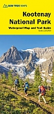
Wandelkaart 10 Kootenay National Park | Gem Trek Publishing | Water- en scheurvaste wandelkaartHiking Map & Guide of the Kootenay National Park (British Columbia) published by Gem Trek. Contour lines at 100-metre intervals (330 feet), relief-shading, hiking trailswith detailed explanations, bike routes, elevations and durations, campgrounds, hotels, outdoor activities and detailed legend. This map covers all of Kootenay National Park, from Castle Mountain Junction south through Radium, to Windermere. All the official hiking and mountain biking trails in Kootenay National Park are shown on the map. Popular trails on the map include Boom Lake, Twin and Arnica ... Schaal: 1:100.000 |
17,75 |
|
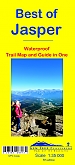
Wandelkaart 12 Best of Jasper | Gem Trek PublishingHiking Map & Guide of the most touristic part of Jasper National Park (Alberta), published by Gem Trek. Contour lines at 25-metre intervals (80 feet), hiking trails with detailed explanations, bike routes, elevations and durations, campgrounds, hotels, outdoor activities and detailed legend. This map is designed for people who are only going to be in Jasper for one to three days, and want to know what the highlights are and how to find them. On the front is a 1:35,000-scale detailed topographic map of the Jasper townsite area, which covers the entire network of tra... Schaal: 1:35.000 |
13,99 |
|
Wegenkaart Best of Icefield Parkway | Gem Trek Publishing | Water- en scheurvaste wegenkaartThe map shows all viewpoints, picnic areas, trailheads, campgrounds, hostels, lodges and other services along the Icefields Parkway, while the brief descriptions in the guide point you to the best of these - the best viewpoints of mountains and lakes, the most interesting points of interest and Parks exhibits, and the best bets for spotting moose, bighorn sheep and mountain goats. Also included are short descriptions of the ten best walks and day hikes along the Icefields Parkway - from ten-minute strolls to more strenuous all-day outings, with the highlights of each t... Schaal: 1:400.000 |
13,50 |
|
Wandelkaart 4 Lake Louise & Yoho | Gem Trek Publishing | Water- en scheurvaste wandelkaart
Schaal: 1:50.000 |
17,75 |
|
Wandelkaart 3 Bow Lake & Saskatchewan Crossing | Gem Trek Publishing | Includes the Mosquito Creek/Fish Lakes areaHiking map & guide of Bow Lake and Mount Saskatchewan areas (Banff National Park and Jasper National Park, Alberta), published by Gem Trek. This map covers the trails departing from the southern section of the Icefields Parkway from Rampart Creek south to Hector Lake. A 1:100 000-scale inset map on the back of the map increases coverage to the adjoining Mosquito Creek/Fish Lakes area. Contour lines at 50-metre (165-feet) intervals. On the back of the map are trail descriptions and photos of 16 recommended day hikes, ranging from short and easy to long and strenuous... Schaal: 1:70.000 |
15,99 |
|
Wandelkaart 1 Jasper National Park & Maligne Lake | Gem Trek Publishing | Water- en scheurvaste wandelkaartHiking Map & Guide of Jasper National Park including the area of Maligne Lake (Alberta), published by Gem Trek. Contour lines at 50-metre intervals (150 feet), hiking trails with detailed explanations, and campsites, hotels, outdoor activities and.This map covers the most popular hiking and mountain biking terrain in Jasper National Park, from Miette Hot Springs and Maligne Lake in the north, west to Jasper townsite and the Tonquin Valley, and south to Fortress Lake. Premier day hikes on this map include Bald Hills, Opal Hills, Cavell Meadows, Sulphur Skyline and V... Schaal: 1:100.000 |
17,50 |
|
Wandelkaart West Coast Trail & Carmanah Valley - ITMB Map | Water- en scheurvaste wandelkaartDe ITMB kaarten kenmerken zich door een kleurrijke en volle cartografische weergave. Het zijn degelijke kaarten, zeker voor gebieden waarvoor kaarten lastig te krijgen zijn, met aanduidingen van onder andere nationale parken en natuurgebieden, vliegvelden, toeristische bezienswaardigheden en een goede aanduiding van het wegennet. Daarnaast bevatten enkele kaarten ook stadsplattegronden (hoofdsteden of belangrijke centra). Bevat voor sommige landen ook aanduidingen in de orginele taal. Water- en scheurvaste wandelkaart. This is actually completely new artwork, thanks to... Schaal: 1:50.000 |
13,50 |
|
Wandelkaart Gulf Islands (BC) - ITMB Map | Water- en scheurvaste wandelkaartDe ITMB kaarten kenmerken zich door een kleurrijke en volle cartografische weergave. Het zijn degelijke kaarten, zeker voor gebieden waarvoor kaarten lastig te krijgen zijn, met aanduidingen van onder andere nationale parken en natuurgebieden, vliegvelden, toeristische bezienswaardigheden en een goede aanduiding van het wegennet. Daarnaast bevatten enkele kaarten ook stadsplattegronden (hoofdsteden of belangrijke centra). Bevat voor sommige landen ook aanduidingen in de orginele taal. Water- en scheurvaste wandelkaart. This is completely new artwork and a new approach ... Schaal: 1:50.000 |
13,50 Tijdelijk niet leverbaar |
|
Wandelkaart 5 Banff & Mount Assiniboine | Gem Trek Publishing | Water- en scheurvaste wandelkaartHiking map of a portion of Banff National Park (Alberta and British Columbia), centered on Mount Assiniboine. Waterproof map published by Gem Trek. Contour lines at 50-metre intervals (150 feet), hiking trails with detailed explanations, campsites, hotels, outdoor activities and detailed legend are included. This map covers the most popular hiking and mountain biking terrain in Banff National Park, from Lake Louise in the north to the south end of Banff National Park, plus all of Mt. Assiniboine Provincial Park. Schaal: 1:100.000 |
16,99 |
|
|
Wandelkaart Jasper National Park Map and Guide | Gem Trek Publishing | Water- en scheurvaste wandelkaartWhether you are a first-time visitor or a long-time local, you’ll find Gem Trek’s Jasper National Park Map to be an invaluable tool. Researched and designed by locals, and printed in Canada, this map features accurate cartography and subtly colored relief that puts the mountainous region in perspective. The map is printed on high-quality synthetic waterproof paper that can be folded and refolded hundreds of times. Schaal: 1:210.000 |
15,99 |
|
Wandelkaart 11 Banff Up-Close | Gem Trek Publishing | Water- en scheurvaste wandelkaartWaterproof Hiking map & Guide of the area around the town of Banff (Banff National Park, Alberta), published by Gem Trek. Contour lines at 25-metre intervals (80 feet), relief shading, hiking with detailed explanations, campsites, hotels, outdoor activities and detailed legend. This map-and-guide-in-one is designed for people who are only going to be in Banff for one to three days, and want to know what the highlights are and how to find them. On the front is a detailed relief-shaded topographic map of the Banff townsite area, from the Sundance and Sulphur Mountain... Schaal: 1:35.000 |
13,50 |
|
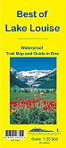
Wandelkaart 13 Best of Lake Louise | Gem Trek Publishing | Water- en scheurvaste wandelkaartHiking map and Guide of the area of Lake Louise in Banff National Park (Alberta), published by Gem Trek. Contour lines at 25-metre (80-foot) intervals, hiking trails with explanations, campsites, hotels, outdoor activities and detailed legend. This map is designed for people who only plan to be in the Lake Louise area for one to three days, and want to know what the highlights are and how to find them. On the front is a 1:35,000-scale detailed topographic map of the Lake Louise area, including the network of trails around Lake Louise Village, as well as those up at the... Schaal: 1:35.000 |
13,99 |
|
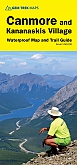
Wandelkaart 6 Canmore & Kananaskis Village | Gem Trek Publishing | Water- en scheurvaste wandelkaartWaterproof Hiking Map & Guide of Canmore and Kananaskis areas (Kananaskis Country), in the Rockies (Alberta), published by Gem Trek. This map covers some of the most popular terrain for hikers and mountain bikers in Kananaskis Country “ Bow Valley Provincial Park, the Canmore area, the Smith-Dorrien/Spray Lakes area south to Mount Shark trailhead, Barrier Lake, and the Kananaskis Village area from Ribbon Creek south to Galatea Lakes trailhead. The new snowshoe trails in the Ribbon Creek area have also been added. Schaal: 1:50.000 |
17,50 |
|
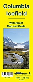
Wandelkaart 2 Columbia Icefield Guide & Map | Gem Trek Publishing | Water- en scheurvaste wandelkaartHiking Map & Guide of Columbia Icefield in Banff and Jasper National Parks (Alberta, British Columbia), published by Gem Trek. The map combines contour lines with relief shading and covers the Columbia Icefield area, from Sunwapta Peak and Beauty Creek in Jasper National Park in the north to Mount Saskatchewan in Banff National Park to the south. Popular trails on the map include Parker Ridge, Wilcox Pass and Nigel Pass. (Only the southern portion of the Brazeau Loop is shown on the map, from Four Point Campground northwest to just north of Jonas Pass, and from Fou... Schaal: 1:75.000 |
14,90 |
|
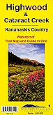
Wandelkaart 9 Highwood & Cataract Creek | Gem Trek Publishing | Water- en scheurvaste wandelkaartHiking Map & Guide of South Kananaskis (Alberta, British Columbia) published by Gem Trek. Contour lines at 25-metre intervals (80 ft.), hiking trails with detailed explanations, campsites, hotels, outdoor activities and detailed legend. This map in Gem Trek"s Kananaskis Country series, covers south Kananaskis Country from Sheep River Falls in the north to Plateau Mountain in the south. It extends coverage south where the Bragg Creek-Sheep Valley map leaves off, and east where the Kananaskis Lakes map leaves off. It covers the trails southeast of Highwood Pass.... Schaal: 1:50.000 |
14,99 |
|
Wandelkaart 8 Bragg Creek & Sheep Valley | Gem Trek Publishing | Water- en scheurvaste wandelkaartHiking Map & Guide of Bragg Creek and of the Sheep Valley areas (Kananaskis Country) published by Gem Trek. Contour lines at 25-metre intervals (80 ft), hiking trails, mountain bike trails with detailed explanations, campsites, hotels, outdoor activities and detailed legend. This map covers the popular recreational terrain close to Calgary, from Sibbald Flats (Hwy 68) in the north, through the Elbow Valley (Hwy 66), and south to Hwy 546 in the Sheep Valley. The map extends west as far as Powderface Trail Road. Schaal: 1:50.000 |
17,75 |
|
Wandelkaart 14 Lake O'hara | Gem Trek Publishing | Water- en scheurvaste wandelkaartDetailed map of the Lake O"Hara area publoshed by Gem Trek. On the front is a 1:20,000-scale topographic map covering the entire Lake O"Hara trail network with all of the hiking trails and alpine routes labelled. The contour interval on the map is 25 metres (80 feet). Schaal: 1:20.000 |
8,99 |

|
Wandelkaart 16 Waterton Lakes National Park | Gem Trek Publishing | Water- en scheurvaste wandelkaartHiking map & Guide of the Waterton Lakes National Park in south-western Alberta, published by Gem Trek. Contour lines at 25-metre intervals (82 ft), relief-shading, hiking trails with detailed explanations, bike routes, elevations and durations, campgrounds, hotels, outdoor activities and detailed legend. The map covers all of Waterton Lakes National Park, the eastern end of Akamina-Kishinena Provincial Park, and the Goat Haunt or northern area of Glacier National Park, Montana, at the south end of Upper Waterton Lake. Schaal: 1:50.000 |
16,99 |
|
Wandelkaart 7 Kananaskis Lakes (Peter Lougheed Provincial Park) | Gem Trek Publishing | Water- en scheurvaste wandelkaartWaterproof Hiking Map & Guide of the Kananaskis Lakes (Kananaskis Country, Alberta) published by Gem Trek. This detailed map also covers part of Banff National Park. Curves spaced 25 meters, hiking trails, mountain bike trails with detailed explanations, campsites, hotels, outdoor activities and detailed legend. This map covers what some say is the most scenic terrain in all of Kananaskis Country “ the upper Smith-Dorrien-Spray Trail south of Mt. Shark, Peter Lougheed Provincial Park including the network of trails in the Kananaskis Lakes area, and the northe... Schaal: 1:50.000 |
15,99 |
|
Wandelkaart 903 Jasper North National Park - Trails Illustrated Map / National Park Maps National Geographic | Water - en scheurvaste WandelkaartDeze gedetailleerde kaarten van National Geographic zorgen ervoor dat je jezelf niet verloren loopt, fietst of rijdt in een van de uitgestrekte natuur- en cultuurgebieden (reservaten, nationale parken). Een gedetailleerde kaart zorgt er daarnaast ook voor dat je niets van al het moois mist. Wandelpaden en geadviseerde wandelroutes staan aangegeven op de kaarten, daarbij ook een heldere aanduiding van picknickplaatsen en informatiecentra. Daarnaast bevat de kaart ook toegevoegde informatie over belangrijkste highlights van het gebied die je absoluut niet kunt missen. Ko... Schaal: 1:100.000 |
16,99 |
|
Wandelkaart 902 Jasper South National Park - Trails Illustrated Map / National Park Maps National Geographic | Water - en scheurvaste WandelkaartDeze gedetailleerde kaarten van National Geographic zorgen ervoor dat je jezelf niet verloren loopt, fietst of rijdt in een van de uitgestrekte natuur- en cultuurgebieden (reservaten, nationale parken). Een gedetailleerde kaart zorgt er daarnaast ook voor dat je niets van al het moois mist. Wandelpaden en geadviseerde wandelroutes staan aangegeven op de kaarten, daarbij ook een heldere aanduiding van picknickplaatsen en informatiecentra. Daarnaast bevat de kaart ook toegevoegde informatie over belangrijkste highlights van het gebied die je absoluut niet kunt missen. Ko... Schaal: 1:100.000 |
16,99 |
|
Wandelkaart Prince Edward Island - ITMB Map | Water- en scheurvaste wandelkaartDe ITMB kaarten kenmerken zich door een kleurrijke en volle cartografische weergave. Het zijn degelijke kaarten, zeker voor gebieden waarvoor kaarten lastig te krijgen zijn, met aanduidingen van onder andere nationale parken en natuurgebieden, vliegvelden, toeristische bezienswaardigheden en een goede aanduiding van het wegennet. Daarnaast bevatten enkele kaarten ook stadsplattegronden (hoofdsteden of belangrijke centra). Bevat voor sommige landen ook aanduidingen in de orginele taal. Water- en scheurvaste wandelkaart. Though Prince Edward Island may be the smallest Ca... Schaal: 1:50.000 |
13,50 Tijdelijk niet leverbaar |
British Columbia, in Canada, heeft onvergetelijke bezienswaardigheden. Vancouver biedt Stanley Park, Granville Island, en Capilano Suspension Bridge. Victoria's Royal BC Museum toont de geschiedenis van de provincie. De natuurlijke schoonheid is overal, van de bergen van Whistler tot de regenwouden van Vancouver Island. Outdoorliefhebbers kunnen skiën in Whistler, wandelen in Garibaldi Park, of walvissen spotten bij Victoria. Overnachtingsmogelijkheden variëren van luxe resorts tot sfeervolle B&B's. Voor uitgebreide informatie, raadpleeg lokale toeristische websites zoals Hello BC en gidsen zoals Lonely Planet om je reis te plannen en deze diverse provincie te verkennen.