- Gratis verzending vanaf 30 euro
- Levert in Nederland, België etc.
- Meer dan 30.000 titels
- Vakkundige klantenservice
- Snelle levering
- Veilig en eenvoudig betalen

Direct contact?
Bel +31 (0)6 42428571
maandag t/m vrijdag
van 10 tot 17 uur
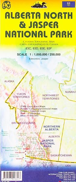
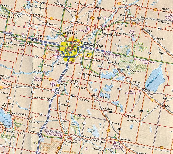
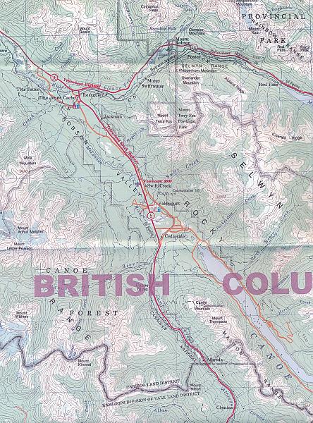
Wegenkaart - landkaart Jasper National Park & Northern Alberta Edmonton | ITMB
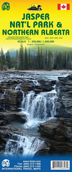
De ITMB kaarten kenmerken zich door een kleurrijke en volle cartografische weergave. Het zijn degelijke kaarten, zeker voor gebieden waarvoor kaarten lastig te krijgen zijn, met aanduidingen van onder andere nationale parken en natuurgebieden, vliegvelden, toeristische bezienswaardigheden en een goede aanduiding van het wegennet. Daarnaast bevatten enkele kaarten ook stadsplattegronden (hoofdsteden of belangrijke centra). Bevat voor sommige landen ook aanduidingen in de orginele taal. Noord Alberta schaal 1:1 Miljoen, Kaart Jasper schaal 1:250.000. Two words immediately come to my mind if I were to describe Northern Alberta: Oil and Cold. Oil sands could be found relatively easily within the Northern Alberta region. This pushes the Canadian economy forward as gasoline and other petroleum products are becoming higher in demand. Northern Alberta is also about the subzero temperature. The region of Northern Alberta mostly contains very cold, long winters and warm, short summers. Fort McMurray, for example, one of the famous urban communities located in the Wood buffalo municipality, has only a yearly mean temperature of 0.7 degrees Celsius. Nonetheless, Northern Alberta is also a land of recreation activities and wild adventures. On the other side of the Northern Alberta map, we have included a map of Jasper National Park. This park is situated deep in the Alberta Rockies and is surrounded by mountains. Although it is dissected by the Trans-Canada Highway, this park remains as one of the most pristine and wild parks of Canada. This park is a must-see as it can be reached with ease and has amazing natural features. Included insets of this map are Jasper and Edmonton. Legend Includes: Roads by classification, Airports, Ferries, Train Stations, Bus Terminals, National Parks, Hot Springs, View Points, Points of Interest, Mountain Peaks, Fishing Sites, Camping Sites, Picnic Areas, Golf Fields, Ski Sites, Waterfalls, Gas Stations, Universities, Museums, Post Offices, Police Stations, Swimming Pools, Theatres, Libraries, Restaurants, Hospitals and more.
Schaal: 1:1 Miljoen
Engelstalig
EAN: 9781553418603
Uitgeverij: ITMB (International Tavel Maps & Books)
Serie: British-Columbia ITM
Meest recente editie
Engelstalig
Op voorraad
Levertijd 1 week (Nederland) (wegens vakantie)
- Vakkundige klantenservice
- Groot assortiment
- Gratis retourneren binnen 14 dagen
- Aangesloten bij WebwinkelKEUR
€ 13,50
Verder in deze serie
- Topografische Wandelkaart 92G/7 N Vancouver Pt. Coquitlam - ITMB Map
- Topografische Wandelkaart Bowron Lakes Travel Refer. map 93H2/3/6/7 - ITMB Map
- Topografische Wandelkaart Lower Mainland Richmond and New Westminster BC 92G/G2/G3 - ITMB Map
- Wandelkaart - Fietskaart North & West Vancouver Biking & Hiking - ITMB Map
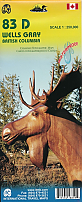
- Wandelkaart 83D Wells Gray Park - ITMB Map
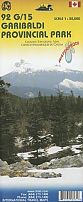
- Wandelkaart Garibaldi Provincial Park (BC) - ITMB Map
- Wandelkaart Gulf Islands (BC) - ITMB Map
- Wandelkaart Prince Edward Island - ITMB Map
- Wandelkaart West Coast Trail & Carmanah Valley - ITMB Map
- Wandelkaart Whistler Sea to Sky Highway - ITMB Map
- Wegenkaart - Landkaart British Columbia - ITMB Map
- Wegenkaart - Landkaart British Columbia South - ITMB Map Best Map!!
- Wegenkaart - Landkaart Fraser Valley / Vancouver's North Shore hiking Trails - ITMB Map
- Wegenkaart - Landkaart Sunshine Coast / British Columbia Zuidwest | ITM
- Wegenkaart - Landkaart Vancouver's Northshore Hiking Trails - ITMB Map
- Wegenkaart - Landkaart Vancouver Island Victoria Tofino Region - ITMB Map
- Wegenkaart - landkaart British Columbia & Alberta Rockies | ITMB
- Wegenkaart - landkaart Northern British Columbia | ITMB
- Wegenkaart - landkaart Queen Charlotte Islands - Haida Gwai | ITMB
- Wegenkaart - landkaart Vancouver Island south - Victoria | ITMB
- Wegenkaart - landkaart Washington State - British Columbia southwest | ITMB
Meer producten die interessant kunnen zijn
Wandelkaarten British-Columbia
Wandelgidsen British-Columbia
Wildlife-gidsen British-Columbia
Reisgidsen British-Columbia
Topografische kaarten British-Columbia
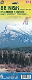
Topografische Wandelkaart Canadian Rockies Banff, Kootenay, Yoho Park 82J/K/N/O - ITMB Map
Water- en scheurvaste wandelkaart
€ 13,50