- Gratis verzending vanaf 30 euro
- Levert in Nederland, België etc.
- Meer dan 30.000 titels
- Vakkundige klantenservice
- Snelle levering
- Veilig en eenvoudig betalen

Direct contact?
Bel +31 (0)6 42428571
maandag t/m vrijdag
van 10 tot 17 uur
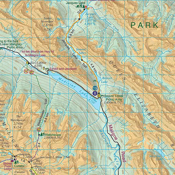
Wandelkaart 1 Jasper National Park & Maligne Lake | Gem Trek Publishing
Water- en scheurvaste wandelkaart
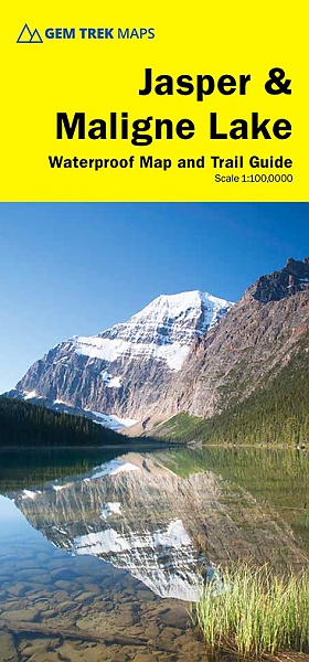
Hiking Map & Guide of Jasper National Park including the area of Maligne Lake (Alberta), published by Gem Trek. Contour lines at 50-metre intervals (150 feet), hiking trails with detailed explanations, and campsites, hotels, outdoor activities and.This map covers the most popular hiking and mountain biking terrain in Jasper National Park, from Miette Hot Springs and Maligne Lake in the north, west to Jasper townsite and the Tonquin Valley, and south to Fortress Lake. Premier day hikes on this map include Bald Hills, Opal Hills, Cavell Meadows, Sulphur Skyline and Valley of the Five Lakes. Multi-day hikes such as the Skyline Trail, Tonquin Valley, Fortress Lake, Geraldine Lakes, Athabasca Pass (Alberta side) and Fryatt Valley are shown in their entirety on this map.
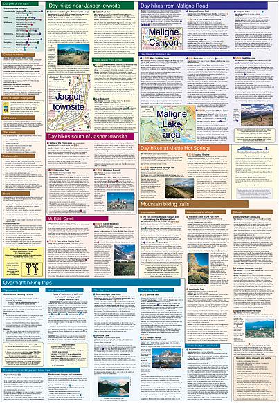
On the back of the map are trail descriptions and photos of 18 recommended day hikes, four overnight or multi-day trips and six classic mountain bike rides. Also on the back is contact information for Jasper National Park, as well for as the three backcountry lodges located in the Tonquin Valley and on the Skyline Trail. Waterproof map.
Schaal: 1:100.000
Engelstalig
EAN: 9781990161070
Uitgeverij: Gem Trek Publishing (Canada)
Serie: Gem Trek Wandelkaart
Meest recente editie
Engelstalig

Op voorraad
Overmorgen in huis (Nederland)
- Vakkundige klantenservice
- Groot assortiment
- Gratis retourneren binnen 14 dagen
- Aangesloten bij WebwinkelKEUR
€ 17,50
Verder in deze serie
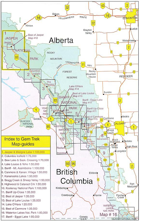
- Wandelkaart 2 Columbia Icefield Guide & Map | Gem Trek Publishing
- Wandelkaart 3 Bow Lake & Saskatchewan Crossing | Gem Trek Publishing
- Wandelkaart 4 Lake Louise & Yoho | Gem Trek Publishing
- Wandelkaart 5 Banff & Mount Assiniboine | Gem Trek Publishing
- Wandelkaart 6 Canmore & Kananaskis Village | Gem Trek Publishing
- Wandelkaart 7 Kananaskis Lakes (Peter Lougheed Provincial Park) | Gem Trek Publishing
- Wandelkaart 8 Bragg Creek & Sheep Valley | Gem Trek Publishing
- Wandelkaart 8 Bragg Creek & Sheep Valley | Gem Trek Publishing
- Wandelkaart 9 Highwood & Cataract Creek | Gem Trek Publishing
- Wandelkaart 10 Kootenay National Park | Gem Trek Publishing
- Wandelkaart 10 Kootenay National Park | Gem Trek Publishing
- Wandelkaart 11 Banff Up-Close | Gem Trek Publishing
- Wandelkaart 12 Best of Jasper | Gem Trek Publishing
- Wandelkaart 13 Best of Lake Louise | Gem Trek Publishing
- Wandelkaart 14 Lake O'hara | Gem Trek Publishing
- Wandelkaart 16 Waterton Lakes National Park | Gem Trek Publishing
- Wandelkaart 17 Banff: Egypt Lake | Gem Trek Map
- Wandelkaart Jasper National Park Map and Guide | Gem Trek Publishing
- Wegenkaart Best of Icefield Parkway | Gem Trek Publishing
Meer producten die interessant kunnen zijn
Wegenkaart - Landkaart 1 Banff National Park Map and Guide | Gem Trek Publishing
Water- en scheurvaste wandelkaart
€ 15,99