- Gratis verzending vanaf 30 euro
- Levert in Nederland, België etc.
- Meer dan 30.000 titels
- Vakkundige klantenservice
- Snelle levering
- Veilig en eenvoudig betalen

Direct contact?
Bel +31 (0)6 42428571
maandag t/m vrijdag
van 10 tot 17 uur
Wandelkaart 10 Kootenay National Park | Gem Trek Publishing
Water- en scheurvaste wandelkaart
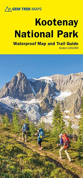
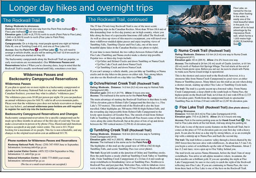
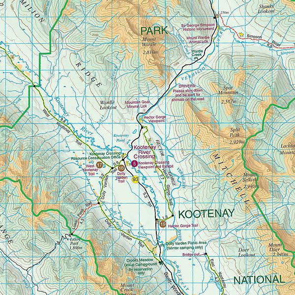
Hiking Map & Guide of the Kootenay National Park (British Columbia) published by Gem Trek. Contour lines at 100-metre intervals (330 feet), relief-shading, hiking trailswith detailed explanations, bike routes, elevations and durations, campgrounds, hotels, outdoor activities and detailed legend. This map covers all of Kootenay National Park, from Castle Mountain Junction south through Radium, to Windermere. All the official hiking and mountain biking trails in Kootenay National Park are shown on the map. Popular trails on the map include Boom Lake, Twin and Arnica Lakes, Stanley Glacier, Marble Canyon and the Paint Pots, Hawk Creek, Kindersley Pass-Sinclair Creek, plus Floe Lake and the entire Rockwall Trail.
On the back of the map are trail descriptions and photos of 10 short interpretive walks to viewpoints or points of interest, six recommended day hikes, four classic mountain bike rides. Also on the back is an inset map of Radium Hot Springs townsite, as well as contact information for visitor centres and campgrounds.
Schaal: 1:100.000
Engelstalig
EAN: 9781990161025
Uitgeverij: Gem Trek Publishing (Canada)
Serie: Gem Trek Wandelkaart
Verschijningsdatum: 2022
Meest recente editie
Engelstalig
Op voorraad
Overmorgen in huis (Nederland)
- Vakkundige klantenservice
- Groot assortiment
- Gratis retourneren binnen 14 dagen
- Aangesloten bij WebwinkelKEUR
€ 17,75
Verder in deze serie
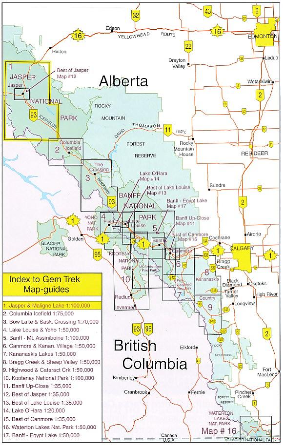
- Wandelkaart 1 Jasper National Park & Maligne Lake | Gem Trek Publishing
- Wandelkaart 2 Columbia Icefield Guide & Map | Gem Trek Publishing
- Wandelkaart 3 Bow Lake & Saskatchewan Crossing | Gem Trek Publishing
- Wandelkaart 4 Lake Louise & Yoho | Gem Trek Publishing
- Wandelkaart 5 Banff & Mount Assiniboine | Gem Trek Publishing
- Wandelkaart 6 Canmore & Kananaskis Village | Gem Trek Publishing
- Wandelkaart 7 Kananaskis Lakes (Peter Lougheed Provincial Park) | Gem Trek Publishing
- Wandelkaart 8 Bragg Creek & Sheep Valley | Gem Trek Publishing
- Wandelkaart 8 Bragg Creek & Sheep Valley | Gem Trek Publishing
- Wandelkaart 9 Highwood & Cataract Creek | Gem Trek Publishing
- Wandelkaart 10 Kootenay National Park | Gem Trek Publishing
- Wandelkaart 11 Banff Up-Close | Gem Trek Publishing
- Wandelkaart 12 Best of Jasper | Gem Trek Publishing
- Wandelkaart 13 Best of Lake Louise | Gem Trek Publishing
- Wandelkaart 14 Lake O'hara | Gem Trek Publishing
- Wandelkaart 16 Waterton Lakes National Park | Gem Trek Publishing
- Wandelkaart 17 Banff: Egypt Lake | Gem Trek Map
- Wandelkaart Jasper National Park Map and Guide | Gem Trek Publishing
- Wegenkaart Best of Icefield Parkway | Gem Trek Publishing
Meer producten die interessant kunnen zijn
Wegenkaart - Landkaart 1 Banff National Park Map and Guide | Gem Trek Publishing
Water- en scheurvaste wandelkaart
€ 15,99
Wandelkaart 1 Jasper National Park & Maligne Lake | Gem Trek Publishing
Water- en scheurvaste wandelkaart
€ 17,50