- Gratis verzending vanaf 30 euro
- Levert in Nederland, België etc.
- Meer dan 30.000 titels
- Vakkundige klantenservice
- Snelle levering
- Veilig en eenvoudig betalen

Direct contact?
Bel +31 (0)6 42428571
maandag t/m vrijdag
van 10 tot 17 uur
Wandelgids The Speyside Way Cicerone Guidebooks
With Dava Way and Moray Coast Trail

This guidebook describes the Speyside Way, an official 66 mile (106km) Scottish Long Distance Route which follows the River Spey through northern Scotland from Aviemore to the old port of Buckie on the Moray coast. Featuring easy walking on good paths and along disused railway lines, the route can be comfortably completed in a week and is presented in 10 stages of between 2 and 13 miles (3-21km). The guide also details the recently opened 61/2-mile (10.5km) extension to the Speyside Way between Kincraig and Aviemore as well as two alternatives to the main route and routes to the source of the Spey. Also featured are three other trails in the same region which can be combined with the Speyside Way to form a longer trek: the 25 mile (40km) Dava Way, 47 mile (76km) Moray Coast Trail and 121/2 mile (20km) Badenoch Way. Alongside detailed route description, the guide includes background information, local points of interest (including a list of distilleries!), tips on transport and accommodation and recommendations for mountain-bikers and riders, who can follow stretches of the route. A handy booklet containing all the OS 1:25,000 Explorer mapping needed to complete the Speyside Way is located in the back cover sleeve. The Spey is Scotland's third longest river, famed for its salmon and its distilleries. Rising in the Monadhliath Mountains, it flows through remote glens to the Highland resort of Aviemore, surrounded by the wild Cairngorms. From there, the Speyside Way follows the river's course through the countryside, forests and small towns of Strathspey and Moray to reach its mouth on the Moray
Engelstalig
EAN: 9781852848682
Auteur(s): Alan castle
Uitgeverij: Cicerone Press
Serie: National Trail
Verschijningsdatum: 2017
Meest recente editie
Engelstalig

(Tijdelijk) niet leverbaar
- Vakkundige klantenservice
- Groot assortiment
- Gratis retourneren binnen 14 dagen
- Aangesloten bij WebwinkelKEUR
Verder in deze serie

- Wandelgids Ridgeway Cicerone Guidebooks
- Wandelgids South Downs Way described east–west and west–east | Cicerone
- Wandelgids St Oswald's Way and St Cuthbert's Way | Cicerone
- Wandelgids The Cotswolds Way Cicerone Guidebooks
- Wandelgids The Great Glen Way Cicerone Guidebooks
- Wandelgids The Great Glen Way | Cicerone
- Wandelgids The North Downs Way | Cicerone
- Wandelgids The South West Coast Path (Zoutpad) Cicerone Guidebooks
- Wandelgids The Thames Path Cicerone Guidebooks
- Wandelgids The West Highland Way Cicerone Guidebooks
- Wandelkaartgids South West Coast Path Map Booklet - Minehead to St Ives deel 1(Zoutpad) | Cicerone
- Wandelkaartgids South West Coast Path Map Booklet - Plymouth to Poole deel 3 (Zoutpad) | Cicerone
- Wandelkaartgids South West Coast Path Map Booklet - St Ives to Plymouth deel 2 (Zoutpad) | Cicerone
- Wandelkaartgids The North Downs Way Booklet | Cicerone
- Wandelkaartgids The Thames Path Map Booklet | Cicerone
- Wandelkaartgids Walking the Cotswold Way | Cicerone
- Wandelkaartgids West Highland Way Map Booklet | Cicerone
Meer producten die interessant kunnen zijn
Topografische kaarten Noord-Schotland
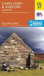
Topografische Wandelkaart OL57 van Groot-Brittannië (1:25.000) Cairn Gorm & Aviemore, Loch Morlich - Explorer Map OL 57
Wandelkaart | Ordnance Survey (OS) Groot-Brittannië
€ 18,99
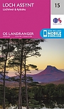
Topografische Wandelkaart 15 Loch Assynt Lochinver & Kylesku - Landranger Map
Wandelkaart & Fietskaart | Ordnance Survey (OS) Groot-Brittannië
€ 18,99
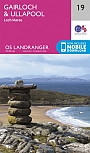
Topografische Wandelkaart 19 Gairloch / Ullapool (Loch Maree) - Landranger Map
Wandelkaart & Fietskaart | Ordnance Survey (OS) Groot-Brittannië
€ 18,99
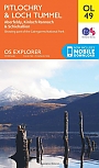
Topografische Wandelkaart OL49 van Groot-Brittannië (1:25.000) Pitlorchry & Loch Tummel / Aberfeldy - Explorer Map OL 49
Wandelkaart | Ordnance Survey (OS) Groot-Brittannië
€ 18,99
Wandelkaarten Noord-Schotland
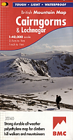
Wandelkaart Cairngorms and Lochnagar - Mountain Map | Harvey Maps
Water- en scheurvaste wandelkaart
€ 28,99
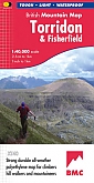
Wandelkaart Torridon & Fisherfield - Mountain Map | Harvey Maps
Water- en scheurvaste wandelkaart
€ 28,99