- Gratis verzending vanaf 30 euro
- Levert in Nederland, België etc.
- Meer dan 30.000 titels
- Vakkundige klantenservice
- Snelle levering
- Veilig en eenvoudig betalen

Direct contact?
Bel +31 (0)6 42428571
maandag t/m vrijdag
van 10 tot 17 uur
Harvey Map Greenland
|
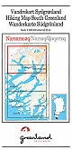
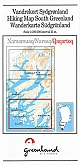
Wandelkaart Groenland 1 Narsarsuaq Hiking Map Greenland Harvey MapsNarsarsuaq - Narsaq - Qaqortog, map no. 1, in a series of waterproof and tear-resistant topographic maps of popular coastal areas of southern and central Greenland. Countours are shown at 25-metre intervals, with additional altitude colouring. The maps show settlements, farms, shepherds' huts, water supply areas, roads and tracks, fords, rivers and streams, etc. Tourist information includes marked or partly marked hiking routes, recommended kayak routes, information centres, hotels, campsites, youth hostels, general stores, places of interest, etc. A grid gives UTM... Schaal: 1:100.000 |
24,99 |
|
Wandelkaart Groenland 10 Sisimiut Hiking Map Greenland | Harvey MapsSisimiut, map no. 10, in a series of waterproof and tear-resistant topographic maps of popular coastal areas of southern and central Greenland. Countours are shown at 25-metre intervals, with additional altitude colouring. The maps show settlements, farms, shepherds' huts, water supply areas, roads and tracks, fords, rivers and streams, etc. Tourist information includes marked or partly marked hiking routes, recommended kayak routes, information centres, hotels, campsites, youth hostels, general stores, places of interest, etc. A grid gives UTM co-ordinates plus la... Schaal: 1:100.000 |
Tijdelijk niet leverbaar |
|
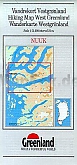
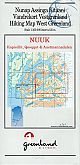
Wandelkaart Groenland 11 Nuuk Hiking Map Greenland | Harvey MapsA series of waterproof and tear-resistant topographic maps of popular coastal areas of southern and central Greenland. Countours are shown at 25-metre intervals, with additional altitude colouring. The maps show settlements, farms, shepherds' huts, water supply areas, roads and tracks, fords, rivers and streams, etc. Tourist information includes marked or partly marked hiking routes, recommended kayak routes, information centres, hotels, campsites, youth hostels, general stores, places of interest, etc. A grid gives UTM co-ordinates plus latitude in steps of 5'... Schaal: 1:75.000 |
24,99 |
|
Wandelkaart Groenland 11a Nuuk Omgeving Nuuk Hiking Map Greenland | Harvey MapsThese are the only topographic hiking maps of Greenland printed on waterproof paper (produced by Harvey Maps). The reverse side of the map has information on hiking, weather, choice of route, clothing, camping etc. The best detailed maps of Greenland. Wandelkaart voor net buiten de stad Nuuk. Schaal: 1:20.000 |
24,99 |
|
Wandelkaart Groenland 12 Ilulissat Hiking Map Greenland | Harvey MapsIlulissat, map no. 12, in a series of waterproof and tear-resistant topographic maps of popular coastal areas of southern and central Greenland. Countours are shown at 25-metre intervals, with additional altitude colouring. The maps show settlements, farms, shepherds' huts, water supply areas, roads and tracks, fords, rivers and streams, etc. Tourist information includes marked or partly marked hiking routes, recommended kayak routes, information centres, hotels, campsites, youth hostels, general stores, places of interest, etc. A grid gives UTM co-ordinates plus l... Schaal: 1:100.000 |
24,99 |
|
Wandelkaart Groenland 12b Ilulissat Hiking Map Greenland | Harvey MapsVery detailed map of the area around Illulissatt including Nuuluk, Uujuk Kangileq and Naujatsiant and Inussuissuaq. These are the only topographic hiking maps of Greenland printed on waterproof paper (produced by Harvey Maps). The reverse side of the map has information on hiking, weather, choice of route, clothing, camping etc. The best detailed maps of Greenland. Schaal: 1:20.000 |
24,99 |
|
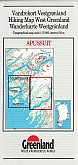
Wandelkaart Groenland 13 Apussuit Hiking Map Greenland | Harvey MapsA West Greenland topographic hiking map of Apussuit printed on waterproof paper (produced by Harvey Maps). The reverse side of the map has information on hiking, weather, choice of route, clothing, camping etc. The best detailed maps of Greenland. Schaal: 1:75.000 |
24,99 |
|
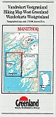
Wandelkaart Groenland 14 Maniitsoq Hiking Map Greenland | Harvey MapsManitsoq, map no. 14, in a series of waterproof and tear-resistant topographic maps of popular coastal areas of southern and central Greenland. Countours are shown at 25-metre intervals, with additional altitude colouring. The maps show settlements, farms, shepherds' huts, water supply areas, roads and tracks, fords, rivers and streams, etc. Tourist information includes marked or partly marked hiking routes, recommended kayak routes, information centres, hotels, campsites, youth hostels, general stores, places of interest, etc. A grid gives UTM co-ordinates plus la... Schaal: 1:75.000 |
24,99 |
|
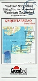
Wandelkaart Groenland 15 Qeqertarsuaq - Disko Island Hiking Map Greenland | Harvey MapsQegertarsuaq Hiking Map No. 15 at 1: 100,000 part of a series covering the Coastal areas of Greenland at 1:100,000 or 1:75,000 of GPS compatible contoured topographic maps from Greenland Tourism, indicating both recommended hiking trails and snowmobile routes, plus camping places, youth hostels, etc. Contours lines are at 25m intervals and additional altitude colouring. The maps provide a very detailed picture of the terrain, showing topographic features such as rivers and streams with fords, sand or gravel shoreline, marshes, boulder fields, etc. Recommended hiki... Schaal: 1:100.000 |
24,99 |
|
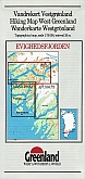
Wandelkaart Groenland 16 Evighedsfjorden Hiking Map Greenland | Harvey MapsEvighedsfjorden Hiking Map No. 16 at 1: 75,000 part of a series covering the Coastal areas of Greenland at 1:100,000 or 1:75,000 of GPS compatible contoured topographic maps from Greenland Tourism, indicating both recommended hiking trails and snowmobile routes, plus camping places, youth hostels, etc. Contours lines are at 25m intervals and additional altitude colouring. The maps provide a very detailed picture of the terrain, showing topographic features such as rivers and streams with fords, sand or gravel shoreline, marshes, boulder fields, etc. Recommended hi... Schaal: 1:75.000 |
24,99 |
|
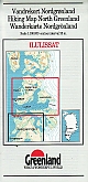
Wandelkaart Groenland 17 Qasigianguit Hiking Map Greenland | Harvey MapsQasigiannguit, map no. 17, in a series of waterproof and tear-resistant topographic maps of popular coastal areas of southern and central Greenland. Countours are shown at 25-metre intervals, with additional altitude colouring. The maps show settlements, farms, shepherds' huts, water supply areas, roads and tracks, fords, rivers and streams, etc. Tourist information includes marked or partly marked hiking routes, recommended kayak routes, information centres, hotels, campsites, youth hostels, general stores, places of interest, etc. A grid gives UTM co-ordinates pl... Schaal: 1:100.000 |
24,99 |
|
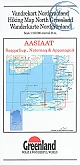
Wandelkaart Groenland 18 Aasiaat Hiking Map Greenland | Harvey Maps | van 24.99 voor 18.99 kaft licht beschadigdAasiaat - Saqqarliup - Naternaq - Appannguit, map no. 18, in a series of waterproof and tear-resistant topographic maps of popular coastal areas of southern and central Greenland. Countours are shown at 25-metre intervals, with additional altitude colouring. The maps show settlements, farms, shepherds' huts, water supply areas, roads and tracks, fords, rivers and streams, etc. Tourist information includes marked or partly marked hiking routes, recommended kayak routes, information centres, hotels, campsites, youth hostels, general stores, places of interest, etc. A... Schaal: 1:100.000 |
18,99 |
|
Wandelkaart Groenland 19 Nuuk Kapisillit Qooqqut & Austmannadalen Hiking Map Greenland | Harvey MapsA series of waterproof and tear-resistant topographic maps of popular coastal areas of southern and central Greenland. Countours are shown at 25-metre intervals, with additional altitude colouring. The maps show settlements, farms, shepherds' huts, water supply areas, roads and tracks, fords, rivers and streams, etc. Tourist information includes marked or partly marked hiking routes, recommended kayak routes, information centres, hotels, campsites, youth hostels, general stores, places of interest, etc. A grid gives UTM co-ordinates plus latitude in steps of 5'... Schaal: 1:75.000 |
24,99 |
|
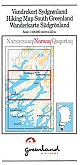
Wandelkaart Groenland 2 Narsaq Hiking Map Greenland | Harvey MapsNarsaq, map no. 2, in a series of waterproof and tear-resistant topographic maps of popular coastal areas of southern and central Greenland. Countours are shown at 25-metre intervals, with additional altitude colouring. The maps show settlements, farms, shepherds' huts, water supply areas, roads and tracks, fords, rivers and streams, etc. Tourist information includes marked or partly marked hiking routes, recommended kayak routes, information centres, hotels, campsites, youth hostels, general stores, places of interest, etc. A grid gives UTM co-ordinates plus latit... Schaal: 1:100.000 |
Tijdelijk niet leverbaar |
|
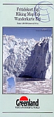
Wandelkaart Groenland 20 Eqi - Alluttoq - Arveprinsen Ejland Greenland | Harvey MapsEqi - Alluttoq - Arveprinses Island, map no. 20, in a series of waterproof and tear-resistant topographic maps of popular coastal areas of southern and central Greenland. Countours are shown at 25-metre intervals, with additional altitude colouring. The maps show settlements, farms, shepherds' huts, water supply areas, roads and tracks, fords, rivers and streams, etc. Tourist information includes marked or partly marked hiking routes, recommended kayak routes, information centres, hotels, campsites, youth hostels, general stores, places of interest, etc. A grid giv... Schaal: 1:100.000 |
24,99 |
|
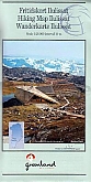
Wandelkaart Groenland 20c Eqi Greenland | Harvey MapsA North Greenland topographic hiking map printed on waterproof paper (produced by Harvey Maps). The reverse side of the map has information on hiking, weather, choice of route, clothing, camping etc. The best detailed maps of Greenland. Schaal: 1:30.000 |
24,99 |
|
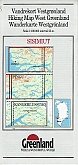
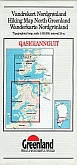
Wandelkaart Groenland 3 Qaqortoq Hiking Map Greenland | Harvey MapsQaqortoq, map no. 3, in a series of waterproof and tear-resistant topographic maps of popular coastal areas of southern and central Greenland. Countours are shown at 25-metre intervals, with additional altitude colouring. The maps show settlements, farms, shepherds' huts, water supply areas, roads and tracks, fords, rivers and streams, etc. Tourist information includes marked or partly marked hiking routes, recommended kayak routes, information centres, hotels, campsites, youth hostels, general stores, places of interest, etc. A grid gives UTM co-ordinates plus lat... Schaal: 1:100.000 |
24,99 |
|
Wandelkaart Groenland 4 Ivittuut Hiking Map Greenland | Harvey MapsIvittuut, map no. 4, in a series of waterproof and tear-resistant topographic maps of popular coastal areas of southern and central Greenland. Countours are shown at 25-metre intervals, with additional altitude colouring. The maps show settlements, farms, shepherds' huts, water supply areas, roads and tracks, fords, rivers and streams, etc. Tourist information includes marked or partly marked hiking routes, recommended kayak routes, information centres, hotels, campsites, youth hostels, general stores, places of interest, etc. A grid gives UTM co-ordinates plus lat... Schaal: 1:75.000 |
24,99 |
|
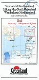
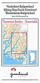
Wandelkaart Groenland 5 Tasermiut Fjord Nanortalik Hiking Map Greenland | Harvey MapsTasermiut fjorden - Nanortalik, a South Greenland topographic hiking map. These are the only hiking maps of Greenland printed on waterproof paper (produced by Harvey Maps). The reverse side of the map has information on hiking, weather, choice of route, clothing, camping etc. The best detailed maps of Greenland. Schaal: 1:100.000 |
24,99 |
|
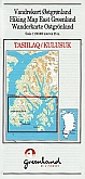
Wandelkaart Groenland 6 Tasiilaq - Kulusuk Hiking Map Greenland | Harvey MapsTasiilaq, map no. 6, in a series of waterproof and tear-resistant topographic maps of popular coastal areas of southern and central Greenland. Countours are shown at 25-metre intervals, with additional altitude colouring. The maps show settlements, farms, shepherds' huts, water supply areas, roads and tracks, fords, rivers and streams, etc. Tourist information includes marked or partly marked hiking routes, recommended kayak routes, information centres, hotels, campsites, youth hostels, general stores, places of interest, etc. A grid gives UTM co-ordinates plus lat... Schaal: 1:100.000 |
24,99 |
|
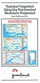
Wandelkaart Groenland 8 Kangerlussuaq Hiking Map Greenland | Harvey MapsKangerlussuaq, map no. 8, in a series of waterproof and tear-resistant topographic maps of popular coastal areas of southern and central Greenland. Countours are shown at 25-metre intervals, with additional altitude colouring. The maps show settlements, farms, shepherds' huts, water supply areas, roads and tracks, fords, rivers and streams, etc. Tourist information includes marked or partly marked hiking routes, recommended kayak routes, information centres, hotels, campsites, youth hostels, general stores, places of interest, etc. A grid gives UTM co-ordinates plu... Schaal: 1:100.000 |
24,99 |
|
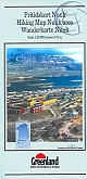
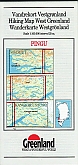
Wandelkaart Groenland 9 Pingu Hiking Map Greenland | Harvey MapsPingu, map no. 9, in a series of waterproof and tear-resistant topographic maps of popular coastal areas of southern and central Greenland. Countours are shown at 25-metre intervals, with additional altitude colouring. The maps show settlements, farms, shepherds' huts, water supply areas, roads and tracks, fords, rivers and streams, etc. Tourist information includes marked or partly marked hiking routes, recommended kayak routes, information centres, hotels, campsites, youth hostels, general stores, places of interest, etc. A grid gives UTM co-ordinates plus latitu... Schaal: 1:100.000 |
24,99 |