- Gratis verzending vanaf 30 euro
- Levert in Nederland, België etc.
- Meer dan 30.000 titels
- Vakkundige klantenservice
- Snelle levering
- Veilig en eenvoudig betalen

Direct contact?
Bel +31 (0)6 42428571
maandag t/m vrijdag
van 10 tot 17 uur
Wandelgids Cotswold Way Trailblazer
Chipping Campden to Bath

All-in-one hiking route guide and maps to the Cotswold Way, a 102-mile National Trail that runs from Chipping Campden to Bath, following the beautiful Cotswold escarpment for most of its course. The trail leads through quintessentially English countryside with little villages of honey-coloured stone to the well-known town of Bath. Includes 44 large-scale maps (3 1/8 inches to 1 mile); 9 town plans and 8 overview maps. Full details of all accommodations and campsites, restaurants and pubs; plus full public transport information. Plus day-walks.Fully revised and rewalked 3rd edition. 44 large-scale walking maps at just under 1:20,000 showing route times, places to stay, points of interest and much more 9 town plans - Chipping Campden, Broadway, Winchcombe, Cheltenham, Painswick, Dursley, Wotton-under-Edge, and the city of Bath 8 area maps and trail profiles Itineraries for all walkers whether walking the route in its entirety over seven to eight days or sampling the highlights on day walks and short breaks Practical information for all budgets camping, bunkhouses, hostels, B&Bs, pubs and hotels; Chipping Campden to Bath where to stay, where to eat, what to see, plus detailed street plans Comprehensive public transport information for all access points on the Cotswold Way. Flora and fauna four page full color flower guide, plus an illustrated section on local wildlife Green hiking understanding the local environment and minimizing our impact on it Bath city guide Includes downloadable gps waypoints"
Schaal: 1:40.000
Engelstalig
EAN: 9781912716418
Auteur(s): Tricia hayne
Uitgeverij: Trailblazer
Verschijningsdatum: 2024
Meest recente editie
Engelstalig
200 pagina's


EAN: 9781912716418
Auteur(s): Tricia hayne
Uitgeverij: Trailblazer
Verschijningsdatum: 2024
Engelstalig
direct leverbaar
20,95
Meer producten die interessant kunnen zijn


Reisgids Slow Cotswolds Bradt Travel Guide
Including Bath, Stratford-Upon-Avon & Oxford
€ 17,99
Tijdelijk niet leverbaar


Topografische Wandelkaart OL45 van Groot-Brittannië (1:25.000) The Cotswolds - Explorer Map OL 45
Wandelkaart | Ordnance Survey (OS) Groot-Brittannië
€ 18,99
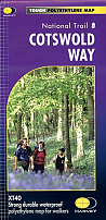
Wandelkaart Cotswold Way - National Trail Maps | Harvey Maps
Water- en scheurvaste wandelkaart
€ 25,99