- Gratis verzending vanaf 30 euro
- Levert in Nederland, België etc.
- Meer dan 30.000 titels
- Vakkundige klantenservice
- Snelle levering
- Veilig en eenvoudig betalen

Direct contact?
Bel +31 (0)6 42428571
maandag t/m vrijdag
van 10 tot 17 uur
Wandelkaart Ruka Oulanka karhunkierros | Karttakeskus Ulkoilukartta
Kaart geschikt voor het lopen van het Berenpad.

Gedetailleerde topografische wandelkaart van dit Nationaal Park in het Noordoosten van Finland. Hoogtelijnen, wandelpaden, skiroutes, loipen, kanoroutes. Verder is er toeristische informatie op de kaart aanwezig: camping, hutten, hotels en bezienswaardigheden. The outdoor recreation maps cover the most important camping sites from Northern Finland to the wilderness areas of Southern Finland. The maps are based on the exact terrain maps and therefore it is easy to find the destination in the terrain. All the services needed by the hiker have been presented with symbols and texts. Also the sights are marked on the map. Precise scale makes it possible to find even the most minute roads as well as the points of interest. Kaart geschikt voor het lopen van het Berenpad.
Schaal: 1:50.000
Engelstalig
EAN: 9789522666741
Uitgeverij: Karttakeskus Ulkoilukartta
Serie: Finland Noord
Meest recente editie
Engelstalig


EAN: 9789522666741
Uitgeverij: Karttakeskus Ulkoilukartta
Engelstalig
direct leverbaar
20,99
Verder in deze serie

Meer producten die interessant kunnen zijn

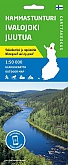
Wandelkaart Hammastunturi Southern Inari | Karttakeskus Ulkoilukartta
Ivalojoki gold fields and wild Lake Inarijärvi
€ 20,99