- Gratis verzending vanaf 30 euro
- Levert in Nederland, België etc.
- Meer dan 30.000 titels
- Vakkundige klantenservice
- Snelle levering
- Veilig en eenvoudig betalen

Direct contact?
Bel +31 (0)6 42428571
maandag t/m vrijdag
van 10 tot 17 uur
Finland Noord
|
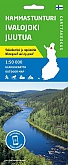
Wandelkaart Hammastunturi Southern Inari | Karttakeskus Ulkoilukartta | Ivalojoki gold fields and wild Lake InarijärviGedetailleerde topografische wandelkaart van dit Nationaal Park in het Noorden van Finland. Hoogtelijnen, wandelpaden, skiroutes, loipen, kanoroutes. Verder is er toeristische informatie op de kaart aanwezig: camping, hutten, hotels en bezienswaardigheden. Schaal: 1:100.000 |
20,99 |
|
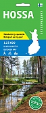
Wandelkaart Hossa | Karttakeskus UlkoilukarttaGedetailleerde topografische wandelkaart van dit Nationaal Park in het Noorden van Finland. Hoogtelijnen, wandelpaden, skiroutes, loipen, kanoroutes. Verder is er toeristische informatie op de kaart aanwezig: camping, hutten, hotels en bezienswaardigheden. The outdoor map Hossa 1:25 000 is printed on new synthetic material. The new durable domestic outdoor maps can be identified by the yellow marking on the cover. The double-sided map covers the newly established Hossa national park and its surroundings. There has been a wide range of hiking trails and services in the ... Schaal: 1:25.000 |
20,99 |
|
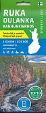
Wandelkaart Ruka Oulanka karhunkierros | Karttakeskus Ulkoilukartta | Kaart geschikt voor het lopen van het Berenpad.Gedetailleerde topografische wandelkaart van dit Nationaal Park in het Noordoosten van Finland. Hoogtelijnen, wandelpaden, skiroutes, loipen, kanoroutes. Verder is er toeristische informatie op de kaart aanwezig: camping, hutten, hotels en bezienswaardigheden. The outdoor recreation maps cover the most important camping sites from Northern Finland to the wilderness areas of Southern Finland. The maps are based on the exact terrain maps and therefore it is easy to find the destination in the terrain. All the services needed by the hiker have been presented with symbols ... Schaal: 1:50.000 |
20,99 |
|
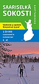
Wandelkaart Saarisselkä Sokosti | Karttakeskus UlkoilukarttaGedetailleerde topografische wandelkaart van dit Nationaal Park in het noorden van Finland. Hoogtelijnen, wandelpaden, skiroutes, loipen, kanoroutes. Verder is er toeristische informatie op de kaart aanwezig: camping, hutten, hotels en bezienswaardigheden. Schaal: 1:50.000 |
20,99 |
|
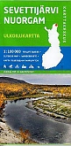
Wandelkaart Sevettijärvi Nuorgam | Karttakeskus UlkoilukarttaGedetailleerde topografische wandelkaart van dit Nationaal Park in het Noorden van Finland. Hoogtelijnen, wandelpaden, skiroutes, loipen, kanoroutes. Verder is er toeristische informatie op de kaart aanwezig: camping, hutten, hotels en bezienswaardigheden. The outdoor recreation maps cover the most important camping sites from Northern Finland to the wilderness areas of Southern Finland. The maps are based on the exact terrain maps and therefore it is easy to find the destination in the terrain. All the services needed by the hiker have been presented with symbols ... Schaal: 1:100.000 |
20,99 |

|
Wandelkaart Ylläs Levi | Karttakeskus UlkoilukarttaGedetailleerde topografische wandelkaart van dit Nationaal Park in het Noorden van Finland. Hoogtelijnen, wandelpaden, skiroutes, loipen, kanoroutes. Verder is er toeristische informatie op de kaart aanwezig: camping, hutten, hotels en bezienswaardigheden. The Ylläs Levi Aakenus map replaces the southern half of the previous Pallas-Yllästunturi 1:50 000 outdoor map and the Pallas Hetta Olos map replaces the northern half. Schaal: 1:50.000 |
20,99 |