- Gratis verzending vanaf 30 euro
- Levert in Nederland, België etc.
- Meer dan 30.000 titels
- Vakkundige klantenservice
- Snelle levering
- Veilig en eenvoudig betalen

Direct contact?
Bel +31 (0)6 42428571
maandag t/m vrijdag
van 10 tot 17 uur
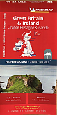
Wegenatlas Groot-Brittannië & Ierland Schotland Engeland Wales Ierland - Michelin Wegenatlassen
A4 Formaat met spiraalbinding

De wegenatlassen van Michelin bieden uitstekende overzichtskaarten van een hoge kwaliteit. Deze bekende serie wegenkaarten bevatten in goed detail alle hoofdwegen en verbindingswegen tussen de dorpen en steden. Uitgebreid met andere belangrijke weginformatie, zoals tolwegen, tankstations, parkeerplaatsen, af- en opritten, wegnummers, campings, hoogteverschillen, winterafsluitingen en groene routes. Het zijn dus complete kaarten voor onderweg. Daarnaast bevatten de wegenatlassen een handige index om de plaatsen op te zoeken en een aantal stadsplattegronden van de belangrijkste steden. Full of practical features, the Michelin Great Britain & Ireland - Main Roads Atlas (A4-Spiral) is the perfect companion for your everyday journey and holiday planning. Updated every year, it gives you clear and accurate information for a safe and enjoyable journey thanks to a detailed mapping scale of 1/300 000. The route planner as well as the time and distance charts will help you plan and optimise your journey.
Michelin's safety alerts warn you about dangerous driving areas, such as steep hills, level crossing as well as risk zone subject to tighter speed check. The Great Britain & Ireland 2023 - Main Roads Atlas (A4-Spiral) also shows tourist sights, leisure facilities, as well as scenic routes so that you can make the most of your journey.
The Michelin Great Britain & Ireland - Main Roads Atlas (A4-Spiral) features: Detailed mapping with a scale 1/300 000 (4.75 miles to 1 inch)
Mileage chart and journey times to help you plan your journey
Key to Map Pages to quickly access your region of interest
Practical street plan section for an easy navigation in urban areas: 52 town plans embedded in the mapping of their surrounding area.
Easier navigation thanks to the location map featured on top of each page.
An extensive place name index to easily identify the destination of your choice
Comprehensive and detailed key to symbols used
Fuel station and service areas
Tourist information with place of interest and leisure facilities, as well as scenic routes, cross-referenced with the famous Michelin Green Guides, with towns underlined in green
Schaal: 1:300.000
Engelstalig
EAN: 9782067235861
Uitgeverij: Michelin
Verschijningsdatum: 2023
Meest recente editie
Engelstalig
192 pagina's


Op voorraad
Levertijd 2 dagen (Nederland)
- Vakkundige klantenservice
- Groot assortiment
- Gratis retourneren binnen 14 dagen
- Aangesloten bij WebwinkelKEUR
€ 21,50
Meer producten die interessant kunnen zijn
Wegenkaarten Groot-Brittannië
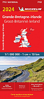
Wegenkaart - Landkaart 798 - Groot-Brittannië & Ierland - Michelin National
Water- en scheurvaste wegenkaart
€ 12,50
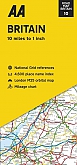
Wegenkaart - Landkaart 10 Groot Brittannië Britain - AA Road Map Britain
€ 8,99
Tijdelijk niet leverbaar

Campinggidsen Groot-Brittannië

Reisgidsen Groot-Brittannië
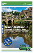
Reisgids Groot-Brittannië ontdek | ANWB
Londen Glastonbury Dartmoor Park Bath Cardiff Hadrian's Wall Peak District Liverpool Edinburgh
€ 23,50
Wandelkaarten Groot-Brittannië
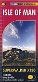
Wandelkaart Isle of Man - Walking Maps Superwalker | Harvey Maps
Water- en scheurvaste wandelkaart
€ 23,99
Wandelgidsen Groot-Brittannië

Wandelgids Best Day Walks Great Britain | Lonely Planet
60 wandelingen
€ 22,50
Tijdelijk niet leverbaar