- Gratis verzending vanaf 30 euro
- Levert in Nederland, België etc.
- Meer dan 30.000 titels
- Vakkundige klantenservice
- Snelle levering
- Veilig en eenvoudig betalen

Direct contact?
Bel +31 (0)6 42428571
maandag t/m vrijdag
van 10 tot 17 uur
Europa / Groot-Brittannië / Wandelen / Wandelgidsen
Groot-Brittannië Wandelgidsen bestsellers
Wandelgids Great Mountain Days in Scotland Cicerone Guidebooks
50 classic hillwalking challenges
25,99
|
Wandelgids Schotland Rother wandelgids | 50 wandelingenDe Rother wandelgids Schotland bevat 50 prachtige wandelingen langs de kust en in de hooglanden van deze wonderschone wandelbestemming. Ervaar de prachtige, ruige natuur tijdens de in dit handzame boekje opgenomen dag- en meerdaagse tochten in de Southern Uplands, in de Hooglanden, langs de kust en op de eilanden. Zoals gebruikelijk zijn er verschillende wandelingen voor beginnende en ervaren wandelaars en is er onmisbare informatie over de streek, de bezienswaardigheden en recreatiemogelijkheden. De betrouwbare routebeschrijvingen, gedetailleerde kaarten en hoogteprof... |
19,99 |
|
Wandelgids Hadrian's Wall Path Trailblazer | Two-way guide: Bowness to Newcastle and Newcastle to BownessPractical guide with 58 large scale maps (1:20,000). Includes accommodation guides, pubs and restaurants and public transport information. Hadrian's Wall Path is a magnificent 84 mile national trail that follows the course of northern Europe's largest surviving Roman monument, the 2nd century fortification built on the orders of the Emperor Hadrian in AD122 and now listed as a UNESCO World Heritage Site. The guide includes 58 detailed walking maps, unique mapping features such as walking times, directions, tricky junctions, places to stay, places to eat, points... |
19,50 |
|
Wandelgids 269 Wales Rother Bergverlag | Rother Bergverlag | Die schonsten Küsten- und Bergwanderungen. 50 Touren. Mit GPS-DatenDe vermaarde wandelgiden van Rother Bergverlag zijn uitstekende wandelgidsen voor ieder niveau. Op een kaartje is de wandelroute aangegeven, maar deze is ook beschreven in een beknopte en heldere tekst. Daarnaast is ook de afstand, de verwachte wandeltijd, het niveau, de hoogte en andere praktische informatie aangegeven. Met deze degelijke wandelgids ontdek je de mooiste plekken van jouw bestemming en kun je de spannendste wandeluitdagingen zoeken. In Wales, dem kleinen Land zwischen Irland und England, findet sich eine unglaubliche landschaftliche Vielfalt diese lasst... |
14,90 |
|
Wandelgids Walking in the Cotswolds | Cicerone guides | 30 rondwandelingenA guidebook to 30 circular walks in the Cotswolds, the largest Area of Outstanding Natural Beauty in England. Ranging from 4 to 12 miles in length, the routes are graded from easy to strenuous, offering something for every walker. Fourteen of the routes described include sections of the Cotswold Way National Trail, a 102-mile walk that winds its way from Chipping Campden to Bath. Step-by-step route descriptions are accompanied by 1:50,000 mapping. There is plenty of information on the many points of interest passed en route, including Roman ruins, ancient stone ci... |
16,99 |

|
Wandelgids 04 Cotswolds Pathfinder Guide (Short Walks) | 20 Korte wandelingen tot 8kmDeze Pathfinder Guide is een goed uitgevoerde gids met verschillende wandelingen in Groot-Britannië. De gids bevat naast goede topografische kaarten van de Britse topografische dienst (Ordanance Survey) ook beschrijvingen van het landschap, de cultuur en/of de flora en fauna. Verder is de gids voorzien van praktische informatie zoals startpunten, verwachte wandeltijd, restaurants en cafés voor onderweg. 20 Korte wandelingen tot 8km. This book contains 20 short circular walks, all rated by length and difficulty, that are carefully selected for the whole family to enjo... |
10,99 Tijdelijk niet leverbaar |
|
Wandelgids Walking in Kent Cicerone Guidebooks | 40 rondwandelingenWalking in Kent describes 40 walks in the Garden of England selected by Kev Reynolds. This guidebook includes the best routes from the previous two volumes (now out of print), as well as recently discovered routes in all corners of the county. There"s plenty to appeal to both family strollers and determined ramblers, and each route has been rewalked by the author and carefully revised. |
16,99 |

|
Wandelgids Jersey Sunflower Car tours and walksSunflower reisgidsen zijn handige handzame gidsen. Een combinatie van autotochten en wandeltochten. Rondwandelingen en lijnwandelingen. De lengte van de wandelingen variërend van 4 tot 20 kilometer. Moeilijkheidsgraad van de wandeling staat vermeldt. Met gedetailleerde kaartjes. Degelijk informatie over de bezienswaardigheden onderweg. Schaal: 1:50.000 |
12,99 Tijdelijk niet leverbaar |
|
Wandelgids 60 Lake District Pathfinder Guide | Pathfinder Guide 60 | Met Ordanance Survey kaartenDeze Pathfinder Guide is een goed uitgevoerde gids met verschillende wandelingen in Groot-Britannië. De gids bevat naast goede topografische kaarten van de Britse topografische dienst (Ordanance Survey) ook beschrijvingen van het landschap, de cultuur en/of de flora en fauna. Verder is de gids voorzien van praktische informatie zoals startpunten, verwachte wandeltijd, restaurants en cafés voor onderweg. Pathfinder Lake District covering Coniston, Kewswick and Devoke Water. This selection offers interest, regional variety and balance of routes in the Lake Di... |
17,99 |
|
Wandelgids 253 Engeland Nord Rother Wanderführer | Rother Bergverlag | Mit Lake District Yorkshire Dales Northumberland 60 TourenDe vermaarde wandelgiden van Rother Bergverlag zijn uitstekende wandelgidsen voor ieder niveau. Op een kaartje is de wandelroute aangegeven, maar deze is ook beschreven in een beknopte en heldere tekst. Daarnaast is ook de afstand, de verwachte wandeltijd, het niveau, de hoogte en andere praktische informatie aangegeven. Met deze degelijke wandelgids ontdek je de mooiste plekken van jouw bestemming en kun je de spannendste wandeluitdagingen zoeken. Mit Lake District Yorkshire Dales Northumberland 60 wandelingen. |
14,90 |
|
Wandelgids Cornwall Devon Rother Wandelgids | 50 Wandelingen | De mooiste kust- en veenwandelingenCornwall Devon is een fantastisch wandelparadijs voor natuurliefhebbers; uitzicht op zee en kust, groene heuvels en kronkelende landweggetjes. De mystieke sfeer komt tot leven bij het zien van de brede baaien met ruige kliffen, woeste kloven met subtropische vegetatie en afgelegen stranden met smaragdgroene wateren. Een wandeling naar het meest westelijke punt van Engeland, Land"s End, is een magische ervaring voor elke wandelaar. Alle 50 wandelroutes voor Cornwall en Devon zijn voorzien van duidelijke kaartjes, onmisbare hoogteprofielen, en uitgebreide beschrijvi... |
18,99 |
|
Wandelgids Snowdonia Way | Cicerone | A walking route through Snowdonia from Machynlleth to ConwyThis guidebook describes the Snowdonia Way in Wales, a long-distance route through Snowdonia National Park from Machynlleth to Conwy. A low-level route of 97 miles (in 6 stages of between 13 and 21 miles) passes through the heart of Snowdonia"s stunning mountain scenery and includes Pass of Aberglaslyn, Ogwen Valley and Aber Falls. It is suitable for walkers of average fitness and stamina, though days are long. An alternative mountain route covers 122 miles in 9 stages of 12–18 miles giving a spectacular journey over the most famous peaks such as Cadair Idris, S... |
19,99 |
|
Wandelgids 11 Dorset Pathfinder Guide | Pathfinder Guide 11 | Met Ordanance Survey kaartenDeze Pathfinder Guide is een goed uitgevoerde gids met verschillende wandelingen in Groot-Britannië. De gids bevat naast goede topografische kaarten van de Britse topografische dienst (Ordanance Survey) ook beschrijvingen van het landschap, de cultuur en/of de flora en fauna. Verder is de gids voorzien van praktische informatie zoals startpunten, verwachte wandeltijd, restaurants en cafés voor onderweg. Dorset must rank as one of the most unspoilt counties in England. Dominating the landscape are the chalk downs open, sweeping, grassy uplands that stretch f... |
17,99 |
|
Wandelgids 06 Cotswolds Pathfinder Guide | Pathfinder Guide 6 | Met Ordanance Survey kaartenDeze Pathfinder Guide is een goed uitgevoerde gids met verschillende wandelingen in Groot-Britannie. De gids bevat naast goede topografische kaarten van de Britse topografische dienst (Ordanance Survey) ook beschrijvingen van het landschap, de cultuur en/of de flora en fauna. Verder is de gids voorzien van praktische informatie zoals startpunten, verwachte wandeltijd, restaurants en cafes voor onderweg. Pathfinder(R) Cotswolds covering parts of the Snowshill, Buckholt Wood and Burford. This selection offers interest, regional variety and balance of routes in the Cotswo... |
17,99 |
|
Wandelgids 34 Pembrokeshire and Carmarthenshire Pathfinder Guide | Pathfinder Guide 34 | Met Ordanance Survey kaartenDeze Pathfinder Guide is een goed uitgevoerde gids met verschillende wandelingen in Groot-Britannië. De gids bevat naast goede topografische kaarten van de Britse topografische dienst (Ordanance Survey) ook beschrijvingen van het landschap, de cultuur en/of de flora en fauna. Verder is de gids voorzien van praktische informatie zoals startpunten, verwachte wandeltijd, restaurants en cafés voor onderweg. Although deep in South Wales, Pembrokeshire and Carmarthenshire have a strong English influence, but their most striking feature, from the point of view of ... |
17,99 |
|
Wandelkaartgids West Highland Way Map Booklet | CiceroneHandzaam kaartgidsje. Gedetailleerde topografische wandelkaarten gebonden in een handig boekje. Licht voor onderweg. This compact booklet of maps shows the full route of the 95 mile West Highland Way Scottish Long Distance Route, via Loch Lomond and Rannoch Moor. This booklet is included with the Cicerone guidebook to the trail, and shows the full route on Ordnance Survey 1:25,000 maps. Milngavie, Drymen, Crianlarich, Tyndrum, Kinlochleven, Fort William. The walking is not difficult for anyone accustomed to regular walks longer than 10 miles, although there is ample sc... Schaal: 1:25.000 |
12,50 Tijdelijk niet leverbaar |
|
Wandelgids Kintyre Way Rucksack ReadersRucksack Readers zijn handig uitgevoerd in een klapper met ringband. Deze gids heeft een goede beschrijving van de lange afstands route met overzichtelijke kaarten doch zonder veel detail. De kracht van de Rucksack Readers is de uitgebreide achtergrondinformatie over de flora, fauna en geologische verschijnselen. Dit alles rijkelijk omkleed met kleurrijke foto's en praktische tips. The Kintyre Way is a fully waymarked trail that criss-crosses the Kintyre peninsula for 100 miles (161 km). Starting from Tarbert in the north, it visits coastal villages and inland loch... |
23,90 |
|
Wandelgids 47 Brecon Beacons Pathfinder Guide (Short Walks) | 20 korte wandelingen 7.5 kmDeze Pathfinder Guide is een goed uitgevoerde gids met verschillende wandelingen in Groot-Britannie. De gids bevat naast goede topografische kaarten van de Britse topografische dienst (Ordanance Survey) ook beschrijvingen van het landschap, de cultuur en/of de flora en fauna. Verder is de gids voorzien van praktische informatie zoals startpunten, verwachte wandeltijd, restaurants en cafes voor onderweg. Short Walks Brecon Beacons covering parts of The Sugar Loaf, Pen y Fan and Llyn y Fan Fach. This selection offers interest and regional variety in the Brecon Beacons, p... |
11,50 Tijdelijk niet leverbaar |
|
Wandelgids 08 Kent Pathfinder Guide | Pathfinder Guide 8 | Met Ordanance Survey kaartenDeze Pathfinder Guide is een goed uitgevoerde gids met verschillende wandelingen in Groot-Britannië. De gids bevat naast goede topografische kaarten van de Britse topografische dienst (Ordanance Survey) ook beschrijvingen van het landschap, de cultuur en/of de flora en fauna. Verder is de gids voorzien van praktische informatie zoals startpunten, verwachte wandeltijd, restaurants en cafés voor onderweg. Walkers in Kent enjoy a number of long-distance footpaths, including the North Downs Way, Wealdway, Pilgrims' Way and Greensand Way, and sections of them are incorpor... |
17,99 |
|
Wandelgids Cape Wrath Trail Cicerone Guidebooks | through the Scottish Highlands from Fort William to Cape WrathThis is a glorious long-distance walk in the West Highlands from Fort William to Cape Wrath. Described as 'a quintessential backpacking walk' it is a challenging route for the experienced walker. The authors had six main criteria in mind: a variety of scenery, no long hauls over featureless terrain, use of designated paths, interesting geography, no high peaks to climb and a good day's walk every day with accommodation at the end. The route is split into 21 stages, many with an easier bad-weather alternative. Guide includes details of accommodation and advi... |
21,99 |
|
Wandelgids Tour of the Lake District Cicerone GuidebooksDesigned as a scenic tour of the Lake District, this seven day circular route (93 miles) is primarily one of valleys and passes, rather than a tick list of peaks attained. The route starts at the railway terminus at Windermere village. Quickly leaving the crowds behind, it passes through Ambleside, the Langdale valley, Coniston, Dunnerdale, Eskdale, Wasdale, Ennerdale, Buttermere, Newlands Valley, Keswick, Borrowdale, Grasmere then Ullswater, before returning back to Windermere via the Troutbeck valley. |
Tijdelijk niet leverbaar |
|
Wandelgids Guernsey with Alderney Sark and Herm Sunflower Car tours and WalksSunflower reisgidsen zijn handige handzame gidsen. Een combinatie van autotochten en wandeltochten. Rondwandelingen en lijnwandelingen. De lengte van de wandelingen variërend van 4 tot 20 kilometer. Moeilijkheidsgraad van de wandeling staat vermeldt. Met gedetailleerde kaartjes. Degelijk informatie over de bezienswaardigheden onderweg. An ideal introduction for the first-time visitor, this book also provides new ideas for those who come year after year. Apart from marvellous coastal scenery that’s been compared to that of Cornwall and Brittany, there is much... |
12,99 |
|
Wandelgids West Highland Way Trailblazer | Glasgow to Fort WilliamVolledig herziene 8e editie. De West Highland Way passeert een aantal van de meest spectaculaire landschappen in heel Groot-Brittannië. Vanuit de buitenwijken van Glasgow slingert het 154,5 km lang langs de beboste oevers van Loch Lomond, over de wildernis van Rannoch Moor, over de bergen boven Glencoe tot een dramatische finish langs Ben Nevis - de hoogste berg van Groot-Brittannië - naar het centrum van Fort William. * 4 grootschalige stadsplattegronden, 8 overzichtskaarten en 53 grootschalige wandelkaarten - bijna 1: 20.000 - met routetijden, verblijfplaat... |
18,50 |
|
Wandelgids Schottland Rother Wanderführer | Rother Bergverlag | Wanderungen an den Küsten und in den Highlands 50 wandelingenDe vermaarde wandelgiden van Rother Bergverlag zijn uitstekende wandelgidsen voor ieder niveau. Op een kaartje is de wandelroute aangegeven, maar deze is ook beschreven in een beknopte en heldere tekst. Daarnaast is ook de afstand, de verwachte wandeltijd, het niveau, de hoogte en andere praktische informatie aangegeven. Met deze degelijke wandelgids ontdek je de mooiste plekken van jouw bestemming en kun je de spannendste wandeluitdagingen zoeken. Grune Hugel und felsige Kamme, eine malerische Kuste und unergrundliche Moorseen das ist Schottland. Das wechselhafte Wett... |
14,90 Tijdelijk niet leverbaar |
|
Wandelgids Offa's Dyke Path Cicerone Guidebooks | A journey through the border country of England and WalesThis guidebook to the Offas Dyke Path National Trail has been designed to allow some flexibility in following the official route, offering suggestions for circular walks covering sections of the dyke. The walk typically takes around two weeks to complete, while this is fully described, alternative routes to places of interest, or to find accommodation are included and form part of the total mileage quoted. Offas Dyke was constructed by the powerful King of Mercia in the late eighth century to mark out the western boundary of his kingdom. Hundreds of years later this is... |
19,99 |
|
Wandelgids Backpacker's Britain: Northern Scotland Cicerone Guidebooks | Thirty two- and three-day treksThe Highlands of Scotland are one of Britain's great wilderness areas, particularly in the Far North. Backpackers venturing into these remote lands get a true sense of being away from it, and this book gives a superb starting point for those wanting to explore this wonderful mountain region. A total of 30 multi-day backpacking routes are described, along rugged coastlines from the Shetland Islands to the Rough Bounds of Knoydart, and across mountain ridges from the northern tip of Skye to the great trench of Glen Affric. Most routes take just 2 or 3 days to ... |
16,99 |
|
Wandelgids 35 Northumberland & the Scottish Borders Pathfinder Guide | Pathfinder Guide 35 | Met Ordanance Survey kaartenDeze Pathfinder Guide is een goed uitgevoerde gids met verschillende wandelingen in Groot-Britannie. De gids bevat naast goede topografische kaarten van de Britse topografische dienst (Ordanance Survey) ook beschrijvingen van het landschap, de cultuur en/of de flora en fauna. Verder is de gids voorzien van praktische informatie zoals startpunten, verwachte wandeltijd, restaurants en cafes voor onderweg. 28 wandelingen. Pathfinder(R) Northumberland and the Scottish Borders covering Blanchland, Melrose and Hartside. This selection offers interest, regional variety and ba... |
17,99 |
|
Wandelgids Snowdonia mountain walking 40 finest routes Cicerone Guidebooks | 40 wandelingenThis guidebook describes 40 day walks exploring Snowdonia. It showcases some of the best mountain walks in the area, with routes up Snowdon and Tryfan alongside other classic peaks like Y Garn, Cadair Idris and the Glyders. Routes are graded easy to strenuous and include airy and pulse-quickening scrambles such as Crib Goch and Bristly Ridge as well as the Snowdon Horseshoe, the Nantlle Ridge and a 2-day traverse of all 15 of Snowdon"s peaks over 3000ft. |
17,99 |
|
Wandelgids 254 Zuid Engeland Süd | Rother | 56 wandelingen Zwischen London, Dover, Jurassic Coast und Exmoor.De vermaarde wandelgiden van Rother Bergverlag zijn uitstekende wandelgidsen voor ieder niveau. Op een kaartje is de wandelroute aangegeven, maar deze is ook beschreven in een beknopte en heldere tekst. Daarnaast is ook de afstand, de verwachte wandeltijd, het niveau, de hoogte en andere praktische informatie aangegeven. Met deze degelijke wandelgids ontdek je de mooiste plekken van jouw bestemming en kun je de spannendste wandeluitdagingen zoeken. 56 wandelingen. |
14,90 |
|
Wandelgids 10 Snowdonia Pathfinder Guide | Pathfinder Guide 10 | Met Ordanance Survey kaartenDeze Pathfinder Guide is een goed uitgevoerde gids met verschillende wandelingen in Groot-Britannië. De gids bevat naast goede topografische kaarten van de Britse topografische dienst (Ordanance Survey) ook beschrijvingen van het landschap, de cultuur en/of de flora en fauna. Verder is de gids voorzien van praktische informatie zoals startpunten, verwachte wandeltijd, restaurants en cafés voor onderweg. Pathfinder Snowdonia covering Bont Newydd, Aber and Tal-y-lln. This selection offers interest, regional variety and balance of routes in Snowdonia providing... |
17,99 |
|
Wandelgids Suffolk Coast and Heath Walks | Cicerone | 3 long-distance routes in the AONBGuidebook to 3 long-distance routes exploring the varied landscapes of the Suffolk Coast and Heaths AONB. The Suffolk Coast Path covers 55 to 60 miles from Lowestoft to Felixstowe. The Stour and Orwell Walk is 40 miles from Felixstowe to Cattawade near Manningtree, while the Sandlings Walk is 59 miles from Ipswich to Southwold. all the routes can be walked at any time of year; summer is the busiest time and accommodation may be hard to find during the Aldeburgh Festival in June; spring and autumn are best for watching birds; winter has its own charm when you may find t... |
17,99 |
|
Wandelgids Walking in Northumberland | Ciceorone | 36 walks throughout the national park - coast, Cheviots, Hadrian's Wall and PenninesGuidebook to walking in Northumberland. 36 graded walks of 4 to 14 miles, from the beautiful coast with its immense, empty beaches and dramatic, crag-top castles to the remote hills of the Cheviots and Pennines. Includes Hadrian's Wall, Lindisfarne Priory, Kielder, Berwick, Bamburgh and Dunstanburgh Castles and more. Lindisfarne, Craster, Berwick-upon-Tweed, Seahouses, Wooler, Rothbury, Allendale, Haltwhistle, Alwinton, Ingram, Kielder and many other villages. A wide selection of walks including full days on the hills and coast and shorter walks at lower levels. Terrai... |
17,99 |
|
Wandelgids Walking The Skye Trail | Cicerone Guidebook | A challenging backpacking route from Rubha Hunish to BroadfordThis guidebook describes the challenging 80-mile (128km) Skye Trail, a week-long trek across the magical Isle of Skye, the largest island in Scotland's Inner Hebrides. As yet unwaymarked, the route demands navigational skill, fitness and self-reliance and is therefore suitable for experienced backpackers and mountain walkers. The trail is presented in 7 stages of between 7 ¼ (11.5km) and 17 ¾ miles (28.5km), plus an alternative stage to include an ascent of Bla Bheinn. Alongside detailed route description, 1:50,000 OS mapping and stunnin... |
19,95 |
|
Wandelgids Snowdonia Slate Trail Rucksack Readers | Waterproof met spiraalbindingRucksack Readers zijn handig uitgevoerd in een klapper met ringband. Deze gids heeft een goede beschrijving van de lange afstands route met overzichtelijke kaarten doch zonder veel detail. De kracht van de Rucksack Readers is de uitgebreide achtergrondinformatie over de flora, fauna en geologische verschijnselen. Dit alles rijkelijk omkleed met kleurrijke foto's en praktische tips. The Snowdonia Slate Trail is a waymarked trail that runs for 83 miles (134 km) from Bangor on the North Wales coast, making a circuit through the heart of Snowdonia. It visits welcoming ... |
21,99 |
|
Wandelgids 55 Gower / Swansea / Cardiff Pathfinder Guide | Pathfinder Guide 55 | Met Ordanance Survey kaartenDeze Pathfinder Guide is een goed uitgevoerde gids met verschillende wandelingen in Groot-Britannie. De gids bevat naast goede topografische kaarten van de Britse topografische dienst (Ordanance Survey) ook beschrijvingen van het landschap, de cultuur en/of de flora en fauna. Verder is de gids voorzien van praktische informatie zoals startpunten, verwachte wandeltijd, restaurants en cafes voor onderweg. 28 wandelingen. |
17,99 Tijdelijk niet leverbaar |
|
Wandelgids 21 Exmoor Pathfinder Guide (Short Walks) | Korte wandelingen tot 7.5 kmDeze Pathfinder Guide is een goed uitgevoerde gids met verschillende wandelingen in Groot-Britannie. De gids bevat naast goede topografische kaarten van de Britse topografische dienst (Ordanance Survey) ook beschrijvingen van het landschap, de cultuur en/of de flora en fauna. Verder is de gids voorzien van praktische informatie zoals startpunten, verwachte wandeltijd, restaurants en cafes voor onderweg. Exmoor consists of wide expanses of heather and rich woodland all of which are greatly enhanced by its varied wildlife. It has the West Country's largest population of ... |
11,50 |
|
Wandelgids 18 Brecon Beacons Pathfinder Guide | Pathfinder Guide 18 | Met Ordanance Survey kaarteneze Pathfinder Guide is een goed uitgevoerde gids met verschillende wandelingen in Groot-Britannië. De gids bevat naast goede topografische kaarten van de Britse topografische dienst (Ordanance Survey) ook beschrijvingen van het landschap, de cultuur en/of de flora en fauna. Verder is de gids voorzien van praktische informatie zoals startpunten, verwachte wandeltijd, restaurants en cafés voor onderweg. Within the boundaries of the Brecon Beacons National Park there are four separate mountain ranges: Black Mountain, the most westerly, Fforest Fawr, th... |
17,99 |
|
Wandelgids Wales | Rother BergverlagDe Rother wandelgids Wales beschrijft de 50 mooiste kust- en bergwandelingen in het westen van het Verenigd Koninkrijk - van Pembrokeshire tot Anglesey, van de Ierse Zee tot de grens met Engeland, in de bergachtige regio's, het binnenland en langs de kust. * Betrouwbare routebeschrijvingen * Gedetailleerde wandelkaarten * Informatieve hoogteprofielen * Downloadbare GPS Tracks |
18,99 |

|
Wandelgids Thames Path Thames Head to the Thames Barrier | TrailblazerPraktische, alles-in-een gids voor het lopen van het Thames Path National Trail van de Costwolds naar de Thames Barrier in Londen, inclusief grootschalige wandelkaarten, verblijfplaatsen, plaatsen om te eten en informatie over het openbaar vervoer. De National Trail van The Thames Path loopt over 294 km van de bron bij Thames Head bij Kemble in de Cotswolds naar de Thames Barrier in Londen. Het landschap is prachtig gevarieerd, variërend van wilde en eenzame delen van de bovenloop van de rivier tot even indrukwekkende stedelijke vergezichten. Je komt langs zoveel ... |
18,95 |
|
Wandelgids Walking in Torridon Fisherfield Fannichs and An Teallach Cicerone Guidebooks | Including the ridges of Beinn Alligin, Liathach and Beinn Eighe
|
21,99 |
|
Wandelgids Arran Coastal Way Rucksack ReadersDeze gids heeft een goede beschrijving van de lange afstands route met overzichtelijke kaarten doch zonder veel detail. De kracht van de Rucksack Readers is de uitgebreide achtergrondinformatie over de flora, fauna en geologische verschijnselen. Dit alles rijkelijk omkleed met kleurrijke foto's en praktische tips. The Arran Coastal Way is perhaps Scotland's finest circular long-distance trail, running 65 miles (105 km) around the Isle of Arran in a memorable week-long hike from Brodick. It's accessible from near Glasgow by the Ardrossan ferry. Famous as`Sco... |
21,50 |
|
Wandelgids Walking on Harris and Lewis Cicerone Guidebooks | 30 day walks on the Isles of Harris and LewisThis guidebook describes 30 day walks all over the Isles of Harris and Lewis, in the Outer Hebrides. The walks range from 2 and 14 miles (4 to 22km) in length, and are easily accessible from Stornaway or Tarbet. Routes vary from short strolls to long wilderness hikes, high-level and low-level, and include the An Cliseam horseshoe, visits to ancient historic monuments like the stone circles of Calanais and the famous Butt of Lewis lighthouse, all illustrated with OS 1:50,000 maps and dramatic photography. |
21,99 |
|
Wandelgids Not the West Highland Way Cicerone GuidebooksThe West Highland Way is one of the finest of Britain's long-distance paths. It passes through six separate mountain ranges, from the tall elegant cone of Ben Lomond and the crag towers of grim Glen Coe to the seductive Mamores. But does it go onto those enticing Stobs and Bens? It does not. It runs along Glens Falloch and Finnan, close to the Highlands' second busiest main road and the West Highland Railway. It may be Scotland's best long-distance path: but this book intends to do better. So here they are: the mountains alongside the way. When the sun shin... |
19,99 |
|
Wandelgids 28 North York Moors Pathfinder Guide | Pathfinder Guide 28 | Met Ordanance Survey kaartenDeze Pathfinder Guide is een goed uitgevoerde gids met verschillende wandelingen in Groot-Britannië. De gids bevat naast goede topografische kaarten van de Britse topografische dienst (Ordanance Survey) ook beschrijvingen van het landschap, de cultuur en/of de flora en fauna. Verder is de gids voorzien van praktische informatie zoals startpunten, verwachte wandeltijd, restaurants en cafés voor onderweg. A total of 175 miles of superb walking in the North York Moors National Park. |
17,99 |
|
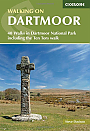
Wandelgids Walking on Dartmoor Cicerone Guidebooks | National Park and surrounding areasA guidebook to 39 day walks and one two-day Ten Tors challenge across the Dartmoor National Park and its surrounding area. The guide contains low-level shorter walks and higher level more strenuous and challenging routes, therefore there's a walk suitable for all abilities, allowing you to explore all of what Devon's national park has to offer. Each walk contains a detailed route description, 1:50,000 OS maps and colour photography, alongside practical information on public transport links and refreshment stops on each walk. Dartmoor, a National Park sin... |
19,99 |
|
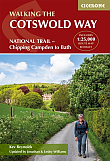
Wandelgids The Cotswolds Way Cicerone Guidebooks | Two-way trail guide - Chipping Campden to BathGuidebook to walking the 102 mile (163km) Cotswold Way National Trail between Chipping Campden and Bath, across the Cotswolds AONB. The guidebook - which includes both a guide to the route and a separate OS 1:25,000 map booklet - describes the route in both directions. The route is described over 13 stages, each following the Cotswold escarpment, with dramatic and far-reaching views across the Severn Vale towards the Welsh hills, plunging down to visit honey-coloured villages, old market towns and the elegant and historic city of Bath. The longest of the 13 stage... |
23,50 |
|
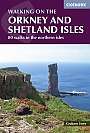
Wandelgids Walking on the Orkney and Shetland Isles Cicerone Guidebooks | 80 WalksA guidebook to 80 walking routes on Scotland's Northern Isles of Orkney and Shetland. Routes are described on the islands of Orkney (Orkney Mainland, Hoy, South Ronaldsay, Burray, Rousay, Eday, Westray, Papa Westray, North Ronaldsay) and the islands of Shetland (Shetland Mainland, West Burra, East Burra, Foula, Fair Isle, Isle of Noss, Bressay, Whalsay, Papa Stour, Muckle Roe, Out Skerries, Esha Ness, Yell, Fetlar and Unst). Â Routes vary in length from 1 mile to 16 miles, with something to suit all abilities. Offering a variety of landscapes t... |
19,99 |
|
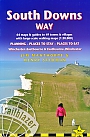
Wandelgids South Downs Way Trailblazer | Winchester to EastbourneDe South Downs Way is een 160 km lange nationale route die de lijn van krijtheuvels volgt die zich uitstrekt van Winchester in Hampshire over Sussex naar Eastbourne. Langs de Downs lopen is de beste manier om dit prachtige landschap te ervaren met zijn mix van glooiende heuvels, steile hangende bossen en winderige velden. Je passeert ook dorpjes met ansichtkaarten met gastvrije pubs, huisjes met rieten daken en typisch Engelse landtuinen. |
18,90 |
|
Wandelgids Cornwall Coast Path (Zoutpad) Part 2 Bude to Falmouth TrailblazerThis fully revised new edition has now been considerably expanded to cover the full length of the Cornwall coast, 280 miles. This second part of the South West Coast Path around the south-western tip of Britain, includes some of the best coastal walking in Europe. With constantly changing scenery, the footpath takes in secluded coves, tiny fishing villages, rocky headlands, bustling resorts, wooded estuaries and golden surf-washed beaches. It is an area rich in wildlife with seabirds, wild flowers, dolphins and seals. 15 town plans and 130 large-scale walking maps &nda... |
19,90 Tijdelijk niet leverbaar |
|
Wandelgids Walking in Pembrokeshire Cicerone Guide | 40 circular walks in and around the Pembrokeshire Coast National ParkGuidebook to 40 circular walks in Pembrokeshire in Wales. Routes take in the dramatic beauty of the national park and its coast, the Daugleddau and the Preseli Hills, while exploring wooded gorges, prehistoric hillforts and medieval castles. Walks range from 1 to 12 miles and route descriptions are accompanied by 1:50,000 OS map extracts. |
16,99 |
|
Wandelgids 03 Lake District Pathfinder Guide (Short Walks) | 20 korte wandelingen 3 tot 9km.Deze Pathfinder Guide is een goed uitgevoerde gids met verschillende wandelingen in Groot-Britannie. De gids bevat naast goede topografische kaarten van de Britse topografische dienst (Ordanance Survey) ook beschrijvingen van het landschap, de cultuur en/of de flora en fauna. Verder is de gids voorzien van praktische informatie zoals startpunten, verwachte wandeltijd, restaurants en cafes voor onderweg. Short Walks Lake District covering parts of Keswick, Patterdale and Hawkshead. This selection offers interest and regional variety in the Lake District, providing the b... |
11,50 Tijdelijk niet leverbaar |
Bij een bezoek aan Groot-Brittannië zijn must-sees onder andere de Tower of London en Buckingham Palace in Londen, de mysterieuze Stonehenge in Zuid-Engeland, de natuurlijke pracht van de Schotse Hooglanden, en de historische steden van Wales. Ontdek de rijke geschiedenis in het British Museum en het Edinburgh Castle. Natuurliefhebbers zullen genieten van het Lake District en Snowdonia National Park. Outdoor activiteiten omvatten wandelen, golfen in Schotland, en surfen in Cornwall. Overnachtingsmogelijkheden variëren van iconische hotels in stedelijke gebieden tot gezellige B&B's op het platteland. Raadpleeg lokale toeristische informatie voor reisadviezen en om de veelzijdigheid van Groot-Brittannië te ervaren.