- Gratis verzending vanaf 30 euro
- Levert in Nederland, België etc.
- Meer dan 30.000 titels
- Vakkundige klantenservice
- Snelle levering
- Veilig en eenvoudig betalen

Direct contact?
Bel +31 (0)6 42428571
maandag t/m vrijdag
van 10 tot 17 uur
Europa / Groot-Brittannië / Wandelen / Wandelgidsen
Groot-Brittannië Wandelgidsen bestsellers

Wandelgids Great Mountain Days in Scotland Cicerone Guidebooks
50 classic hillwalking challenges
25,99
|
Wandelgids St Cuthbert's Way Rucksack ReadersRucksack Readers zijn handig uitgevoerd in een klapper met ringband. Deze gids heeft een goede beschrijving van de lange afstands route met overzichtelijke kaarten doch zonder veel detail. De kracht van de Rucksack Readers is de uitgebreide achtergrondinformatie over de flora, fauna en geologische verschijnselen. Dit alles rijkelijk omkleed met kleurrijke foto's en praktische tips. Follow the footsteps of St Cuthbert in this easy-going walk of 63 miles (101 km) from Melrose Abbey in the Scottish Borders to the Holy Island of Lindisfarne in Northumberland. St ... |
23,99 |
|
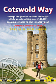
Wandelgids Cotswold Way Trailblazer | Chipping Campden to BathAll-in-one hiking route guide and maps to the Cotswold Way, a 102-mile National Trail that runs from Chipping Campden to Bath, following the beautiful Cotswold escarpment for most of its course. The trail leads through quintessentially English countryside with little villages of honey-coloured stone to the well-known town of Bath. Includes 44 large-scale maps (3 1/8 inches to 1 mile); 9 town plans and 8 overview maps. Full details of all accommodations and campsites, restaurants and pubs; plus full public transport information. Plus day-walks.Fully revised and rewalked... Schaal: 1:40.000 |
20,95 |
|
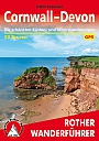
Wandelgids 250 Cornwall-Devon Rother Wanderführer | Rother Bergverlag | 53 touren Die schonsten Küsten- und MoorwanderungenDe vermaarde wandelgiden van Rother Bergverlag zijn uitstekende wandelgidsen voor ieder niveau. Op een kaartje is de wandelroute aangegeven, maar deze is ook beschreven in een beknopte en heldere tekst. Daarnaast is ook de afstand, de verwachte wandeltijd, het niveau, de hoogte en andere praktische informatie aangegeven. Met deze degelijke wandelgids ontdek je de mooiste plekken van jouw bestemming en kun je de spannendste wandeluitdagingen zoeken. 53 wandelingen. |
14,90 |
|
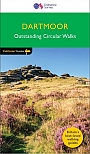
Wandelgids 26 Dartmoor Pathfinder Guide | Pathfinder Guide 26 | Met Ordanance Survey kaartenDeze Pathfinder Guide is een goed uitgevoerde gids met verschillende wandelingen in Groot-Britannië. De gids bevat naast goede topografische kaarten van de Britse topografische dienst (Ordanance Survey) ook beschrijvingen van het landschap, de cultuur en/of de flora en fauna. Verder is de gids voorzien van praktische informatie zoals startpunten, verwachte wandeltijd, restaurants en cafes voor onderweg. Discover the rugged, iconic landscape of Dartmoor with this selection of 28 walks designed to help you find the best it has to offer. While largely uninhabited wil... |
17,99 |
|
Wandelgids Coast to Coast path Two-way trekking guide | Knife Edge | St Bees to Robin Hood's BayThe definitive two-way guide to the Coast to Coast Path: both eastbound and westbound routes are described in full. |
20,99 |
|
Wandelgids Walking in the Yorkshire Dales: South and West | Cicerone | Wharfedale, Littondale, Malhamdale, Dentdale and RibblesdaleThe Yorkshire Dales need little introduction: their picturesque scenery and hundreds of miles of footpaths, tracks and bridleways have been attracting walkers for decades. Part of a two-volume set, this guidebook presents over 40 routes in the south and west of the National Park, with bases including Sedburgh, Malham, Grassington, Skipton, Settle and Kirkby Lonsdale. The walks cover the valleys of Wharfedale, Littondale, Malhamdale, Ribblesdale and Dentdale – each with its own distinctive landscape and character. Also included is the Yorkshire Three Peaks, a 23 ... |
16,99 |
|
Wandelkaartgids The Coast to Coast map Booklet | CiceroneHandzaam kaartgidsje. Gedetailleerde topografische wandelkaarten gebonden in een handig boekje. Licht voor onderweg. Map of the 190 miles (300km) Coast to Coast Walk, between St Bees Head in Cumbria and Robin Hood's Bay in Yorkshire. This booklet is included with the Cicerone guidebook to the trail, and shows the full route on Ordnance Survey 1:25,000 maps. This popular long-distance route typically takes a fortnight to walk. Schaal: 1:25.000 |
14,99 |
|
Wandelgids Walking St Cuthbert's Way | Cicerone | Melrose and Jedburgh to Holy IslandThis guidebook describes the long-distance trail of St Cuthbert's Way through Northumberland and the Borders. The route starts in Melrose and travels 100km (62 miles) through the Northumberland National Park to Holy Island. It also includes a description of the route from Holy Island up the coast to Berwick-upon-Tweed. |
21,99 |
|
Wandelgids 63 Peak District Pathfinder Guide | Pathfinder Guide 63 | Met Ordanance Survey kaartenDeze Pathfinder Guide is een goed uitgevoerde gids met verschillende wandelingen in Groot-Britannië. De gids bevat naast goede topografische kaarten van de Britse topografische dienst (Ordanance Survey) ook beschrijvingen van het landschap, de cultuur en/of de flora en fauna. Verder is de gids voorzien van praktische informatie zoals startpunten, verwachte wandeltijd, restaurants en cafés voor onderweg. 28 beautiful country walks around the Peak District, graded by length and ranging from 3 to 11 miles. All routes come with a clear, large-scale OS map, GPS ... |
17,99 |
|
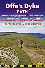
Wandelgids Offa's Dyke Path Trailblazer | Prestatyn to ChepstowThe Offa's Dyke Path is a superb National Trail that runs from the North Wales coast to the Severn Estuary following the line of Offa's Dyke, an impressive 8th-century earthwork along the English/Welsh border. The ever-changing landscape – the Clwydian Range, the Shropshire Hills, the Black Mountains and the Wye Valley – is steeped in history and legend providing 177 miles (285km) of fascinating walking. Fourth edition entirely rewalked with all accommodation and each place to eat fully checked. Includes 98 detailed walking maps: the largest-scale m... |
18,99 Tijdelijk niet leverbaar |
|
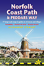
Wandelgids Peddars Way and Norfolk Coast Path Trailblazer | Knettishall Heath to Cromer
|
21,50 |
|
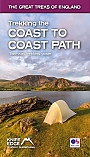
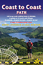
Wandelgids Coast to Coast Path Trailblazer | St Bees to Robin Hood's Bay, Planning, Places to Stay
|
19,90 |
|
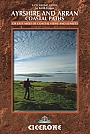
Wandelgids The Ayrshire and Arran Coastal Paths Cicerone GuidebooksFeaturing 11 day stages across a 150-mile coastline full of beautiful sandy beaches and secluded coves, this guide to the Ayrshire and Arran Coastal Paths is a wonderful showcase of long-distance coastal walking at its finest. Historic sites including many castles passed along the way show the area"s rich past, and there are obvious links here to significant Scottish figures including Robert the Bruce and Robert Burns. seven days on the Ayrshire mainland and a four-day tour round Arran fantastic photography throughout fully illustrates the area"s exceptional views and ... |
17,99 |
|
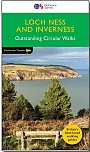
Wandelgids 30 Loch Ness & Iverness Pathfinder Guide | Pathfinder Guide 30 | Met Ordanance Survey kaartenDeze Pathfinder Guide is een goed uitgevoerde gids met verschillende wandelingen in Groot-Britannië. De gids bevat naast goede topografische kaarten van de Britse topografische dienst (Ordanance Survey) ook beschrijvingen van het landschap, de cultuur en/of de flora en fauna. Verder is de gids voorzien van praktische informatie zoals startpunten, verwachte wandeltijd, restaurants en cafes voor onderweg. 28 wandelingen. Discover the Highland 'capital' of Inverness, the dramatic shore of Loch Ness, Ben Wyvis and much more with this Pathfinder walking guidebo... |
17,99 |
|
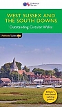
Wandelgids 66 West Sussex / South Downs Pathfinder Guide | Pathfinder Guide 66 | Met Ordanance Survey kaartenDeze Pathfinder Guide is een goed uitgevoerde gids met verschillende wandelingen in Groot-Britannie. De gids bevat naast goede topografische kaarten van de Britse topografische dienst (Ordanance Survey) ook beschrijvingen van het landschap, de cultuur en/of de flora en fauna. Verder is de gids voorzien van praktische informatie zoals startpunten, verwachte wandeltijd, restaurants en cafes voor onderweg. 28 dagwandelingen. Containing 28 circular, graded walks that have all been created and tested by experienced walkers, this walking guidebook is ideal for both visitors ... |
17,99 |
|
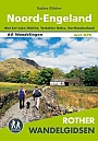
Wandelgids Noord-Engeland Rother Wandelgids | 60 wandelingenDe 60 mooiste wandelingen in Noord-Engeland, met het lake District, de Yorkshire Dales en Northumberland. Zoals gebruikelijk zijn er verschillende wandelingen voor beginnende en ervaren wandelaars en is er onmisbare informatie over de streek, de bezienswaardigheden en recreatiemogelijkheden. met het Lake District, Yorkshire Dales, Northumberland. De betrouwbare routebeschrijvingen, gedetailleerde kaarten en hoogteprofielen zorgen voor een onvergetelijke wandelervaring. |
18,99 |

|
Wandelgids Cleveland Way | TrailblazerThe Cleveland Way is a National Trail set in the beautiful wild countryside of the North York Moors National Park. It runs 107.4 miles (127.9km) from Helmsley near Thirsk around the western edge of the park to reach the coast at Saltburn-by-the-Sea. It then continues along the eastern edge of the park south down the coast through Whitby, Robin Hood’s Bay and Scarborough to finish in Filey. Combining moorland and coast, there’s wonderful scenic variety to this walk, with crumbling castles and idyllic fishing villages to explore. Includes 48 detailed walking ... |
16,99 |
|
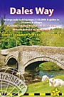
Wandelgids Dales Way | Trailblazer | Ilkley to Bowness-on-Windermere: 38 Large-scale Maps & Guides to 32 Towns and Villages - Planning - Places to Stay - Places to EThe popular Dales Way long-distance footpath begins in Ilkley, West Yorkshire and runs for 84 miles (135km) to end in the Lake District, in Bowness-on-Windermere. It follows riverside paths along the River Wharf towards Ribblehead and the watershed of northern England, then meanders along the river valleys of Dentdale, the River Mint and the River Kent dropping down into the Lake District to end beside Lake Windermere. It's a relatively easy walk that takes about a week. Includes 40 large-scale maps (3 1/8 inches to 1 mile); 9 town plans and 8 overview maps. Full d... Schaal: 1:20.000 |
18,95 |
|
Wandelgids Lakeland Fellranger - Walking the Southern Fells Cicerone GuidebooksLakeland Fellranger walking guide by Mark Richards covering 23 summits in the Southern Fells of the Lake District, including a wide range of walks old and new, between Wrynose and Hardknott passes and Harter Fell in the north and Black Combe in the south and Muncaster in the west. The fells run south, on both sides of the beautiful Duddon. The famous Coniston Fells lie to the east and sweeping horizons to the west. Author Mark Richards combines his passion for the Lake District and artistic flair with all the information the experienced walker needs to explore and enjo... |
20,99 |
|
Wandelgids Walking Loch Lomond and the Trossachs Cicerone Guidebooks | The Lomond Trossachs National Park, Glen Artney, Ben Lui and the Cowal PeninsulaGuidebook to over 70 walking routes in the hills of Loch Lomond and the Trossachs National Park in Scotland's Southern Highlands. Including 21 Munros on less-popular routes, as well as plenty of Corbetts and Grahams. Hill summits of Ben Lomond, the Cobbler, Ben Lui and the Arrochar Alps have plenty of routes to explore. The routes in this guide range from 1 to 17 miles, and are clearly graded for distance and difficulty, as well as dividing between low-level, mid-level and mountain walks. From short, loch-side strolls suitable for all walkers, to long, challenging moun... |
20,99 |
|
Wandelgids Walking in the North Pennines Cicerone Guidebooks | 50 Walks in England's remotest Area of Outstanding Natural BeautyThis guidebook describes 50 day walks across the North Pennines, England's remotest Area of Outstanding Natural Beauty taking in parts of Cumbria, County Durham and Northumberland. Most of the routes are circular and they range from 5 to 14 miles, with something to suit all abilities. Route descriptions are accompanied by 1:50K OS mapping. A guidebook to day walks in the North Pennines Area of Outstanding Natural Beauty (AONB), across Cumbria, County Durham and Northumberland. The book includes 50 walks exploring England"s "last wilderness", ranging from 5 miles (8km) ... |
19,99 |
|
Wandelgids The Border Country: A Walker’s Guide Cicerone GuidebooksCovering the border hills, northern Northumberland and the Southern Uplands, this full-colour third edition of the guide offers a broad selection of around 50 routes, as well as outlines of a number of long-distance trails which cross the region. The Border country that lies between England and Scotland is a countryside surrounded by ridge after high ridge rythmically fading into gently folding valleys, through which the Tweed and Teviot rivers flow. The area has been the scene of thousands of years of sometimes turbulent history, from the early Iron Age, through the R... |
17,99 |
|
Wandelgids Walking in the Ochils, Campsie Fells and Lomond Hills Cicerone Guidebooks | 33 Walks in Scotland’s central fellsAs rugged and spectacular as they can be tranquil and picturesque, the Campsie Fells, the Ochils and the Lomonds are the most accessible hills in Scotland"s Central Belt. Despite their close proximity to Edinburgh, Glasgow and Perth, these three ranges remain a remarkably uncrowded wilderness area. Combining a rich mixture of open moorland peaks, steep sided glens, fast flowing burns and lush woodland, few other areas can treat the hillwalker to such diverse scenery and varieties of animal and plant life in the space of a single day"s outing. This guide describes 33 co... |
17,99 Tijdelijk niet leverbaar |
|
Wandelgids Scotland walks treks climbs Cicerone Guidebooks | Southern Uplands Cairngorms Skye - ScotlandScotland is a mountainous country with a wide variety of wild landscapes: there are the rolling hills of the Southern Uplands, the great granite plateaus of the Cairngorms, the steep castellated rock peaks of Torridon and the jagged narrow aretes and spires of the Cuillin hills on the Isle of Skye. Of the many majestic summits, 284 reach 3000ft or more; these are the Munros, the ascent of which is the aim of many walkers. Below them lie splendid pine forests, beautiful lochs, deep glens, rushing rivers; a magnificent northern landscape. Whether you are planning a day s... |
34,99 |
|
Wandelgids Great Mountain Days in the Pennines | Cicerone | 50 classic walksAn inspirational guidebook to 50 classic walks on the rolling Pennine landscape. The graded routes, between 6 and 13 miles in length, cover classic Pennine fells and moorland such as Whernside, Ilkley Moor and Pendle Hill; exploring the North and South Pennines, Yorkshire Dales, Howgills and Dark Peak. Many routes are also suited to fell running. Walks are grouped into five areas: the North Pennines, the Howgills, the Yorkshire Dales, the South Pennines and the Dark Peak. Walks are graded from 'Moderate' to 'Strenuous' but unlike other mountainous areas where the abili... |
23,99 |

|
Wandelgids Walking the Galloway Hills Cicerone GuidebooksThe Galloway Hills of south-east Scotland offer almost unlimited access for walkers, a rare freedom that has contributed to their description as 'A Walker's Paradise'. A tract of rocky, heathery wilderness interspersed by forest park, these hills offer a varied walking programme, from gentle waymarked forest trails to strenuous, bothy-based treks. You can marvel at the wild qualities of the hills and follow the colourful and turbulent history of the Scottish clans and Robert the Bruce. The mixed woodland and moors support a varied wildlife, including many species of bi... |
17,99 |
|
Wandelgids The Pennine Way Cicerone Guidebooks | From Edale to Kirk YetholmThe Pennine Way is Britain's oldest, toughest long-distance footpath and arguably its most iconic. Now a National Trail, the 427km (265 ½ mile) route from Edale in Derbyshire to Kirk Yetholm in the Scottish Borders offers wayfarers the opportunity to immerse themselves in wild beauty of the North. The Pennines boast rolling hills, sweeping moorland and wide glacial valleys, and the Pennine Way has come to embody personal challenge and adventure. This guidebook presents the route in 20 daily stages of 10.5-31.5km (6 ½-19 ½ miles). Step-by... |
22,99 |
|
Wandelgids The West Highland Way Cicerone Guidebooks | Milngavie to Fort William. Incl. map booklet 1:25.000A guidebook to Scotland"s West Highland Way, a 95-mile walk from Milngavie near Glasgow to Fort William, passing Loch Lomond, crossing Rannoch Moor and finishing in the shadow of Britain"s highest mountain. The walk, which takes roughly one week to complete, is described in seven stages, with each stage ranging from 8 to 20 miles. The guide details the "classic" south-north direction but also provides a summary description for those wanting to walk the route in the opposite direction. The guidebook, which features step-by-step route descriptio... |
19,99 |
|
Wandelgids Isle of Man Coastal Path Cicerone Guidebooks | Raad Ny Foillan - The Way of the Gull; The Millennium and Herring WaysThe Raad ny Foillan path, Way of the Gull, is a 98-mile coastal footpath around the Isle of Man. Splendid scenery is encountered throughout, from the rugged sea cliffs and mountain moorland in the south, to the glens, beaches and dunes of the north. The route passes sites of historical interest, colourful fishing villages, historic towns and peaceful havens. Walkers will appreciate the Isle of Man's unique character, where the pace of life seems easier and there are no coastal caravan sites to sully the scene. You will enjoy the company of gulls and seals. The extraord... |
16,99 |
|
Wandelgids The South West Coast Path (Zoutpad) Cicerone Guidebooks | From Minehead to South Haven PointThe South West Coast Path is Britain"s longest way-marked trail, measuring a staggering 1015km (630 miles). Written by the well-known outdoor writer, Paddy Dillon, this guidebook provides lots of information to help tackle this immense National Trail route with confidence. It describes the coastal path from Minehead to Poole. The tradition of walking the coastal route anti-clockwise has arisen because in this direction there are more miles with the wind and weather behind you as you walk, than against you. A full introduction provides the SWCP"s historic... |
21,99 |
|
Wandelgids Ridgeway Cicerone Guidebooks | From Lyme Regis to HunstantonThis guidebook - which includes both a guide to the route and a separate OS map booklet - describes the Ridgeway National Trail, an 87 mile (139km) route through southern England from Avebury in Wiltshire to Ivinghoe Beacon in Buckinghamshire. Typically walked in 6 or 8 days, this is a low-level waymarked route suitable for all abilities and for year round walking. The guidebook details the trail in both directions, west to east and east to west. Step-by-step route descriptions are accompanied by 1:100,000 OS mapping and a separate OS 1:25,000 map booklet showing the e... |
17,99 |
|
Wandelgids The Cumbria Way | Cicerone Guide | Ulverston to Carlisle main route with mountain alternativesA guidebook to the Cumbria Way, a 73-mile long distance path through the heart of the English Lake District from Ulverston to Carlisle. The route is largely low-level, and accessible to new trekkers, but this guide offers alternative mountain days to climb some of the famous fells en route. The guide divides the route into 5 stages of between 12 and 16 miles, but there is plenty of opportunity to plan your itinerary for a more easy-going 7 to 8 days. The Lake District is a walkers paradise, and there is no better way to experience the fells, lakes and woodlands ... |
18,99 Tijdelijk niet leverbaar |
|
Wandelgids The Reivers Way Cicerone Guidebooks | through historic NorthumberlandWalk in the footsteps of the notorious border reivers and discover how they survived centuries of strife and warfare. The Reivers Way almost encircles the county of Northumberland, offering a wonderful opportunity to walk and explore its wildest and most scenic parts. The trail starts at Corbridge in the North Pennines AONB. After following part of Hadrian"s Wall, a series of little towns and villages are visited, as the route heads in an out of the Northumberland National Park. After catching a glimpse of Lindisfarne, the route traces the scenic Northumberland Heritag... |
14,99 Tijdelijk niet leverbaar |
|
Wandelgids The Dales Way Cicerone Guidebooks | A complete guide to the TrailThe Dales Way is a delightful multi-day walk through the Yorkshire Dales and the eastern fringe of the Lake District between Ilkley and Bowness on Windermere, a total of 78 miles. One of the gentlest multi-day walks in Britain, the Dales Way route is suitable for all ages and an excellent introduction to long-distance walking. The route makes the most of delectable Wharfedale, travelling virtually to the source of the great river before crossing into the equally delightful Dentdale. This too is followed as it fashions a lovely course through the village of Dent and on ... |
19,99 |
|
Wandelgids The Teesdale Way Cicerone Guidebooks | From Dufton to the North SeaA new, fully updated, full-colour edition of this guide. The Teesdale Way explores the course of the River Tees for exactly 100 miles from its source in the Cumbrian North Pennines to its outlet at Middlesbrough on the north-east coast. This is a delightful walk through unmatched river scenery including historic sites, SSSIs, pretty villages, woods, rolling farmland and wetlands. Passing as it does from remote Pennine moorland, through traditional Dales towns and finally to Teeside's industrial heartland, the Teesdale Way gives us a fascinating cross-section of the reg... |
16,99 Tijdelijk niet leverbaar |
|
Wandelgids The Cleveland Way and the Yorkshire Wolds Way Cicerone Guidebooks | National TrailGuidebook to the Cleveland Way and Yorkshire Wolds Way National Trails, plus the Tabular Hills Walk link route. The guidebook also contains a 1:25,000 scale OS route map booklet of the Cleveland Way. The Cleveland Way National Trail, described in seven day stages, is a fine 177km (110 miles) walk around the North York Moors National Park from Helmsley to Filey. The Yorkshire Wolds Way is one of the quietest of Britain's National Trails and wanders for 130km (80 miles) through gentle, cultivated and sparsely populated countryside. Described here in nine day stages, f... |
22,99 Tijdelijk niet leverbaar |
|
Wandelgids The Thames Path Cicerone Guidebooks | National Trail from London to the river's source in Gloucestershire
|
22,99 |
|
Wandelgids Offa's Dyke Path (Prestatyn - Chepstow) | Aurum Press | Official National Trail Guide
Schaal: 1:25.000 |
20,50 |
|
Wandelgids Walking in Cumbria's Eden Valley Cicerone Guidebooks | 30 walks between the Yorkshire Dales and the Solway salt marshesGuidebook to 30 graded walks in Cumbria's Eden Valley. The routes, which range from 3 to 15 miles and are best from bases such as Kirkby Stephen and Appleby, explore the region's diverse landscapes and offer dramatic views, either of the Pennines, Lake District or the Scottish hills. Linear routes link with the Settle-Carlisle railway. Kirkby Stephen, Appleby, Crosby Ravensworth, Dufton, Penrith, Kirkoswald, Armathwaite, Brampton, Carlisle. Terrain includes pathless moorland, which can be boggy in places, farmland and good riverside tracks and trails. Routes from 6-24k... |
16,99 |
|
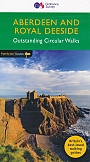
Wandelgids 46 Aberdeen / Royal Deeside Pathfinder Guide | Pathfinder Guide 46 | Met Ordanance Survey kaartenDeze Pathfinder Guide is een goed uitgevoerde gids met verschillende wandelingen in Groot-Britannie. De gids bevat naast goede topografische kaarten van de Britse topografische dienst (Ordanance Survey) ook beschrijvingen van het landschap, de cultuur en/of de flora en fauna. Verder is de gids voorzien van praktische informatie zoals startpunten, verwachte wandeltijd, restaurants en cafes voor onderweg. The Aberdeen and Grampian Tourist Board describes the area as 'Royal Deeside, Whisky, Castles and Coast' and it is easy to see why. The royal connection is most obvious... |
17,99 |

|
Wandelgids The Yorkshire Dales - Walking in the North and East | Cicerone | Howgills, Mallerstang, Swaledale, Wensleydale, Coverdale and NidderdaleThis guidebook contains 43 circular day walks in the north and east Yorkshire Dales. It explores the dales, hills and moors between Kirkby Stephen and Pateley Bridge. Walking ranges from gentle three-mile strolls to more strenuous day-long rambles across the Howgills, Wensleydale, Swaledale, Nidderdale, Mallerstang and Coverdale In this guidebook, 43 circular walks, ranging from 3-mile strolls to full-day adventures are explored in the northern and eastern Dales. Few areas in England are as appealing as the Yorkshire Dales and this volume of a two-part guide provide... |
17,99 |
|
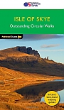
Wandelgids 03 Isle of Skye Pathfinder Guide | Pathfinder Guide 03 | Met Ordanance Survey kaartenDeze Pathfinder Guide is een goed uitgevoerde gids met verschillende wandelingen in Groot-Britannië. De gids bevat naast goede topografische kaarten van de Britse topografische dienst (Ordanance Survey) ook beschrijvingen van het landschap, de cultuur en/of de flora en fauna. Verder is de gids voorzien van praktische informatie zoals startpunten, verwachte wandeltijd, restaurants en cafes voor onderweg. Are you planning a visit to the Isle of Skye? Do you enjoy a walk in the country or a leisurely afternoon stroll? Britain's best loved walking guides brings yo... |
17,99 |
|
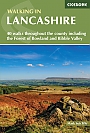
Wandelgids Walking in Lancashire | Cicerone Guide | 40 walks throughout the county including the Forest of Bowland and Ribble ValleyGuidebook of 40 walks exploring the dales, moors, uplands and coasts of Lancashire, including Morecambe Bay, the Forest of Bowland, Ribble Valley and the West Pennine Moors. With routes for all seasons of the year and for a variety of abilities, these walks are within easy reach of Preston, Blackburn, Burnley, Lancaster and Clitheroe. Seasons Most of these walks can be completed all year round. Some higher level routes are challenging in winter, while lower level routes may become waterlogged after heavy rain. Centres Walks in the Forest of Bowland, Ribble Valley and W... |
16,99 |
|
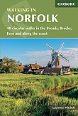
Wandelgids Walking in Norfolk | Cicerone | 40 circular walks in the Broads, Brecks, Fens and along the coastThis book describes 40 easy-to-moderate circular day walks, grouped by area: Northeast coast and the Broads; South Norfolk, the Yare and the Waveney; North Norfolk and coast; Central Norfolk and Breckland and West Norfolk and Fens. Each walk is described step-by-step, illustrated with 1:40K OS map extracts and packed with historical, geological and other information about the landscape the route passes through. |
18,99 |
|
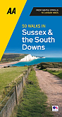
Wandelgids 50 Walks in Sussex and South Downs | AA PublishingOverzichtelijke wandelgids met duidelijke beschrijvingen en wandelkaarten. Wandeltochten van 5 tot 13 kilometer. A variety of mostly mapped walks to suit both the casual walker and the more serious hiker are contained in this illustrated guide. Detailed maps include information on the route - scenery, distance, terrain, places of interest - together with dog-friendly walks. Special features include: an introductory location map indicating the starting point of every walk; a summary of distance, time, gradient, level of difficulty, type of surface ... |
18,99 Tijdelijk niet leverbaar |
|
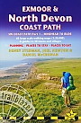
Wandelgids Exmoor & North Devon Coast Path Trailblazer | South West Coast Path Part 1 Minehead to BudeThis new guide covers the coastal route from Minehead to Bude (125 miles), the first section of the 630 mile South West Coast Path. This spectacular route passes through the Exmoor National Park following the highest coastline in England (over 800ft), through numerous idyllic villages such as Lynton and Clovelly, around Barnstaple Bay and Hartland Point to the seaside resort of Bude just over the border with Cornwall. · 5 town plans and 53 large-scale walking maps – at just under 1:20,000 – showing route times, places to stay, places to eat, points o... |
18,95 |
|
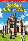
Wandelgids Borders Abbeys Way Rucksack Readers | Waterproof met spiraalbindingRucksack Readers zijn handig uitgevoerd in een klapper met ringband. Deze gids heeft een goede beschrijving van de lange afstands route met overzichtelijke kaarten doch zonder veel detail. De kracht van de Rucksack Readers is de uitgebreide achtergrondinformatie over de flora, fauna en geologische verschijnselen. Dit alles rijkelijk omkleed met kleurrijke foto's en praktische tips. Waterproof papier. |
18,50 |
|
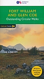
Wandelgids 07 Fort William & Glen Coe Walks Pathfinder Guide | Pathfinder Guide 7 | Met Ordanance Survey kaartenDeze Pathfinder Guide is een goed uitgevoerde gids met verschillende wandelingen in Groot-Britannië. De gids bevat naast goede topografische kaarten van de Britse topografische dienst (Ordanance Survey) ook beschrijvingen van het landschap, de cultuur en/of de flora en fauna. Verder is de gids voorzien van praktische informatie zoals startpunten, verwachte wandeltijd, restaurants en cafés voor onderweg. Fort William and Glen Coe encompass one of the greatest areas of sea and mountain landscape in Scotland, backed by some of the biggest and most deman... |
17,95 |
|
Wandelgids Walking in the Pentland Hills Edinburgh Cicerone Guidebooks | 30 walks in Edinburgh's local hillsThis guidebook details 30 circular walks in Scotland's Pentland Hills, a range of low summits which extends between Edinburgh and Biggar in South Lanarkshire. Ranging from 3 to 27km (2-17 miles), there is something to suit all abilities from the novice to the experienced hill-walker, with each route showcasing a different aspect of the area's unique character. Step-by-step route description is accompanied by 1:50,000 OS mapping and a wealth of interesting information on the region's rich natural and cultural heritage: its geology, history, wildlife and connections w... |
17,99 |
|
Wandelgids 27 Isle of Wight Pathfinder Guide (Short Walks) | Pathfinder Guide 27 | Met Ordanance Survey kaartenDeze Pathfinder Guide is een goed uitgevoerde gids met verschillende wandelingen in Groot-Britannië. De gids bevat naast goede topografische kaarten van de Britse topografische dienst (Ordanance Survey) ook beschrijvingen van het landschap, de cultuur en/of de flora en fauna. Verder is de gids voorzien van praktische informatie zoals startpunten, verwachte wandeltijd, restaurants en cafés voor onderweg. Short Walks Isle of Wight covering parts of Newtown, Tennyson Down and Bembridge.This selection offers interest and regional variety in the Isle of Wight, p... |
11,50 |