- Gratis verzending vanaf 30 euro
- Levert in Nederland, België etc.
- Meer dan 30.000 titels
- Vakkundige klantenservice
- Snelle levering
- Veilig en eenvoudig betalen

Direct contact?
Bel +31 (0)6 42428571
maandag t/m vrijdag
van 10 tot 17 uur
Wandelgids Walking in Cumbria's Eden Valley Cicerone Guidebooks
30 walks between the Yorkshire Dales and the Solway salt marshes

Guidebook to 30 graded walks in Cumbria's Eden Valley. The routes, which range from 3 to 15 miles and are best from bases such as Kirkby Stephen and Appleby, explore the region's diverse landscapes and offer dramatic views, either of the Pennines, Lake District or the Scottish hills. Linear routes link with the Settle-Carlisle railway. Kirkby Stephen, Appleby, Crosby Ravensworth, Dufton, Penrith, Kirkoswald, Armathwaite, Brampton, Carlisle. Terrain includes pathless moorland, which can be boggy in places, farmland and good riverside tracks and trails. Routes from 6-24km, graded 1-5. Navigational competence and stamina is required for some of the higher routes. No scrambling involved. Cross Fell, the highest point on the Pennines; breath-taking High Cup; the ruins of Pendragon Castle; limestone pavement within the extended Yorkshire Dales National Park; a disused railway and imposing viaduct in Smardale Gill; prehistoric settlements; delightful red sandstone villages; pretty wooded gorges; and one of the largest and most atmospheric stone circles in England.
Engelstalig
EAN: 9781852849016
Uitgeverij: Cicerone Press
Verschijningsdatum: 2018
Meest recente editie
Engelstalig


Op voorraad
Overmorgen in huis (Nederland)
- Vakkundige klantenservice
- Groot assortiment
- Gratis retourneren binnen 14 dagen
- Aangesloten bij WebwinkelKEUR
€ 16,99
Meer producten die interessant kunnen zijn
Topografische kaarten Lake District / Yorkshire Dales
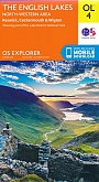
Topografische Wandelkaart OL4 van Groot-Brittannië (1:25.000) English Lakes - North Western area - Explorer Map OL 4
Wandelkaart | Ordnance Survey (OS) Groot-Brittannië
€ 18,99
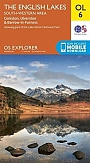
Topografische Wandelkaart OL6 van Groot-Brittannië (1:25.000) English Lakes - South Western area - Explorer Map OL 6
Wandelkaart | Ordnance Survey (OS) Groot-Brittannië
€ 18,99
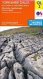
Topografische Wandelkaart OL2 van Groot-Brittannië (1:25.000) Yorkshire Dales - Southern & Western areas - Explorer Map OL 2
Wandelkaart | Ordnance Survey (OS) Groot-Brittannië
€ 18,99
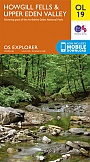
Topografische Wandelkaart OL19 van Groot-Brittannië (1:25.000) Howgill Fells / Upper Eden Valley - Explorer Map OL 19
Wandelkaart | Ordnance Survey (OS) Groot-Brittannië
€ 18,99
Wandelkaarten Lake District / Yorkshire Dales