- Gratis verzending vanaf 30 euro
- Levert in Nederland, België etc.
- Meer dan 30.000 titels
- Vakkundige klantenservice
- Snelle levering
- Veilig en eenvoudig betalen

Direct contact?
Bel +31 (0)6 42428571
maandag t/m vrijdag
van 10 tot 17 uur
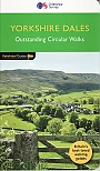
Wandelkaart Yorkshire Dales - Mountain Map | Harvey Maps
Water- en scheurvaste wandelkaart

De Harvey Map is de wandelkaart voor het wandelen in de mooiste natuurgebieden in het Groot-Brittannië. Duidelijke topografische wandelkaarten met praktische informatie van de route zoals overnachtingsmogelijkheden, eetgelegenheden en bezienswaardigheden. Deze wandelkaart is scheur- en watervast. Met GPS compatible (UTM-Grid). Double-sided waterproof mountain map of the Yorkshire Dales from Harvey at 1:40,000, with a geological map of the region on the reverse, and advice on navigating the region safely.
MAIN MAP: Topography is shown through clear altitude shading, spot heights, contours at 15m intervals, and index contours at 75m intervals. A variety of symbols are used to show terrain detail, such as caves/mines, major and climbing crags, shafts, sinkholes, cairns, and large boulders. The map is GPS compatible, with the National Grid overprinted on the cartography.
Rights of way shown include tracks, long distance and intermittent paths. Road detail includes minor, residential and forest roads; railway lines and stops are marked, as are chairlifts and ski tows. Points of interest and facilities such as campsites, information points, and mountain rescue post are prominently highlighted.
Schaal: 1:40.000
Engelstalig
EAN: 9781851376551
Uitgeverij: Harvey Maps (UK)
Verschijningsdatum: 2023
Meest recente editie
Engelstalig


Op voorraad
Levertijd 3 dagen (Nederland)
- Vakkundige klantenservice
- Groot assortiment
- Gratis retourneren binnen 14 dagen
- Aangesloten bij WebwinkelKEUR
€ 28,99
Meer producten die interessant kunnen zijn
Wandelgidsen Lake District / Yorkshire Dales
Wandelgids 15 Yorkshire Dales Pathfinder Guide
Pathfinder Guide 15 | Met Ordanance Survey kaarten
€ 17,99
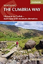
Wandelgids The Cumbria Way | Cicerone Guide
Ulverston to Carlisle main route with mountain alternatives
€ 18,99
Tijdelijk niet leverbaar
Reisgidsen Lake District / Yorkshire Dales
Topografische kaarten Lake District / Yorkshire Dales
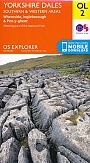
Topografische Wandelkaart OL2 van Groot-Brittannië (1:25.000) Yorkshire Dales - Southern & Western areas - Explorer Map OL 2
Wandelkaart | Ordnance Survey (OS) Groot-Brittannië
€ 18,99
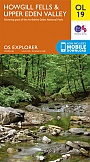
Topografische Wandelkaart OL19 van Groot-Brittannië (1:25.000) Howgill Fells / Upper Eden Valley - Explorer Map OL 19
Wandelkaart | Ordnance Survey (OS) Groot-Brittannië
€ 18,99
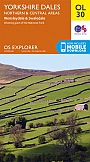
Topografische Wandelkaart OL30 van Groot-Brittannië (1:25.000) Yorkshire Dales - Northern & Central areas - Explorer Map OL 30
Wandelkaart | Ordnance Survey (OS) Groot-Brittannië
€ 18,99
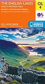
Topografische Wandelkaart OL4 van Groot-Brittannië (1:25.000) English Lakes - North Western area - Explorer Map OL 4
Wandelkaart | Ordnance Survey (OS) Groot-Brittannië
€ 18,99