- Gratis verzending vanaf 30 euro
- Levert in Nederland, België etc.
- Meer dan 30.000 titels
- Vakkundige klantenservice
- Snelle levering
- Veilig en eenvoudig betalen

Direct contact?
Bel +31 (0)6 42428571
maandag t/m vrijdag
van 10 tot 17 uur
Europa / Groot-Brittannië / Wandelen
|
Wandelgids Schotland Rother wandelgids | 50 wandelingenDe Rother wandelgids Schotland bevat 50 prachtige wandelingen langs de kust en in de hooglanden van deze wonderschone wandelbestemming. Ervaar de prachtige, ruige natuur tijdens de in dit handzame boekje opgenomen dag- en meerdaagse tochten in de Southern Uplands, in de Hooglanden, langs de kust en op de eilanden. Zoals gebruikelijk zijn er verschillende wandelingen voor beginnende en ervaren wandelaars en is er onmisbare informatie over de streek, de bezienswaardigheden en recreatiemogelijkheden. De betrouwbare routebeschrijvingen, gedetailleerde kaarten en hoogteprof... |
19,99 |
|
Wandelkaart Lake District - Mountain Map | Harvey Maps | Water- en scheurvaste wandelkaartDe Harvey Map is de wandelkaart voor het wandelen in de mooiste natuurgebieden in het Groot-Brittannië. Duidelijke topografische wandelkaarten met praktische informatie van de route zoals overnachtingsmogelijkheden, eetgelegenheden en bezienswaardigheden. Deze wandelkaart is scheur- en watervast. Met GPS compatible (UTM-Grid). Using Harvey's mapping the BMC has produced a first class map of the Lake District. All the areas most famous fells are all on the single sheet which is printed on a durable plastic making it tear resistant and 100% waterproof, there is ... Schaal: 1:40.000 |
28,99 |
|
Wandelkaart Cairngorms and Lochnagar - Mountain Map | Harvey Maps | Water- en scheurvaste wandelkaartDe Harvey Map is de wandelkaart voor het wandelen in de mooiste natuurgebieden in het Groot-Brittannië. Duidelijke topografische wandelkaarten met praktische informatie van de route zoals overnachtingsmogelijkheden, eetgelegenheden en bezienswaardigheden. Deze wandelkaart is scheur- en watervast. Met GPS compatible (UTM-Grid). 'An inspiring map covering much of Scotland's newest National Park. Clear and easy to read with masses of information for the walker, climber and mountain biker, and it's virtually indestructible' Nigel Williams, Head of Trai... Schaal: 1:40.000 |
28,99 |
|
Wandelgids Hadrian's Wall Path Trailblazer | Two-way guide: Bowness to Newcastle and Newcastle to BownessPractical guide with 58 large scale maps (1:20,000). Includes accommodation guides, pubs and restaurants and public transport information. Hadrian's Wall Path is a magnificent 84 mile national trail that follows the course of northern Europe's largest surviving Roman monument, the 2nd century fortification built on the orders of the Emperor Hadrian in AD122 and now listed as a UNESCO World Heritage Site. The guide includes 58 detailed walking maps, unique mapping features such as walking times, directions, tricky junctions, places to stay, places to eat, points... |
19,50 |
|
Wandelgids 269 Wales Rother Bergverlag | Rother Bergverlag | Die schonsten Küsten- und Bergwanderungen. 50 Touren. Mit GPS-DatenDe vermaarde wandelgiden van Rother Bergverlag zijn uitstekende wandelgidsen voor ieder niveau. Op een kaartje is de wandelroute aangegeven, maar deze is ook beschreven in een beknopte en heldere tekst. Daarnaast is ook de afstand, de verwachte wandeltijd, het niveau, de hoogte en andere praktische informatie aangegeven. Met deze degelijke wandelgids ontdek je de mooiste plekken van jouw bestemming en kun je de spannendste wandeluitdagingen zoeken. In Wales, dem kleinen Land zwischen Irland und England, findet sich eine unglaubliche landschaftliche Vielfalt diese lasst... |
14,90 |
|
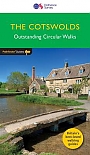
Wandelgids Walking in the Cotswolds | Cicerone guides | 30 rondwandelingenA guidebook to 30 circular walks in the Cotswolds, the largest Area of Outstanding Natural Beauty in England. Ranging from 4 to 12 miles in length, the routes are graded from easy to strenuous, offering something for every walker. Fourteen of the routes described include sections of the Cotswold Way National Trail, a 102-mile walk that winds its way from Chipping Campden to Bath. Step-by-step route descriptions are accompanied by 1:50,000 mapping. There is plenty of information on the many points of interest passed en route, including Roman ruins, ancient stone ci... |
16,99 |
|
Wandelkaart Isle of Arran - Walking Maps Superwalker | Harvey Maps | Water- en scheurvaste wandelkaartDe Harvey Map is de wandelkaart voor het wandelen in de mooiste natuurgebieden in het Groot-Brittannië. Duidelijke topografische wandelkaarten met praktische informatie van de route zoals overnachtingsmogelijkheden, eetgelegenheden en bezienswaardigheden. Deze wandelkaart is scheur- en watervast. Met GPS compatible (UTM-Grid). A detailed map for hillwalkers of the whole island at the popular 1:25,000 scale. Features the renowned Goat Fell, A'Chir ridge, Beinn Bharrain, Glen Sannox & Glen Rosa. Schaal: 1:25.000 |
23,99 |
|
Wandelgids 04 Cotswolds Pathfinder Guide (Short Walks) | 20 Korte wandelingen tot 8kmDeze Pathfinder Guide is een goed uitgevoerde gids met verschillende wandelingen in Groot-Britannië. De gids bevat naast goede topografische kaarten van de Britse topografische dienst (Ordanance Survey) ook beschrijvingen van het landschap, de cultuur en/of de flora en fauna. Verder is de gids voorzien van praktische informatie zoals startpunten, verwachte wandeltijd, restaurants en cafés voor onderweg. 20 Korte wandelingen tot 8km. This book contains 20 short circular walks, all rated by length and difficulty, that are carefully selected for the whole family to enjo... |
10,99 Tijdelijk niet leverbaar |
|
Wandelkaart South Downs Way - National Trail Maps | Harvey Maps | Water- en scheurvaste wandelkaartDe Harvey Map is de wandelkaart voor het lange afstand wandelpad in het Groot-Brittannië. Duidelijke topografische wandelkaarten met praktische informatie van de route zoals overnachtingsmogelijkheden, eetgelegenheden en bezienswaardigheden. Deze wandelkaart is scheur- en watervast. Met GPS compatible (UTM-Grid). Shows the entire route on one sheet, 162km (101 miles) between Winchester and Eastbourne. Suitable for walkers, cyclists and horse riders with alternative routes clearly shown. Information on finding accommodation, camping, food. Directions to the start. Also... Schaal: 1:40.000 |
25,99 |

|
Wandelkaart Hadrian's Wall Path - National Trail Maps | Harvey Maps | Water- en scheurvaste wandelkaartDe Harvey Map is de wandelkaart voor het lange afstand wandelpad in het Groot-Brittannië. Duidelijke topografische wandelkaarten met praktische informatie van de route zoals overnachtingsmogelijkheden, eetgelegenheden en bezienswaardigheden. Deze wandelkaart is scheur- en watervast. Met GPS compatible (UTM-Grid). Compact and light - the map itself weighs just 60gms - a third of the weight of a laminated map, and much less bulky. And you can fold or refold it time and again, or stuff it in your back pocket and it won't fall to pieces. Schaal: 1:40.000 |
25,99 |
|
Wandelgids Walking in Kent Cicerone Guidebooks | 40 rondwandelingenWalking in Kent describes 40 walks in the Garden of England selected by Kev Reynolds. This guidebook includes the best routes from the previous two volumes (now out of print), as well as recently discovered routes in all corners of the county. There"s plenty to appeal to both family strollers and determined ramblers, and each route has been rewalked by the author and carefully revised. |
16,99 |
|
Wandelgids Jersey Sunflower Car tours and walksSunflower reisgidsen zijn handige handzame gidsen. Een combinatie van autotochten en wandeltochten. Rondwandelingen en lijnwandelingen. De lengte van de wandelingen variërend van 4 tot 20 kilometer. Moeilijkheidsgraad van de wandeling staat vermeldt. Met gedetailleerde kaartjes. Degelijk informatie over de bezienswaardigheden onderweg. Schaal: 1:50.000 |
12,99 Tijdelijk niet leverbaar |
|
Wandelkaart Ben Nevis and Glen Coe - Mountain Map | Harvey Maps | Water- en scheurvaste wandelkaartDe Harvey Map is de wandelkaart voor het wandelen in de mooiste natuurgebieden in het Groot-Brittannië. Duidelijke topografische wandelkaarten met praktische informatie van de route zoals overnachtingsmogelijkheden, eetgelegenheden en bezienswaardigheden. Deze wandelkaart is scheur- en watervast. Met GPS compatible (UTM-Grid). Stunning new map of Ben Nevis and Glen Coe. "This excellent Ben Nevis and Glen Coe map provides all the details needed for safe navigation on these iconic mountains". Cameron McNeish . Printed on polyethylene - durable, tear-resist... Schaal: 1:40.000 |
28,99 |
|
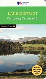
Wandelgids 60 Lake District Pathfinder Guide | Pathfinder Guide 60 | Met Ordanance Survey kaartenDeze Pathfinder Guide is een goed uitgevoerde gids met verschillende wandelingen in Groot-Britannië. De gids bevat naast goede topografische kaarten van de Britse topografische dienst (Ordanance Survey) ook beschrijvingen van het landschap, de cultuur en/of de flora en fauna. Verder is de gids voorzien van praktische informatie zoals startpunten, verwachte wandeltijd, restaurants en cafés voor onderweg. Pathfinder Lake District covering Coniston, Kewswick and Devoke Water. This selection offers interest, regional variety and balance of routes in the Lake Di... |
17,99 |
|
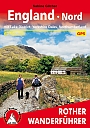
Wandelgids 253 Engeland Nord Rother Wanderführer | Rother Bergverlag | Mit Lake District Yorkshire Dales Northumberland 60 TourenDe vermaarde wandelgiden van Rother Bergverlag zijn uitstekende wandelgidsen voor ieder niveau. Op een kaartje is de wandelroute aangegeven, maar deze is ook beschreven in een beknopte en heldere tekst. Daarnaast is ook de afstand, de verwachte wandeltijd, het niveau, de hoogte en andere praktische informatie aangegeven. Met deze degelijke wandelgids ontdek je de mooiste plekken van jouw bestemming en kun je de spannendste wandeluitdagingen zoeken. Mit Lake District Yorkshire Dales Northumberland 60 wandelingen. |
14,90 |
|
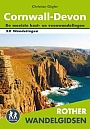
Wandelgids Cornwall Devon Rother Wandelgids | 50 Wandelingen | De mooiste kust- en veenwandelingenCornwall Devon is een fantastisch wandelparadijs voor natuurliefhebbers; uitzicht op zee en kust, groene heuvels en kronkelende landweggetjes. De mystieke sfeer komt tot leven bij het zien van de brede baaien met ruige kliffen, woeste kloven met subtropische vegetatie en afgelegen stranden met smaragdgroene wateren. Een wandeling naar het meest westelijke punt van Engeland, Land"s End, is een magische ervaring voor elke wandelaar. Alle 50 wandelroutes voor Cornwall en Devon zijn voorzien van duidelijke kaartjes, onmisbare hoogteprofielen, en uitgebreide beschrijvi... |
18,99 Tijdelijk niet leverbaar |
|
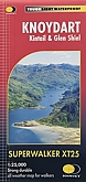
Wandelkaart Knoydart - Walking Maps Superwalker | Harvey Maps | Water- en scheurvaste wandelkaartDe Harvey Map is de wandelkaart voor het wandelen in de mooiste natuurgebieden in het Groot-Brittannië. Duidelijke topografische wandelkaarten met praktische informatie van de route zoals overnachtingsmogelijkheden, eetgelegenheden en bezienswaardigheden. Deze wandelkaart is scheur- en watervast. Met GPS compatible (UTM-Grid). 'Scotland's last wilderness': The Knoydart Superwalker map covers this wild, remote and beautiful area at 1:25,000 scale. The map area includes 6 Munros, 7 Corbetts and 2 Grahams. Schaal: 1:25.000 |
25,99 |
|
Wandelgids Snowdonia Way | Cicerone | A walking route through Snowdonia from Machynlleth to ConwyThis guidebook describes the Snowdonia Way in Wales, a long-distance route through Snowdonia National Park from Machynlleth to Conwy. A low-level route of 97 miles (in 6 stages of between 13 and 21 miles) passes through the heart of Snowdonia"s stunning mountain scenery and includes Pass of Aberglaslyn, Ogwen Valley and Aber Falls. It is suitable for walkers of average fitness and stamina, though days are long. An alternative mountain route covers 122 miles in 9 stages of 12–18 miles giving a spectacular journey over the most famous peaks such as Cadair Idris, S... |
19,99 |
|
Wandelkaart Cape Wrath Trail South | Harvey Maps | Water- en scheurvaste wandelkaartDe Harvey Map is de wandelkaart voor het wandelen in de mooiste natuurgebieden in het Groot-Brittannië. Duidelijke topografische wandelkaarten met praktische informatie van de route zoals overnachtingsmogelijkheden, eetgelegenheden en bezienswaardigheden. Deze wandelkaart is scheur- en watervast. Met GPS compatible (UTM-Grid). Compact and light - the map itself weighs just 60gms - a third of the weight of a laminated map, and much less bulky. And you can fold or refold it time and again, or stuff it in your back pocket and it won't fall to pieces. Shows the entire rou... Schaal: 1:40.000 |
25,99 |
|
Wandelkaart Cape Wrath Trail North | Harvey Maps | Water- en scheurvaste wandelkaartDe Harvey Map is de wandelkaart voor het wandelen in de mooiste natuurgebieden in het Groot-Brittannië. Duidelijke topografische wandelkaarten met praktische informatie van de route zoals overnachtingsmogelijkheden, eetgelegenheden en bezienswaardigheden. Deze wandelkaart is scheur- en watervast. Met GPS compatible (UTM-Grid). Compact and light - the map itself weighs just 60gms - a third of the weight of a laminated map, and much less bulky. And you can fold or refold it time and again, or stuff it in your back pocket and it won't fall to pieces. Shows the entire rou... Schaal: 1:40.000 |
25,99 |
|
Wandelgids 11 Dorset Pathfinder Guide | Pathfinder Guide 11 | Met Ordanance Survey kaartenDeze Pathfinder Guide is een goed uitgevoerde gids met verschillende wandelingen in Groot-Britannië. De gids bevat naast goede topografische kaarten van de Britse topografische dienst (Ordanance Survey) ook beschrijvingen van het landschap, de cultuur en/of de flora en fauna. Verder is de gids voorzien van praktische informatie zoals startpunten, verwachte wandeltijd, restaurants en cafés voor onderweg. Dorset must rank as one of the most unspoilt counties in England. Dominating the landscape are the chalk downs open, sweeping, grassy uplands that stretch f... |
17,99 |
|
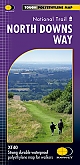
Wandelkaart North Downs Way - National Trail Maps | Harvey Maps | Water- en scheurvaste wandelkaartDe Harvey Map is de wandelkaart voor het lange afstand wandelpad in het Groot-Brittannië. Duidelijke topografische wandelkaarten met praktische informatie van de route zoals overnachtingsmogelijkheden, eetgelegenheden en bezienswaardigheden. Deze wandelkaart is scheur- en watervast. Met GPS compatible (UTM-Grid). Compact and light - the map itself weighs just 60gms - a third of the weight of a laminated map, and much less bulky. And you can fold or refold it time and again, or stuff it in your back pocket and it won't fall to pieces. Schaal: 1:40.000 |
25,99 |
|
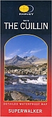
Wandelkaart The Cuillin of Skye - Walking Maps Superwalker | Harvey Maps | Water- en scheurvaste wandelkaartDe Harvey Map is de wandelkaart voor het wandelen in de mooiste natuurgebieden in het Groot-Brittannië. Duidelijke topografische wandelkaarten met praktische informatie van de route zoals overnachtingsmogelijkheden, eetgelegenheden en bezienswaardigheden. Deze wandelkaart is scheur- en watervast. Met GPS compatible (UTM-Grid). From Glen Brittle and the unique Black Cuillin in the west to the Red Cuillin and Broadford in the east. From the Sligachan Hotel and the A87 to the dramatic Loch Coruisk to the south. An enlargement of the Black Cuillin ridge at 1:12,500 scale ... Schaal: 1:25.000 |
25,99 |
|
Wandelgids 06 Cotswolds Pathfinder Guide | Pathfinder Guide 6 | Met Ordanance Survey kaartenDeze Pathfinder Guide is een goed uitgevoerde gids met verschillende wandelingen in Groot-Britannie. De gids bevat naast goede topografische kaarten van de Britse topografische dienst (Ordanance Survey) ook beschrijvingen van het landschap, de cultuur en/of de flora en fauna. Verder is de gids voorzien van praktische informatie zoals startpunten, verwachte wandeltijd, restaurants en cafes voor onderweg. Pathfinder(R) Cotswolds covering parts of the Snowshill, Buckholt Wood and Burford. This selection offers interest, regional variety and balance of routes in the Cotswo... |
17,99 Tijdelijk niet leverbaar |

|
Wandelkaartgids Hadrian's Wall Path | All the Ordnance Survey mapping needed for Hadrian's Wall PathHandzaam gidsje met topografische kaartjes van het gehele traject. Schaal 1:25.000, het wandelpad is extra ingetekend. Praktische informatie zoals pubs, picknick plekken, campings etc zijn door middel van pictogrammen aangegeven. Map of the 84-mile (135km) Hadrian's Wall Path National Trail, from Bowness-on-Solway to Wallsend, Newcastle. The trail typically takes a week to walk, and is suitable for walkers at all levels of experience. This compact booklet of Ordnance Survey 1:25,000 maps shows the full route, providing all of the mapping you need to complete ... Schaal: 1:25.000 |
13,50 |
|
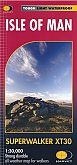
Wandelkaart Isle of Man - Walking Maps Superwalker | Harvey Maps | Water- en scheurvaste wandelkaartDe Harvey Map is de wandelkaart voor het wandelen in de mooiste natuurgebieden in het Groot-Brittannië. Duidelijke topografische wandelkaarten met praktische informatie van de route zoals overnachtingsmogelijkheden, eetgelegenheden en bezienswaardigheden. Deze wandelkaart is scheur- en watervast. Met GPS compatible (UTM-Grid). The whole island on two sides of the sheet with a generous overlap. Includes long distance routes, rights of way and Public Ramblage. Excellent map for walking, cycling and touring. This is THE map to have for the Isle of Man Walking Festiva... Schaal: 1:30.000 |
23,99 |

|
Wandelkaart Cleveland Way - National Trail Maps | Harvey Maps | Water- en scheurvaste wandelkaartDe Harvey Map is de wandelkaart voor het lange afstand wandelpad in het Groot-Brittannië. Duidelijke topografische wandelkaarten met praktische informatie van de route zoals overnachtingsmogelijkheden, eetgelegenheden en bezienswaardigheden. Deze wandelkaart is scheur- en watervast. Met GPS compatible (UTM-Grid). Compact and light - the map itself weighs just 60gms - a third of the weight of a laminated map, and much less bulky. And you can fold or refold it time and again, or stuff it in your back pocket and it won't fall to pieces. Shows the entire route on one shee... Schaal: 1:40.000 |
25,99 |
|
Wandelgids 34 Pembrokeshire and Carmarthenshire Pathfinder Guide | Pathfinder Guide 34 | Met Ordanance Survey kaartenDeze Pathfinder Guide is een goed uitgevoerde gids met verschillende wandelingen in Groot-Britannië. De gids bevat naast goede topografische kaarten van de Britse topografische dienst (Ordanance Survey) ook beschrijvingen van het landschap, de cultuur en/of de flora en fauna. Verder is de gids voorzien van praktische informatie zoals startpunten, verwachte wandeltijd, restaurants en cafés voor onderweg. Although deep in South Wales, Pembrokeshire and Carmarthenshire have a strong English influence, but their most striking feature, from the point of view of ... |
17,99 Tijdelijk niet leverbaar |
|
Wandelkaartgids West Highland Way Map Booklet | CiceroneHandzaam kaartgidsje. Gedetailleerde topografische wandelkaarten gebonden in een handig boekje. Licht voor onderweg. This compact booklet of maps shows the full route of the 95 mile West Highland Way Scottish Long Distance Route, via Loch Lomond and Rannoch Moor. This booklet is included with the Cicerone guidebook to the trail, and shows the full route on Ordnance Survey 1:25,000 maps. Milngavie, Drymen, Crianlarich, Tyndrum, Kinlochleven, Fort William. The walking is not difficult for anyone accustomed to regular walks longer than 10 miles, although there is ample sc... Schaal: 1:25.000 |
12,50 Tijdelijk niet leverbaar |
|
Wandelkaart Snowdonia North Snowdon, Glyders, Carnedds - Walking Maps Superwalker | Harvey Maps | Water- en scheurvaste wandelkaartDe Harvey Map is de wandelkaart voor het lange afstand wandelpad in het Groot-Brittannië. Duidelijke topografische wandelkaarten met praktische informatie van de route zoals overnachtingsmogelijkheden, eetgelegenheden en bezienswaardigheden. Deze wandelkaart is scheur- en watervast. Met GPS compatible (UTM-Grid). Detailed map for walking, scrambling and climbing. This map covers Snowdon, the Glyders and the Carnedds, and includes all the Welsh 3000' mountains on one sheet. Schaal: 1:25.000 |
25,99 |
|
Wandelkaart Southern Upland Way | Harvey MapsDe Harvey Map is de wandelkaart voor het wandelen in de mooiste natuurgebieden in het Groot-Brittannië. Duidelijke topografische wandelkaarten met praktische informatie van de route zoals overnachtingsmogelijkheden, eetgelegenheden en bezienswaardigheden. Deze wandelkaart is scheur- en watervast. Schaal: 1:40.000 |
25,99 |
|
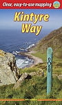
Wandelgids Kintyre Way Rucksack ReadersRucksack Readers zijn handig uitgevoerd in een klapper met ringband. Deze gids heeft een goede beschrijving van de lange afstands route met overzichtelijke kaarten doch zonder veel detail. De kracht van de Rucksack Readers is de uitgebreide achtergrondinformatie over de flora, fauna en geologische verschijnselen. Dit alles rijkelijk omkleed met kleurrijke foto's en praktische tips. The Kintyre Way is a fully waymarked trail that criss-crosses the Kintyre peninsula for 100 miles (161 km). Starting from Tarbert in the north, it visits coastal villages and inland loch... |
23,90 |
|
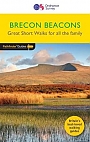
Wandelgids 47 Brecon Beacons Pathfinder Guide (Short Walks) | 20 korte wandelingen 7.5 kmDeze Pathfinder Guide is een goed uitgevoerde gids met verschillende wandelingen in Groot-Britannie. De gids bevat naast goede topografische kaarten van de Britse topografische dienst (Ordanance Survey) ook beschrijvingen van het landschap, de cultuur en/of de flora en fauna. Verder is de gids voorzien van praktische informatie zoals startpunten, verwachte wandeltijd, restaurants en cafes voor onderweg. Short Walks Brecon Beacons covering parts of The Sugar Loaf, Pen y Fan and Llyn y Fan Fach. This selection offers interest and regional variety in the Brecon Beacons, p... |
11,50 Tijdelijk niet leverbaar |

|
Wandelkaart Snowdonia North - Mountain Map | Harvey Maps | Water- en scheurvaste wandelkaartDe Harvey Map is de wandelkaart voor het wandelen in de mooiste natuurgebieden in het Groot-Brittannië. Duidelijke topografische wandelkaarten met praktische informatie van de route zoals overnachtingsmogelijkheden, eetgelegenheden en bezienswaardigheden. Deze wandelkaart is scheur- en watervast. Met GPS compatible (UTM-Grid). Waterproof mountain map of Snowdonia from Harvey at 1:40,000, with a geological map of the region on the reverse, enlargements of Snowdon and Tryfan, and advice on navigating the region safely. Schaal: 1:40.000 |
28,99 |
|
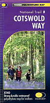
Wandelkaart Cotswold Way - National Trail Maps | Harvey Maps | Water- en scheurvaste wandelkaartDe Harvey Map is de wandelkaart voor het lange afstand wandelpad in het Groot-Brittannië. Duidelijke topografische wandelkaarten met praktische informatie van de route zoals overnachtingsmogelijkheden, eetgelegenheden en bezienswaardigheden. Deze wandelkaart is scheur- en watervast. Met GPS compatible (UTM-Grid). A leap forward in technical excellence: Tough, durable and 100% waterproof - virtually indestructible in normal use. Compact and light - the map itself weighs just 60gms - a third of the weight of a bulky laminated map. You can fold or refold it time and agai... Schaal: 1:40.000 |
25,99 |
|
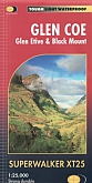
Wandelkaart Glen Coe, Glen Etive & Black Mount - Walking Maps Superwalker | Harvey Maps | Water- en scheurvaste wandelkaartDe Harvey Map is de wandelkaart voor het wandelen in de mooiste natuurgebieden in het Groot-Brittannië. Duidelijke topografische wandelkaarten met praktische informatie van de route zoals overnachtingsmogelijkheden, eetgelegenheden en bezienswaardigheden. Deze wandelkaart is scheur- en watervast. Met GPS compatible (UTM-Grid). Detailed map for walking and climbing. This map for hillwalkers covers Loch Leven south to Loch Etive via the Aonach Eagach, Buachaille Etive Mor, Three Sisters of Glen Coe, Bidean nam Bian. From Victoria Bridge north over the Black Mount and we... Schaal: 1:25.000 |
25,99 |
|
Wandelkaart West Highland Way - National Trail Maps | Harvey Maps | Water- en scheurvaste wandelkaartDe Harvey Map is de wandelkaart voor het lange afstand wandelpad in het Groot-Brittannië. Duidelijke topografische wandelkaarten met praktische informatie van de route zoals overnachtingsmogelijkheden, eetgelegenheden en bezienswaardigheden. Deze wandelkaart is scheur- en watervast. Met GPS compatible (UTM-Grid). Compact and light - the map itself weighs just 60gms - a third of the weight of a laminated map, and much less bulky. And you can fold or refold it time and again, or stuff it in your back pocket and it won't fall to pieces. Shows the entire route on ... Schaal: 1:40.000 |
25,99 |
|
Wandelgids 08 Kent Pathfinder Guide | Pathfinder Guide 8 | Met Ordanance Survey kaartenDeze Pathfinder Guide is een goed uitgevoerde gids met verschillende wandelingen in Groot-Britannië. De gids bevat naast goede topografische kaarten van de Britse topografische dienst (Ordanance Survey) ook beschrijvingen van het landschap, de cultuur en/of de flora en fauna. Verder is de gids voorzien van praktische informatie zoals startpunten, verwachte wandeltijd, restaurants en cafés voor onderweg. Walkers in Kent enjoy a number of long-distance footpaths, including the North Downs Way, Wealdway, Pilgrims' Way and Greensand Way, and sections of them are incorpor... |
17,99 Tijdelijk niet leverbaar |
|
Wandelgids Cape Wrath Trail Cicerone Guidebooks | through the Scottish Highlands from Fort William to Cape WrathThis is a glorious long-distance walk in the West Highlands from Fort William to Cape Wrath. Described as 'a quintessential backpacking walk' it is a challenging route for the experienced walker. The authors had six main criteria in mind: a variety of scenery, no long hauls over featureless terrain, use of designated paths, interesting geography, no high peaks to climb and a good day's walk every day with accommodation at the end. The route is split into 21 stages, many with an easier bad-weather alternative. Guide includes details of accommodation and advi... |
21,99 |
|
Wandelgids Tour of the Lake District Cicerone GuidebooksDesigned as a scenic tour of the Lake District, this seven day circular route (93 miles) is primarily one of valleys and passes, rather than a tick list of peaks attained. The route starts at the railway terminus at Windermere village. Quickly leaving the crowds behind, it passes through Ambleside, the Langdale valley, Coniston, Dunnerdale, Eskdale, Wasdale, Ennerdale, Buttermere, Newlands Valley, Keswick, Borrowdale, Grasmere then Ullswater, before returning back to Windermere via the Troutbeck valley. |
Tijdelijk niet leverbaar |
|
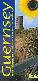
Wandelgids Guernsey with Alderney Sark and Herm Sunflower Car tours and WalksSunflower reisgidsen zijn handige handzame gidsen. Een combinatie van autotochten en wandeltochten. Rondwandelingen en lijnwandelingen. De lengte van de wandelingen variërend van 4 tot 20 kilometer. Moeilijkheidsgraad van de wandeling staat vermeldt. Met gedetailleerde kaartjes. Degelijk informatie over de bezienswaardigheden onderweg. An ideal introduction for the first-time visitor, this book also provides new ideas for those who come year after year. Apart from marvellous coastal scenery that’s been compared to that of Cornwall and Brittany, there is much... |
12,99 |
|
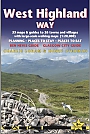
Wandelgids West Highland Way Trailblazer | Glasgow to Fort WilliamVolledig herziene 8e editie. De West Highland Way passeert een aantal van de meest spectaculaire landschappen in heel Groot-Brittannië. Vanuit de buitenwijken van Glasgow slingert het 154,5 km lang langs de beboste oevers van Loch Lomond, over de wildernis van Rannoch Moor, over de bergen boven Glencoe tot een dramatische finish langs Ben Nevis - de hoogste berg van Groot-Brittannië - naar het centrum van Fort William. * 4 grootschalige stadsplattegronden, 8 overzichtskaarten en 53 grootschalige wandelkaarten - bijna 1: 20.000 - met routetijden, verblijfplaat... |
18,50 |
|
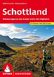
Wandelgids Schottland Rother Wanderführer | Rother Bergverlag | Wanderungen an den Küsten und in den Highlands 63 wandelingenDe vermaarde wandelgiden van Rother Bergverlag zijn uitstekende wandelgidsen voor ieder niveau. Op een kaartje is de wandelroute aangegeven, maar deze is ook beschreven in een beknopte en heldere tekst. Daarnaast is ook de afstand, de verwachte wandeltijd, het niveau, de hoogte en andere praktische informatie aangegeven. Met deze degelijke wandelgids ontdek je de mooiste plekken van jouw bestemming en kun je de spannendste wandeluitdagingen zoeken. Schottland ist bekannt für seine atemberaubenden Landschaften: Von den majestätischen Highlands bis zu den ... |
16,90 |
|
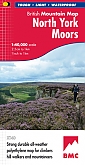
Wandelkaart North York Moors - Mountain Map | Harvey Maps | Water- en scheurvaste wandelkaartDe Harvey Map is de wandelkaart voor het wandelen in de mooiste natuurgebieden in het Groot-Brittannië. Duidelijke topografische wandelkaarten met praktische informatie van de route zoals overnachtingsmogelijkheden, eetgelegenheden en bezienswaardigheden. Deze wandelkaart is scheur- en watervast. Met GPS compatible (UTM-Grid). North York Moors - Part of the highly successful and innovative British Mountain Map series. It covers around 560 square miles of country - the only really detailed map to cover this whole area on one sheet. It also includes the popular North Yo... Schaal: 1:40.000 |
28,99 |
|
Wandelgids Offa's Dyke Path Cicerone Guidebooks | A journey through the border country of England and WalesThis guidebook to the Offas Dyke Path National Trail has been designed to allow some flexibility in following the official route, offering suggestions for circular walks covering sections of the dyke. The walk typically takes around two weeks to complete, while this is fully described, alternative routes to places of interest, or to find accommodation are included and form part of the total mileage quoted. Offas Dyke was constructed by the powerful King of Mercia in the late eighth century to mark out the western boundary of his kingdom. Hundreds of years later this is... |
19,99 |
|
Wandelgids Backpacker's Britain: Northern Scotland Cicerone Guidebooks | Thirty two- and three-day treksThe Highlands of Scotland are one of Britain's great wilderness areas, particularly in the Far North. Backpackers venturing into these remote lands get a true sense of being away from it, and this book gives a superb starting point for those wanting to explore this wonderful mountain region. A total of 30 multi-day backpacking routes are described, along rugged coastlines from the Shetland Islands to the Rough Bounds of Knoydart, and across mountain ridges from the northern tip of Skye to the great trench of Glen Affric. Most routes take just 2 or 3 days to ... |
16,99 |
|
Wandelgids 35 Northumberland & the Scottish Borders Pathfinder Guide | Pathfinder Guide 35 | Met Ordanance Survey kaartenDeze Pathfinder Guide is een goed uitgevoerde gids met verschillende wandelingen in Groot-Britannie. De gids bevat naast goede topografische kaarten van de Britse topografische dienst (Ordanance Survey) ook beschrijvingen van het landschap, de cultuur en/of de flora en fauna. Verder is de gids voorzien van praktische informatie zoals startpunten, verwachte wandeltijd, restaurants en cafes voor onderweg. 28 wandelingen. Pathfinder(R) Northumberland and the Scottish Borders covering Blanchland, Melrose and Hartside. This selection offers interest, regional variety and ba... |
17,99 |
|
Wandelgids Snowdonia mountain walking 40 finest routes Cicerone Guidebooks | 40 wandelingenThis guidebook describes 40 day walks exploring Snowdonia. It showcases some of the best mountain walks in the area, with routes up Snowdon and Tryfan alongside other classic peaks like Y Garn, Cadair Idris and the Glyders. Routes are graded easy to strenuous and include airy and pulse-quickening scrambles such as Crib Goch and Bristly Ridge as well as the Snowdon Horseshoe, the Nantlle Ridge and a 2-day traverse of all 15 of Snowdon"s peaks over 3000ft. |
17,99 |
|
Wandelgids 254 Zuid Engeland Süd | Rother | 56 wandelingen Zwischen London, Dover, Jurassic Coast und Exmoor.De vermaarde wandelgiden van Rother Bergverlag zijn uitstekende wandelgidsen voor ieder niveau. Op een kaartje is de wandelroute aangegeven, maar deze is ook beschreven in een beknopte en heldere tekst. Daarnaast is ook de afstand, de verwachte wandeltijd, het niveau, de hoogte en andere praktische informatie aangegeven. Met deze degelijke wandelgids ontdek je de mooiste plekken van jouw bestemming en kun je de spannendste wandeluitdagingen zoeken. 56 wandelingen. |
14,90 Tijdelijk niet leverbaar |
|
Wandelgids 10 Snowdonia Pathfinder Guide | Pathfinder Guide 10 | Met Ordanance Survey kaartenDeze Pathfinder Guide is een goed uitgevoerde gids met verschillende wandelingen in Groot-Britannië. De gids bevat naast goede topografische kaarten van de Britse topografische dienst (Ordanance Survey) ook beschrijvingen van het landschap, de cultuur en/of de flora en fauna. Verder is de gids voorzien van praktische informatie zoals startpunten, verwachte wandeltijd, restaurants en cafés voor onderweg. Pathfinder Snowdonia covering Bont Newydd, Aber and Tal-y-lln. This selection offers interest, regional variety and balance of routes in Snowdonia providing... |
17,99 |
Bij een bezoek aan Groot-Brittannië zijn must-sees onder andere de Tower of London en Buckingham Palace in Londen, de mysterieuze Stonehenge in Zuid-Engeland, de natuurlijke pracht van de Schotse Hooglanden, en de historische steden van Wales. Ontdek de rijke geschiedenis in het British Museum en het Edinburgh Castle. Natuurliefhebbers zullen genieten van het Lake District en Snowdonia National Park. Outdoor activiteiten omvatten wandelen, golfen in Schotland, en surfen in Cornwall. Overnachtingsmogelijkheden variëren van iconische hotels in stedelijke gebieden tot gezellige B&B's op het platteland. Raadpleeg lokale toeristische informatie voor reisadviezen en om de veelzijdigheid van Groot-Brittannië te ervaren.