- Gratis verzending vanaf 30 euro
- Levert in Nederland, België etc.
- Meer dan 30.000 titels
- Vakkundige klantenservice
- Snelle levering
- Veilig en eenvoudig betalen

Direct contact?
Bel +31 (0)6 42428571
maandag t/m vrijdag
van 10 tot 17 uur
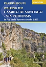
Wandelgids The Way of St James GR65 - Le Puy to the Pyrenees | Cicerone
GR65: The Chemin de Saint Jacques
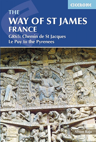
Guidebook to the Way of St James pilgrim route, describing the 730km French section of the Camino de Santiago route from Le Puy-en-Valey in central France to Saint-Jean-Pied-de-Port in the Pyrenees, including pilgrimage history, points of interest, links to other routes and accommodation. Suitable for all abilities but basic fitness is required. from Le Puy-en-Velay passes through Conques, Figeac, Cahors, Moissac, Aire-sur-l'Adour to Saint-Jean-Pied-de-Port. far from flat but requires no specialist equipment and can be undertaken, with appropriate preparation, by anyone of average health and fitness. Must see: starts in the volcanic Velay region of France, passes through the Margeride, over the Aubrac plateau, the causse before Cahors and the flat Landes region before reaching the foothills of the Pyrenees and the Basque country; interesting churches, cathedrals, historic monunments and vernacular architecture along the way.
EAN: 9781852848767
Uitgeverij: Cicerone Press
Verschijningsdatum: 2018
Meest recente editie

(Tijdelijk) niet leverbaar
- Vakkundige klantenservice
- Groot assortiment
- Gratis retourneren binnen 14 dagen
- Aangesloten bij WebwinkelKEUR
Meer producten die interessant kunnen zijn
Topografische kaarten Pyreneeën

Topografische Wandelkaart van Frankrijk 2249OT - Bourg Madame / Col Puymorens Pic Carlit Port d'Envalira
Carte de Randonnee | Wandelkaart | Institut Geographique National (IGN) Frankrijk
€ 16,50
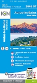
Topografische Wandelkaart van Frankrijk 2048OT - Aulus-les-Bains / Mont Valier Guzet-Neige
Carte de Randonnee | Wandelkaart | Institut Geographique National (IGN) Frankrijk
€ 16,50

Topografische Wandelkaart van Frankrijk 1345OT - Cambo-les-Bains / Hasparren
Carte de Randonnee | Wandelkaart | Institut Geographique National (IGN) Frankrijk
€ 16,50

Topografische Wandelkaart van Frankrijk 1245OT - Hendaye / St-Jean-de-Luz / Cote d'Argent
Carte de Randonnee | Wandelkaart | Institut Geographique National (IGN) Frankrijk
€ 16,50
Wandelkaarten Pyreneeën
Wegenkaarten Pyreneeën

Wegenkaart - Landkaart Pyreneeën Pyrenäen - World Mapping Project (Reise Know-How)
Water- en scheurvaste wegenkaart
€ 13,50
Pelgrimeren naar Santiago de Compostella Pyreneeën
Wandelgids 6533 Pyreneeën GR653 Saint Jacques De Compostelle Via Arles Toulouse 6533 | FFRP Topoguides
GR 653 | Ref. 6533 | FFRP Topoguides
€ 19,99
Wandelgids Camino de Santiago - Via Podiensis GR65 | Cicerone Press
Le Puy to the Pyrenees on the GR 65
€ 22,99
Fietsgidsen Pyreneeën

Fietsgids Canal du Midi Bikeline Esterbauer
Entlang des Weltkulturerbes von Toulouse ans Mittelmeer - Mit Canal de la Robine - 322 km
€ 14,99

Fietskaarten Pyreneeën

Fietskaart 174 Carcassonne Beziers Perpignan Roussillon - Côte Vermeille - IGN Top 100 - Tourisme et Velo
Water- en scheurvaste fietskaart
€ 10,50

Fietskaart 166 Dax Bayonne Pays Basque - IGN Top 100 - Tourisme et Velo
Water- en scheurvaste fietskaart
€ 10,50