- Gratis verzending vanaf 30 euro
- Levert in Nederland, België etc.
- Meer dan 30.000 titels
- Vakkundige klantenservice
- Snelle levering
- Veilig en eenvoudig betalen

Direct contact?
Bel +31 (0)6 42428571
maandag t/m vrijdag
van 10 tot 17 uur
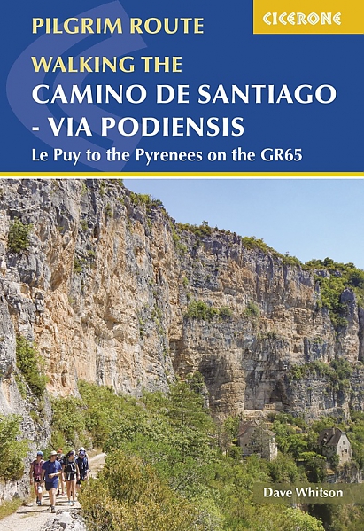
Wandelgids Camino de Santiago - Via Podiensis GR65 | Cicerone Press
Le Puy to the Pyrenees on the GR 65
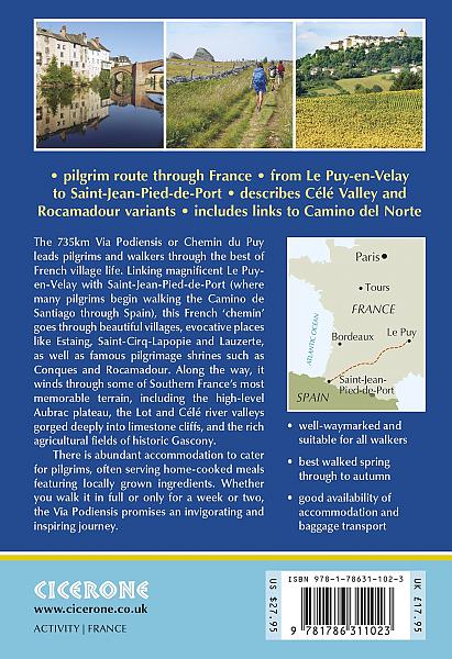
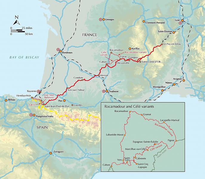
This guidebook describes in full the 735km Via Podiensis (GR65), a historic pilgrimage route through southern France from Le Puy-en-Velay to Saint-Jean-Pied-de-Port, where the trail meets the famous Camino Francés to Santiago de Compostela (Spain). Also detailed are 2 major variants: the Célé Valley (GR651) and Rocamadour (GR6 and GR46). Split into 28 stages, the full route takes 4 to 6 weeks to complete but can be divided into shorter sections - Figeac and Condom are well positioned to break the walk into three 2-week chunks. It can be adapted to suit all abilities, with regularly spaced accommodation and baggage transport available, and is best walked in spring and autumn, with May and September the most popular months. Abundant accommodation options offer a warm welcome to walkers and pilgrims and a chance to enjoy delicious home-cooked meals made with local ingredients.
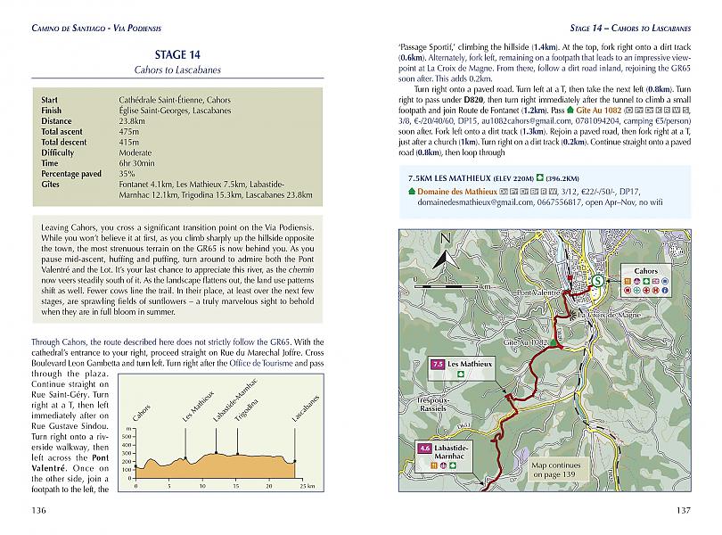
Walking directions are accompanied by 1;100,000 maps showing the route line and the facilities available at different locations. Accommodation listings provide invaluable information on where to stay. There are useful town maps for Cahors, Condom, Figeac, Le Puy, Moissac and Saint-Jean-Pied-de-Port, and a stage planning table listing intermediate distances between accommodation means the schedule can be easily customised to individual requirements.
The Via Podiensis leads pilgrims and walkers through the best of French village life, offering a unique combination of pleasant trails, quaint historic communities and cultural delights. It passes through charming Estaing, Saint-Cirq-Lapopie and Lauzerte, and visits pilgrim shrines including Conques and Rocamadour. Pilgrims carrying on to Santiago can either proceed directly from Saint-Jean on the Camino Fra
Engelstalig
EAN: 9781786311023
Uitgeverij: Cicerone Press
Verschijningsdatum: 2022
Meest recente editie
Engelstalig
296 pagina's
Op voorraad
Overmorgen in huis (Nederland)
- Vakkundige klantenservice
- Groot assortiment
- Gratis retourneren binnen 14 dagen
- Aangesloten bij WebwinkelKEUR
€ 22,99
Meer producten die interessant kunnen zijn
Topografische kaarten Pyreneeën

Topografische Wandelkaart van Frankrijk 2249OT - Bourg Madame / Col Puymorens Pic Carlit Port d'Envalira
Carte de Randonnee | Wandelkaart | Institut Geographique National (IGN) Frankrijk
€ 16,50

Topografische Wandelkaart van Frankrijk 2048OT - Aulus-les-Bains / Mont Valier Guzet-Neige
Carte de Randonnee | Wandelkaart | Institut Geographique National (IGN) Frankrijk
€ 16,50

Topografische Wandelkaart van Frankrijk 1345OT - Cambo-les-Bains / Hasparren
Carte de Randonnee | Wandelkaart | Institut Geographique National (IGN) Frankrijk
€ 16,50

Topografische Wandelkaart van Frankrijk 1245OT - Hendaye / St-Jean-de-Luz / Cote d'Argent
Carte de Randonnee | Wandelkaart | Institut Geographique National (IGN) Frankrijk
€ 16,50
Wandelkaarten Pyreneeën
Wandelgidsen Pyreneeën
Wandelgids Pyreneeën the GR10 Trail Cicerone Guidebooks
Coast to Coast through the French Pyrenees
€ 24,99
Wandelgids 1091 Pyreneeën GR 10 GR 101 Pyrénées Centrales tour du Val d'Azun Ffrp Topoguide Ref. 1091| FFRP Topoguides
GR10 | Ref. 1091 | Ffrp Topo-Guides
€ 19,99
Wandelgids 284 Pyreneeën Pyrenaen 2 Rother Wanderführer | Rother Bergverlag
58 Wandelingen | Französische Zentralpyrenäen: Arrens bis Seix
€ 14,90
Wegenkaarten Pyreneeën

Wegenkaart - Landkaart Pyreneeën Pyrenäen - World Mapping Project (Reise Know-How)
Water- en scheurvaste wegenkaart
€ 13,50
Fietsgidsen Pyreneeën

Fietsgids Canal du Midi Bikeline Esterbauer
Entlang des Weltkulturerbes von Toulouse ans Mittelmeer - Mit Canal de la Robine - 322 km
€ 14,99

Fietskaarten Pyreneeën
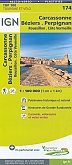
Fietskaart 174 Carcassonne Beziers Perpignan Roussillon - Côte Vermeille - IGN Top 100 - Tourisme et Velo
Water- en scheurvaste fietskaart
€ 10,50

Fietskaart 166 Dax Bayonne Pays Basque - IGN Top 100 - Tourisme et Velo
Water- en scheurvaste fietskaart
€ 10,50