- Gratis verzending vanaf 30 euro
- Levert in Nederland, België etc.
- Meer dan 30.000 titels
- Vakkundige klantenservice
- Snelle levering
- Veilig en eenvoudig betalen

Direct contact?
Bel +31 (0)6 42428571
maandag t/m vrijdag
van 10 tot 17 uur
Wandelgids Pyreneeën the GR10 Trail Cicerone Guidebooks
Coast to Coast through the French Pyrenees
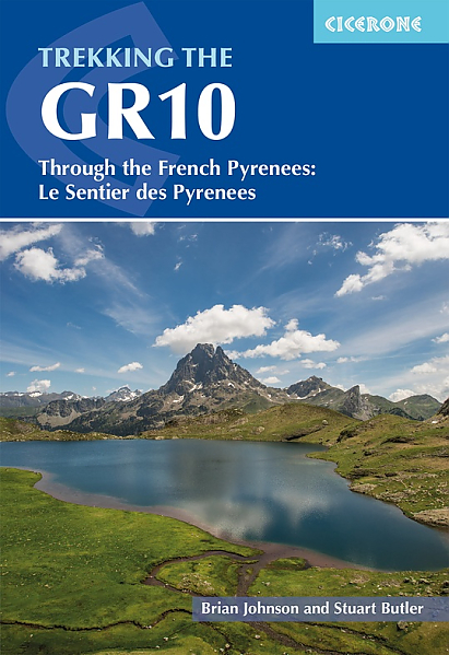
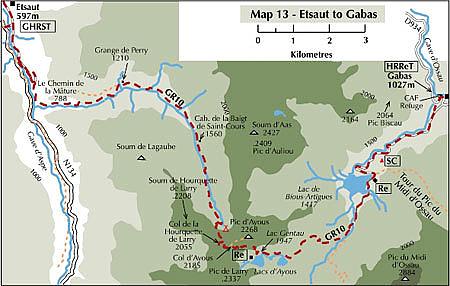
Guidebook to the GR10, a 955km trek across the French Pyrenees from Hendaye on the Atlantic Coast to the Mediterranean coast at Banyuls-sur-Mer. Described in 55-day stages, the route can be completed in its entirety, or in shorter sections using the bus and rail links found throughout the Pyrenees. Step by step route descriptions are accompanied by 1:100,000 mapping and gradient profiles. Useful practical information is also included such as when to go, getting there and back, camping, accessing fuel and water, plus handy equipment tips and more. The easiest, oldest and most popular of the three long-distance routes that traverse the mountain range, the GR 10 is well waymarked and follows good mountain paths. For many walkers, the highlight of the route is the magnificent wildflowers and associated butterflies. For others, it"s the spectacular mountain terrain, while those keen on bird watching will delight in scanning the sky for the many varieties of birds of prey that can be seen in the region, from the massive Griffon vulture to the distinctly coloured Egyptian vulture. Activities
Trekking, long distance walking, hiking Seasons
Best July to October (June in a low snow year) Centres
Hendaye-Plage on the Atlantic coast to Banyuls-sur-Mer on the Mediterranean through the French Pyrenees. Difficulty
The GR10 is extremely well waymarked following good mountain paths with short sections of boulderfield and occasional very easy scrambling. It is tough because there is more steep climb and descent than on many long-distance paths. Good network of inexpensive accommodation for those who prefer not to camp. Frequent resupply possible. In early season (May/June) ice-axe and crampons may be required. Must See
The GR10 starts with the rolling hills of the Basque country leading to the High Pyrenees including Pic du Midi d'Ossau, Vignemale and Gavarnie. The remote Ariège with Mont Vallier follows and Canigou dominates the approach to the Mediterranean. Wildflower meadows are magnificent throughout.
Engelstalig
EAN: 9781786311160
Auteur(s): Lucia, p.
Uitgeverij: Cicerone Press
Verschijningsdatum: 2023
Meest recente editie
Engelstalig
316 pagina's


Op voorraad
Overmorgen in huis (Nederland)
- Vakkundige klantenservice
- Groot assortiment
- Gratis retourneren binnen 14 dagen
- Aangesloten bij WebwinkelKEUR
€ 24,99
Meer producten die interessant kunnen zijn
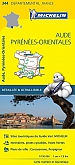
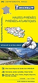
Topografische kaarten Pyreneeën
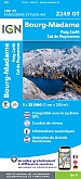
Topografische Wandelkaart van Frankrijk 2249OT - Bourg Madame / Col Puymorens Pic Carlit Port d'Envalira
Carte de Randonnee | Wandelkaart | Institut Geographique National (IGN) Frankrijk
€ 16,50
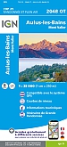
Topografische Wandelkaart van Frankrijk 2048OT - Aulus-les-Bains / Mont Valier Guzet-Neige
Carte de Randonnee | Wandelkaart | Institut Geographique National (IGN) Frankrijk
€ 16,50

Topografische Wandelkaart van Frankrijk 1345OT - Cambo-les-Bains / Hasparren
Carte de Randonnee | Wandelkaart | Institut Geographique National (IGN) Frankrijk
€ 16,50
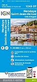
Topografische Wandelkaart van Frankrijk 1245OT - Hendaye / St-Jean-de-Luz / Cote d'Argent
Carte de Randonnee | Wandelkaart | Institut Geographique National (IGN) Frankrijk
€ 16,50
Wandelkaarten Pyreneeën
Wegenkaarten Pyreneeën
Wegenkaart - Landkaart Pyreneeën Pyrenäen - World Mapping Project (Reise Know-How)
Water- en scheurvaste wegenkaart
€ 13,50
Pelgrimeren naar Santiago de Compostella Pyreneeën
Wandelgids 6533 Pyreneeën GR653 Saint Jacques De Compostelle Via Arles Toulouse 6533 | FFRP Topoguides
GR 653 | Ref. 6533 | FFRP Topoguides
€ 19,99
Wandelgids Camino de Santiago - Via Podiensis GR65 | Cicerone Press
Le Puy to the Pyrenees on the GR 65
€ 22,99
Fietsgidsen Pyreneeën

Fietsgids Canal du Midi Bikeline Esterbauer
Entlang des Weltkulturerbes von Toulouse ans Mittelmeer - Mit Canal de la Robine - 322 km
€ 14,99

Fietskaarten Pyreneeën
Fietskaart 174 Carcassonne Beziers Perpignan Roussillon - Côte Vermeille - IGN Top 100 - Tourisme et Velo
Water- en scheurvaste fietskaart
€ 10,50
Fietskaart 166 Dax Bayonne Pays Basque - IGN Top 100 - Tourisme et Velo
Water- en scheurvaste fietskaart
€ 10,50