- Gratis verzending vanaf 30 euro
- Levert in Nederland, België etc.
- Meer dan 30.000 titels
- Vakkundige klantenservice
- Snelle levering
- Veilig en eenvoudig betalen

Direct contact?
Bel +31 (0)6 42428571
maandag t/m vrijdag
van 10 tot 17 uur
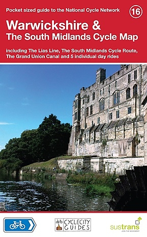
Fietskaart 16 Engeland Warwickshire & the South Midlands Cycle Map Sustrans Pocket Sized
This area map shows the National Cycle Network and local routes in this area. It covers the Warwickshire & South Midlands area of the Midlands region of England, including Warwick, Coventry, Rugby, Northampton and Kettering. This pocket-sized colour map shows clearly mapped on-road and traffic-free paths, easy to read contours, and detailed inset maps for the major towns and cities as well as recommended linking routes connecting the NCN with quiet roads. The map also features 5 day rides with directions and a description of the area, highlighting key cycle routes, local history and places of interest. Major cycle routes covered by this map: National Route 6 between Leighton Buzzard and Kelmarsh via Milton Keynes and Northampton. National Route 51 between Cranfield and Kidlington via Milton Keynes & Bicester. National Route 50 between Buckingham and Swinford via Daventry. National Route 5 between Kidlington and Wilmcote via Banbury, Shipston-on-Stour and Stratford-upon-Avon. National Route 48 between Moreton-in-Marsh and Long Itchingham via Shipston-on-Sour and Southam. The Lias Line from Rugby to Leamington Spa and Warwick on National Route 41 The Grand Union Canal on National Route 6 Brampton Valley Way from Market Harborough to Northampton on National Route 6 Scale: 1:110,000 - Main Map
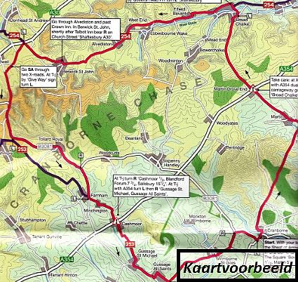
Schaal: 1:110.000
Engelstalig
EAN: 9781900623384
Uitgeverij: Sustrans (UK)
Serie: Pocket Map Eng
Meest recente editie
Engelstalig


Op voorraad
Vóór 17 uur besteld, morgen in huis (Nederland)
- Vakkundige klantenservice
- Groot assortiment
- Gratis retourneren binnen 14 dagen
- Aangesloten bij WebwinkelKEUR
€ 10,99
Verder in deze serie

- Fietskaart 21 East Midlands Cycle Map Sustrans Pocket Sized
- Fietskaart 22 Shropshire Staffordshire & the Black Country Cycle Map Sustrans Pocket Sized
- Fietskaart 36 West Dumfries & Galloway Cycle Map Sustrans Pocket Sized
- Fietskaart 38 Lanarkshire & The Scottish Boders Cycle Map Sustrans Pocket Sized
- Fietskaart 51 Derry-Londonderry the North west cycle map Cycle Map Sustrans Pocket Sized
- Fietskaart 52 The Causeway Coast & Glens Cycle Map Sustrans Pocket Sized
Meer producten die interessant kunnen zijn
Wandelgidsen Midden-Engeland


Wandelgids 74 Malverns to Warwickshire Pathfinder Guide
Pathfinder Guide 01 | Met Ordanance Survey kaarten
€ 17,95
Tijdelijk niet leverbaar

Topografische kaarten Midden-Engeland

Topografische Wandelkaart 196 Sudbury / Hadleigh / Dedham Vale Lavenham & Long Melford - Explorer Map
Wandelkaart & Fietskaart | Ordnance Survey (OS) Groot-Brittannië
€ 18,99

Topografische Wandelkaart 205 Stratford-upon-Avon / Evesham Alcester - Explorer Map
Wandelkaart & Fietskaart | Ordnance Survey (OS) Groot-Brittannië
€ 18,99

Topografische Wandelkaart 211 Bury St Edmunds / Stowmarket Debenham & Elmswell - Explorer Map
Wandelkaart & Fietskaart | Ordnance Survey (OS) Groot-Brittannië
€ 18,99
Tijdelijk niet leverbaar
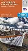
Topografische Wandelkaart 212 Woodbridge / Saxmundham Aldeburgh & Framlingham - Explorer Map
Wandelkaart & Fietskaart | Ordnance Survey (OS) Groot-Brittannië
€ 18,99
Reisgidsen Midden-Engeland


Reisgids Slow Norfolk Bradt Travel Guide
Local, Characterful Guides To Britain's Special Places
€ 21,50