- Gratis verzending vanaf 30 euro
- Levert in Nederland, België etc.
- Meer dan 30.000 titels
- Vakkundige klantenservice
- Snelle levering
- Veilig en eenvoudig betalen

Direct contact?
Bel +31 (0)6 42428571
maandag t/m vrijdag
van 10 tot 17 uur
Wandelgids Pyreneeën The Pyrenees Cicerone Guidebooks
The High Pyrenees from the Cirque de Lescun to the Carlit Massif

The guide describes the High Pyrenees from the Cirque de Lescun in the west to the Carlit massif and Cerdagne east of Andorra, in five regional chapters. The guide contains: Valley-by-valley descriptions of range, its facilities and infrastructure Information on the best mountaineering, walking and climbing opportunities in the area Summaries of long-distance through-routes and treks Accommodation, camping, refuges and travel details Extensive introductory materials on the region, climate, geology, structure, towns, villages, access, best regions History and background of the great explorations, with profiles of the pioneers and personalities of each range A full listing of all the Pyrenean 3000m summits and their location Detailed sketch maps and excellent colour photographs.
Engelstalig
EAN: 9781852844202
Auteur(s): Reynolds, k.
Uitgeverij: Cicerone Press
Verschijningsdatum: 2010
Meest recente editie
Engelstalig
461 pagina's


Op voorraad
Levertijd 3 dagen (Nederland)
- Vakkundige klantenservice
- Groot assortiment
- Gratis retourneren binnen 14 dagen
- Aangesloten bij WebwinkelKEUR
€ 28,99
Meer producten die interessant kunnen zijn
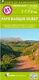
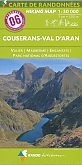
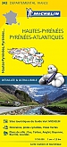
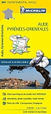
Topografische kaarten Pyreneeën

Topografische Wandelkaart van Frankrijk 2249OT - Bourg Madame / Col Puymorens Pic Carlit Port d'Envalira
Carte de Randonnee | Wandelkaart | Institut Geographique National (IGN) Frankrijk
€ 16,50
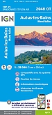
Topografische Wandelkaart van Frankrijk 2048OT - Aulus-les-Bains / Mont Valier Guzet-Neige
Carte de Randonnee | Wandelkaart | Institut Geographique National (IGN) Frankrijk
€ 16,50
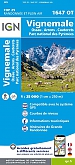
Topografische Wandelkaart van Frankrijk 1647OT - Vignemale / Ossau / Arrens / Cauterets PNR
Carte de Randonnee | Wandelkaart | Institut Geographique National (IGN) Frankrijk
€ 16,50

Topografische Wandelkaart van Frankrijk 1345OT - Cambo-les-Bains / Hasparren
Carte de Randonnee | Wandelkaart | Institut Geographique National (IGN) Frankrijk
€ 16,50
Wandelkaarten Pyreneeën
Wegenkaarten Pyreneeën

Wegenkaart - Landkaart Pyreneeën Pyrenäen - World Mapping Project (Reise Know-How)
Water- en scheurvaste wegenkaart
€ 13,50
Pelgrimeren naar Santiago de Compostella Pyreneeën
Wandelgids 6533 Pyreneeën GR653 Saint Jacques De Compostelle Via Arles Toulouse 6533 | FFRP Topoguides
GR 653 | Ref. 6533 | FFRP Topoguides
€ 19,99
Wandelgids Camino de Santiago - Via Podiensis GR65 | Cicerone Press
Le Puy to the Pyrenees on the GR 65
€ 22,99
Fietsgidsen Pyreneeën

Fietsgids Canal du Midi Bikeline Esterbauer
Entlang des Weltkulturerbes von Toulouse ans Mittelmeer - Mit Canal de la Robine - 322 km
€ 14,99

Fietskaarten Pyreneeën

Fietskaart 166 Dax Bayonne Pays Basque - IGN Top 100 - Tourisme et Velo
Water- en scheurvaste fietskaart
€ 10,50