- Gratis verzending vanaf 30 euro
- Levert in Nederland, België etc.
- Meer dan 30.000 titels
- Vakkundige klantenservice
- Snelle levering
- Veilig en eenvoudig betalen

Direct contact?
Bel +31 (0)6 42428571
maandag t/m vrijdag
van 10 tot 17 uur
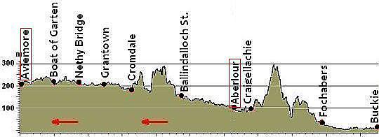
Wandelgids The Speyside Way | Rucksack Readers
Buckie to Aviemore

Deze gids heeft een goede beschrijving van de lange afstands route met overzichtelijke kaarten doch zonder veel detail. De kracht van de Rucksack Readers is de uitgebreide achtergrondinformatie over de flora, fauna en geologische verschijnselen. Dit alles rijkelijk omkleed met kleurrijke foto's en praktische tips. The Speyside Way is one of Scotland’s Great Trails. Its main spine runs for 85 miles (136 km) from the fishing port of Buckie to Newtonmore in the Cairngorm National Park, with an optional 16-mile spur to Tomintoul via Glenlivet. Following the lovely valley of the River Spey, you walk through countryside rich in malt whisky and wildlife, along riverside paths, railway trackbed and forest and moorland tracks. This third edition, based on fieldwork in 2021, has been fully revised to celebrate the long-awaited extension to Newtonmore. It has custom large-scale mapping on 17 of its pages. Over half of its 100 colour photos are new, and despite having 16 pages more than the previous edition, it’s lighter and more rainproof than ever.
Engelstalig
EAN: 9781898481997
Uitgeverij: Rucksack Readers
Verschijningsdatum: 2021
Meest recente editie
Engelstalig
80 pagina's

Op voorraad
Levertijd 3 dagen (Nederland)
- Vakkundige klantenservice
- Groot assortiment
- Gratis retourneren binnen 14 dagen
- Aangesloten bij WebwinkelKEUR
€ 21,50
Meer producten die interessant kunnen zijn
Topografische kaarten Centraal-Schotland / Ben Nevis
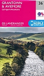
Topografische Wandelkaart 36 Grantown / Aviemore Cairngorm Mountains - Landranger Map
Wandelkaart & Fietskaart | Ordnance Survey (OS) Groot-Brittannië
€ 18,99

Topografische Wandelkaart 392 Ben Nevis / Fort William The Mamores & The Grey Corries Kinlochleven & Spean Bridge - Explorer Map
Wandelkaart & Fietskaart | Ordnance Survey (OS) Groot-Brittannië
€ 18,99
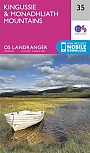
Topografische Wandelkaart 35 Kingussie / Monadhliath Mountains - Landranger Map
Wandelkaart & Fietskaart | Ordnance Survey (OS) Groot-Brittannië
€ 18,99
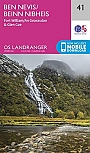
Topografische Wandelkaart 41 Ben Nevis / Fort William / Glen Coe - Landranger Map
Wandelkaart & Fietskaart | Ordnance Survey (OS) Groot-Brittannië
€ 18,99
Wandelkaarten Centraal-Schotland / Ben Nevis
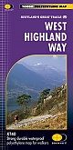
Wandelkaart West Highland Way - National Trail Maps | Harvey Maps
Water- en scheurvaste wandelkaart
€ 25,99
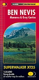
Wandelkaart Ben Nevis - Walking Maps Superwalker | Harvey Maps
Water- en scheurvaste wandelkaart
€ 25,99
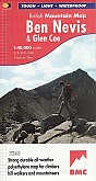
Wandelkaart Ben Nevis and Glen Coe - Mountain Map | Harvey Maps
Water- en scheurvaste wandelkaart
€ 28,99
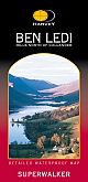
Wandelkaart Ben Ledi & Hills North of Callander - Walking Maps Superwalker | Harvey Maps
Water- en scheurvaste wandelkaart
€ 17,99