Pocket Map Eng

|
Fietskaart 16 Engeland Warwickshire & the South Midlands Cycle Map Sustrans Pocket SizedThis area map shows the National Cycle Network and local routes in this area. It covers the Warwickshire & South Midlands area of the Midlands region of England, including Warwick, Coventry, Rugby, Northampton and Kettering. This pocket-sized colour map shows clearly mapped on-road and traffic-free paths, easy to read contours, and detailed inset maps for the major towns and cities as well as recommended linking routes connecting the NCN with quiet roads. The map also features 5 day rides with directions and a description of the area, highlighting key cycle routes,... Schaal: 1:110.000 |
10,99 |

|
Fietskaart 21 East Midlands Cycle Map Sustrans Pocket Sized | van 9.99 voor 4.99!This is in the series of official pocket sized, folded maps to the National Cycle Network which include clearly mapped on-road and traffic-free paths, easy to read contours and detailed town insets. The series is published by Sustrans. 1:110,000 scale; folded 155mm x 99mm; flat 792mm x 630mm. Schaal: 1:110.000 |
4,99 |

|
Fietskaart 22 Shropshire Staffordshire & the Black Country Cycle Map Sustrans Pocket Sized | van 9.99 voor 4.99!Mid-Wales South Cycle Map including the Ystwyth Trail, Elan Valley Trail, Lon Las Cymru, Lon Teifi, 3 day rides & 6 town centre maps. This is in the series of pocket sized, folded maps to the National Cycle Network which include clearly mapped on-road and traffic-free paths, easy to read contours and detailed town insets. The series is published by CycleCity Guides in partnership with Sustrans. 1:110,000 scale; folded. Schaal: 1:110.00 |
4,99 |

|
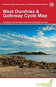
Fietskaart 36 West Dumfries & Galloway Cycle Map Sustrans Pocket Sized | van 9.99 voor 4.99!This is in the series of official pocket sized, folded maps to the National Cycle Network which include clearly mapped on-road and traffic-free paths, easy to read contours and detailed town insets. The series is published by Sustrans. 1:110,000 scale; folded 155mm x 99mm; flat 792mm x 630mm. This area map shows the National Cycle Network and local routes in this area. Schaal: 1:110.000 |
4,99 |

|
Fietskaart 38 Lanarkshire & The Scottish Boders Cycle Map Sustrans Pocket Sized | van 9.99 voor 4.99!This is in the series of official pocket sized, folded maps to the National Cycle Network which include clearly mapped on-road and traffic-free paths, easy to read contours and detailed town insets. The series is published by Sustrans. 1:110,000 scale; folded 155mm x 99mm; flat 792mm x 630mm. Schaal: 1:110.000 |
4,99 |

|
Fietskaart 51 Derry-Londonderry the North west cycle map Cycle Map Sustrans Pocket Sized | van 9.99 voor 4.99!This is in the series of pocket sized, folded maps to the National Cycle Network which include clearly mapped on-road and traffic-free paths, easy to read contours and detailed town insets. Published by Sustrans. 1:110,000 scale; folded 155mm x 99mm; flat 792mm x 630mm.Derry ~ Londonderry & The North West Cycle Map (51). Schaal: 1:110.000 |
4,99 |

|
Fietskaart 52 The Causeway Coast & Glens Cycle Map Sustrans Pocket Sized | van 9.99 voor 4.99!This is in the series of pocket sized, folded maps to the National Cycle Network which include clearly mapped on-road and traffic-free paths, easy to read contours and detailed town insets. Published by Sustrans. 1:110,000 scale; folded 155mm x 99mm; flat 792mm x 630mm.The Causeway Coast & Glens Cycle Map (52). Including Causeway Coast Cycle Route, Lower Bann Cycleway, Loughshore Trail, ecos Cycle Trail and 5 individual day rides. Schaal: 1:110.000 |
4,99 |

