- Gratis verzending vanaf 30 euro
- Levert in Nederland, België etc.
- Meer dan 30.000 titels
- Vakkundige klantenservice
- Snelle levering
- Veilig en eenvoudig betalen

Direct contact?
Bel +31 (0)6 42428571
maandag t/m vrijdag
van 10 tot 17 uur
National Trail
|
Wandelgids Ridgeway Cicerone Guidebooks | From Lyme Regis to HunstantonThis guidebook - which includes both a guide to the route and a separate OS map booklet - describes the Ridgeway National Trail, an 87 mile (139km) route through southern England from Avebury in Wiltshire to Ivinghoe Beacon in Buckinghamshire. Typically walked in 6 or 8 days, this is a low-level waymarked route suitable for all abilities and for year round walking. The guidebook details the trail in both directions, west to east and east to west. Step-by-step route descriptions are accompanied by 1:100,000 OS mapping and a separate OS 1:25,000 map booklet showing the e... |
17,99 |
|
Wandelgids South Downs Way described east–west and west–east | CiceroneGuidebook for walking the South Downs Way long-distance path that leads the walker along the 100 miles (160km) between Eastbourne and Winchester, high on the escarpment, exploring the Sussex Downs and East Hampshire Areas of Outstanding Natural Beauty. Details of the walk split into 12 daily stages, described in both directions. The South Downs Way National Trail is a glorious walk from Eastbourne to Winchester, exploring the Sussex Downs and East Hampshire Areas of Outstanding Natural Beauty. The official South Downs Way leads the walker along the 100 miles (160km) ro... |
24,50 |
|
Wandelgids The Cotswolds Way Cicerone Guidebooks | Two-way trail guide - Chipping Campden to BathGuidebook to walking the 102 mile (163km) Cotswold Way National Trail between Chipping Campden and Bath, across the Cotswolds AONB. The guidebook - which includes both a guide to the route and a separate OS 1:25,000 map booklet - describes the route in both directions. The route is described over 13 stages, each following the Cotswold escarpment, with dramatic and far-reaching views across the Severn Vale towards the Welsh hills, plunging down to visit honey-coloured villages, old market towns and the elegant and historic city of Bath. The longest of the 13 stage... |
23,50 |
|
Wandelgids The Great Glen Way Cicerone Guidebooks | Two Way Trail guide
|
19,99 |
|
Wandelgids The Great Glen Way | Cicerone | Handzaam wandelgidsje, alleen topografische kaarten met de wandelrouteThis booklet of Ordnance Survey 1:25,000 Explorer maps has been designed for convenient use on the trail. It shows the full and up-to-date line of the Way, along with the relevant extract from the OS Explorer map legend. It is conveniently sized for slipping into a jacket pocket or top of a rucksack and comes in a clear PVC sleeve. The companion guidebook The Great Glen Way describes the full route in both directions with lots of other practical and historical information. NOTE: The accompanying guidebook includes a copy of this map booklet. The Great Glen Way is ... Schaal: 1:25.000 |
11,95 Tijdelijk niet leverbaar |
|
Wandelgids The North Downs Way | Cicerone | National trail from Farnham to DoverA guidebook to walking the North Downs Way National Trail, a 130 mile (208km) walk between the high downland of Farnham and the historic city of Dover on the Kent coast, with an optional visit to Canterbury. The route is described in 11 stages, and is fully illustrated with colour photographs and OS map extracts. The North Downs Way is one of the easier national trails with a modest number of steep (but short) ascents and descents and long sections with no noticeable height gain or loss. Several historic sites including Neolithic burial chambers, Roman roads and Norman... |
19,99 Tijdelijk niet leverbaar |
|
Wandelgids The South West Coast Path (Zoutpad) Cicerone Guidebooks | From Minehead to South Haven PointThe South West Coast Path is Britain"s longest way-marked trail, measuring a staggering 1015km (630 miles). Written by the well-known outdoor writer, Paddy Dillon, this guidebook provides lots of information to help tackle this immense National Trail route with confidence. It describes the coastal path from Minehead to Poole. The tradition of walking the coastal route anti-clockwise has arisen because in this direction there are more miles with the wind and weather behind you as you walk, than against you. A full introduction provides the SWCP"s historic... |
21,99 |

|
Wandelgids The Speyside Way Cicerone Guidebooks | With Dava Way and Moray Coast TrailThis guidebook describes the Speyside Way, an official 66 mile (106km) Scottish Long Distance Route which follows the River Spey through northern Scotland from Aviemore to the old port of Buckie on the Moray coast. Featuring easy walking on good paths and along disused railway lines, the route can be comfortably completed in a week and is presented in 10 stages of between 2 and 13 miles (3-21km). The guide also details the recently opened 61/2-mile (10.5km) extension to the Speyside Way between Kincraig and Aviemore as well as two alternatives to the main route and rou... |
22,99 Tijdelijk niet leverbaar |
|
Wandelgids The Thames Path Cicerone Guidebooks | National Trail from London to the river's source in Gloucestershire
|
22,99 |

|
Wandelgids The West Highland Way Cicerone Guidebooks | Milngavie to Fort William. Incl. map booklet 1:25.000A guidebook to Scotland"s West Highland Way, a 95-mile walk from Milngavie near Glasgow to Fort William, passing Loch Lomond, crossing Rannoch Moor and finishing in the shadow of Britain"s highest mountain. The walk, which takes roughly one week to complete, is described in seven stages, with each stage ranging from 8 to 20 miles. The guide details the "classic" south-north direction but also provides a summary description for those wanting to walk the route in the opposite direction. The guidebook, which features step-by-step route descriptio... |
23,95 |
|
Wandelkaartgids South West Coast Path Map Booklet - Minehead to St Ives deel 1(Zoutpad) | CiceroneHandzaam kaartgidsje. Gedetailleerde topografische wandelkaarten gebonden in een handig boekje. Licht voor onderweg. Map of the northern section of the 630 mile (1014km) South West Coast Path National Trail. Covers the trail from Minehead to St Ives along the north Devon and Cornish coastline. This convenient and compact booklet of Ordnance Survey 1:25,000 maps shows the route, providing all of the mapping you need to walk the trail in either direction. Schaal: 1:25.000 |
17,99 Tijdelijk niet leverbaar |

|
Wandelkaartgids South West Coast Path Map Booklet - Plymouth to Poole deel 3 (Zoutpad) | CiceroneHandzaam kaartgidsje. Gedetailleerde topografische wandelkaarten gebonden in een handig boekje. Map of part of the southern section of the 630 mile (1014km) South West Coast Path National Trail. Covers the trail from Plymouth to Poole along the coastline of Devon and Dorset. This convenient and compact booklet of Ordnance Survey 1:25,000 maps shows the route, providing all of the mapping you need to walk the trail in either direction. Schaal: 1:25.000 |
16,99 |
|
Wandelkaartgids South West Coast Path Map Booklet - St Ives to Plymouth deel 2 (Zoutpad) | CiceroneHandzaam kaartgidsje. Gedetailleerde topografische wandelkaarten gebonden in een handig boekje. Licht voor onderweg. Map of part of the southern section of the 630 mile (1014km) South West Coast Path National Trail. Covers the trail from St Ives to Plymouth along the west Cornwall and Devon coastline. This convenient and compact booklet of Ordnance Survey 1:25,000 maps shows the route, providing all of the mapping you need to walk the trail in either direction. Schaal: 1:25.000 |
17,99 |
|
Wandelkaartgids The North Downs Way Booklet | Cicerone | National trail from Farnham to DoverHandzaam kaartgidsje. Gedetailleerde topografische wandelkaarten gebonden in een handig boekje. Licht voor onderweg. Map of the 130 mile (208km) North Downs Way National Trail, between Farnham and Dover, including an optional visit to Canterbury. This booklet is included with the Cicerone guidebook to the trail and shows the full route on OS 1:25,000 maps. One of the easier National Trails, it can be comfortably walked in 11-12 days. Schaal: 1:25.000 |
13,99 Tijdelijk niet leverbaar |
|
Wandelkaartgids The Thames Path Map Booklet | CiceroneHandzaam kaartgidsje. Gedetailleerde topografische wandelkaarten gebonden in een handig boekje. Licht voor onderweg. The River Thames is a constantly changing green corridor. While care must be taken during occasional winter flooding this is an all season walk always offering new rewards and views. Greenwich, Southwark opposite St Paul's Cathedral in central London, Richmond-upon-Thames, Windsor, Henley, Reading, Abingdon, Oxford, Lechlade and Cricklade. The route is described in 20 sections between 4 and 16 miles in length. This is a mainly flat walk with only one... Schaal: 1:25.000 |
17,99 |
|
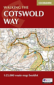
Wandelkaartgids Walking the Cotswold Way | Cicerone | Handzaam wandelgidsje, alleen topografische kaarten met de wandelrouteAll the mapping you need to complete the Cotswold Way National Trail between Chipping Campden and Bath, across the Cotswolds AONB. An accompanying Cicerone guidebook The Cotswold Way‚ - describes the full route in both directions with lots of other practical and historical information. NOTE: The accompanying guidebook includes a copy of this map booklet. Following the Cotswold escarpment, the Cotswold Way provides dramatic and far-reaching views across the Severn Vale towards the Welsh hills, plunging down to visit honey-coloured villages,... Schaal: 1:25.000 |
13,50 |

|
Wandelkaartgids West Highland Way Map Booklet | CiceroneHandzaam kaartgidsje. Gedetailleerde topografische wandelkaarten gebonden in een handig boekje. Licht voor onderweg. This compact booklet of maps shows the full route of the 95 mile West Highland Way Scottish Long Distance Route, via Loch Lomond and Rannoch Moor. This booklet is included with the Cicerone guidebook to the trail, and shows the full route on Ordnance Survey 1:25,000 maps. Milngavie, Drymen, Crianlarich, Tyndrum, Kinlochleven, Fort William. The walking is not difficult for anyone accustomed to regular walks longer than 10 miles, although there is ample sc... Schaal: 1:25.000 |
13,95 |