- Gratis verzending vanaf 30 euro
- Levert in Nederland, België etc.
- Meer dan 30.000 titels
- Vakkundige klantenservice
- Snelle levering
- Veilig en eenvoudig betalen

Direct contact?
Bel +31 (0)6 42428571
maandag t/m vrijdag
van 10 tot 17 uur
MapStudio Regionaal
|
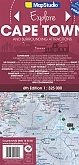
Wegenkaart - Landkaart 1 Kaapstad & omgeving Cape Town | MapStudio | Cape Town Ceres Franschhoek Hermanus Montagu Paarl Robertson Somerset West Stellenbosch Strand Swellendam Tulbagh WellingtonThis detailed map of South Western Cape, Overberg and Winelands is at a 1:325 000 scale. Coverage includes Cape Town, west coast, cape Winelands, Stellenbosch, Franschhoek, Paarl, Wellington, Robertson, Hermanus, Breede River Valley, Overberg, Route 43, Boland, Hex River Valley, Swartland, whale route, Route 62. The street maps at a scale of 1:20 000 include coverage of Stellenbosch, Franschhoek, Paarl, Wellington, Hermanus, Somerset West, Strand, Montagu, Robertson, Worcester, Ceres, Tulbagh and Cape Town CBD. The map is perfect for scenic drives within the region. It... Schaal: 1:325.000 |
16,50 |
|
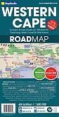
Wegenkaart - Landkaart 10 Western Cape Westkaap | MapStudioRoad map of the Western Cape Province with an enlargement for the Cape Peninsula and 27 street plans of the central areas in main towns. The map is annotated numerous places of interest, vineyards, etc. GPS coordinates are provides for main road junctions. The map is double-sided, dividing the province east/west, and shows its road and rail networks. Unsurfaced minor roads and selected 4WD tracks are included and GPS coordinates are provided for over 150 road junctions. Railways are shown with stations. Numerous places of interest are highlighted, including wineries, h... Schaal: 1:500.000 |
16,50 |
|
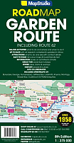
Wegenkaart - Landkaart 2 Garden Route & Route 62 | MapStudioGarden Route on a double-sided map from Map Studio with coverage including an alternative route R62 further inland and GPS waypoints for main locations or road junctions. Numerous street maps, annotated with accommodation and tourist facilities, are provided for main towns. The map presents the route on a plain base with topographic information limited to rivers and colouring for nature reserves and other protected areas. Road network distinguishes between surfaced and untarred roads, shows distances on main routes and is annotated with GPS waypoints for important junc... Schaal: 1:375.000 |
16,50 |
|
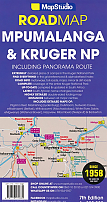
Wegenkaart - Landkaart 4 Mpumalanga, Kruger National Park & Panorama Route | MapStudio
Schaal: 1:200.000 |
16,50 |
|
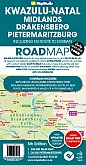
Wegenkaart - Landkaart 5 Kwazulu-Natal | MapStudioThis revised road map includes GPS co-ordinates and useful tourism contact details. The map features information boxes on activities and places of interest and lists what to see and do. It has easy-to-read full colour maps and text, detailed map of Pietermaritzburg with street index, place names index for main map. Coverage: KwaZulu-Natal, Pietermaritzburg, Drakensberg, Midlands, Battle sites, Route 617 & Bushman's River Region and N3 route from Harrismith to Durban. Schaal: 1:250.000 |
16,50 |
|
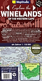
Wegenkaart - Landkaart 7 Winelands of the Western Cape | MapStudioMaps van onder andere the Breede River Valley, Greater Cape Town, Tulbagh, Swartland, Olifants River Valley and the Little Karoo, Wellingtonm, Paarl, Stellenbosch. A selection of road maps of five wine regions, with additional street plans and site maps of selected locations. The principal map at 1:130,000 covers Cape Town and the peninsula, Stellenbosch, Franschhoek, Paarl, Somerset West, Wellington and Worcester. The road detail shows primarily the major routes but includes minor roads in the vicinity of wine-related locations. Colours distinguish highlands, parks or... Schaal: 1:130.000 |
16,50 |