- Gratis verzending vanaf 30 euro
- Levert in Nederland, België etc.
- Meer dan 30.000 titels
- Vakkundige klantenservice
- Snelle levering
- Veilig en eenvoudig betalen

Direct contact?
Bel +31 (0)6 42428571
maandag t/m vrijdag
van 10 tot 17 uur
Topografische Wandelkaart 245 The National Forest Burton upon Trent, Swadlincote, Ashby-de-la-Zouch & Coalville - Explorer Map
Wandelkaart & Fietskaart | Ordnance Survey (OS) Groot-Brittannië

Deze gedetailleerde en informatieve topografische kaart (stafkaart, schaal 1:25.000) van Groot-Brittannië bevat alle topografische elementen van het landschap en geeft daarmee een nauwkeurig beeld van het terrein. Daarnaast heeft Ordnance Survey (OS) ook toeristische informatie op de meeste kaart verwerkt, zoals de aanduiding voor campings en ingetekende wandelpaden . Deze kaart is ideaal voor wandelaars of fietsers, maar ook voor de scouting of sportverenigingen die activiteiten in Groot-Brittannië gaan uitvoeren. De kaarten zijn voorzien van een GPS aanduiding en een duidelijke legenda. Map sheet number 245 in the OS Explorer series covers The National Forest in the Midlands of England. The Ivanhoe Way is a circular walk that takes in a large section of the National Forest, and other walks in the area include the Leicestershire Round and The Way for the Millennium, taking in the towns of Burton upon Trent, Swadlincote, Ashby-de-la-Zouch and Coalville.
Schaal: 1:25.000
EAN: 9780319263525
Auteur(s): Algemeen
Uitgeverij: Ordnance Survey (UK)
Serie: Explorer Map Midden-Engeland
Meest recente editie


EAN: 9780319263525
Auteur(s): Algemeen
Uitgeverij: Ordnance Survey (UK)
direct leverbaar
18,99
Verder in deze serie

- Topografische Wandelkaart 190 Malvern Hills / Bredon Hill Tewkesbury, Ledbury, Pershore & Upton upon Severn - Explorer Map
- Topografische Wandelkaart 191 Banbury / Bicester / Chipping Norton Brackley - Explorer Map
- Topografische Wandelkaart 192 Buckingham / Milton Keynes Leighton Buzzard & Woburn - Explorer Map
- Topografische Wandelkaart 193 Luton / Stevenage Hitchin & Ampthill - Explorer Map
- Topografische Wandelkaart 194 Hertford / Bishop's Stortford Buntingford & Clavering - Explorer Map
- Topografische Wandelkaart 204 Worcester / Droitwich Spa - Explorer Map
- Topografische Wandelkaart 205 Stratford-upon-Avon / Evesham Alcester - Explorer Map
- Topografische Wandelkaart 206 Edge Hill / Fenny Compton Badby, Kineton & Middle Tysoe - Explorer Map
- Topografische Wandelkaart 207 Newport Pagnell / Northampton South Towcester & Olney - Explorer Map
- Topografische Wandelkaart 208 Bedford / St Neots Sandy & Biggleswade - Explorer Map
- Topografische Wandelkaart 209 Cambridge Royston, Duxford & Linton - Explorer Map
- Topografische Wandelkaart 218 Kidderminster / Wyre Forest Bridgnorth - Explorer Map
- Topografische Wandelkaart 219 Wolverhampton / Dudley Stourbridge & Kidderminster - Explorer Map
- Topografische Wandelkaart 220 Birmingham Walsall, Solihull & Redditch - Explorer Map
- Topografische Wandelkaart 221 Coventry / Warwick Royal Leamington Spa & Kenilworth - Explorer Map
- Topografische Wandelkaart 222 Rugby / Daventry Southam & Lutterworth - Explorer Map
- Topografische Wandelkaart 223 Northampton / Market Harborough Brixworth & Pitsford Water - Explorer Map
- Topografische Wandelkaart 224 Corby/ Kettering / Wellingborough Rockingham Forest - Explorer Map
- Topografische Wandelkaart 225 Huntingdon / St Ives Grafham Water - Explorer Map
- Topografische Wandelkaart 227 Peterborough /March / Whittlesey / Chatteris /Oundle March, Whittlesey, Chatteris - Explorer Map
- Topografische Wandelkaart 232 Nuneaton / Tamworth Lichfield & Atherstone - Explorer Map
- Topografische Wandelkaart 233 Leicester / Hinckley - Explorer Map
- Topografische Wandelkaart 234 Rutland Water / Stamford / Oakham - Explorer Map
- Topografische Wandelkaart 235 Wisbech / Peterborough North / Market Deeping & Crowland - Explorer Map
- Topografische Wandelkaart 242 Telford / Ironbridge / the Wrekin - Explorer Map
- Topografische Wandelkaart 243 Market Drayton Loggerheads & Eccleshall - Explorer Map
- Topografische Wandelkaart 244 Cannock Chase / Chasewater Stafford, Rugeley & Cannock - Explorer Map
- Topografische Wandelkaart 246 Loughborough Melton Mowbray & Syston - Explorer Map
- Topografische Wandelkaart 247 Grantham Bottesford & Colsterworth - Explorer Map
- Topografische Wandelkaart 248 Bourne / Heckington Billingborough & Morton - Explorer Map
- Topografische Wandelkaart 249 Spalding / Holbeach Long Sutton & Kirton - Explorer Map
- Topografische Wandelkaart 258 Stoke-on-Trent / Newcastle-under-Lyme Biddulph & Stone - Explorer Map
- Topografische Wandelkaart 259 Derby / Utoxeter Uttoxeter, Ashbourne & Cheadle - Explorer Map
- Topografische Wandelkaart 260 Nottingham / Vale of Belvoir - Explorer Map
- Topografische Wandelkaart 261Boston Tattershall, Billinghay & Heckington - Explorer Map
- Topografische Wandelkaart 268 Wilmslow / Macclesfield / Congleton Altrincham, Knutsford & Sandbach - Explorer Map
- Topografische Wandelkaart 269 Chesterfield / Alfreton Sutton in Ashfield & Bolsover - Explorer Map
- Topografische Wandelkaart 270 Sherwood Forest Mansfield, Worksop & Edwinstowe - Explorer Map
- Topografische Wandelkaart 271 Newark-on-Trent Retford, Southwell & Saxilby - Explorer Map
- Topografische Wandelkaart 272 Lincoln Sleaford, Metheringham & Navenby - Explorer Map
- Topografische Wandelkaart 273 Lincolnshire Wolds South Horncastle & Woodhall Spa - Explorer Map
- Topografische Wandelkaart 274 Skegness / Alford / Spilsby Chapel St Leonards & Wainfleet All Saints - Explorer Map
- Topografische Wandelkaart OL1 van Groot-Brittannië (1:25.000) Peak District - Dark Peak area - Explorer Map OL 1
- Topografische Wandelkaart OL24 van Groot-Brittannië (1:25.000) Peak District - White Peak area - Explorer Map OL 24
Meer producten die interessant kunnen zijn

Topografische Wandelkaart 139 Birmingham / Wolverhampton - Landranger Map
Wandelkaart & Fietskaart | Ordnance Survey (OS) Groot-Brittannië
€ 18,99

Topografische Wandelkaart 150 Worcester / The Malverns Evesham & Tewkesbury - Landranger Map
Wandelkaart & Fietskaart | Ordnance Survey (OS) Groot-Brittannië
€ 18,99
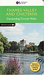
Wandelgids 25 Thames Valley and Chilterns Pathfinder Guide
Pathfinder Guide 25 | Met Ordanance Survey kaarten
€ 17,99

Wandelgids 252 Engeland Mitte | Rother Bergverlag
Im herzen von den Cotswols zum Peak District 52 wandelingen
€ 14,90