- Gratis verzending vanaf 30 euro
- Levert in Nederland, België etc.
- Meer dan 30.000 titels
- Vakkundige klantenservice
- Snelle levering
- Veilig en eenvoudig betalen

Direct contact?
Bel +31 (0)6 42428571
maandag t/m vrijdag
van 10 tot 17 uur
Wandelkaart Dark Peak - Mountain Map | Harvey Maps
Water- en scheurvaste wandelkaart

De Harvey Map is de wandelkaart voor het wandelen in de mooiste natuurgebieden in het Groot-Brittannië. Duidelijke topografische wandelkaarten met praktische informatie van de route zoals overnachtingsmogelijkheden, eetgelegenheden en bezienswaardigheden. Deze wandelkaart is scheur- en watervast. Met GPS compatible (UTM-Grid). Covering the popular highpoints of the Dark Peak. Printed on polyethylene - durable, tear-resistant and 100% waterproof. Made in cooperation with the British Mountaineering Council, colour shading for easy identification of hills and valleys. Less than half the weight of a laminated map, detailed 1:20,000 enlargements of the Kinder plateau. Geological map the Dark Peak supplied by the British Geological Survey. Mountain incident and first aid advice, tips on using your map and compass. Useful local phone numbers and websites.
Schaal: 1:40.000
Engelstalig


Op voorraad
Overmorgen in huis (Nederland)
- Vakkundige klantenservice
- Groot assortiment
- Gratis retourneren binnen 14 dagen
- Aangesloten bij WebwinkelKEUR
€ 28,99
Meer producten die interessant kunnen zijn
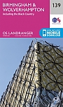
Topografische Wandelkaart 139 Birmingham / Wolverhampton - Landranger Map
Wandelkaart & Fietskaart | Ordnance Survey (OS) Groot-Brittannië
€ 18,99
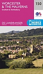
Topografische Wandelkaart 150 Worcester / The Malverns Evesham & Tewkesbury - Landranger Map
Wandelkaart & Fietskaart | Ordnance Survey (OS) Groot-Brittannië
€ 18,99
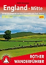
Wandelgids 252 Engeland Mitte | Rother Bergverlag
Im herzen von den Cotswols zum Peak District 52 wandelingen
€ 14,90