- Gratis verzending vanaf 30 euro
- Levert in Nederland, België etc.
- Meer dan 30.000 titels
- Vakkundige klantenservice
- Snelle levering
- Veilig en eenvoudig betalen

Direct contact?
Bel +31 (0)6 42428571
maandag t/m vrijdag
van 10 tot 17 uur
Historische kaart van Oostenrijk en Hongarije (Monarchiekaart 1890) - Freytag & Berndt
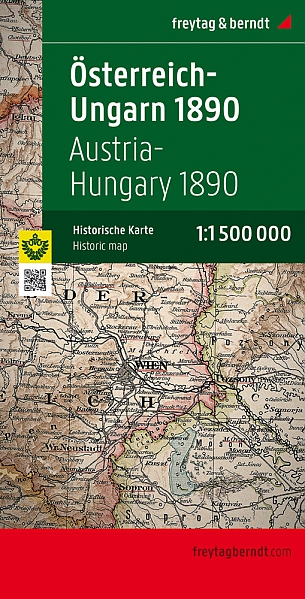
This is a facsimile of the official map of the Empire created by then crown cartographer Gustav Freytag at scale 1:1,500,000. The map shows internal administrative units within the Dual Monarchy, from Bohemia, Moravia, Silesia and Galicia in the north to Bosnia and Herzegovina in the south, with coverage including the neighbouring areas of the Balkans. It shows railway lines. Skillfully executed hachures present the relief, with plenty of names of geographical features. Reprinted by Freytag & Berndt in 2009. Size 87 x 67cm, 34 x 28,5 in., supplied folded, hard covered.
Schaal: 1:1.5Miljoen


Op voorraad
Vóór 17 uur besteld, morgen in huis (Nederland)
- Vakkundige klantenservice
- Groot assortiment
- Gratis retourneren binnen 14 dagen
- Aangesloten bij WebwinkelKEUR
€ 13,90
Meer producten die interessant kunnen zijn
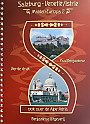
Fietsgids Onbegrensd fietsen van Salzburg naar Venetië / Istrië + Alpe-Adria | Benjaminse Uitgeverij
Met Spiraalbinding. 500 kilometer.
€ 23,50
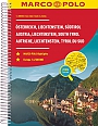
Wegenatlas Oostenrijk Österreich, Liechtenstein, Südtirol | Marco Polo Reiseatlas
A4 Formaat spiraalbinding
€ 16,50
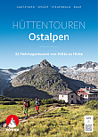
Wandelgids Huttentrekking Ostalpen Rother Wanderführer | Rother Bergverlag
32 Mehrtagestouren von Hütte zu Hütte
€ 26,90

Wandelgids Hochtouren In Ostalpen Rother Wanderführer | Rother Bergverlag
100 Fels- und Eistouren zwischen Bernina und Tauern
€ 29,99

Wegenatlas Oostenrijk Österreich Supertouring met spiraalverbinding | Freytag & Berndt
Formaat 17 x 26 cm
€ 21,99
Tijdelijk niet leverbaar