- Gratis verzending vanaf 30 euro
- Levert in Nederland, België etc.
- Meer dan 30.000 titels
- Vakkundige klantenservice
- Snelle levering
- Veilig en eenvoudig betalen

Direct contact?
Bel +31 (0)6 42428571
maandag t/m vrijdag
van 10 tot 17 uur
Wandelgids 50 Walks in Sussex and South Downs | AA Publishing

Overzichtelijke wandelgids met duidelijke beschrijvingen en wandelkaarten. Wandeltochten van 5 tot 13 kilometer. A variety of mostly mapped walks to suit both the casual walker and the more serious hiker are contained in this illustrated guide. Detailed maps include information on the route - scenery, distance, terrain, places of interest - together with dog-friendly walks. Special features include: an introductory location map indicating the starting point of every walk; a summary of distance, time, gradient, level of difficulty, type of surface and access, landscape, dog friendliness, parking and public toilets; places to visit along the way; refreshment information; and a "what to look for" panel featuring more specific detail of urban and industrial heritage, flora and fauna. Savour the Sussex countryside with the help of this slim-line pocket-sized walking guide. The guide offers over 50 walks, Rye and the coast, Ditchling Beacon, Amberly and Chichester Town Trail. A lively introduction to the county sets the scene
Engelstalig
EAN: 9780749583293
Uitgeverij: AA Publishing
Verschijningsdatum: 2023
Meest recente editie
Engelstalig
178 pagina's


(Tijdelijk) niet leverbaar
- Vakkundige klantenservice
- Groot assortiment
- Gratis retourneren binnen 14 dagen
- Aangesloten bij WebwinkelKEUR
Meer producten die interessant kunnen zijn
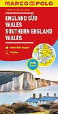
Wegenkaart - Landkaart Zuid-Engeland Wales - World Mapping Project (Reise Know-How)
Water- en scheurvaste wegenkaart
€ 11,25
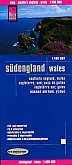
Wandelkaart South Downs Way - National Trail Maps | Harvey Maps
Water- en scheurvaste wandelkaart
€ 25,99