- Gratis verzending vanaf 30 euro
- Levert in Nederland, België etc.
- Meer dan 30.000 titels
- Vakkundige klantenservice
- Snelle levering
- Veilig en eenvoudig betalen

Direct contact?
Bel +31 (0)6 42428571
maandag t/m vrijdag
van 10 tot 17 uur
Wandelgids Tour of the Lake District Cicerone Guidebooks

Designed as a scenic tour of the Lake District, this seven day circular route (93 miles) is primarily one of valleys and passes, rather than a tick list of peaks attained. The route starts at the railway terminus at Windermere village. Quickly leaving the crowds behind, it passes through Ambleside, the Langdale valley, Coniston, Dunnerdale, Eskdale, Wasdale, Ennerdale, Buttermere, Newlands Valley, Keswick, Borrowdale, Grasmere then Ullswater, before returning back to Windermere via the Troutbeck valley.
With a flavour of each of the main Lakeland valleys, and time to stop and wonder at their charms, the walk described in this book leads quickly away from the busy tourist centres to the quiet pleasures of the fell country. The shepherds and drovers chose their paths well, logical links from one valley to the next, and many of these ancient ways have been chosen for this walk. All footpaths and bridleways used are on established rights of way. Full route description with OS maps High level alternatives given, including options for Coniston Old Man, Scafell Pike and Helvellyn. Nine short walks from the overnight stops Information on accommodation, facilities and transport for each day stage
Â
Engelstalig
EAN: 9781852844967
Auteur(s): Jim ried
Uitgeverij: Cicerone Press
Verschijningsdatum: 2017
Meest recente editie
Engelstalig

Tijdelijk niet leverbaar
- Vakkundige klantenservice
- Groot assortiment
- Gratis retourneren binnen 14 dagen
- Aangesloten bij WebwinkelKEUR
Tijdelijk niet leverbaar
Meer producten die interessant kunnen zijn
Reisgidsen Lake District / Yorkshire Dales


Wandelkaarten Lake District / Yorkshire Dales
Topografische kaarten Lake District / Yorkshire Dales
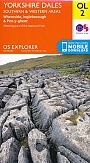
Topografische Wandelkaart OL2 van Groot-Brittannië (1:25.000) Yorkshire Dales - Southern & Western areas - Explorer Map OL 2
Wandelkaart | Ordnance Survey (OS) Groot-Brittannië
€ 18,99
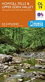
Topografische Wandelkaart OL19 van Groot-Brittannië (1:25.000) Howgill Fells / Upper Eden Valley - Explorer Map OL 19
Wandelkaart | Ordnance Survey (OS) Groot-Brittannië
€ 18,99
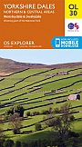
Topografische Wandelkaart OL30 van Groot-Brittannië (1:25.000) Yorkshire Dales - Northern & Central areas - Explorer Map OL 30
Wandelkaart | Ordnance Survey (OS) Groot-Brittannië
€ 18,99
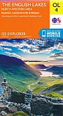
Topografische Wandelkaart OL4 van Groot-Brittannië (1:25.000) English Lakes - North Western area - Explorer Map OL 4
Wandelkaart | Ordnance Survey (OS) Groot-Brittannië
€ 18,99