- Gratis verzending vanaf 30 euro
- Levert in Nederland, België etc.
- Meer dan 30.000 titels
- Vakkundige klantenservice
- Snelle levering
- Veilig en eenvoudig betalen

Direct contact?
Bel +31 (0)6 42428571
maandag t/m vrijdag
van 10 tot 17 uur
Wandelgids Walking in the Cotswolds | Cicerone guides
30 rondwandelingen

A guidebook to 30 circular walks in the Cotswolds, the largest Area of Outstanding Natural Beauty in England. Ranging from 4 to 12 miles in length, the routes are graded from easy to strenuous, offering something for every walker. Fourteen of the routes described include sections of the Cotswold Way National Trail, a 102-mile walk that winds its way from Chipping Campden to Bath. Step-by-step route descriptions are accompanied by 1:50,000 mapping. There is plenty of information on the many points of interest passed en route, including Roman ruins, ancient stone circles, Neolithic long barrows and historic villages. Also included is a useful route table summary, information on accommodation, and details on the region"s geology, landscape, plants and wildlife. Covering 790 square miles, the Cotswolds is home to lush green hills, picturesque valleys and beautiful beech woodlands. The impressive Edge a remarkable limestone escarpment offers ethereal views across the Vales of the Severn, Berkeley and Gloucester to the Malverns and the distant mountains of Wales.
Engelstalig
EAN: 9781852848330
Uitgeverij: Cicerone Press
Verschijningsdatum: 2019
Meest recente editie
Engelstalig
176 pagina's


Op voorraad
Vóór 17 uur besteld, morgen in huis (Nederland)
- Vakkundige klantenservice
- Groot assortiment
- Gratis retourneren binnen 14 dagen
- Aangesloten bij WebwinkelKEUR
€ 16,99
Meer producten die interessant kunnen zijn
Reisgidsen Cotswolds
Wandelkaarten Cotswolds
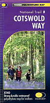
Wandelkaart Cotswold Way - National Trail Maps | Harvey Maps
Water- en scheurvaste wandelkaart
€ 25,99
Topografische kaarten Cotswolds

Topografische Wandelkaart OL45 van Groot-Brittannië (1:25.000) The Cotswolds - Explorer Map OL 45
Wandelkaart | Ordnance Survey (OS) Groot-Brittannië
€ 18,99
Fietsgidsen Cotswolds
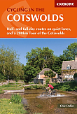
Fietsgids Cotswold Cycling in the Cotswolds | Cicerone
Half- and full day routes and a 200 km tour of the Cotswolds
€ 17,99
Wegenkaarten Cotswolds

Stedengidsen Cotswolds