- Gratis verzending vanaf 30 euro
- Levert in Nederland, België etc.
- Meer dan 30.000 titels
- Vakkundige klantenservice
- Snelle levering
- Veilig en eenvoudig betalen

Direct contact?
Bel +31 (0)6 42428571
maandag t/m vrijdag
van 10 tot 17 uur
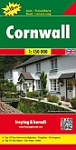
Fietskaart Cornwall | Goldeneye
Water- en scheurvaste fietskaart

Explore Cornwall by bike with this laminated, waterproof Cornwall map. With 21 circular, clearly-marked routes this easy-to-use map will help you discover the best of Cornwall along the quietest country lanes. Cornwall has something for everyone regardless of the bike you ride or your level of fitness.
From the breath-taking moors and rolling hills to the picturesque coastal roads, these long, winding lanes connect beautiful villages with excellent pubs and friendly tearooms. Our Cornwall Cycling Country Lanes map includes:* Traffic-free family cycling trails - including the Camel Trail, Bugle to Eden Project, Cardinham Woods and Lanhydrock Estate with recommendations on where to park. * National Cycle Network routes - the linked series of traffic-free paths and traffic-calmed roads being developed across the UK.
* Our personal favourites - we've explored every corner of this glorious county to bring you the best circular routes to make the most of your weekend whether you fancy a lazy meander or a full-on tour. * New route included - we've included a new, inset map which shows you the route along the Mineral Tramways and Mining Trails near Redruth and Cambourne. These beautiful routes are all clearly marked on the map and designed to follow the quietest country lanes and to introduce you to the very best of Cornwall.
Schaal: 1:126.720
Engelstalig
EAN: 9781859652725
Uitgeverij: GoldenEye Publishing
Serie: Fietskaart GoldenEye Publishing
Meest recente editie
Engelstalig

(Tijdelijk) niet leverbaar
- Vakkundige klantenservice
- Groot assortiment
- Gratis retourneren binnen 14 dagen
- Aangesloten bij WebwinkelKEUR
Verder in deze serie
- Fietskaart Costwolds mapguide | Goldeneye
- Fietskaart Dartmoor / South Devon cycling map | Goldeneye
- Fietskaart Exmoor / North Devon cycling map | Goldeneye
- Fietskaart Kent cycling map | Goldeneye
- Fietskaart Lake District cycling map | Goldeneye
- Fietskaart Norfolk cycling map | Goldeneye
- Fietskaart North York Moors cycling map | Goldeneye
- Fietskaart Peak District cycling map | Goldeneye
- Fietskaart Pembrokeshire West Wales cycling map | Goldeneye
- Fietskaart Snowdonia & Anglesey cycling map | Goldeneye
- Fietskaart Suffolk cycling map | Goldeneye
- Fietskaart Sussex South Surrey cycling map | Goldeneye
- Fietskaart Yorkshire Dales cycling map | Goldeneye
Meer producten die interessant kunnen zijn
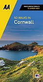
Wandelgidsen Devon / Cornwall
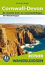
Wandelgids Cornwall Devon Rother Wandelgids
50 Wandelingen | De mooiste kust- en veenwandelingen
€ 18,99
Tijdelijk niet leverbaar
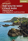
Wandelgids The South West Coast Path (Zoutpad) Cicerone Guidebooks
From Minehead to South Haven Point
€ 21,99
Reisgidsen Devon / Cornwall
Reisgids Slow Devon South & Dartmoor Bradt Travel Guide
Local, Characterful Guides To Britain's Special Places
€ 16,99
Tijdelijk niet leverbaar
Topografische kaarten Devon / Cornwall
Topografische Wandelkaart OL28 van Groot-Brittannië (1:25.000) Dartmoor - Explorer Map OL 28
Wandelkaart | Ordnance Survey (OS) Groot-Brittannië
€ 18,99
Topografische Wandelkaart 102 Land's End - Explorer Map
Wandelkaart & Fietskaart | Ordnance Survey (OS) Groot-Brittannië
€ 18,99
Topografische Wandelkaart 204 Truro / Falmouth Roseland Peninsula - Landranger Map
Wandelkaart & Fietskaart | Ordnance Survey (OS) Groot-Brittannië
€ 18,99
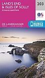
Topografische Wandelkaart 203 Land's End / Isles of Scilly St Ives & Lizard Point - Landranger Map
Wandelkaart & Fietskaart | Ordnance Survey (OS) Groot-Brittannië
€ 18,99
Wegenkaarten Devon / Cornwall
Wandelkaarten Devon / Cornwall
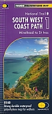
Wandelkaart South West Coast Path 1 Minehead to St Ives - National Trail Maps (Zoutpad) | Harvey Maps
Water- en scheurvaste wandelkaart
€ 25,99
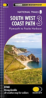
Wandelkaart South West Coast Path 3 Plymouth to Poole Harbour - National Trail Maps (Zoutpad) | Harvey Maps
Water- en scheurvaste wandelkaart
€ 25,99