- Gratis verzending vanaf 30 euro
- Levert in Nederland, België etc.
- Meer dan 30.000 titels
- Vakkundige klantenservice
- Snelle levering
- Veilig en eenvoudig betalen

Direct contact?
Bel +31 (0)6 42428571
maandag t/m vrijdag
van 10 tot 17 uur
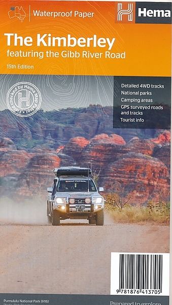
Wegenkaart - Landkaart Kimberley (Gibb River Road) - Hema Maps
Water- en scheurvaste wegenkaart
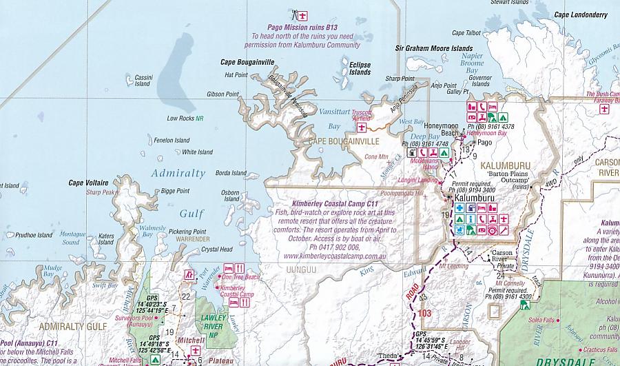
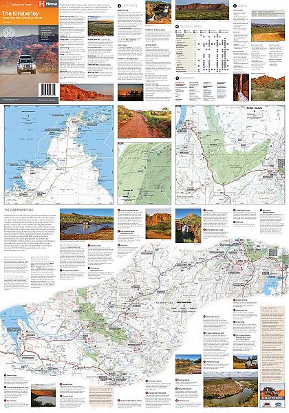
Hema Maps, een uitgever uit Australië, maakt fantastische kaarten welke zich kenmerken door het overzichtelijke en rustige karakter. Op de meeste kaarten zijn de dorpen en steden duidelijk aangegeven, inclusief de additionele informatie voor onderweg. Hierbij kun je denken aan een afstandstabel, tankstations, campsites, wegtype, tolwegen, regionale verbindingswegen rondom de steden, spoorwegen en andere belangrijke orientatiepunten. Daarnaast staan op de meeste kaarten ook toeristische bezienswaardigheden aangegeven, zoals natuurparken, natuurfenomen, musea, monumenten, opgravingen enzovoorts. Thoroughly field-checked using Hema's GPS Mapping System, The Kimberley map clearly differentiates between roads and tracks and shows all road distances, points of interest, and facilities. The reverse side comes alive with photos capturing the essence of this rugged landscape. The text is packed with historic, cultural and tourist information on the Kimberley Region. Detailed, indexed road map of the Kimberley area in the northern part of Western Australia. Cartography is similar to Hema’s excellent coverage of Australia’s interior in the “Great Desert Tracks” series: road information distinguishes between tracks plotted by the publishers themselves with GPS and those complied from the country’s topographic survey data. Topography is shown by relief shading, with colours and graphics indicating various types of terrain and highlighting national parks, protected areas, aboriginal lands, etc. A wide range of symbols highlight roadside facilities including accommodation, campsites, different types of fuels supplies, general stores and meals, medical facilities, etc. Latitude and longitude lines are drawn at 30’ intervals with ticks in steps of 5', full coordinates are given in the index, and GPS waypoints are marked for selected places. On the reverse, an enlargement at 1:900,000 shows the Gibb River Road in more detail with descriptions of 32 places of interest along it. The map also includes general notes and advice on places of interest and tourist information sources, lists of contact addresses, a table of facilities in the national parks, and distance tables.
Schaal: 1:1 Miljoen
Engelstalig
EAN: 9781876413705
Auteur(s): Algemeen
Uitgeverij: Hema Maps Australia
Meest recente editie
Engelstalig
Op voorraad
Levertijd 4 dagen (Nederland)
- Vakkundige klantenservice
- Groot assortiment
- Gratis retourneren binnen 14 dagen
- Aangesloten bij WebwinkelKEUR
€ 15,50