- Gratis verzending vanaf 30 euro
- Levert in Nederland, België etc.
- Meer dan 30.000 titels
- Vakkundige klantenservice
- Snelle levering
- Veilig en eenvoudig betalen

Direct contact?
Bel +31 (0)6 42428571
maandag t/m vrijdag
van 10 tot 17 uur
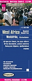
Wegenatlas Africa West Route: Tangier - Cape Town via Senegal Atlas - ITMB Map
A5 Formaat geniet
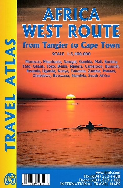
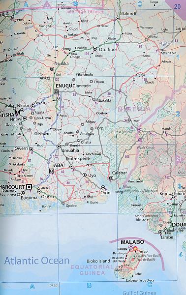
De ITMB wegatlassen kenmerken zich door een kleurrijke en volle cartografische weergave. De wegenatlas bevat degelijke kaarten, zeker voor gebieden waarvoor kaarten lastig te krijgen zijn, met aanduidingen van onder andere nationale parken en natuurgebieden, vliegvelden, toeristische bezienswaardigheden en een goede aanduiding van het wegennet. Daarnaast bevat de wegenatlas ook stadsplattegronden van de hoofdstad en andere belangrijke centra. Bevat voor sommige landen ook aanduidingen in de orginele taal. A5 Formaat geniet. There are three routes one can follow on an overland expedition from Europe to Cape Town (or the reverse). Last year, ITMB published the eastern route, via Cairo and Sudan to Ethiopia and Kenya. This year, we are pleased to announce the publication of a more practical route to follow, via Tangier, Morocco, Mauritania, Senegal, Mali and Ghana, through the Congo to Uganda, and then south over a variety of options to Namibia and South Africa. The advantage of this route is that it avoids the conflict-ridden countries closest to infection from the extremist Islam movement. It also avoids the current difficulties of the central route through Algeria (the Hoggar route) and Niger. We do have to caution that all routes through Africa contain risks. Routes are not well-developed and are subject to disruption; also, by the nature of extremist Islam, those countries with a sizeable Muslim population tend to be under threat, although at this time the route should be considered safer than the other two routes. Having used this route myself many years ago, I can attest to its attractiveness. Crossing the Sahara is challenging, due to shifting sand dunes, but the new coastal highway through Morocco and Mauritania makes reaching Senegal much easier than previously. Crossing the Congo also remains a challenge, due to poor infrastructure, but once one reaches Uganda several options are available for southward travel. As we focused on the eastern routes in our first volume (Africa Overland), in this volume we provide more westerly routes. We have chosen to ignore Angola for now, due to lack of knowledge of travel conditions in that country, but we know of no reason for travellers to avoid that country. In addition to providing route maps through all the countries involved (shown on the back cover of the book), 43 full-page maps of cities along the route are included, such as Casablanca, Nouakchott, Banjul, Bobo Diolasso, Lome, Douala, Kigali, Abuja, Livingstone and other cities never before included in a travel atlas of Africa. Legend Includes: Roads by classification, UNESCO World Heritage, National Parks, Hotels, Point of interest, Airports, Tourist information, Hospitals, Shopping centre, Lake, River, Golf course, museums, and much more.
Schaal: 1:3.4 Miljoen
Engelstalig
EAN: 9781771290111
Uitgeverij: ITMB (International Tavel Maps & Books)
Meest recente editie
Engelstalig

Op voorraad
Overmorgen in huis (Nederland)
- Vakkundige klantenservice
- Groot assortiment
- Gratis retourneren binnen 14 dagen
- Aangesloten bij WebwinkelKEUR
€ 16,50
Meer producten die interessant kunnen zijn
Wegenkaarten West-Afrika
Wegenkaart - Landkaart Westafrika Sahellanden - World Mapping Project (Reise Know-How)
Mauretanië, Mali, Niger
€ 11,25
Tijdelijk niet leverbaar
Wegenkaart - Landkaart Westafrika Kustlanden - World Mapping Project (Reise Know-How)
Water- en scheurvaste wegenkaart
€ 11,25