- Gratis verzending vanaf 30 euro
- Levert in Nederland, België etc.
- Meer dan 30.000 titels
- Vakkundige klantenservice
- Snelle levering
- Veilig en eenvoudig betalen

Direct contact?
Bel +31 (0)6 42428571
maandag t/m vrijdag
van 10 tot 17 uur
Wandelgids Arran Coastal Way Rucksack Readers

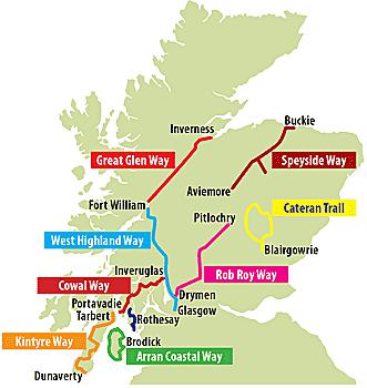
Deze gids heeft een goede beschrijving van de lange afstands route met overzichtelijke kaarten doch zonder veel detail. De kracht van de Rucksack Readers is de uitgebreide achtergrondinformatie over de flora, fauna en geologische verschijnselen. Dit alles rijkelijk omkleed met kleurrijke foto's en praktische tips. The Arran Coastal Way is perhaps Scotland's finest circular long-distance trail, running 65 miles (105 km) around the Isle of Arran in a memorable week-long hike from Brodick. It's accessible from near Glasgow by the Ardrossan ferry. Famous as`Scotland in miniature', Arran is rich in scenery, castles, caves and standing stones. The walking is varied, from mountain paths to deserted beaches, from minor road-walking to boulder-hopping, and in places it is refreshingly rugged. Arran's wildlife is uniquely approachable, and its residents welcoming. Our second edition was thoroughly updated during 2017 with many route changes and extra options. This guidebook contains all you need to plan and enjoy the Arran Coastal Way, including: detailed description of the route walked anticlockwise, updated for 2021
background on geology, pre-history and history
whisky-making, wildlife and habitats
boat trip to the Holy Isle
Foreword by wilderness walker Cameron McNeish
clear mapping of the entire route (1:55,000)
information about public transport and travel
lavishly illustrated, with 125 colour photographs
on rainproof paper.
Engelstalig
EAN: 9781913817022
Uitgeverij: Rucksack Readers
Serie: Rucksack Readers Schot
Verschijningsdatum: 2021
Meest recente editie
Engelstalig
80 pagina's

Op voorraad
Overmorgen in huis (Nederland)
- Vakkundige klantenservice
- Groot assortiment
- Gratis retourneren binnen 14 dagen
- Aangesloten bij WebwinkelKEUR
€ 21,50
Verder in deze serie

- Wandelgids Borders Abbeys Way Rucksack Readers
- Wandelgids Cateran Trail Rucksack Readers
- Wandelgids Fife Coastal Path Trail Rucksack Readers
- Wandelgids Great Glen Way Rucksack Readers
- Wandelgids John Muir Trail Rucksack Readers
- Wandelgids Kintyre Way Rucksack Readers
- Wandelgids Rob Roy Way Rucksack Readers
- Wandelgids St Cuthbert's Way Rucksack Readers
- Wandelgids West Highland Way Rucksack Readers
Meer producten die interessant kunnen zijn
Topografische kaarten Zuid-Schotland
Topografische Wandelkaart OL37 van Groot-Brittannië (1:25.000) Cowal East / Dunoon & Iverary - Explorer Map OL 37
Wandelkaart | Ordnance Survey (OS) Groot-Brittannië
€ 18,99
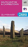
Topografische Wandelkaart 68 South Kintyre / Campbeltown - Landranger Map
Wandelkaart & Fietskaart | Ordnance Survey (OS) Groot-Brittannië
€ 18,99
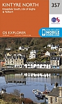
Topografische Wandelkaart 357 Kintyre North Knapdale South & Isle of Gigha Tarbert - Explorer Map
Wandelkaart & Fietskaart | Ordnance Survey (OS) Groot-Brittannië
€ 18,99
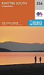
Topografische Wandelkaart 356 Kintyre South Campbeltown - Explorer Map
Wandelkaart & Fietskaart | Ordnance Survey (OS) Groot-Brittannië
€ 18,99
Wandelkaarten Zuid-Schotland
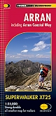
Wandelkaart Isle of Arran - Walking Maps Superwalker | Harvey Maps
Water- en scheurvaste wandelkaart
€ 23,99