- Gratis verzending vanaf 30 euro
- Levert in Nederland, België etc.
- Meer dan 30.000 titels
- Vakkundige klantenservice
- Snelle levering
- Veilig en eenvoudig betalen

Direct contact?
Bel +31 (0)6 42428571
maandag t/m vrijdag
van 10 tot 17 uur
Wandelgids Walking in the Dordogne Cicerone Guidebooks
35 wandelingen in de Dordogne: Bergerac, Lalinde, Sarlat & Souillac

Guidebook to 35 half-day and day walks in France's beautiful Dordogne region, based around Bergerac, Lalinde, Sarlat and Souillac (Lot). The walks, which range from 6 to 18.5km, take in the region"s myriad delights, from spectacular gorges to enchanting chateaux and charming medieval villages. All walks are within the capacity of the average walker, and are on well-marked paths or quiet roads. They are graded easy or medium; there are no long, steep climbs or abrupt descents. There are step-by-step descriptions and maps for each route. Also included is information on the history, flora and fauna of the region, together with practical pointers such as what to take and when to go, as well as notes on waymarking, accommodation and transport. A route summary table and glossary are also provided. Lying in south west France, the Dordogne is a land of great scenic variety, from rolling wooded hills and fertile valleys to barren upland plateaus and limestone cliffs riddled with caves. The charm of the Dordogne also lies in the picturesque medieval towns, châteaux, churches and abbeys that stud the landscape, and these are the focus of many of the walks.
Engelstalig
EAN: 9781852848439
Auteur(s): Norton, j.
Uitgeverij: Cicerone Press
Verschijningsdatum: 2018
Meest recente editie
Engelstalig
262 pagina's

Op voorraad
Levertijd 3 dagen (Nederland)
- Vakkundige klantenservice
- Groot assortiment
- Gratis retourneren binnen 14 dagen
- Aangesloten bij WebwinkelKEUR
€ 19,99
Meer producten die interessant kunnen zijn
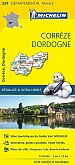
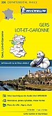
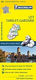
Topografische kaarten Dordogne / Limousin / Berry

Topografische Wandelkaart van Frankrijk 1936ET - Les Eyzies / Vallees de la Dordogne et de la Vezere
Carte de Randonnee | Wandelkaart | Institut Geographique National (IGN) Frankrijk
€ 16,50
Tijdelijk niet leverbaar
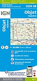
Topografische Wandelkaart van Frankrijk 2034SB - Objat / Hautefort
Carte de Randonnee | Wandelkaart | Institut Geographique National (IGN) Frankrijk
€ 16,50
Tijdelijk niet leverbaar

Topografische Wandelkaart van Frankrijk 1933SB - Thiviers St-Pardoux-la-Rivière
Carte de Randonnee | Wandelkaart | Institut Geographique National (IGN) Frankrijk
€ 16,50

Topografische Wandelkaart van Frankrijk 1833SB - Nontron Brantome Mareuil
Carte de Randonnee | Wandelkaart | Institut Geographique National (IGN) Frankrijk
€ 16,50
Wegenkaarten Dordogne / Limousin / Berry

Fietskaarten Dordogne / Limousin / Berry

Fietskaart 154 Brive la Gaillarde Figeac Tulle -PNR des Causses du Query (Nord) - IGN Top 100 - Tourisme et Velo
Water- en scheurvaste fietskaart
€ 10,50

Fietskaart 153 Perigueux Bergerac Perigord - IGN Top 100 - Tourisme et Velo
Water- en scheurvaste fietskaart
€ 10,50

Fietskaart 161 Montauban Cahors Albi - IGN Top 100 - Tourisme et Velo
Water- en scheurvaste fietskaart
€ 10,50
Reisgidsen Dordogne / Limousin / Berry