- Gratis verzending vanaf 30 euro
- Levert in Nederland, België etc.
- Meer dan 30.000 titels
- Vakkundige klantenservice
- Snelle levering
- Veilig en eenvoudig betalen

Direct contact?
Bel +31 (0)6 42428571
maandag t/m vrijdag
van 10 tot 17 uur
Wandelgids Haute Savoie Walking in the Haute Savoie: North Cicerone Guidebooks
Book 1: South of Lake Geneva (Salève, Vallé Verte Chablais)

A guidebook of half and full-day walks in the lovely Haute Savoie mountains of France. This guide describes 30 circular routes of between 7 and 13km, based around Evian-les-Bains, Morzine, Abondance, Châtel, St-Julien-en-Genevois, Bellevaux, Boège and Habère-Poche. Graded from easy to difficult, there are walks to suit most abilities, but a few have some exposed sections and need a head for heights.
The guide is divided into 6 areas covering the Salève and Vuache, the Vallée Verte, the Vallée du Brevon, Pre-Alpes du Léman and Val d'Abondance. Alongside a detailed route description and map, each walk has a summary of all you need to know before you set out (distance, time to walk, ascent, maximum altitude and instructions for accessing the start). The guidebook includes advice on travel, accommodation and equipment, as well as information about local wildlife and Savoyard food and drink, and a glossary of useful French words.
Visitors flock to the Chamonix area and the Mont Blanc range, but that is only part of what the Haute Savoie has to offer. With highlights including Cornettes de Bise, Mont de Grange, Dent d-Oche and Pic Boré, the walks in this guide will show you a quieter, less busy side to this outstandingly beautiful area.
Engelstalig
EAN: 9781852848101
Auteur(s): Norton, j.
Uitgeverij: Cicerone Press
Verschijningsdatum: 2017
Meest recente editie
Engelstalig
258 pagina's

Op voorraad
Overmorgen in huis (Nederland)
- Vakkundige klantenservice
- Groot assortiment
- Gratis retourneren binnen 14 dagen
- Aangesloten bij WebwinkelKEUR
€ 20,90
Meer producten die interessant kunnen zijn
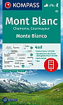
Wandelkaarten Mont-Blanc / Haute Savoie
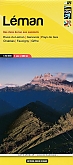
Wandelkaart 01 Léman - Randonnee et Patrimoine | Libris Didier Richard
Rives du Leman - Genevois - Pays de Gex - Chablais - Faucigny - Giffre
€ 16,50
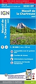
Wandelkaart 3333OTR - Massif de la Chartreuse Nord Geplastificeerd | IGN
Carte de Randonnee | Wandelkaart | Institut Geographique National (IGN) Frankrijk
€ 21,50
Topografische kaarten Mont-Blanc / Haute Savoie
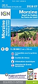
Topografische Wandelkaart van Frankrijk 3528ET - Morzine / Massif du Chablais / Portes du Soleil ign
Carte de Randonnee | Wandelkaart | Institut Geographique National (IGN) Frankrijk
€ 16,50
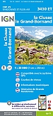
Topografische Wandelkaart van Frankrijk 3430ET - La Clusaz / Grand-Bornand
Carte de Randonnee | Wandelkaart | Institut Geographique National (IGN) Frankrijk
€ 16,50
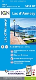
Topografische Wandelkaart van Frankrijk 3431OT - Lac d'Annecy
Carte de Randonnee | Wandelkaart | Institut Geographique National (IGN) Frankrijk
€ 16,50
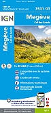
Topografische Wandelkaart van Frankrijk 3531OT - Megeve / Col des Aravis Praz-sur-Arly Ugine Flumet Notre-Dame-de-Bellec
Carte de Randonnee | Wandelkaart | Institut Geographique National (IGN) Frankrijk
€ 16,50
Wegenkaarten Mont-Blanc / Haute Savoie
Fietskaarten Mont-Blanc / Haute Savoie
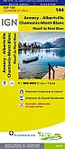
Fietskaart 144 Annecy / Albertville / Chamonix-Mont-Blanc - IGN Top 100 - Tourisme et Velo
Water- en scheurvaste fietskaart
€ 10,50
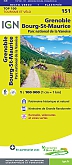
Fietskaart 151 Grenoble Chambery Parc National de la Vanoise - IGN Top 100 - Tourisme et Velo
Water- en scheurvaste fietskaart
€ 10,50
Reliëfkaarten Mont-Blanc / Haute Savoie
