- Gratis verzending vanaf 30 euro
- Levert in Nederland, België etc.
- Meer dan 30.000 titels
- Vakkundige klantenservice
- Snelle levering
- Veilig en eenvoudig betalen

Direct contact?
Bel +31 (0)6 42428571
maandag t/m vrijdag
van 10 tot 17 uur
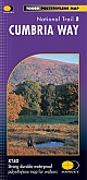
Wandelgids The Cumbria Way | Cicerone Guide
Ulverston to Carlisle main route with mountain alternatives

A guidebook to the Cumbria Way, a 73-mile long distance path through the heart of the English Lake District from Ulverston to Carlisle. The route is largely low-level, and accessible to new trekkers, but this guide offers alternative mountain days to climb some of the famous fells en route. The guide divides the route into 5 stages of between 12 and 16 miles, but there is plenty of opportunity to plan your itinerary for a more easy-going 7 to 8 days. The Lake District is a walkers paradise, and there is no better way to experience the fells, lakes and woodlands of the Lake District than by trekking through their midst. This guidebook also provides useful information for every stage, from accommodation to available facilities en route, as well as an annotated OS map and details on points of interest. The result is a guidebook that enhances a walk on the Cumbria Way, as well as providing the walker with the tools to complete the trek.
Engelstalig
EAN: 9781786311337
Auteur(s): John Gillham
Uitgeverij: Cicerone Press
Verschijningsdatum: 2022
Meest recente editie
Engelstalig
140 pagina's


Op voorraad
Levertijd 4 dagen (Nederland)
- Vakkundige klantenservice
- Groot assortiment
- Gratis retourneren binnen 14 dagen
- Aangesloten bij WebwinkelKEUR
€ 18,99
Meer producten die interessant kunnen zijn
Reisgidsen Lake District / Yorkshire Dales


Topografische kaarten Lake District / Yorkshire Dales
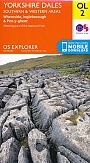
Topografische Wandelkaart OL2 van Groot-Brittannië (1:25.000) Yorkshire Dales - Southern & Western areas - Explorer Map OL 2
Wandelkaart | Ordnance Survey (OS) Groot-Brittannië
€ 18,99
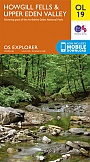
Topografische Wandelkaart OL19 van Groot-Brittannië (1:25.000) Howgill Fells / Upper Eden Valley - Explorer Map OL 19
Wandelkaart | Ordnance Survey (OS) Groot-Brittannië
€ 18,99
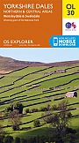
Topografische Wandelkaart OL30 van Groot-Brittannië (1:25.000) Yorkshire Dales - Northern & Central areas - Explorer Map OL 30
Wandelkaart | Ordnance Survey (OS) Groot-Brittannië
€ 18,99
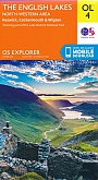
Topografische Wandelkaart OL4 van Groot-Brittannië (1:25.000) English Lakes - North Western area - Explorer Map OL 4
Wandelkaart | Ordnance Survey (OS) Groot-Brittannië
€ 18,99
Wandelkaarten Lake District / Yorkshire Dales