- Gratis verzending vanaf 30 euro
- Levert in Nederland, België etc.
- Meer dan 30.000 titels
- Vakkundige klantenservice
- Snelle levering
- Veilig en eenvoudig betalen

Direct contact?
Bel +31 (0)6 42428571
maandag t/m vrijdag
van 10 tot 17 uur
Wandelkaart Dales Way - National Trail Maps | Harvey Maps
Water- en scheurvaste wandelkaart

De Harvey Map is de wandelkaart voor het lange afstand wandelpad in het Groot-Brittannië. Duidelijke topografische wandelkaarten met praktische informatie van de route zoals overnachtingsmogelijkheden, eetgelegenheden en bezienswaardigheden. Deze wandelkaart is scheur- en watervast. Met GPS compatible (UTM-Grid). Compact and light - the map itself weighs just 60gms - a third of the weight of a bulky laminated map. You can fold or refold it time and again, or stuff it in your back pocket and it won't fall to pieces.
Shows the entire route on one sheet.
130km (81 miles) from Ilkley in Yorkshire through the Dales via Grassington, Buckden and Dent to Bowness on Windermere in the Lake District. Contains all 3 links: from Leeds, Shipley (Bradford) and Harrogate.
Information on finding accommodation, camping, food. Directions to the start. Also Ranger Service contact numbers and enlargements of towns/villages showing facilities available and tips on weather and clothing
Schaal: 1:40.000
Engelstalig


Op voorraad
Overmorgen in huis (Nederland)
- Vakkundige klantenservice
- Groot assortiment
- Gratis retourneren binnen 14 dagen
- Aangesloten bij WebwinkelKEUR
€ 25,99
Meer producten die interessant kunnen zijn
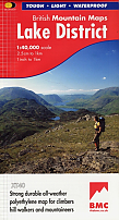
Wandelkaart Lake District - Mountain Map | Harvey Maps
Water- en scheurvaste wandelkaart
€ 28,99
Tijdelijk niet leverbaar
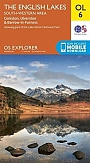
Topografische Wandelkaart OL6 van Groot-Brittannië (1:25.000) English Lakes - South Western area - Explorer Map OL 6
Wandelkaart | Ordnance Survey (OS) Groot-Brittannië
€ 18,99
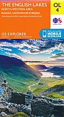
Topografische Wandelkaart OL4 van Groot-Brittannië (1:25.000) English Lakes - North Western area - Explorer Map OL 4
Wandelkaart | Ordnance Survey (OS) Groot-Brittannië
€ 18,99
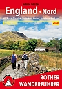
Wandelgids 253 Engeland Nord Rother Wanderführer | Rother Bergverlag
Mit Lake District Yorkshire Dales Northumberland 60 Touren
€ 14,90
Topografische Wandelkaart OL7 van Groot-Brittannië (1:25.000) English Lakes - South Eastern area - Explorer Map OL 7
Wandelkaart | Ordnance Survey (OS) Groot-Brittannië
€ 18,99