- Gratis verzending vanaf 30 euro
- Levert in Nederland, België etc.
- Meer dan 30.000 titels
- Vakkundige klantenservice
- Snelle levering
- Veilig en eenvoudig betalen

Direct contact?
Bel +31 (0)6 42428571
maandag t/m vrijdag
van 10 tot 17 uur
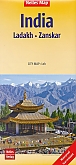
Wandelkaart Ladakh Zanskar North Trekking map Olizane

Northern Ladakh and Zanskar: Brog-Yul - Nubra - Shyog area in a series of excellent topographic trekking maps from the Geneva based Editions Olizane on light, waterproof and tear-resistant plastic paper. Each map is double-sided, covering a large area of 90km x 240km. The maps have exceptionally clear cartography with contours at 100m intervals, enhanced by relief shading, additional spot heights for peaks and passes, plus colouring indicating glaciers, marshes, protected zones and forested or cultivated areas. Population centres are graded into towns, villages, hamlets and settlements and names of local regions are shown. Roads, tracks and numerous trails are clearly highlighted and symbols indicate various places of interest: forts, palaces and ruins: religious sites; old trade routes; caves and hot springs; checkpoints and military posts, etc. The maps have a UTM grid and latitude/longitude margin ticks at intervals of 9". Map legend in English and French. Also provided is a glossary of geographical and cultural local terms.
Schaal: 1:150.000
EAN: 9782880864125
Uitgeverij: Olizane
Meest recente editie


EAN: 9782880864125
Uitgeverij: Olizane
direct leverbaar
18,99
Meer producten die interessant kunnen zijn
Reisgidsen Ladakh / Kashmir
Wegenkaarten Ladakh / Kashmir
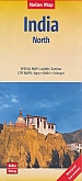
Wegenkaart - Landkaart 1 Noord-India (met Ladakh, Zanskar, Agra, Delhi, Srinagar) - Nelles Map
Water- en scheurvaste wegenkaart
€ 11,90